| Page last updated
Thu 3 September 2025 |
The Freshwater Mussels (Unionoida) of the World (and other less consequential bivalves)
FM(U)otW(aolcb) is the web version of the MUSSEL Project Database. Follow the links to browse the data or use the custom Google search field. Either way, you win!
Search the database pages:
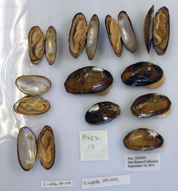
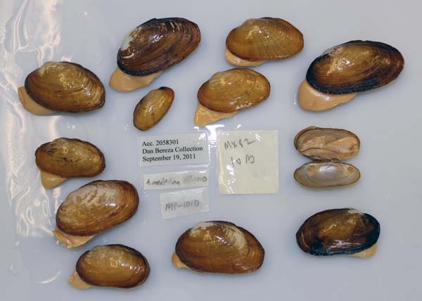
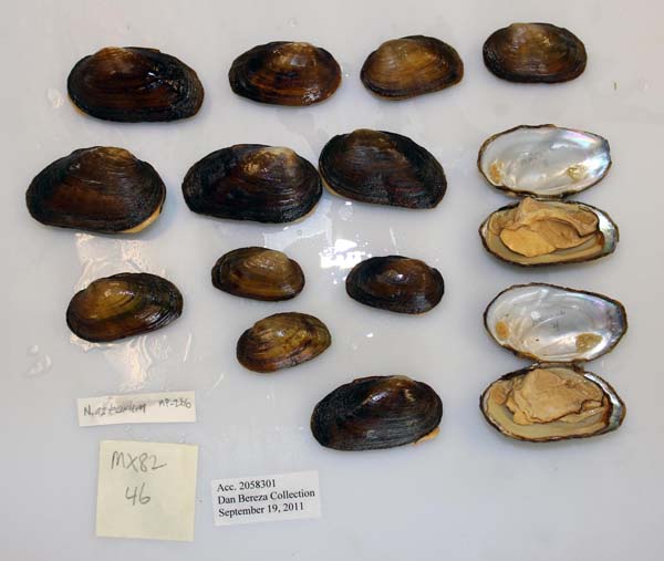
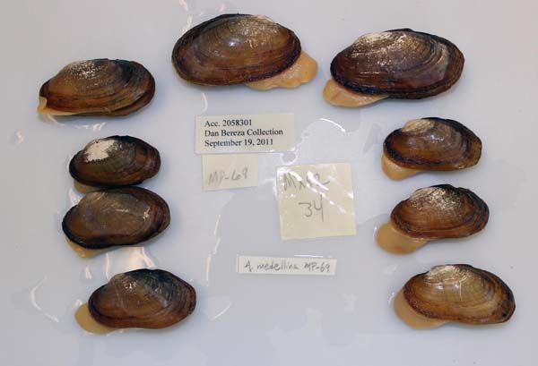
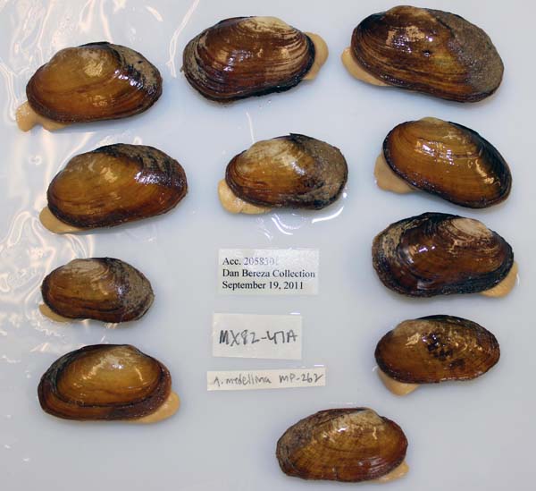
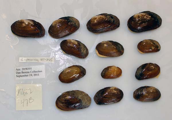
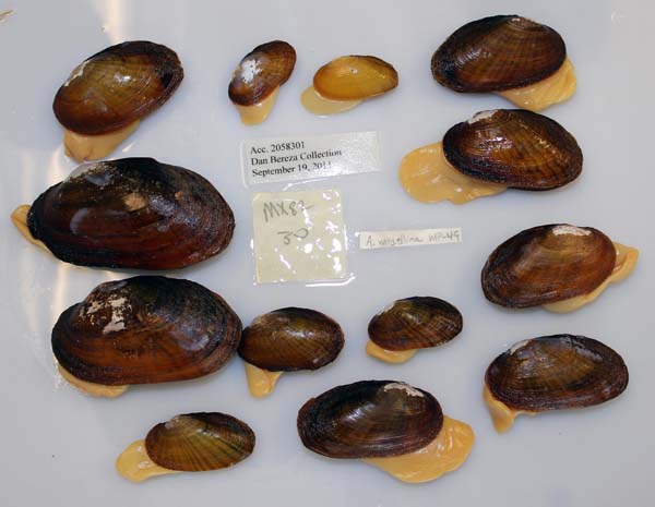
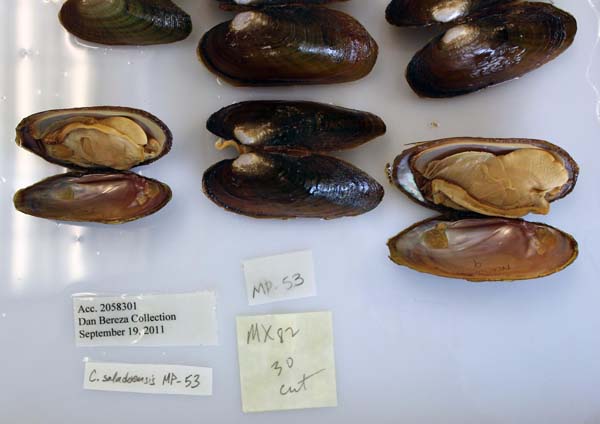
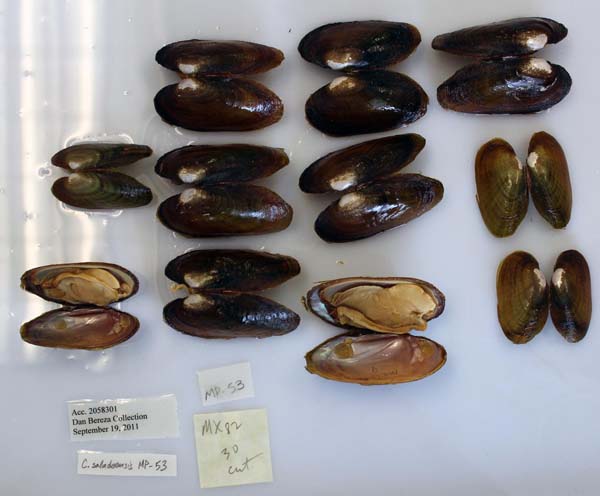
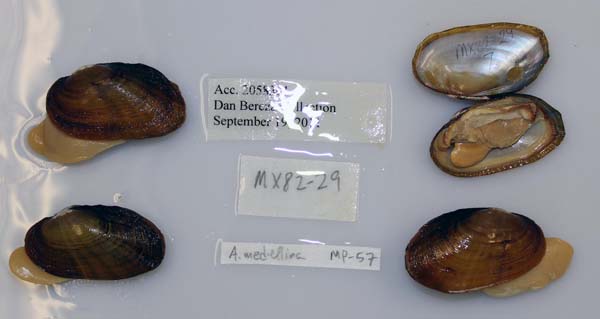
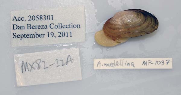
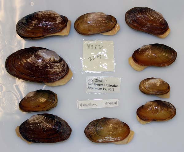
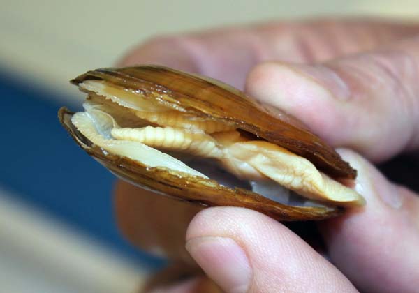
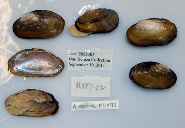
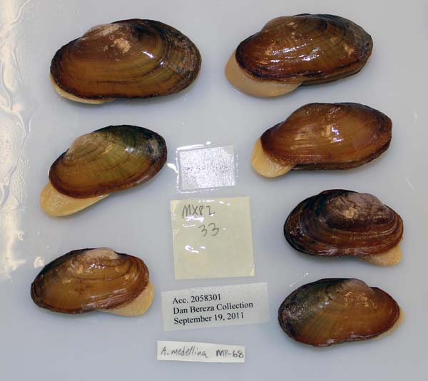
Bivalvia | Unionida | Unionoidea | Unionidae | Ambleminae | Lampsilini | Actinonaias species Actinonaias medellina (Lea, 1838): specimens
2 available nominal species synonyms (3 total synonyms) Recent Taxonomic OpinionsActinonaias medellina — Graf & Cummings (2007), Bogan (2010), Bogan (2013), Graf & Cummings (2021), Czaja et al. (2023), Cummings et al. (2025) RangeVera Cruz, Mexico. Map of Georeferenced Specimens
Mexico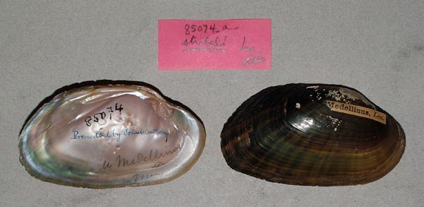
USNM_85074
[no locality available - Central America - Mexico]
| 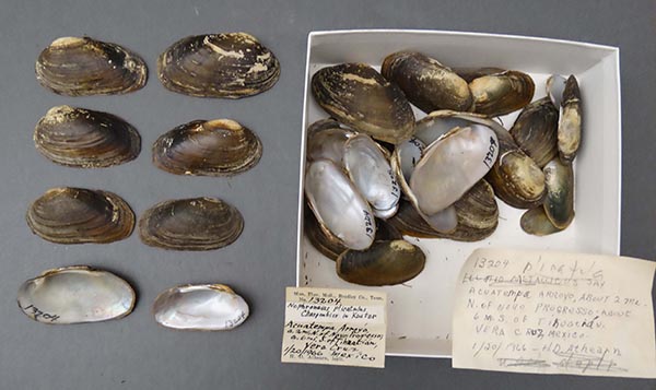
NCSM_MFM_13204
Acuatempa Arroyo, 2 mi N Novo Progresso, about 6 mi S Tihuatian, Veracruz, Mexico
| 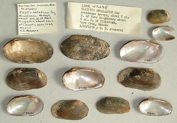
MCZ_272911
Acuatempa Arroyo, about 2 mi N of Nova Progresso; about 6 mi S of Tihuatin, Vera Cruz, Mexico
| 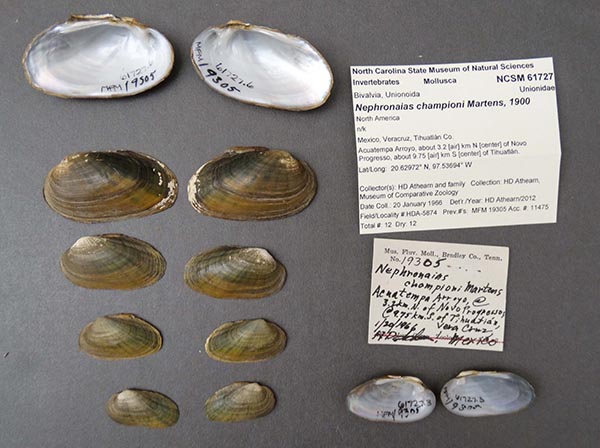
NCSM_61727
Arroyo Acuatempa, 3.2 km N Novo Progresso, 9.75 km S Tihuatlan, Veracruz, Mexico
| 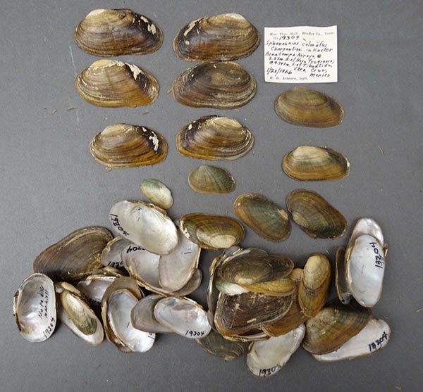
NCSM_MFM_19304
Arroyo Acuatempa, 3.2 km N Novo Progresso, 9.75 km S Tihuatlan, Veracruz, Mexico
| 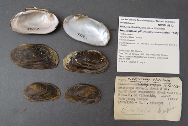
NCSM_5813
Arroyo Acuatempa, 3.2 km N Novo Progresso, 9.75 km S Tihuatlan, Veracruz, Mexico
| 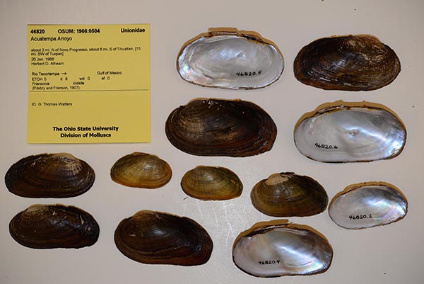
OSUM_46820
Arroyo Acuatempa, about 2 mi N of Novo Progresso, about 6 mi. S of Tihuatlan, [15 mi SW of Tuxpan]
| 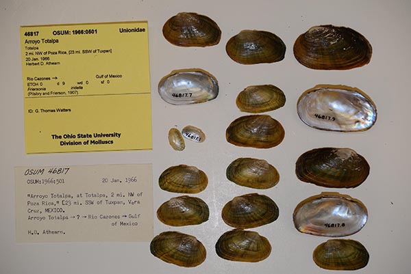
OSUM_46817
Arroyo Totalpa, 2 mi NW of Poza Rica, [23 mi. SSW of Tuxpan]
| 
NCSM_61726
Arroyo Totolapa, Totolapa, 2 mi NW Poza Rica, Veracruz, Mexico
| 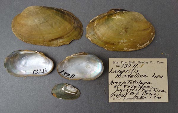
NCSM_MFM_13211
Arroyo Totolapa, Totolapa, 2 mi NW Poza Rica, Veracruz, Mexico
| 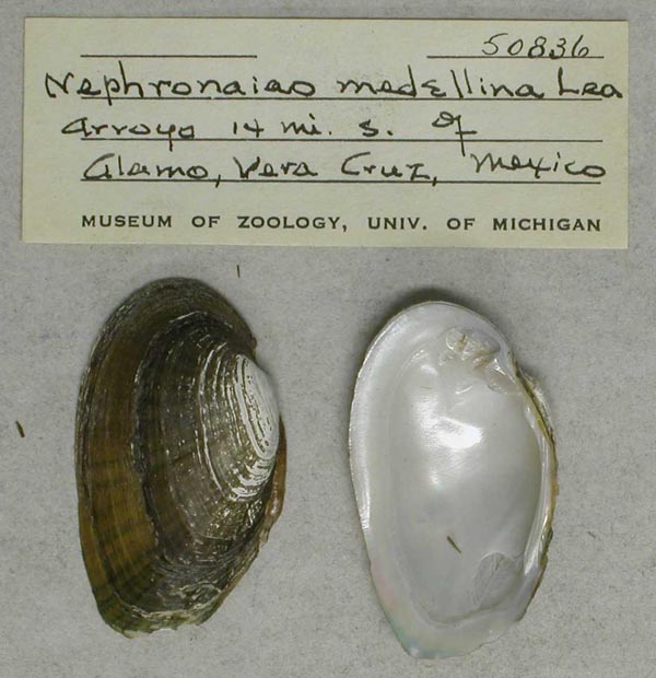
UMMZ_50836
Arroyo, 14 mi S Alamo, Vera Cruz, Mexico
| 
NCSM_MFM_19075
Arroyo, at Hueyapah de Ocampo, 18 km W Soteapan. 0.8 km E of Hwy. 180, 41 km N Acayucan, Veracruz, Mexico
| 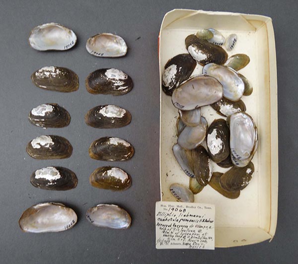
NCSM_MFM_19068
Arroyo, at Hueyapan de Ocampo, 18 km W Soteapan. 0.8 km E of Hwy. 180, 41 km N Acayucan, Veracruz, Mexico
| 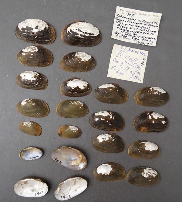
NCSM_MFM_19071
Arroyo, at Hueyapan de Ocampo, 18 km W Soteapan. 0.8 km E of Hwy. 180, 41 km N Acayucan, Veracruz, Mexico
| 
NCSM_MFM_19073
Arroyo, at Hueyapan de Ocampo, 18 km W Soteapan. 0.8 km E of Hwy. 180, 41 km N Acayucan, Veracruz, Mexico
| 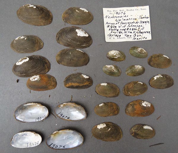
NCSM_MFM_19076
Arroyo, at Hueyapan de Ocampo, 18 km W Soteapan. 0.8 km E of Hwy. 180, 41 km N Acayucan, Veracruz, Mexico
| 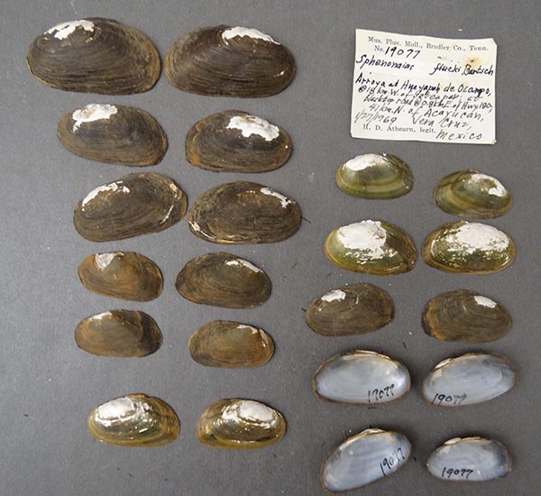
NCSM_MFM_19077
Arroyo, at Hueyapan de Ocampo, 18 km W Soteapan. 0.8 km E of Hwy. 180, 41 km N Acayucan, Veracruz, Mexico
| 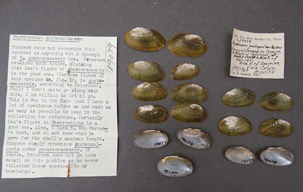
NCSM_MFM_19079
Arroyo, at Hueyapan de Ocampo, 18 km W Soteapan. 0.8 km E of Hwy. 180, 41 km N Acayucan, Veracruz, Mexico
| 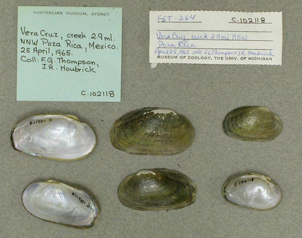
AMS_102118
creek, 2.9 mi NNW Poza Rica, Veracruz, Mexico
| 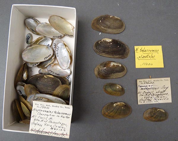
NCSM_5627B
El Carril, about 5 mi N of Chicontepec, Vera Cruz, Mexico
| 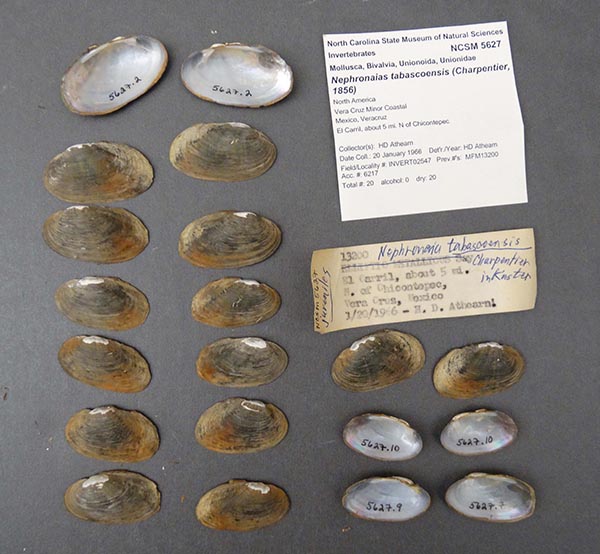
NCSM_5627
El Carril, about 5 mi N of Chicontepec, Vera Cruz, Mexico
| 
MCZ_272910
El Carril, about 5 mi N of Chicontepec, Vera Cruz, Mexico
| 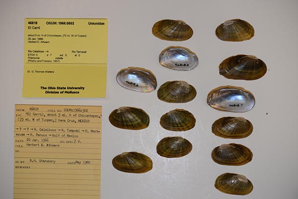
OSUM_46818
El Carril, about 5 mi. N of Chicontepec, [75 mi. W of Tuxpan]
| 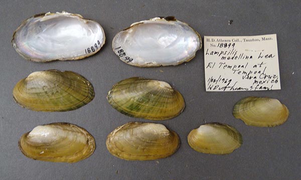
NCSM_MFM_18899
El Tempoal, Tempoal, Veracruz, Mexico
| 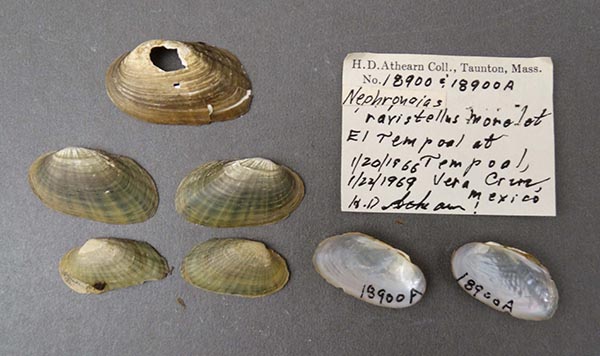
NCSM_MFM_18900
El Tempoal, Tempoal, Veracruz, Mexico
| 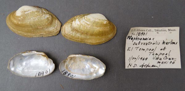
NCSM_MFM_18901
El Tempoal, Tempoal, Veracruz, Mexico
| 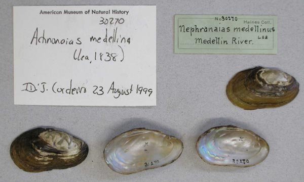
AMNH_30270
Medellin River
| 
ZMB_MP_0518
Medellin River, near Vera Cruz
| 
BMNH_1901-6-22-1536
Medellin River, near Vera Cruz, Mexico
| 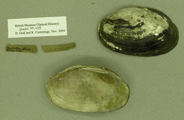
BMNH_MP_039
Medellion River, Vera Cruz
| 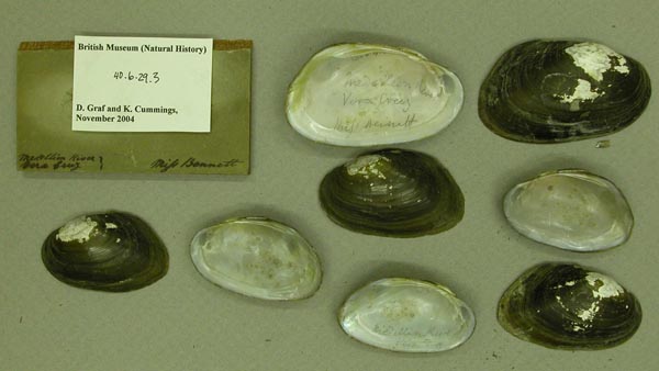
BMNH_40-6-29-2-5
Medellion River, Vera Cruz
| 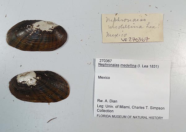
UF_270367
Mexico
| 
UF_270367
Mexico
| 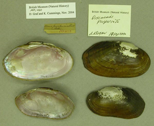
BMNH_MP_420
Mexico
| 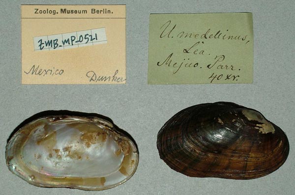
ZMB_MP_0521
Mexico
| 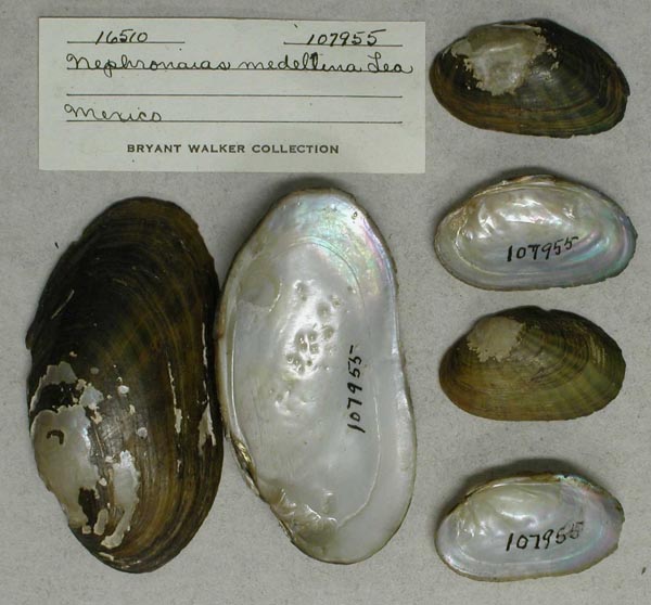
UMMZ_107955
Mexico
| 
AMS_102108
Rio Agua Fria, 7.5 mi NW Cardel, Veracruz, Mexico
| 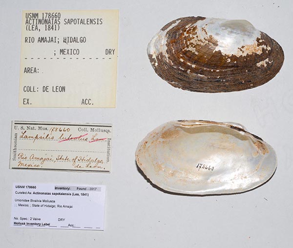
USNM_178660
Rio Amajai; Hidalgo; Mexico
| 
NCSM_MFM_19045
Rio Atoyac, Cotaxtla, Veracruz, Mexico
| 
NCSM_MFM_19048
Rio Atoyac, Cotaxtla, Veracruz, Mexico
| 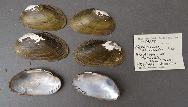
NCSM_MFM_19055
Rio Atoyac, Cotaxtla, Veracruz, Mexico
| 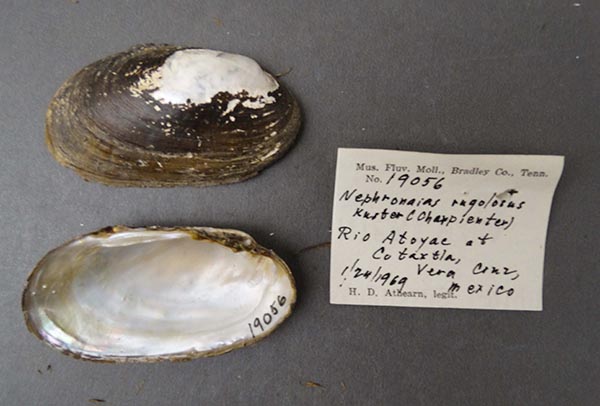
NCSM_MFM_19056
Rio Atoyac, Cotaxtla, Veracruz, Mexico
| 
UF_285399
Rio Axtla, 2 km W Axtla, San Luis Potosi, Mexico
| 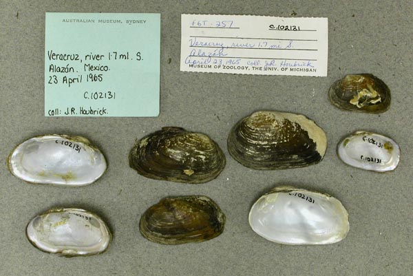
AMS_102131
Rio Buena Vista 1.7 miles S of Alazan, Vera Cruz, Mexico
| 
NCSM_5815
Rio Colipa, Vega de Colipa, 7.3 km N Carranza, 32 km SE Nautla, Veracruz, Mexico
| 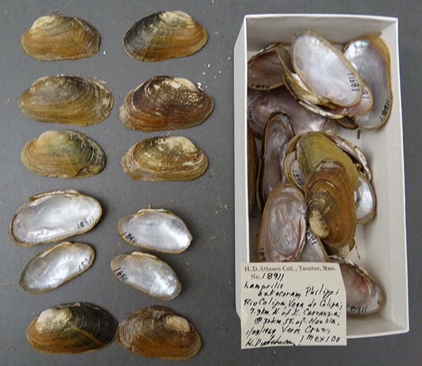
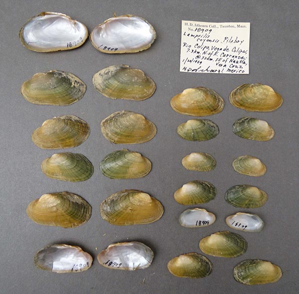
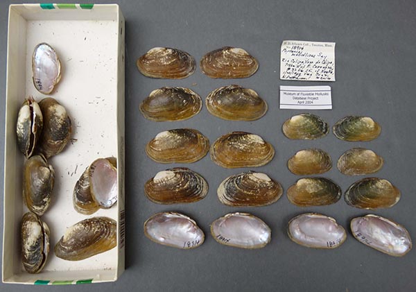
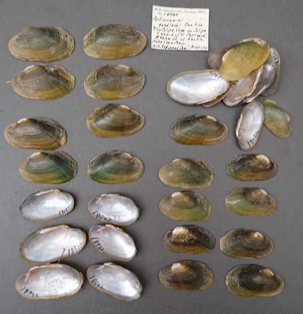
NCSM_MFM_18911
Rio Colipa, Vega de Colipa, 7.3 km N Carranza, 32 km SE Nautla, Veracruz, Mexico
| 
NCSM_MFM_18914
Rio Colipa, Vega de Colipa, 7.3 km N Carranza, 32 km SE Nautla, Veracruz, Mexico
| 
NCSM_MFM_18919
Rio Colipa, Vega de Colipa, 7.3 km N Carranza, 32 km SE Nautla, Veracruz, Mexico
| 
NCSM_MFM_18922
Rio Colipa, Vega de Colipa, 7.3 km N Carranza, 32 km SE Nautla, Veracruz, Mexico
| 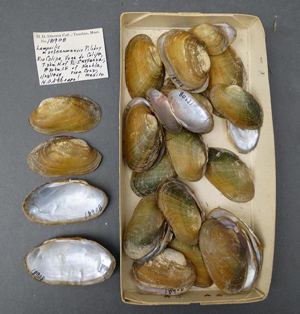
NCSM_MFM_18908
Rio Colipa, Vega de Colipa, 7.3 km N Carranza, 32 km SE Nautla, Veracruz, Mexico.
| 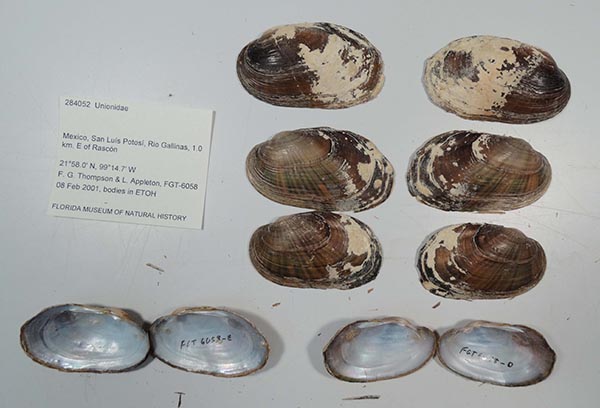
UF_284052
Rio Gallinas, 1 km E Rascon, San Luis Potosi, Mexico
| 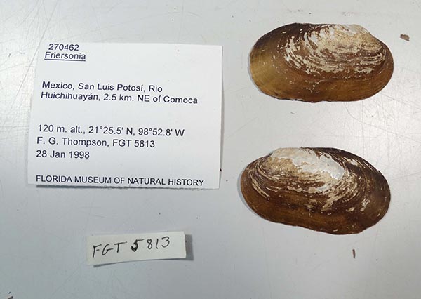
UF_270462
Rio Huichihuayan, 2.5 km NE Comoca, San Luis Potosi, Mexico 21° 25.5’N, 98° 52.8’ W
| 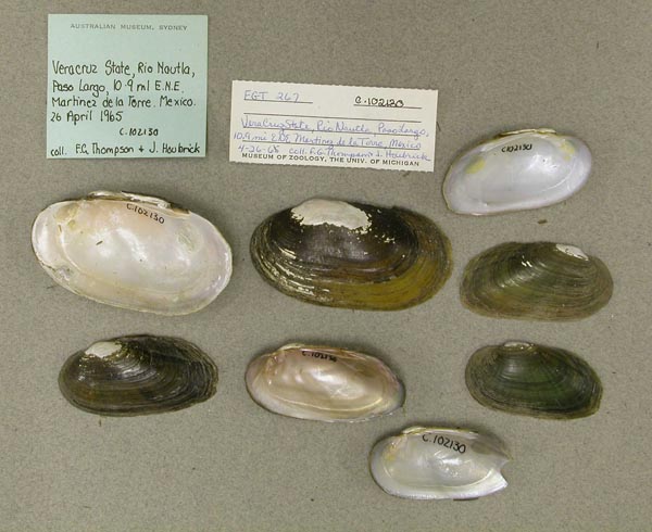
AMS_102130
Rio Nautla, Paso Largo, 10.9 km ENE Martinez de la Torre, Veracruz, Mexico
| 
USNM_1282434
Rio Pantepec across the river from Chapopote, near Alamo, ca. 100-300 yards upriver from the new bridge of the Temapache-Alamo road
| 
USNM_1282293
Rio Pantepec across the river from Chapopote, near Alamo, ca. 100-300 yards upriver from the new bridge of the Temapache-Alamo road
| 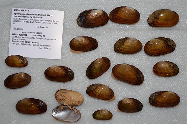
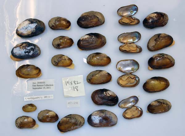
USNM_1282654
Rio Pantepec across the river from Chapopote, near Alamo, ca. 100-300 yards upriver from the new bridge of the Temapache-Alamo road, Veracruz, Mexico
| 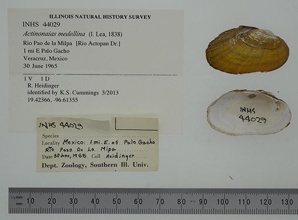
INHS_44029
Rio Paso de Milpa, 1 mi E Palo Gacho, Mexico
| 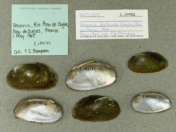
AMS_102122
Rio Paso de Ouejas, Paso de Ouejas, Veracruz, Mexico
| 
USNM_1282277
Rio Tamuin [Tampaón], at Mex. 85 just S of Alvero Obregon, S of Ciudad Valles, San Luis Potosi, Mexico.
| 
AMS_102128
river [Rio Buena Vista], 1.4 mi NW Alazán, Veracruz, Mexico; 800’
| 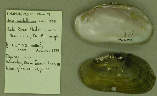
BMNH_1964173
River Medellin, near Vera Cruz, Mexico
| 
USNM_1282278
San Luis Potosi, Rio Huichiuayan at road to Xilitla ca. 0.7 road miles from its junction with Rt. Mex. 85 (this junction is ca. 43.6 roadmiles S of junction of Rt. Mex. 85 and Rt. Mex. 70 in Ciudad Valles). N21°25'30" W9?°54'30"
| 
NCSM_5805
South Fork Hueyapan
| 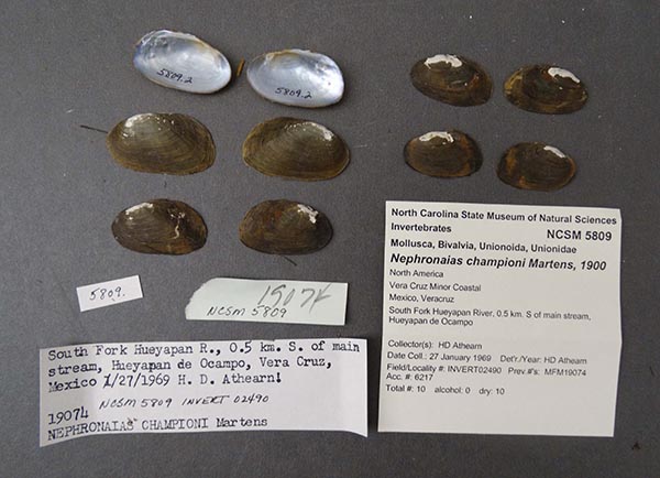
NCSM_5809
South Fork Rio Hueyapan, 0.5 kilometers S of main stream, Hueyapan de Ocampo
| 
NCSM_5814
South Fork Rio Hueyapan, 0.5 kilometers S of main stream, Hueyapan de Ocampo
| 
NCSM_MFM_19078
South Fork Rio Hueyapan, Hueyapan de Campo, Veracruz, Mexico
| 
NCSM_MFM_19080
South Fork Rio Hueyapan, Hueyapan de Campo, Veracruz, Mexico
| 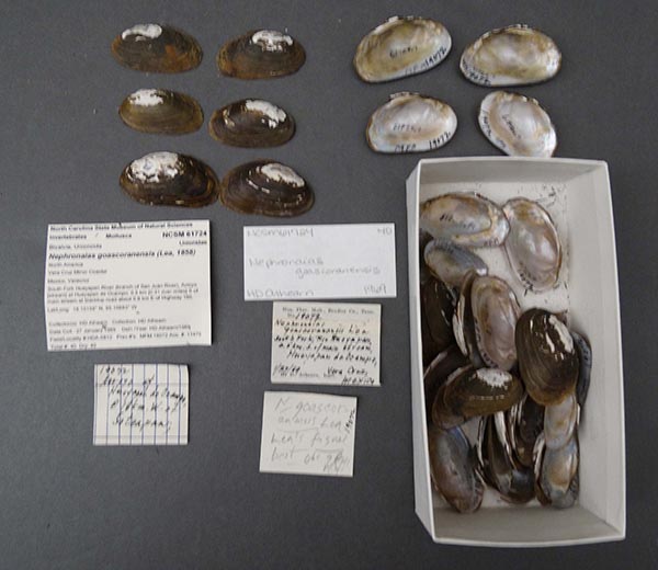
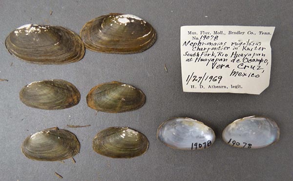
NCSM_61724
South Fork Rio Hueyapan, Hueyapan de Ocampo, 18 km W Soteapan, 0.8 km E of Hwy. 180, 41 km N Acayucan
| 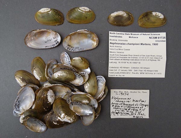
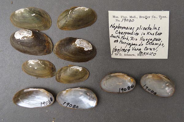
NCSM_61725
South Fork Rio Hueyapan, Hueyapan de Ocampo, 18 km W Soteapan, 0.8 km E of Hwy. 180, 41 km N Acayucan
| 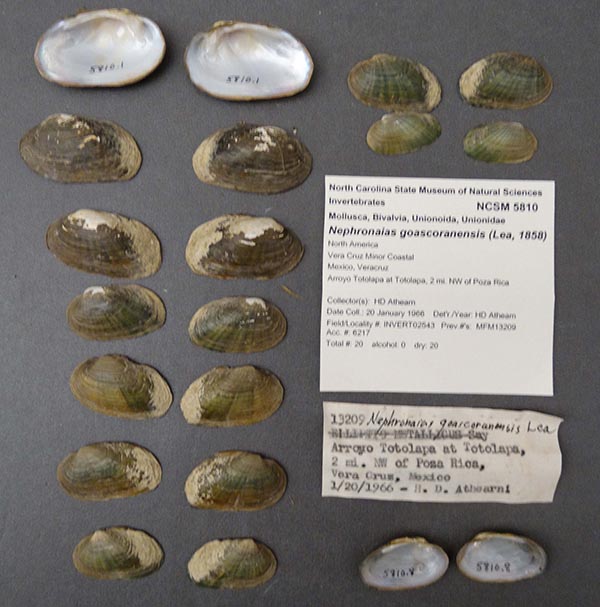
NCSM_5810
Totolapa, 2 mi NW Poza Rica, Veracruz, Mexico
| 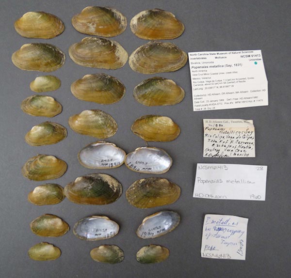
NCSM_61413
Vega de Colipa, 7.3 km N Carranza, 32 km SE Nautla
| 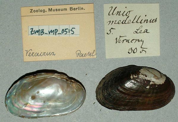
ZMB_MP_0515
Vera Cruz [Mexico]
| 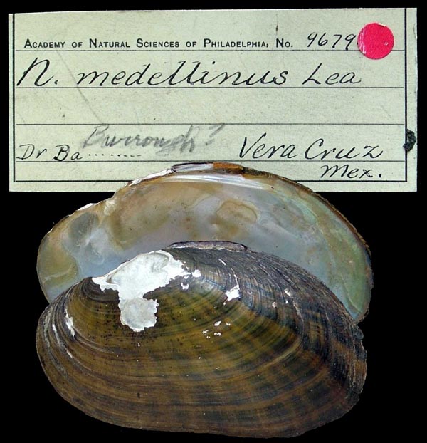
ANSP_9679
Vera Cruz, Mex.
| 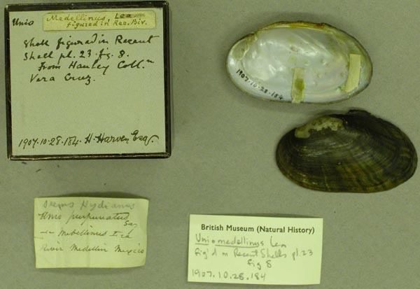
BMNH_1907-10-28-184
Vera Cruz, Mexico
| 
USNM_25432
Vera Cruz, Mexico
| 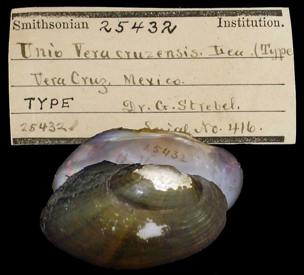
USNM_25432
Vera Cruz, Mexico
| 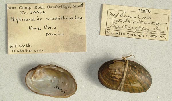
MCZ_30056
Vera Cruz, Mexico
| 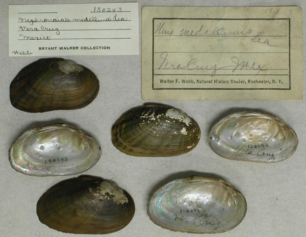
UMMZ_130243
Vera Cruz, Mexico
| 
USNM_1282543-44
Veracruz, creek ca. 2.2 roadmiles along unimproved road starting as Avenida Manantial (it joins Rt. Mex. 130 ca. 1.3 roadmiles W of the junction of Rt. Mex. 130 and Rt. Mex. 180 in Poza Rica)
| 
USNM_1282286
Veracruz, creek flowing into left side of river (Locality 51=33) ca. 0.25 miles above bridge of dirt road which is ca. 2.7 roadmiles upriver from La Gloria, N of Cardel
| 
USNM_1282279
Veracruz, creek reached by turning W at N end of bridge of Rt. Mex. 130 (ca. 1.1 roadmiles N of intersection of Rt. Mex. 130 and Rt. Mex. 180 in Poza Rosa), going W for ca. 0.8 roadmiles and turning S onto farm road for ca. 0.5 roadmiles
| 
USNM_1282433
Veracruz, creek reached by turning W at N end of bridge of Rt. Mex. 130 (ca. 1.1 roadmiles N of intersection of Rt. Mex. 130 and Rt. Mex. 180 in Poza Rosa), going W for ca. 0.8 roadmiles and turning S onto farm road for ca. 0.5 roadmiles
| 
USNM_1282545
Veracruz, creek reached by turning W at N end of bridge of Rt. Mex. 130 (ca. 1.1 roadmiles N of intersection of Rt. Mex. 130 and Rt. Mex. 180 in Poza Rosa), going W for ca. 0.8 roadmiles and turning S onto farm road for ca. 0.5 roadmiles
| 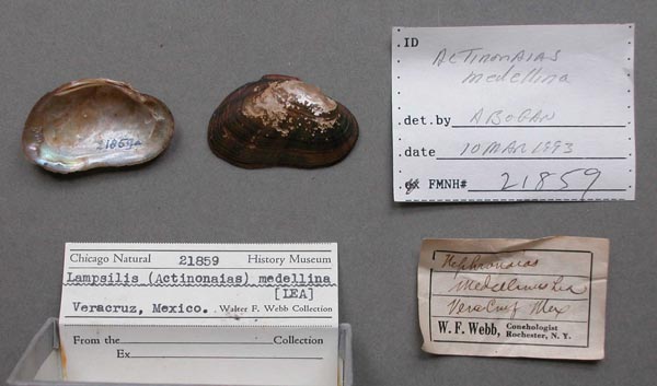
FMNH_21859
Veracruz, Mexico
| 
USNM_1282280-82
Veracruz, Rio Cotaxtla (upper Rio Atoyac) at Rt. Ver. 149 in Cotaxtla (turn-off to road to Cotaxtla from Rt. Mex. 140 is ca. 26.1 roadmiles SW of divergence of Rt. Mex, 150 and Rt. Mex. 140 S of Veracruz
| 
USNM_1282325
Veracruz, Rio Cotaxtla (upper Rio Atoyac) at Rt. Ver. 149 in Cotaxtla (turn-off to road to Cotaxtla from Rt. Mex. 140 is ca. 26.1 roadmiles SW of divergence of Rt. Mex, 150 and Rt. Mex. 140 S of Veracruz
| 
USNM_1282325
Veracruz, Rio Cotaxtla (upper Rio Atoyac) at Rt. Ver. 149 in Cotaxtla (turn-off to road to Cotaxtla from Rt. Mex. 140 is ca. 26.1 roadmiles SW of divergence of Rt. Mex, 150 and Rt. Mex. 140 S of Veracruz
| 
USNM_1282284
Veracruz, Rio Jamapa at road to Medellin at El Tejar, ca. 5.3 roadmiles from junction of this road with Rt. Mex. 140, S of Veracruz (city)
| 
USNM_1282287-89
Veracruz, Rio Tempoal (or Rio Calabazo) at Rt. Mex. 105 between Tempoal and Platon Sanchez. N21°25'00" W98°23'30" 8 Feb 82
| 
USNM_1282292
Veracruz, river ca. 1.5-2 rivermiles above bridge of Rt. Mex. 180 (ca. 3.7 roadmiles N of central square of Cardel) above Gloria (in an area locally called Real del Oro Vero). N19°25'00" W96°22'30" 10 Feb 82 and 14 Feb 82
| 
USNM_1282290
Veracruz, river ca. 1.5-2 rivermiles above bridge of Rt. Mex. 180 (ca. 3.7 roadmiles N of central square of Cardel) above Gloria (in an area locally called Real del Oro Vero). N19°25'00" W96°22'30" 10 Feb 82 and 14 Feb 82
| 
USNM_1282290
Veracruz, river ca. 1.5-2 rivermiles above bridge of Rt. Mex. 180 (ca. 3.7 roadmiles N of central square of Cardel) above Gloria (in an area locally called Real del Oro Vero). N19°25'00" W96°22'30" 10 Feb 82 and 14 Feb 82
| 
USNM_1282291
Veracruz, river ca. 1.5-2 rivermiles above bridge of Rt. Mex. 180 (ca. 3.7 roadmiles N of central square of Cardel) above Gloria (in an area locally called Real del Oro Vero). N19°25'00" W96°22'30" 10 Feb 82 and 14 Feb 82
| 
USNM_1282285
Veracruz, river ca. 2.7 roadmiles upriver from La Gloria, where dirt road crosses river, N of Cardel
|
COMA_B.0187. Rio Jamapa, Veracruz, México COMA_B.0835. Rio Medellín, Veracruz, México COMA_2043. Rio Medellín, Veracruz, México
unknown |

