| Page last updated
Thu 3 September 2025 |
The Freshwater Mussels (Unionoida) of the World (and other less consequential bivalves)
FM(U)otW(aolcb) is the web version of the MUSSEL Project Database. Follow the links to browse the data or use the custom Google search field. Either way, you win!
Search the database pages:
Bivalvia | ... | Unionoidea | Unionidae | Ambleminae | Quadrulini | Quadrulina | Pustulosa species Pustulosa pustulosa (Lea, 1831): specimens
19 available nominal species synonyms (31 total synonyms) Recent Taxonomic OpinionsAmphinaias pustulosa — Graf & Cummings (2007), Cummings & Graf (2010), IUCN (2011), Roe & Boyer (2015)
Quadrula pustulosa — Tiemann et al. (2007), Williams et al. (2008), Bogan (2010), Boyer et al. (2011), Szumowski et al. (2012), Haag (2012), McMurray et al. (2012), Jones (2015), Inoue et al. (2018), Marshall et al. (2018), Klymus et al. (2020), Gasparini et al. (2020)
Amphinaias aurea — Graf & Cummings (2007), Cummings & Graf (2010)
Amphinaias houstonensis — Graf & Cummings (2007), Cummings & Graf (2010)
Amphinaias refulgens — Graf & Cummings (2007), Cummings & Graf (2010)
Quadrula asperata — Williams et al. (2008)
Quadrula refulgens — Williams et al. (2008), Chapman et al. (2008), Chapman et al. (2008), Bogan (2010), ITIS (2012), Szumowski et al. (2012), Haag (2012), Inoue et al. (2018)
Quadrula pustulosa pustulosa — Watters et al. (2009), ITIS (2012)
Quadrula mortoni — Bogan (2010), Pfeiffer et al. (2016), Marshall et al. (2018)
Quadrula aurea — Bogan (2010), ITIS (2012), Szumowski et al. (2012), Haag (2012)
Quadrula houstonensis — Bogan (2010), Breton et al. (2011), ITIS (2012), Haag (2012), Pfeiffer et al. (2016), Chase et al. (2018)
Rotundaria pustulosa — Campbell & Lydeard (2012)
Quadrula pustulosa mortoni — ITIS (2012), Szumowski et al. (2012)
Rotundaria refulgens — Campbell & Lydeard (2012), Campbell & Lydeard (2012)
Cyclonaias pustulosa — Williams et al. (2017), Johnson et al. (2018), Lopes-Lima et al. (2019), Graf & Cummings (2021), Bieler (2021), FMCS (2021), de Moulpied et al. (2022), Hopper et al. (2023), Freeman et al. (2025)
Cyclonaias mortoni — Williams et al. (2017)
Cyclonaias aurea — Williams et al. (2017)
Cyclonaias houstonensis — Williams et al. (2017)
Cyclonaias refulgens — Williams et al. (2017)
Cyclonaias (Quadrula) refulgens — Porto-Hannes et al. (2021)
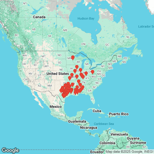
Pustulosa pustulosa — Neemuchwala et al. (2023), FMCS (2025), Campbell & Lydeard (2026) RangeWidespread in the Interior Basin and the Gulf Coastal Plain (west of the Mobile Basin), USA. Map of Georeferenced Specimens
USA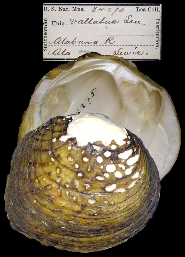
USNM_84275
Alabama R., Ala.
| 
ANSP_10287A
Bayou Teche, Louisiana
| 
USNM_84204
Cahaba R., Ala.
| 
USNM_85763
Columbus, Miss.
| 
USNM_84290
Enterprise, Lauderdale Co., Miss. [Alabama]
| 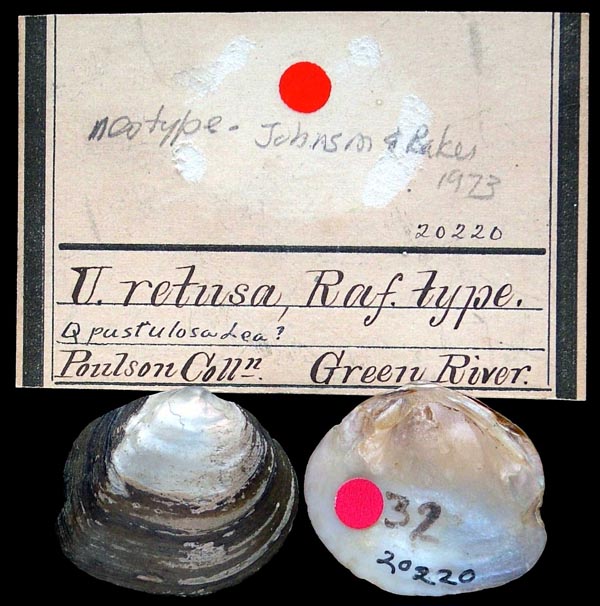
ANSP_20220
Green River
| 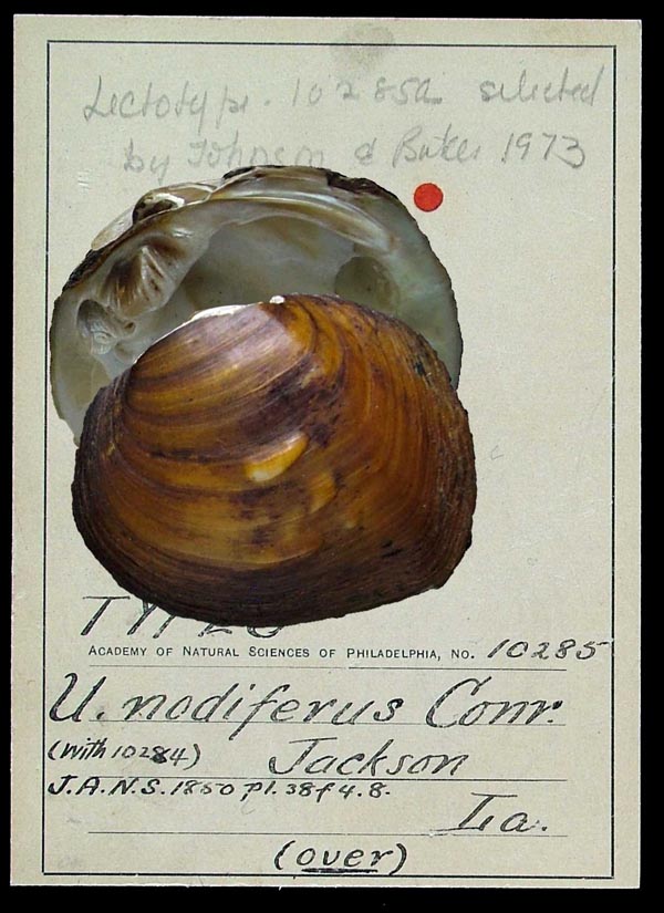
ANSP_10285
Jackson, La
| 
ANSP_20250
Kentucky River
| 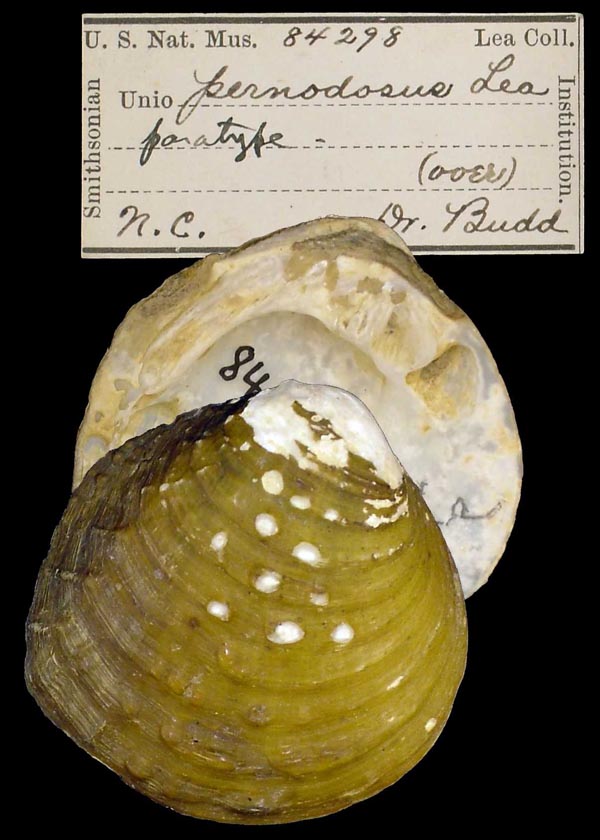
USNM_84298
N.C.
| 
USNM_84277
near New Orleans, La.
| 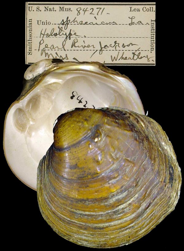
USNM_84271
Pearl River, Jackson, Miss
| 
USNM_85768
Rutersville, Texas
| 
ANSP_416329
Sangamon River, Lake of the Woods, Mahomet, Champaign Co., Illinois 40.2040° N, 88.3876° W
| 
ANSP_416329
Sangamon River, Lake of the Woods, Mahomet, Champaign Co., Illinois 40.2040° N, 88.3876° W
| 
USNM_84572
Texas
| 
USNM_84215
Wabash River, Ind.
|
Georeferenced Genbank Vouchers
U.S.A.Mp_2667_JC. (COI: EF033269, COI M-type: EF033309, go to Genbank) Amite River, near Port Vincent, East Baton Rouge Parish, Louisiana.
USAUAUC_2372. (ND1: AY158766, go to Genbank) Amite R., East Baton Rogue/Livingston Pa., Louisiana. UAUC_1077. (ND1: AY158764, go to Genbank) Big Cypress Bayou, Marion Co., Texas. UAUC_1083. (ND1: AY158745, go to Genbank) Lake Corpus Christi, Live Oak Co., Texas. UAUC_1085. (ND1: AY158765, go to Genbank) ditto. UAUC_2436. (ND1: AY158778, go to Genbank) Lake Lewisville, Denton Co., Texas. UAUC_2590. (ND1: AY158754, go to Genbank) Mississippi R., Marion Co., Missouri. UAUC_1019. (ND1: AY158767, go to Genbank) Mississippi R.,Rock Island Co., Illinois. UAUC_2441. (ND1: AY158763, go to Genbank) Ohio R., Henderson Co., Kentucky. UAUC_2587. (ND1: AY158752, go to Genbank) Ouachita R., Ouachita Co., Arkansas. UAUC_2591. (ND1: AY158753, go to Genbank) ditto. UAUC_405. (ND1: AY158788, go to Genbank) Pascagoula R.,Jackson Co., Mississippi. UAUC_866. (ND1: AY158759, go to Genbank) St. Croix R., Wisconsin. UF_439081 (QrefPrl006). (COI: MH362424, ITS1, 5.8S: MH362606, ND1: MH362081, go to Genbank) USA, Louisiana, St. Tammany Parish, Bogue Chitto River near Lock 2 (30.62254, -89.87655). UF_439081 (QrefPrl007). (COI: MH362425, ND1: MH362082, go to Genbank) ditto. UF_439081 (QrefPrl008). (COI: MH362426, ITS1, 5.8S: MH362607, ND1: MH362083, go to Genbank) ditto. UF_439081 (QrefPrl009). (COI: MH362427, ND1: MH362084, go to Genbank) ditto. UF_439081 (QrefPrl010). (COI: MH362428, ND1: MH362085, go to Genbank) ditto. UF_441174 (QmorSab006). (COI: MH362289, ND1: MH361946, go to Genbank) USA, Louisiana, Vernon County, Anacoco Bayou upstream from Hwy 1211 (31.0163485, -93.3651647). UF_439184 (QpusStC079). (ND1: MH362065, go to Genbank) USA, Minnesota, Chisago County, St. Croix River at Interstate Park (45.3955278, -92.6627834). UF_439184 (QpusStC080). (ND1: MH362066, go to Genbank) ditto. UF_439184 (QpusStC081). (ITS1, 5.8S: MH362638, ND1: MH362067, go to Genbank) ditto. UF_439184 (QpusStC082). (ITS1, 5.8S: MH362639, ND1: MH362068, go to Genbank) ditto. UF_438886 (QrefPas001). (COI: MH362419, ITS1, 5.8S: MH362459, ND1: MH362076, go to Genbank) USA, Mississippi, Jackson County, Pascagoula River at Paper Mill Camp slough about 2 mi. upstream of MS Hwy 614 (30.63228, -88.652401). UF_438886 (QrefPas002). (COI: MH362420, ND1: MH362077, go to Genbank) ditto. UF_438886 (QrefPas003). (COI: MH362421, ND1: MH362078, go to Genbank) ditto. UF_438886 (QrefPas004). (COI: MH362422, ITS1, 5.8S: MH362460, ND1: MH362079, go to Genbank) ditto. UF_438886 (QrefPas005). (COI: MH362423, ITS1, 5.8S: MH362461, ND1: MH362080, go to Genbank) ditto. UF_439126 (QpusOsa065). (COI: MH362400, ITS1, 5.8S: MH362636, ND1: MH362057, go to Genbank) USA, Missouri, Hickory, Pomme de Terre River approx. 500 , below MDC Cross Timber Access Ramp, 2.8 mi N or Hermitage (37.9815, -93.3081). UF_439126 (QpusOsa067). (COI: MH362401, ND1: MH362058, go to Genbank) ditto. UF_439126 (QpusOsa068). (COI: MH362402, ITS1, 5.8S: MH362637, ND1: MH362059, go to Genbank) ditto. UF_439126 (QpusOsa070). (COI: MH362403, ND1: MH362060, go to Genbank) ditto. UF_439127 (QpusNeo061). (COI: MH362396, ITS1, 5.8S: MH362634, ND1: MH362053, go to Genbank) USA, Missouri, McDonald County, Elk River, along Highway DD near Noel (36.568, -94.504). UF_439127 (QpusNeo062). (COI: MH362397, ND1: MH362054, go to Genbank) ditto. UF_439127 (QpusNeo063). (COI: MH362398, ITS1, 5.8S: MH362635, ND1: MH362055, go to Genbank) ditto. UF_439127 (QpusNeo064). (COI: MH362399, ND1: MH362056, go to Genbank) ditto. UF_439124 (QpusStF071). (COI: MH362404, ND1: MH362061, go to Genbank) USA, Missouri, Wayne County, St. Francis River at Camp Lewallen (Bay Scout), 2.25 mi SW of Lodi (37.2371, -90.4857). UF_439124 (QpusStF072). (COI: MH362405, ND1: MH362062, go to Genbank) ditto. UF_439124 (QpusStF073). (COI: MH362406, ND1: MH362063, go to Genbank) ditto. UF_439124 (QpusStF074). (COI: MH362407, ND1: MH362064, go to Genbank) ditto. UF_439157 (QpusOhi051). (COI: MH362364, ITS1, 5.8S: MH362617, ND1: MH362021, go to Genbank) USA, Ohio, Wood County, Ohio River; Buckley Island backchannel (39.3912312, -81.4209442). UF_439157 (QpusOhi052). (COI: MH362365, ITS1, 5.8S: MH362618, ND1: MH362022, go to Genbank) ditto. UF_439157 (QpusOhi053). (COI: MH362366, ND1: MH362023, go to Genbank) ditto. UF_439157 (QpusOhi054). (COI: MH362367, ND1: MH362024, go to Genbank) ditto. UF_439157 (QpusOhi055). (COI: MH362368, ND1: MH362025, go to Genbank) ditto. UF_439157 (QpusOhi056). (COI: MH362369, ITS1, 5.8S: MH362619, ND1: MH362026, go to Genbank) ditto. UF_439076 (QmorTri055). (COI: MH362329, ND1: MH361986, go to Genbank) USA, Texas, Anderson County, Upstream of Hwy 82 near Palestina, TX (31.683591, -95.792124). UF_439076 (QmorTri056). (COI: MH362330, ITS1, 5.8S: MH362598, ND1: MH361987, go to Genbank) ditto. UF_439076 (QmorTri057). (COI: MH362331, ITS1, 5.8S: MH362599, ND1: MH361988, go to Genbank) ditto. UF_439076 (QmorTri058). (COI: MH362332, ITS1, 5.8S: MH362600, ND1: MH361989, go to Genbank) ditto. UF_439076 (QmorTri059). (COI: MH362333, ITS1, 5.8S: MH362601, ND1: MH361990, go to Genbank) ditto. UF_438923 (QmorNec031). (COI: MH362306, ITS1, 5.8S: MH362584, ND1: MH361963, go to Genbank) USA, Texas, Anderson/Cherokee County, Neches River @ CR335 (31.945598, -95.444602). UF_438923 (QmorNec032). (COI: MH362307, ND1: MH361964, go to Genbank) ditto. UF_438923 (QmorNec033). (COI: MH362308, ITS1, 5.8S: MH362585, ND1: MH361965, go to Genbank) ditto. UF_438923 (QmorNec034). (COI: MH362309, ITS1, 5.8S: MH362586, ND1: MH361966, go to Genbank) ditto. UF_438923 (QmorNec035). (COI: MH362310, ND1: MH361967, go to Genbank) ditto. UF_438923 (QmorNec036). (COI: MH362311, ITS1, 5.8S: MH362587, ND1: MH361968, go to Genbank) ditto. UF_438923 (QmorNec037). (COI: MH362312, ND1: MH361969, go to Genbank) ditto. UF_438923 (QmorNec038). (COI: MH362313, ND1: MH361970, go to Genbank) ditto. UF_438923 (QmorNec039). (COI: MH362314, ND1: MH361971, go to Genbank) ditto. UF_438923 (QmorNec040). (COI: MH362315, ITS1, 5.8S: MH362588, ND1: MH361972, go to Genbank) ditto. UF_438923 (QmorNec041). (COI: MH362316, ND1: MH361973, go to Genbank) ditto. UF_438923 (QmorNec042). (COI: MH362317, ND1: MH361974, go to Genbank) ditto. UF_438919 (QmorNec019). (COI: MH362295, ND1: MH361952, go to Genbank) USA, Texas, Anderson/Cherokee County, Neches River downstream of SH 79 (31.885207, -95.431684). UF_438919 (QmorNec020). (COI: MH362296, ND1: MH361953, go to Genbank) ditto. UF_438919 (QmorNec021). (COI: MH362297, ND1: MH361954, go to Genbank) ditto. UF_438919 (QmorNec022). (COI: MH362298, ND1: MH361955, go to Genbank) ditto. UF_438919 (QmorNec023). (COI: MH362299, ND1: MH361956, go to Genbank) ditto. UF_438919 (QmorNec024). (COI: MH362300, ITS1, 5.8S: MH362580, ND1: MH361957, go to Genbank) ditto. UF_438919 (QmorNec025). (COI: MH362301, ND1: MH361958, go to Genbank) ditto. UF_438919 (QmorNec026). (COI: MH362302, ITS1, 5.8S: MH362581, ND1: MH361959, go to Genbank) ditto. UF_438919 (QmorNec028). (COI: MH362303, ITS1, 5.8S: MH362582, ND1: MH361960, go to Genbank) ditto. UF_438919 (QmorNec029). (COI: MH362304, ITS1, 5.8S: MH362583, ND1: MH361961, go to Genbank) ditto. UF_438919 (QmorNec030). (COI: MH362305, ND1: MH361962, go to Genbank) ditto. UF_438011 (QmorTri014). (COI: MH362292, ITS1, 5.8S: MH362657, ND1: MH361949, go to Genbank) USA, Texas, Anderson/Freestone County, Trinity River just upstream of Hwy 79, 3.0 air mi SW of Tucker, TX (31.64941, -95.7897) . UF_438168 (QhouBra035). (COI: MH362273, ND1: MH361930, go to Genbank) USA, Texas, Brazos/Burleson County, Brazos River about 15.5 km downstream from Hwy 21 (30.5811176, -96.4415058). UF_438168 (QhouBra036). (COI: MH362274, ITS1, 5.8S: MH362539, ND1: MH361931, go to Genbank) ditto. UF_438168 (QhouBra037). (COI: MH362275, ITS1, 5.8S: MH362540, ND1: MH361932, go to Genbank) ditto. UF_438168 (QhouBra038). (COI: MH362276, ND1: MH361933, go to Genbank) ditto. UF_440989 (QhouCol003). (COI: MH362255, ND1: MH361912, go to Genbank) USA, Texas, Colorado County, Colorado River at FM 950; just east of Garwood, TX. Sampled ~30m stretch along right ascending bank near old bridge abutments. (29.45354, -96.39587). UF_440989 (QhouCol001). (COI: MH362254, ITS1, 5.8S: MH362475, ND1: MH361911, go to Genbank) USA, Texas, Colorado County, Colorado River at FM 950; just east of Garwood, TX. Sampled ~30m stretch along right ascending bank nearl old bridge abutments. (29.45354, -96.39587). UF_441139 (QhouBra017). (COI: MH362266, ND1: MH361923, go to Genbank) USA, Texas, Comanche County, Leon River downstream from Highway 67 (31.9574036, -98.4589713). UF_438949 (QmorTri048). (COI: MH362322, ND1: MH361979, go to Genbank) USA, Texas, Denton County, Elm Fork of Trinity River, 0.1 km below Lake Lewisville Dam (33.067064, -96.963914). UF_438950 (QmorTri049). (COI: MH362323, ND1: MH361980, go to Genbank) USA, Texas, Denton County, Elm Fork of Trinity River, appx 0.25 km below Lake Lewisville Dam (33.065862, -96.964305). UF_438172 (QaurGua040). (COI: MH362201, ND1: MH361858, go to Genbank) USA, Texas, Dewitt County, Guadalupe River about 15 air km upstream of Cuero, TX (29.221294, -97.329695). UF_438172 (QaurGua041). (COI: MH362202, ND1: MH361859, go to Genbank) ditto. UF_438172 (QaurGua042). (COI: MH362203, ITS1, 5.8S: MH362548, ND1: MH361860, go to Genbank) ditto. UF_438172 (QaurGua043). (COI: MH362204, ITS1, 5.8S: MH362549, ND1: MH361861, go to Genbank) ditto. UF_438172 (QaurGua044). (COI: MH362205, ITS1, 5.8S: MH362550, ND1: MH361862, go to Genbank) ditto. UF_438172 (QaurGua045). (COI: MH362206, ITS1, 5.8S: MH362551, ND1: MH361863, go to Genbank) ditto. UF_438172 (QaurGua046). (COI: MH362207, ND1: MH361864, go to Genbank) ditto. UF_438172 (QaurGua047). (COI: MH362208, ND1: MH361865, go to Genbank) ditto. UF_438172 (QaurGua048). (COI: MH362209, ITS1, 5.8S: MH362552, ND1: MH361866, go to Genbank) ditto. UF_438172 (QaurGua049). (COI: MH362210, ND1: MH361867, go to Genbank) ditto. UF_441257 (QaurGua021). (COI: MH362197, ITS1, 5.8S: MH362523, ND1: MH361854, go to Genbank) USA, Texas, Goliad County, San Antonio River 3.3 mi south of Goliad, TX, just NW of US Hwy 59 bridge; from SW shore in muddy eddy area above large drift against bridge pilings, in fairly deep, soft mud on clay substrate, ~0.5m deep (28.651169, -97.432994). UF_438927 (QaurGua090). (COI: MH362246, ND1: MH361903, go to Genbank) USA, Texas, Gonzales County, San Marcos River @ CR232 (29.56274, -97.543455). UF_438927 (QaurGua091). (COI: MH362247, ND1: MH361904, go to Genbank) ditto. UF_438927 (QaurGua092). (COI: MH362248, ND1: MH361905, go to Genbank) ditto. UF_438927 (QaurGua093). (COI: MH362249, ND1: MH361906, go to Genbank) ditto. UF_438927 (QaurGua094). (COI: MH362250, ND1: MH361907, go to Genbank) ditto. UF_438927 (QaurGua095). (COI: MH362251, ND1: MH361908, go to Genbank) ditto. UF_438927 (QaurGua096). (COI: MH362252, ND1: MH361909, go to Genbank) ditto. UF_441085 (QaurGua012). (COI: MH362190, ND1: MH361847, go to Genbank) USA, Texas, Gonzales/Guadalupe County, San Marcos River between US-90 and SR-80, south of Luling (29.67078, -97.69561). UF_441085 (QaurGua013). (COI: MH362191, ND1: MH361848, go to Genbank) ditto. UF_441085 (QaurGua014). (COI: MH362192, ND1: MH361849, go to Genbank) ditto. UF_441085 (QaurGua015). (COI: MH362193, ND1: MH361850, go to Genbank) ditto. UF_441085 (QaurGua016). (COI: MH362194, ITS1, 5.8S: MH362491, ND1: MH361851, go to Genbank) ditto. UF_441085 (QaurGua017). (COI: MH362195, ND1: MH361852, go to Genbank) ditto. UF_441085 (QaurGua018). (COI: MH362196, ND1: MH361853, go to Genbank) ditto. UF_440981 (QaurGua004). (COI: MH362186, ND1: MH361843, go to Genbank) USA, Texas, Guadalupe County, Guadalupe River at Hwy 77 crossing (28.83119, -97.06129). UF_440981 (QaurGua006). (COI: MH362187, ND1: MH361844, go to Genbank) ditto. UF_440981 (QaurGua008). (COI: MH362188, ITS1, 5.8S: MH362473, ND1: MH361845, go to Genbank) ditto. UF_440981 (QaurGua009). (COI: MH362189, ITS1, 5.8S: MH362474, ND1: MH361846, go to Genbank) ditto. UF_441172 (QmorSab004). (COI: MH362287, ITS1, 5.8S: MH362512, ND1: MH361944, go to Genbank) USA, Texas, Kaufman County, East Fork Trinity River downstream of Lewis Street, near Crandall, TX [32.592543, -96.486377]. UF_438785 (QpusRed001). (COI: MH362348, ITS1, 5.8S: MH362573, ND1: MH362005, go to Genbank) USA, Texas, Lamar County, Pine Creek, ~100 m upstream from CR906 (33.854656, -95.341305). UF_438785 (QpusRed002). (COI: MH362349, ITS1, 5.8S: MH362574, ND1: MH362006, go to Genbank) ditto. UF_438785 (QpusRed004). (COI: MH362350, ITS1, 5.8S: MH362575, ND1: MH362007, go to Genbank) ditto. UF_438785 (QpusRed005). (COI: MH362351, ITS1, 5.8S: MH362576, ND1: MH362008, go to Genbank) ditto. UF_438785 (QpusRed006). (COI: MH362352, ITS1, 5.8S: MH362577, ND1: MH362009, go to Genbank) ditto. UF_438785 (QpusRed007). (COI: MH362353, ND1: MH362010, go to Genbank) ditto. UF_438785 (QpusRed008). (COI: MH362354, ND1: MH362011, go to Genbank) ditto. UF_438785 (QpusRed009). (COI: MH362355, ND1: MH362012, go to Genbank) ditto. UF_438785 (QpusRed010). (COI: MH362356, ITS1, 5.8S: MH362578, ND1: MH362013, go to Genbank) ditto. UF_438013 (QmorTri013). (COI: MH362291, ND1: MH361948, go to Genbank) USA, Texas, Leon/Houston County, Trinity River, just downstream of Hwy 7, about 12 air miles W of Crockett, TX (31.3352, -95.65641). UF_439194 (QmorSaJ071). (COI: MH362338, ND1: MH361995, go to Genbank) USA, Texas, Liberty County, East Fork of San Jacinto River, Site 14; South of Cleveland at Hwy 59 crossing downstream approx. 20 m (30.29125, -95.121296). UF_438566 (QaurNue050). (COI: MH362211, ND1: MH361868, go to Genbank) USA, Texas, Live Oak County, Frio River about 400 m downstream of dam at Choke Canyon (28.48684, -98.23867). UF_438566 (QaurNue051). (COI: MH362212, ITS1, 5.8S: MH362563, ND1: MH361869, go to Genbank) ditto. UF_438566 (QaurNue052). (COI: MH362213, ND1: MH361870, go to Genbank) ditto. UF_438566 (QaurNue054). (COI: MH362214, ND1: MH361871, go to Genbank) ditto. UF_438566 (QaurNue057). (COI: MH362215, ND1: MH361872, go to Genbank) ditto. UF_438566 (QaurNue058). (COI: MH362216, ND1: MH361873, go to Genbank) ditto. UF_438566 (QaurNue059). (COI: MH362217, ND1: MH361874, go to Genbank) ditto. UF_438566 (QaurNue060). (COI: MH362218, ND1: MH361875, go to Genbank) ditto. UF_438566 (QaurNue061). (COI: MH362219, ND1: MH361876, go to Genbank) ditto. UF_438053 (QaurNue027). (COI: MH362198, ITS1, 5.8S: MH362538, ND1: MH361855, go to Genbank) USA, Texas, Live Oak County, Frio River below Choke Canyon Reservoir, Tips State Rec. Area below the fall in Three Rivers (28.46104, -98.19073). UF_438053 (QaurNue028). (COI: MH362199, ND1: MH361856, go to Genbank) ditto. UF_438054 (QaurNue031). (COI: MH362200, ND1: MH361857, go to Genbank) USA, Texas, Live Oak County, Nueces River @ Airport Road, George West (28.37436, -98.11561). UF_438741 (QaurNue080). (COI: MH362238, ND1: MH361895, go to Genbank) USA, Texas, Live Oak County, Nueces River upstream of Airport Rd (28.382964, -98.109617). UF_438741 (QaurNue081). (COI: MH362239, ND1: MH361896, go to Genbank) ditto. UF_438741 (QaurNue082). (COI: MH362240, ND1: MH361897, go to Genbank) ditto. UF_438741 (QaurNue083). (COI: MH362241, ITS1, 5.8S: MH362567, ND1: MH361898, go to Genbank) ditto. UF_438741 (QaurNue085). (COI: MH362242, ND1: MH361899, go to Genbank) ditto. UF_438741 (QaurNue086). (COI: MH362243, ITS1, 5.8S: MH362568, ND1: MH361900, go to Genbank) ditto. UF_438741 (QaurNue088). (COI: MH362244, ND1: MH361901, go to Genbank) ditto. UF_438741 (QaurNue089). (COI: MH362245, ND1: MH361902, go to Genbank) ditto. UF_438574 (QaurNue062). (COI: MH362220, ITS1, 5.8S: MH362564, ND1: MH361877, go to Genbank) USA, Texas, Live Oak County, Nueces River, 400 m upstream of Hwy 59 (28.337458, -98.086636). UF_438574 (QaurNue063). (COI: MH362221, ND1: MH361878, go to Genbank) ditto. UF_438574 (QaurNue064). (COI: MH362222, ND1: MH361879, go to Genbank) ditto. UF_438574 (QaurNue065). (COI: MH362223, ITS1, 5.8S: MH362565, ND1: MH361880, go to Genbank) ditto. UF_438574 (QaurNue066). (COI: MH362224, ND1: MH361881, go to Genbank) ditto. UF_438574 (QaurNue067). (COI: MH362225, ND1: MH361882, go to Genbank) ditto. UF_438574 (QaurNue068). (COI: MH362226, ND1: MH361883, go to Genbank) ditto. UF_438574 (QaurNue069). (COI: MH362227, ND1: MH361884, go to Genbank) ditto. UF_438574 (QaurNue070). (COI: MH362228, ND1: MH361885, go to Genbank) ditto. UF_438574 (QaurNue071). (COI: MH362229, ITS1, 5.8S: MH362566, ND1: MH361886, go to Genbank) ditto. UF_438574 (QaurNue072). (COI: MH362230, ND1: MH361887, go to Genbank) ditto. UF_438574 (QaurNue073). (COI: MH362231, ND1: MH361888, go to Genbank) ditto. UF_438574 (QaurNue074). (COI: MH362232, ND1: MH361889, go to Genbank) ditto. UF_438574 (QaurNue075). (COI: MH362233, ND1: MH361890, go to Genbank) ditto. UF_438574 (QaurNue076). (COI: MH362234, ND1: MH361891, go to Genbank) ditto. UF_438574 (QaurNue077). (COI: MH362235, ND1: MH361892, go to Genbank) ditto. UF_438574 (QaurNue078). (COI: MH362236, ND1: MH361893, go to Genbank) ditto. UF_438574 (QaurNue079). (COI: MH362237, ND1: MH361894, go to Genbank) ditto. UF_438974 (QmorRed051). (COI: MH362324, ITS1, 5.8S: MH362663, ND1: MH361981, go to Genbank) USA, Texas, Marion County, Big Cypress Bayou (just downstream from Hwy 59, near Jefferson, TX) (32.739928, -94.441666). UF_438974 (QmorRed052). (COI: MH362325, ND1: MH361982, go to Genbank) ditto. UF_438974 (QmorRed053). (COI: MH362326, ND1: MH361983, go to Genbank) ditto. UF_438974 (QmorRed054). (COI: MH362327, ND1: MH361984, go to Genbank) ditto. UF_438974 (QmorRed055). (COI: MH362328, ND1: MH361985, go to Genbank) ditto. UF_439206 (QpetCol079). (COI: MH362279, ND1: MH361936, go to Genbank) USA, Texas, Mason County, Llano River at FM1871, ~12 miles SW of Mason, TX (30.658673, -99.3245). UF_439059 (QhouBra044). (COI: MH362280, ITS1, 5.8S: MH362664, ND1: MH361937, go to Genbank) USA, Texas, Milam County, Little River downstream of CR1915 [4 mi. S of Buckholts, TX] (30.81558, -97.13651). UF_439059 (QhouBra047). (COI: MH362281, ITS1, 5.8S: MH362595, ND1: MH361938, go to Genbank) ditto. UF_439193 (QmorSaJ069). (COI: MH362336, ND1: MH361993, go to Genbank) USA, Texas, Montgomery County, Spring Creek, Site 2; North of Tumball, TX at FM 2978 crossing under bridge (30.134462, -95.59674). UF_439192 (QmorSaJ072). (COI: MH362339, ND1: MH361996, go to Genbank) USA, Texas, Montgomery County, West Fork of San Jacinto River NW of Conroe, TX off 105 crossing; site 9 (30.342505, -95.542981). UF_439192 (QmorSaJ073). (COI: MH362340, ND1: MH361997, go to Genbank) ditto. UF_439195 (QmorSaJ070). (COI: MH362337, ND1: MH361994, go to Genbank) USA, Texas, Montgomery County, West Fork of San Jacinto River, Site 7; Downstream of 242 crossing south of Conroe, TX (30.210398, -95.397995). UF_441173 (QmorSab005). (COI: MH362288, ITS1, 5.8S: MH362513, ND1: MH361945, go to Genbank) USA, Texas, Newton County, Lower Sabine River, Site 54A, 4.2 miles north of Deweyville, TX (30.3565919, -93.7606991). UF_438486 (QmorTri017). (COI: MH362293, ND1: MH361950, go to Genbank) USA, Texas, Newton County, Sabine River, 2 mi. NNW of Bancroft, LA (30.591914, -93.698572). UF_438486 (QmorTri018). (COI: MH362294, ITS1, 5.8S: MH362559, ND1: MH361951, go to Genbank) ditto. UF_441171 (QmorSab001). (COI: MH362286, ITS1, 5.8S: MH362511, ND1: MH361943, go to Genbank) USA, Texas, Newton County, Sabine River, near river mile 82.5, Site A (30.6652604, -93.6580554). UF_440968 (QaurGua001). (COI: MH362185, ND1: MH361842, go to Genbank) USA, Texas, Refugio/Victoria Cos., San Antonio River at Hwy 77 crossing (28.531484, -97.042921). UF_441135. (COI: KT285649, ITS1, 5.8S: KT285693, go to Genbank) USA, Texas, Robertson County, Brazos River at FM 485, west of Highway 6 (30.8676502, -96.6956368). UF_441135 (QhouBra011). (COI: MH362261, ITS1, 5.8S: MH362505, ND1: MH361918, go to Genbank) ditto. UF_441135 (QhouBra012). (COI: MH362262, ITS1, 5.8S: MH362506, ND1: MH361919, go to Genbank) ditto. UF_441135 (QhouBra013). (COI: MH362263, ND1: MH361920, go to Genbank) ditto. UF_441135 (QhouBra014). (COI: MH362264, ITS1, 5.8S: MH362507, ND1: MH361921, go to Genbank) ditto. UF_441135 (QhouBra015). (COI: MH362265, ND1: MH361922, go to Genbank) ditto. UF_439198 (QmorSaJ091). (COI: MH362344, ND1: MH362001, go to Genbank) USA, Texas, San Jacinto County, East Fork San Jacinto River, upstream of FM 945, 300 m upstream from bridge (30.42912, -95.12973). UF_439198 (QmorSaJ092). (COI: MH362345, ND1: MH362002, go to Genbank) ditto. UF_439198 (QmorSaJ093). (COI: MH362346, ND1: MH362003, go to Genbank) ditto. UF_439198 (QmorSaJ094). (COI: MH362347, ND1: MH362004, go to Genbank) ditto. UF_438059 (QhouCol029). (COI: MH362272, ND1: MH361929, go to Genbank) USA, Texas, San Saba County, Colorado River, Burnham's property (31.2617789, -98.5947677). UF_441087 (QhouCol004). (COI: MH362256, ITS1, 5.8S: MH362499, ND1: MH361913, go to Genbank) USA, Texas, San Saba County, San Saba River at CR 104, San Saba River Golf Course, near San Saba, TX (31.20738, -98.68761). UF_441087 (QhouCol005). (COI: MH362257, ITS1, 5.8S: MH362500, ND1: MH361914, go to Genbank) ditto. UF_441087 (QhouCol006). (COI: MH362258, ITS1, 5.8S: MH362501, ND1: MH361915, go to Genbank) ditto. UF_441087 (QhouCol007). (COI: MH362259, ITS1, 5.8S: MH362502, ND1: MH361916, go to Genbank) ditto. UF_441087 (QhouCol009). (COI: MH362260, ND1: MH361917, go to Genbank) ditto. UF_439205 (QpetCol026). (COI: MH362267, ND1: MH361924, go to Genbank) USA, Texas, San Saba County, San Saba River downstream from Hwy 190 crossing near San Saba, TX (31.212419, -98.79837). UF_441256 (QmorSab008). (COI: MH362290, ITS1, 5.8S: MH362522, ND1: MH361947, go to Genbank) USA, Texas, Smith/Wood County, Sabine River, Hwy 14, S of Hawkins, TX, collected from a riffle 200m downstream from bridge crossing (32.5573098, -95.2056386). UF_438930 (QmorTri043). (COI: MH362318, ITS1, 5.8S: MH362591, ND1: MH361975, go to Genbank) USA, Texas, Tarrant County, Grapevine Lake, [3.4 mi. NNW of Grapevine, TX] (32.980521, -97.09841). UF_438930 (QmorTri044). (COI: MH362319, ND1: MH361976, go to Genbank) ditto. UF_438930 (QmorTri046). (COI: MH362320, ND1: MH361977, go to Genbank) ditto. UF_438930 (QmorTri047). (COI: MH362321, ITS1, 5.8S: MH362592, ND1: MH361978, go to Genbank) ditto. UF_439201 (QmorNec087). (COI: MH362341, ND1: MH361998, go to Genbank) USA, Texas, Trinity County, Alabama Creek WMA (31.19669, -94.85869). UF_439201 (QmorNec088). (COI: MH362342, ND1: MH361999, go to Genbank) ditto. UF_439201 (QmorNec089). (COI: MH362343, ITS1, 5.8S: MH362647, ND1: MH362000, go to Genbank) ditto. UF_439079 (QmorCol060). (COI: MH362282, ND1: MH361939, go to Genbank) USA, Texas, Wharton, Colorado River near Lane City, TX; Habitat: Run (29.173116, -96.067204). UF_439079 (QmorCol061). (COI: MH362283, ND1: MH361940, go to Genbank) ditto. UF_439079 (QmorCol062). (COI: MH362284, ITS1, 5.8S: MH362602, ND1: MH361941, go to Genbank) ditto. UF_439079 (QmorCol063). (COI: MH362285, ITS1, 5.8S: MH362603, ND1: MH361942, go to Genbank) ditto. UF_438157 (QhouBra041). (COI: MH362277, ITS1, 5.8S: MH362543, ND1: MH361934, go to Genbank) USA, Texas, Williamson County, San Gabriel River about 100m downstream of Co. Road 428 bridge (30.695341, -97.27804). UF_438157 (QhouBra042). (COI: MH362278, ND1: MH361935, go to Genbank) ditto. UF_439080 (QmorSab066). (COI: MH362334, ITS1, 5.8S: MH362604, ND1: MH361991, go to Genbank) USA, Texas, Wood County, Lake Fork Creek 6.7 km south of Hainesville, TX (32.65716, -95.3615). UF_439080 (QmorSab068). (COI: MH362335, ITS1, 5.8S: MH362605, ND1: MH361992, go to Genbank) ditto. JBFMC_9591_1. (16S: PQ238830, go to Genbank) USA: Texas, Little Brazos River. UF_441171. (COI: KT285655, ITS1, 5.8S: KT285699, go to Genbank) USA:Texas:Newton County :Sabine River, near river mile 82.5, Site A (30.6652604, -93.6580554). UAUC_658. (ND1: AY158762, go to Genbank) Wolf R., Fayette Co., Tennessee. |