| Page last updated
Thu 3 September 2025 |
The Freshwater Mussels (Unionoida) of the World (and other less consequential bivalves)
FM(U)otW(aolcb) is the web version of the MUSSEL Project Database. Follow the links to browse the data or use the custom Google search field. Either way, you win!
Search the database pages:
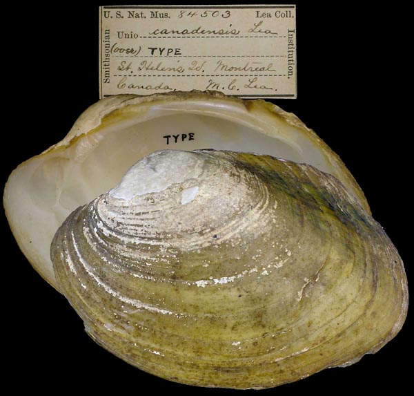
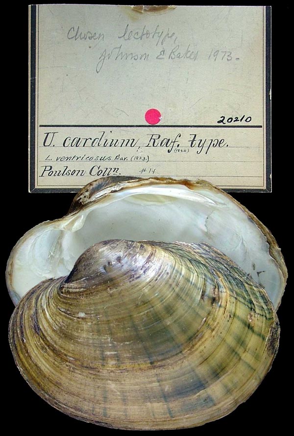
Bivalvia | Unionida | Unionoidea | Unionidae | Ambleminae | Lampsilini | Lampsilis species Lampsilis cardium Rafinesque, 1820: specimens
11 available nominal species synonyms (20 total synonyms) Recent Taxonomic OpinionsLampsilis cardium — Graf & Cummings (2007), Tiemann et al. (2007), Watters et al. (2009), Jadhav & Jamkhedkar (2009), Hoeh et al. (2009), ... Chen et al. (2025), FMCS (2025), Chen et al. (2025), Hou et al. (2025), Campbell & Lydeard (2026)
Lampsilis cardium/ovata — Jones (2015) RangeWidespread in the Interior, Nelson, and Great Lakes basins, North America. Introduced to the Potomac River on the Atlantic Slope. Map of Georeferenced Specimens
Canada
unknown
USA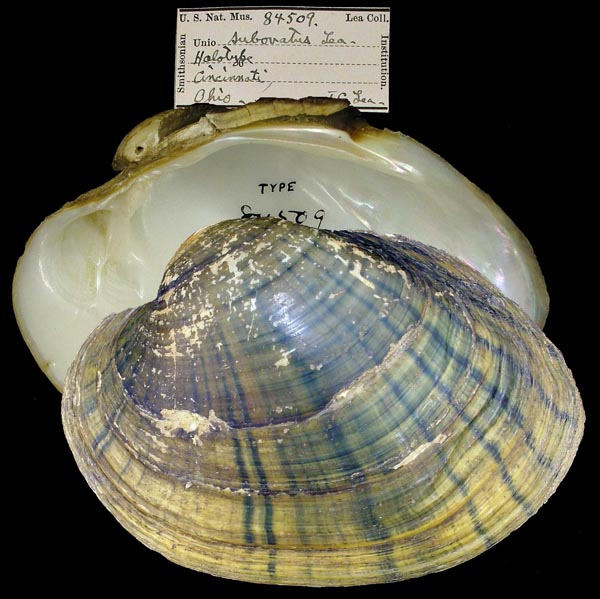
USNM_84509
Cincinnati, Ohio
| 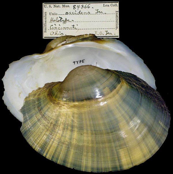
USNM_84866
Cincinnati, Ohio
| 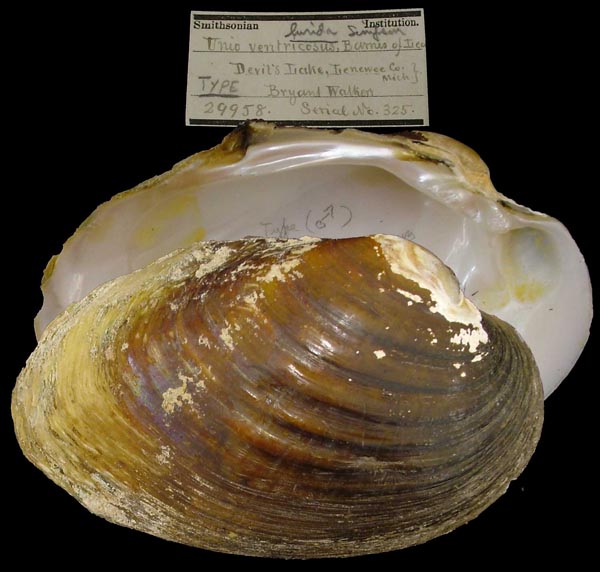
USNM_29958
Devil’s Lake, Lenawee Co., Mich.
| 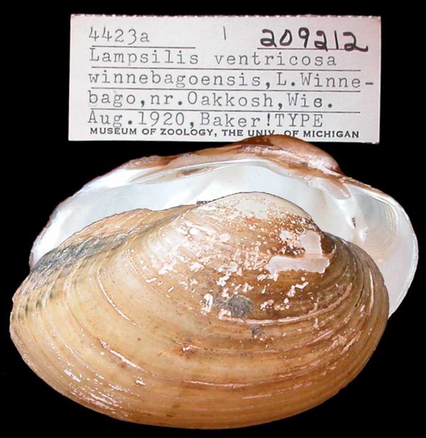
UMMZ_209212
L. Winnebago, nr. Oshkosh, Wis.
| 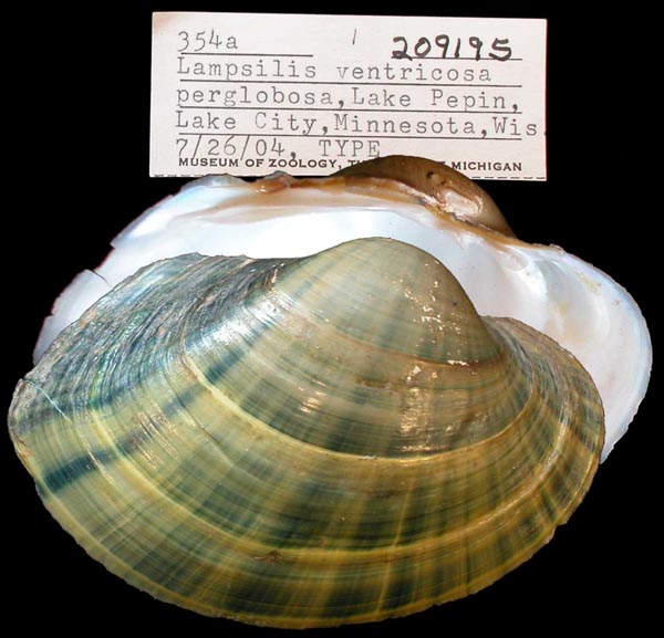
UMMZ_209195
Lake Pepin, Lake City, Minnesota
| 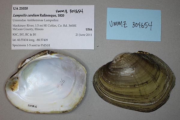
UMMZ_304654
Mackinaw River, 1.5 mi SE Colfax, Co. Rd. 3600E Mclean County, Illinois, 40.5543°, -88.57409°
| 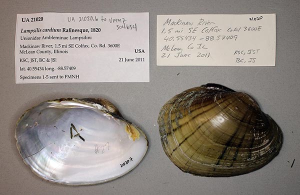
UA_21020
Mackinaw River, 1.5 mi SE Colfax, Co. Rd. 3600E Mclean County, Illinois, 40.5543°, -88.57409°
| 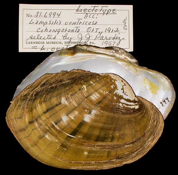
CM_31.6994
Potomac River, Hancock, Washington Co., Maryland
| 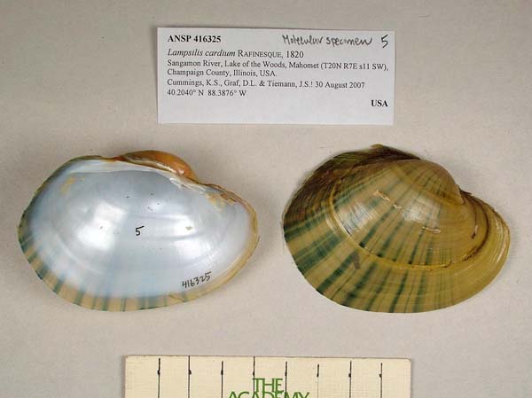
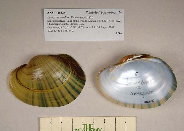
ANSP_416325
Sangamon River, Lake of the Woods, Mahomet, Champaign Co., Illinois 40.2040° N, 88.3876° W
| 
ANSP_416325
Sangamon River, Lake of the Woods, Mahomet, Champaign Co., Illinois 40.2040° N, 88.3876° W
|
Georeferenced Genbank Vouchers
USAUMMZ_265707. (28S: AF305386, COI: AF156519, COI: AF156518, go to Genbank) Huron River, MI. INHS_49380. (28S: MK036082, COI: MK044914, ITS1, 5.8S: MK036165, ND1: MK045065, go to Genbank) St. Croix River, St. Croix drainage (46.0046, -92.4467). UMMZ_304654. (16S: KP795057, 28S: KP795020, COI: KP795038, SRA: SRX5278591, go to Genbank) USA: 1.5 mi SE Colfax, Co. Rd. 3600E (40.55434 N 88.57409 W). ASUMZ_1829_2. (16S: PQ238835, go to Genbank) USA: Arkansas, Frog Bayou. |