| Page last updated
Thu 3 September 2025 |
The Freshwater Mussels (Unionoida) of the World (and other less consequential bivalves)
FM(U)otW(aolcb) is the web version of the MUSSEL Project Database. Follow the links to browse the data or use the custom Google search field. Either way, you win!
Search the database pages:
Bivalvia | Unionida | Unionoidea | Unionidae | Ambleminae | Lampsilini | Cyrtonaias species Cyrtonaias berlandierii (Lea, 1857): specimens
4 available nominal species synonyms (7 total synonyms) Recent Taxonomic OpinionsCyrtonaias tampicoensis — Graf & Cummings (2007), Pfeiffer et al. (2019), Graf & Cummings (2021)
Cyrtonaias saladoensis — Graf & Cummings (2007), Bogan (2010), Cummings & Graf (2010)
Glebula rotundata — Watters et al. (2009)
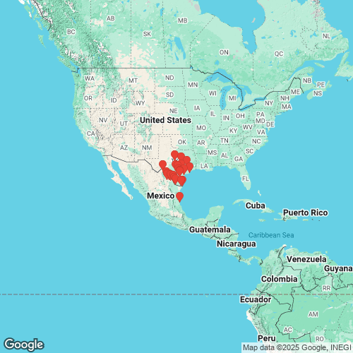
Cyrtonaias berlandierii — Cummings et al. (2025) RangeBrazos River in Texas to the Rio Grande Basin in Mexico. Map of Georeferenced Specimens
Mexico
INHS_31738
100 km W Ciudad Acuna, 0.5 to 10 km E 102nd Meridian, Coahuila, Mexico
| 
USNM_251829
Camargo, Tamaulipas, Mexico
| 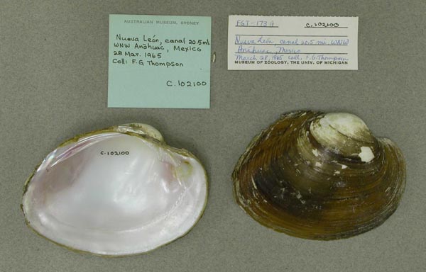
AMS_102100
canal, 20.5 mi WNW Anahuac, Nueva Leon, Mexico
| 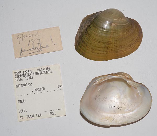
USNM_122379
Matamoras, Mexico
| 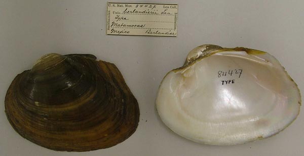
USNM_84427
Matamoras, Mexico
| 
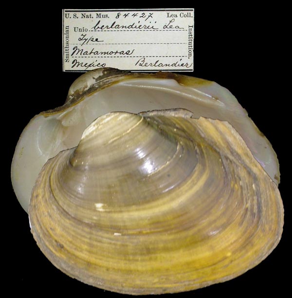
USNM_84427
Matamoras, Mexico
| 
USNM_84427
Matamoras, Mexico
| 
BMNH_1964143
Mexico
| 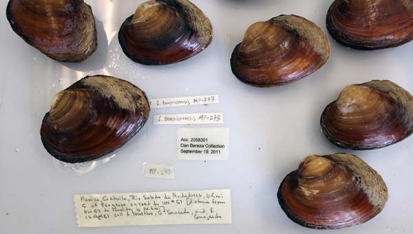
USNM_1282327-28
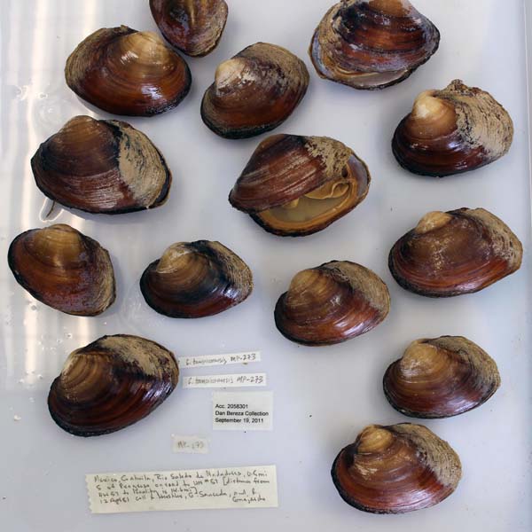
Mexico: Coahuila. Rio Salado de Nadadores, 0.5 mi S Progresso on road to HW 57 [distance from HW 57 is 14.6 mi]
| 
USNM_1282327-28
Mexico: Coahuila. Rio Salado de Nadadores, 0.5 mi S Progresso on road to HW 57 [distance from HW 57 is 14.6 mi]
| 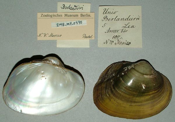
ZMB_MP_0470
N.W. Mexico
| 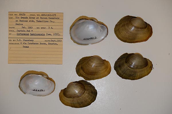
OSUM_22682
Rio Grande at Falcon Reservoir, Tamaulipas, Mexico
| 
AMS_102113
Rio Saldado, Anahuac, Nueva Leon, Mexico
| 
USNM_251830
Sabinas River, Mexico
| 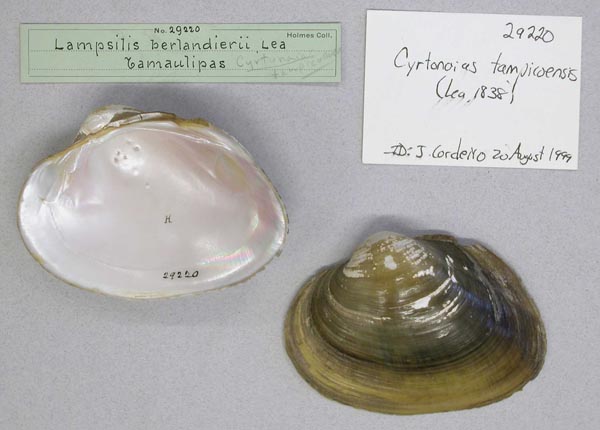
AMNH_29220
Tamaulipas
|
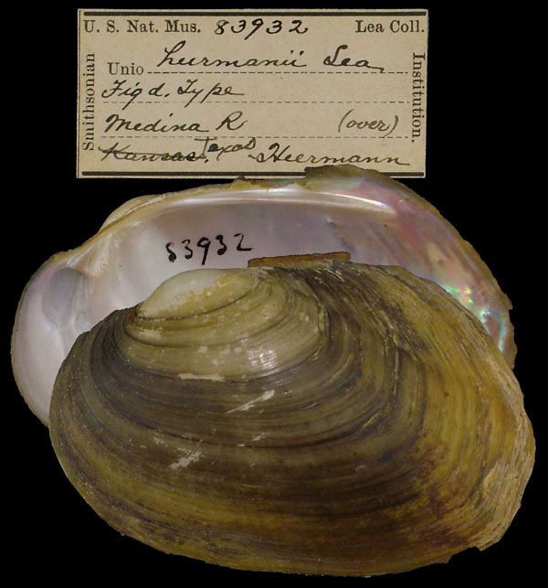
USAUTAP_5193. Medina River, Medina county, Texas, 0.5 mi. N of north edge of Castroville [along river road where low water bridge to Camp Cayoca crosses river, east from river road] Georeferenced Genbank Vouchers
USAMp_2667_H1019. (COI: EF033259, COII: EF033279, go to Genbank) Guadalupe River, upstream of Wood Lake and upstream of the access road from the town of Cost, Gonzales County, Texas. Mp_2667_H1019g. (COI M-type: EF033299, COII M-type: EF033319, go to Genbank) ditto. UAUC_316. (5.8S, ITS1: MH167927, go to Genbank) Lake Corpus Christi, Live Oak Co., Texas. UAUC_78. (16S: AY655032, go to Genbank) Leon River, Belton Reservoir, Bell Co. TX. UF_441145-008. (28S: MK036074, 5.8S, ITS1: MK036157, COI: MK044906, ND1: MK045057, go to Genbank) Navasota River, Brazos drainage (30.3547, -96.1416). UAUC_314. (ITS1: DQ383436, ND1: AY655090, go to Genbank) Nueces River, Lake Corpus Christi, Live Oak Co. TX. UF_441144-007. (16S: MK001807, 28S: MK001841, 28S: MK036073, COI: KT285620, ITS1, 5.8S: KT285664, ND1: MK045056, go to Genbank) USA, Texas, Brown County, Colorado River downstream of Co. Rd. 229 (31.4831003, -99.0305955). UF_438559. (SRA: SRX5278586, go to Genbank) USA, Texas, Live Oak County, Choke Canyon Reservoir at boat ramp on west side of lake near dam (28.47405, -98.25166). NRI_8173_1. (16S: MT561702, ANT: MT558911, COI: MT553984, go to Genbank) USA: Brazos River, Texas. NRI_8208_1. (ANT: MT558912, COI: MT553985, go to Genbank) ditto. NRI_8163_1. (ANT: MT558913, COI: MT553986, go to Genbank) USA: Guadalupe River, Texas. NRI_8163_3. (16S: MT561703, ANT: MT558914, COI: MT553987, go to Genbank) ditto. NRI_8163_4. (16S: MT561704, ANT: MT558915, COI: MT553988, go to Genbank) ditto. NRI_8163_6. (16S: MT561705, COI: MT553989, go to Genbank) ditto. NRI_8163_7. (16S: MT561706, COI: MT553990, go to Genbank) ditto. NRI_8107_1. (ANT: MT558916, COI: MT553991, go to Genbank) USA: Rio Grande, Texas. NRI_8135_3. (ANT: MT558917, COI: MT553992, go to Genbank) ditto. NRI_8503_3. (COI: MT553993, go to Genbank) ditto. UF_439463. (16S: PQ238810, go to Genbank) USA: Texas, Brazos River. |