| Page last updated
Thu 3 September 2025 |
The Freshwater Mussels (Unionoida) of the World (and other less consequential bivalves)
FM(U)otW(aolcb) is the web version of the MUSSEL Project Database. Follow the links to browse the data or use the custom Google search field. Either way, you win!
Search the database pages:
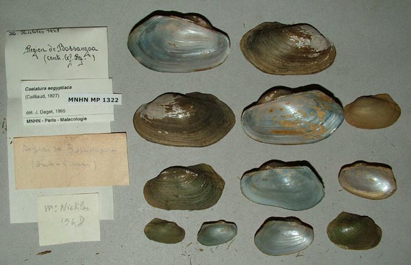
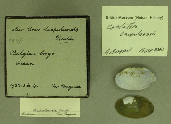
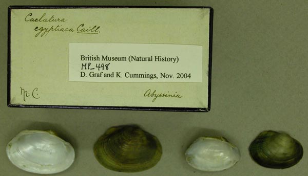
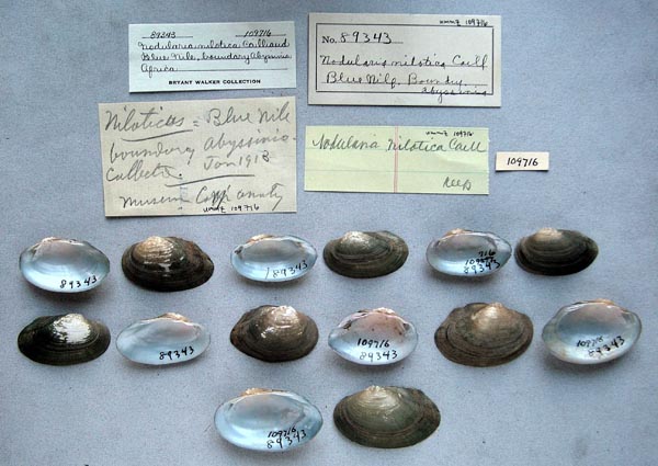
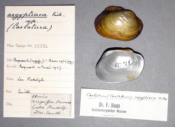
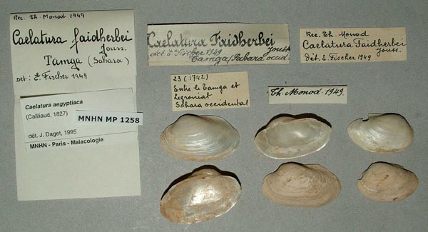
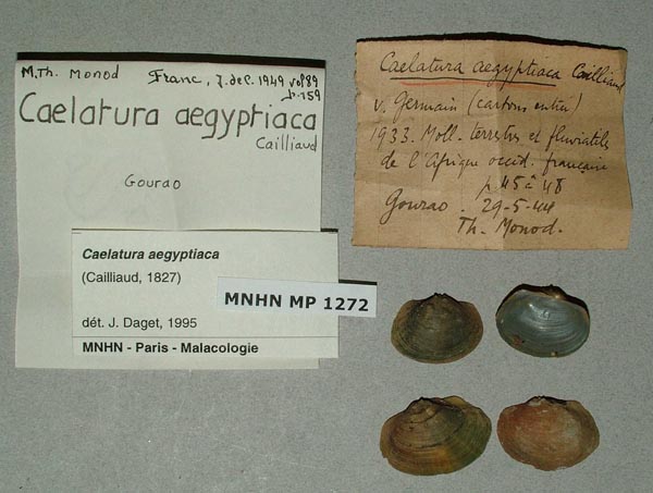
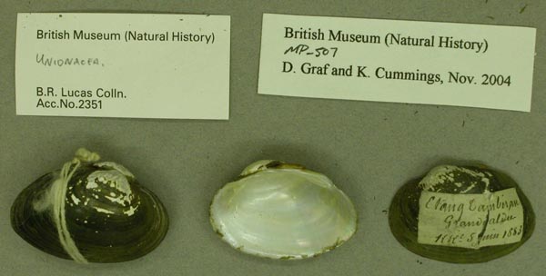
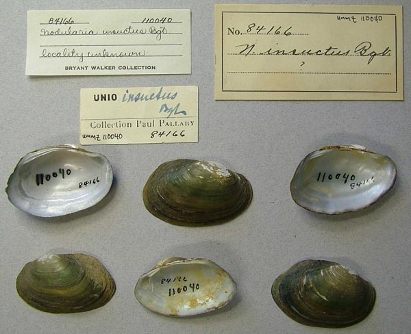
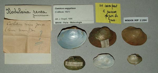
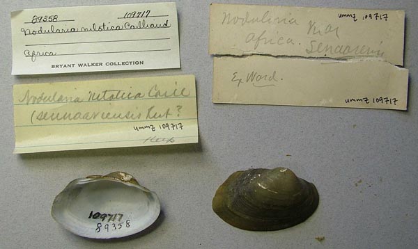
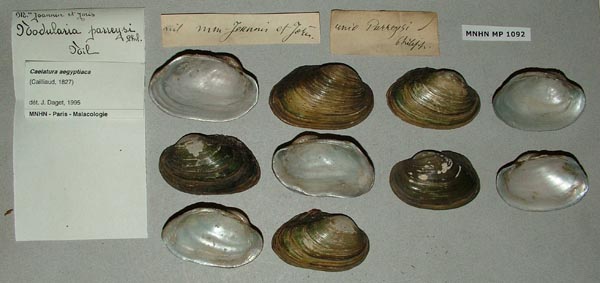
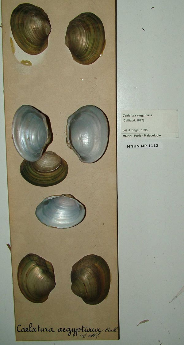
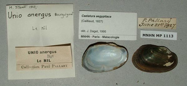
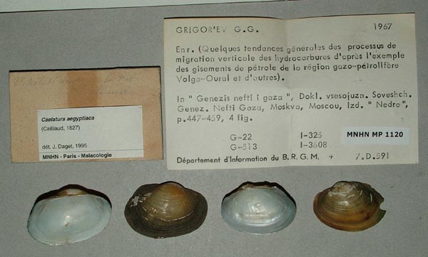
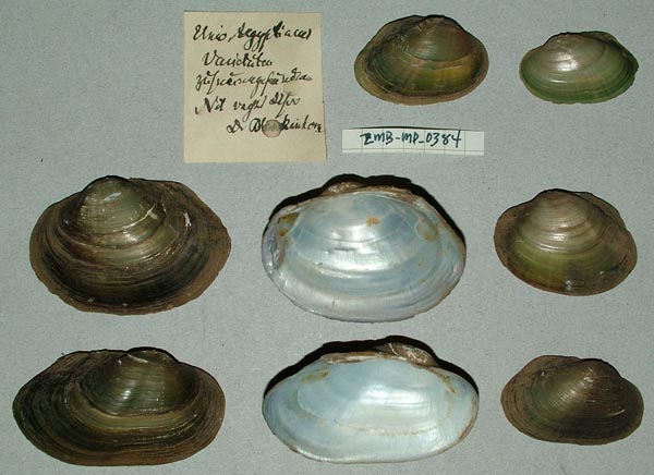
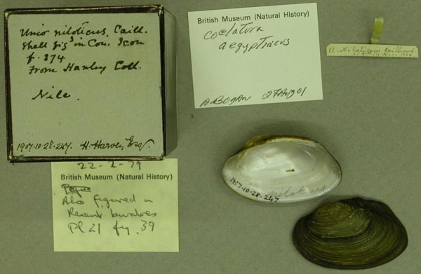
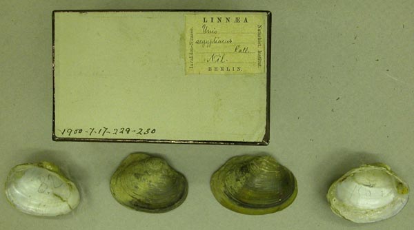
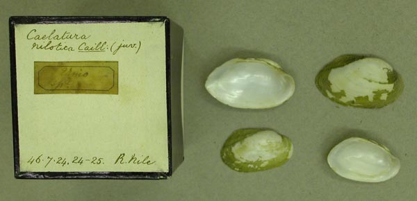
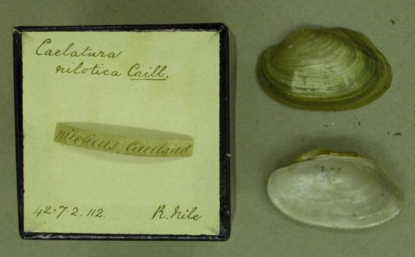
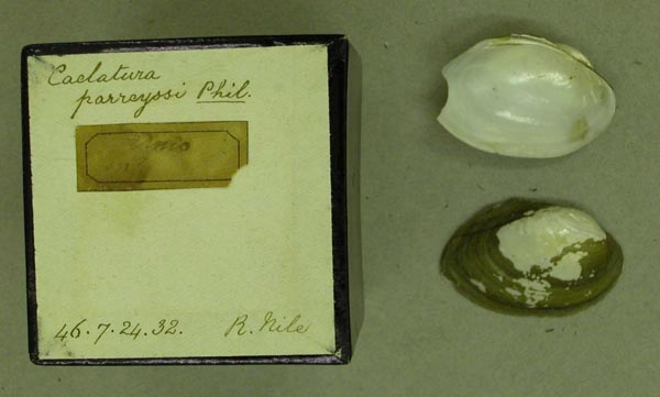
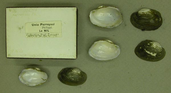
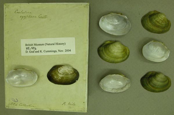
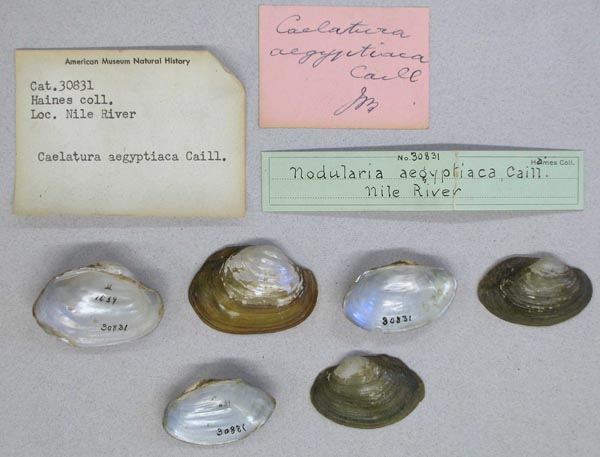
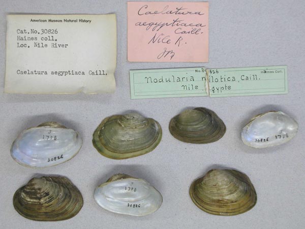
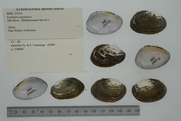
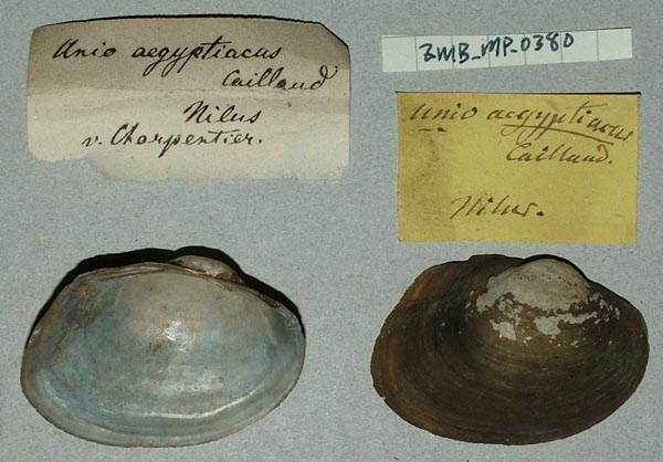
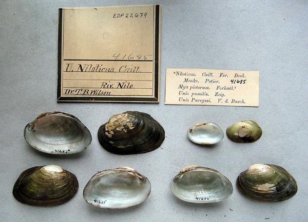
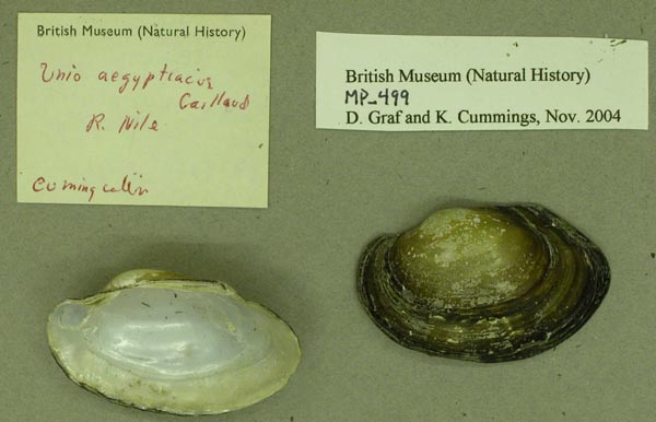
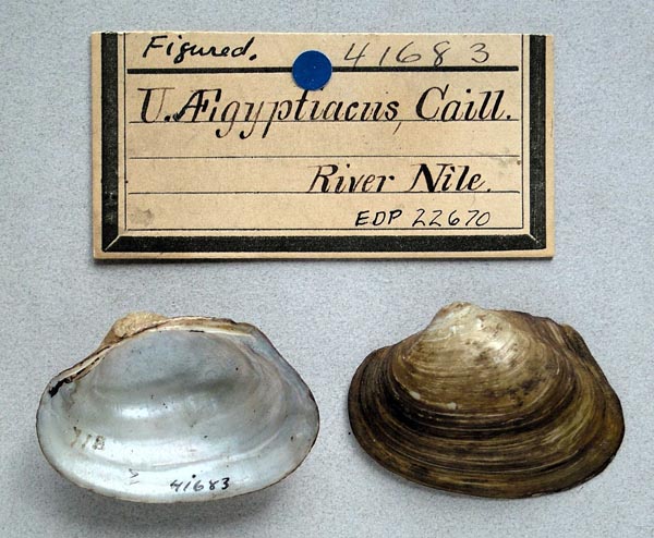
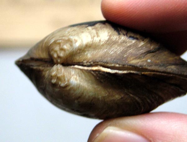
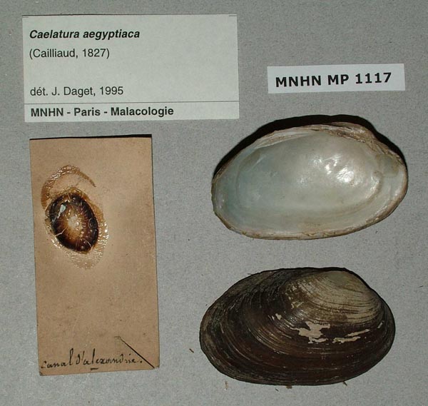
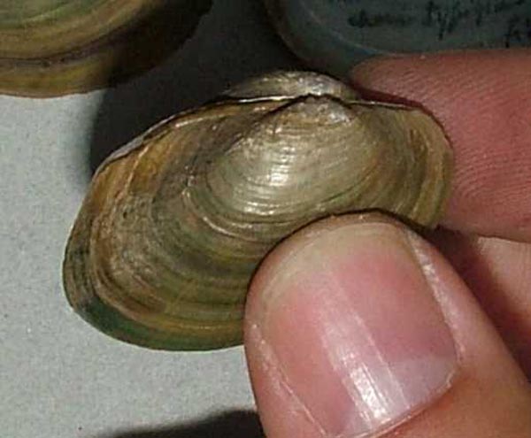
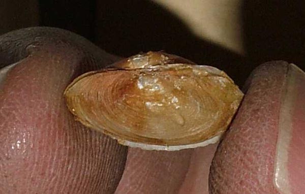
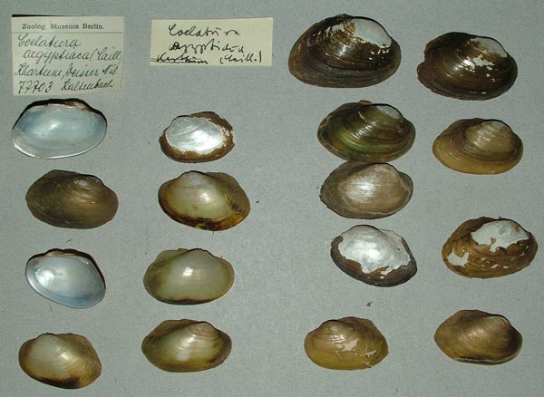
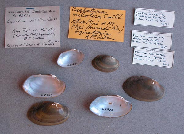
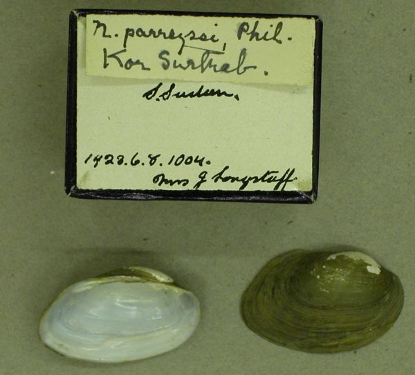
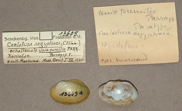
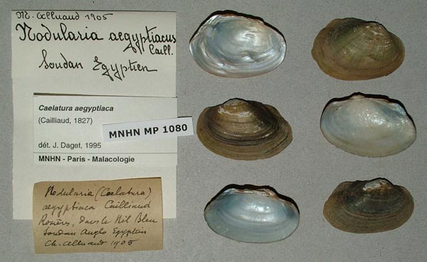
Bivalvia | Unionida | Unionoidea | Unionidae | Parreysiinae | Coelaturini | Coelatura species Coelatura aegyptiaca (Cailliaud, 1827): specimens
54 available nominal species synonyms (158 total synonyms) Recent Taxonomic OpinionsCoelatura aegyptiaca — Graf & Cummings (2007), Graf & Cummings (2007), Graf & Cummings (2009), Hoeh et al. (2009), Van Damme & Van Bocxlaer (2009), ... Galal-Khallaf et al. (2024), Dai et al. (2025), Chen et al. (2025), Campbell & Lydeard (2026), Chen et al. (2026)
Coelatura cariei — Graf & Cummings (2007)
Caelatura (s.s.) [sic] companyoi — Sleem & Ali (2008)
Caelatura (s.s.) [sic] prasidens — Sleem & Ali (2008)
Coelatura bangoranensis — Van Damme & Van Bocxlaer (2009)
Coelatura aff. aegyptiaca — Bolotov et al. (2017), Bolotov et al. (2017), Bolotov et al. (2019), Bolotov et al. (2020)
Coelatura egyptiaca [sic] — Araujo et al. (2017)
Coelatura aff. aegyptiaca sp. 1 — Bolotov et al. (2018), Huang et al. (2019)
Coelatura aff. aegyptiaca sp. 2 — Huang et al. (2019) RangeWidespread from Senegal and the Niger rivers, through the Lake Chad Basin to the Nile, Africa. Map of Georeferenced Specimens
Benin
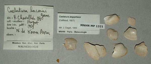
MNHN_MP_1273
Dahomey, cercle de Zagnanado, sur les rivieres du Bas Oueme a Dogba
| 
MNHN_MP_1273
Dahomey, cercle de Zagnanado, sur les rivieres du Bas Oueme a Dogba
| 
MNHN_MP_1315
Dahomey, cercle de Zagnanado, sur les rivieres du Bas Oueme a Dogba
| 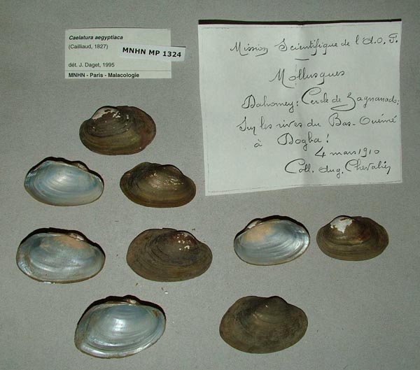
MNHN_MP_1324
Dahomey, cercle de Zagnanado, sur les rivieres du Bas Oueme a Dogba
| 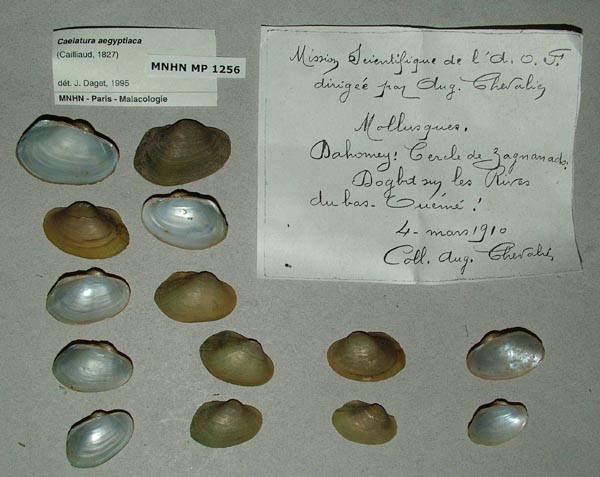
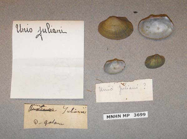
MNHN_MP_1256
Dahomey, cercle de Zagnanado, sur les rivieres du Bas Oueme a Dogba
|
Burkina Faso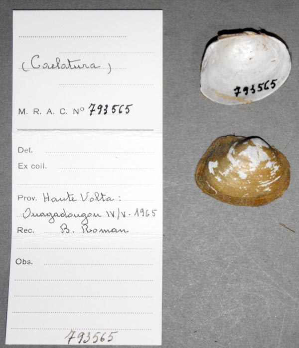
MRAC_793565
Haute Volta: Ouagadougou
| 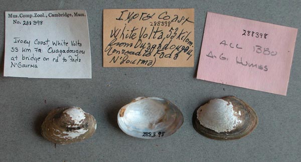
MCZ_288398
Volta Blanche, 53 km fr, Ouagadougou at bridge on rd. to Fada N’Gourma, Ivory Coast
|
Cameroon
Central African Republic
Chad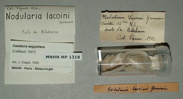
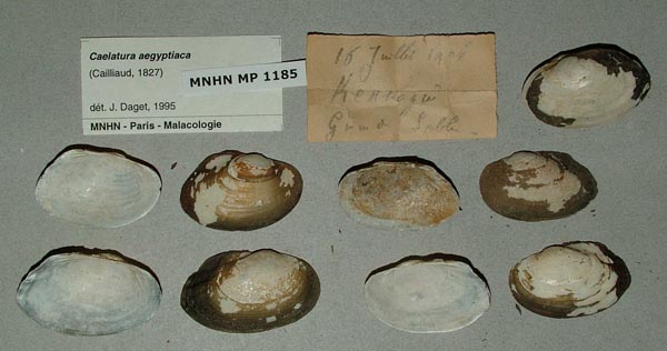
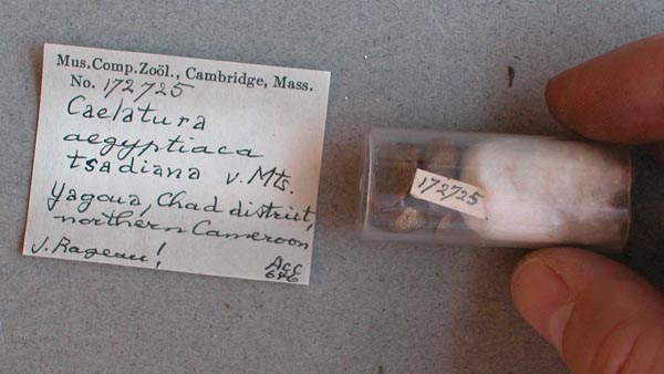
MNHN_MP_1318
12 km N.E. Puits de Bileberim
| 
MNHN_MP_1087
Bahr el Ghazal ... Djourab
| 
MNHN_MP_1166
Bas Chari
| 
MNHN_MP_1162
Bongor fleuve Logone, Tchad
| 
MNHN_MP_1160
Chari
| 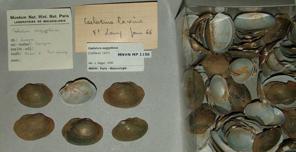
MNHN_MP_1156
Chari a Fort Lamy
| 
UMMZ_248790
Chari River, at N’ D’jamena, Republic of Chad
| 
MNHN_MP_1169
Chari, Soudan oriental
| 
MNHN_MP_1169
Chari, Soudan oriental
| 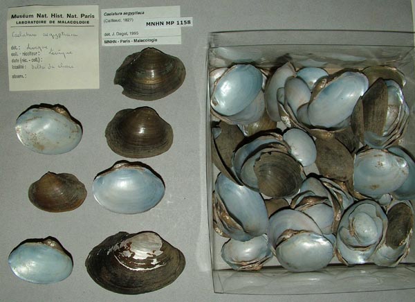
MNHN_MP_1158
Delta du Chari
| 
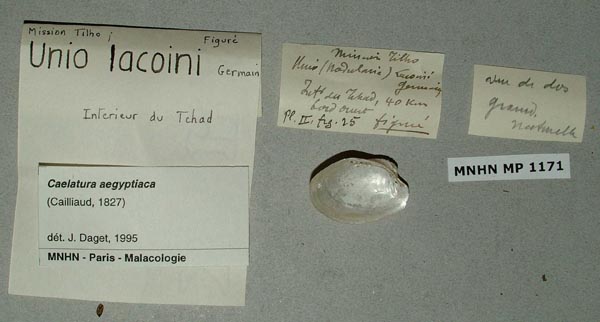
MNHN_MP_1172
Djourab, Egypte, NE du Tchad, Iles du Tchad
| 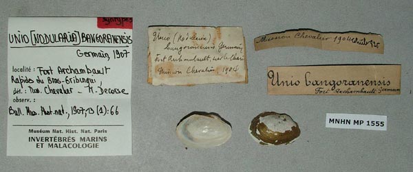
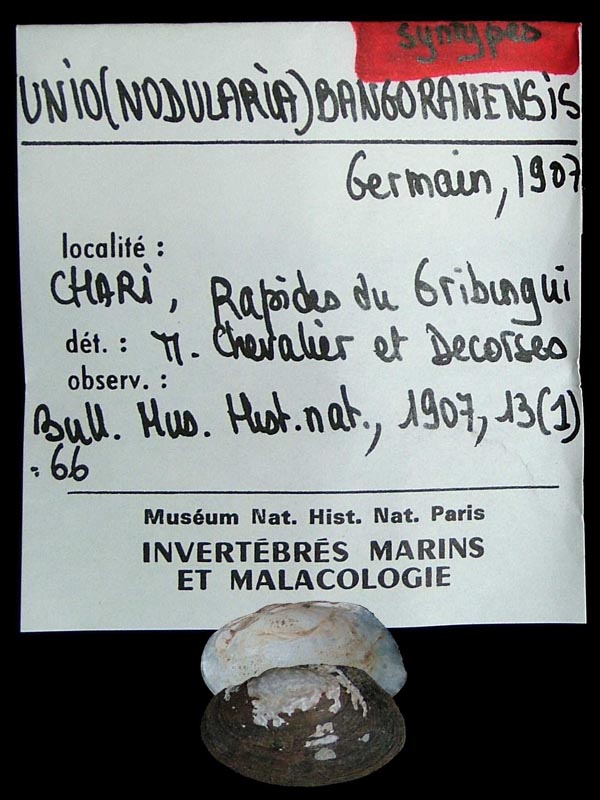
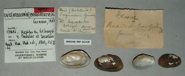
MNHN_MP_1555
Fort Archambault, le Chari, rapides du Bras Gribungi
| 
MNHN_MP_1552
Fort Archambault, le Chari, rapides du Bras Gribungi
| 
MNHN_MP_1157
lac de Lere, Tchad
| 
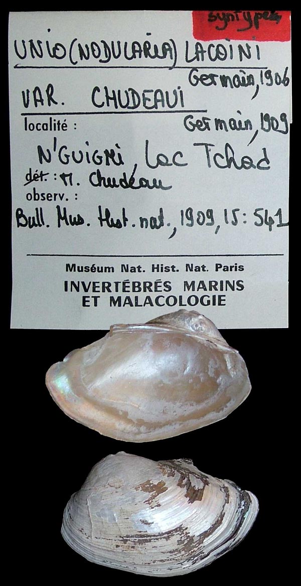
MRAC_797081
Lac Tchad
| 
MRAC_798077
Lac Tchad
| 
MRAC_798080
Lac Tchad
| 
MNHN_MP_1168
Lac Tchad
| 
MNHN_MP_1170
Lac Tchad
| 
MNHN_MP_1176
Lac Tchad
| 
MNHN_MP_0917
Lac Tchad, Hadjer el Hamis
| 
MNHN_MP_0146
Lac Tchad, Kanassarom (Cote N.E.)
| 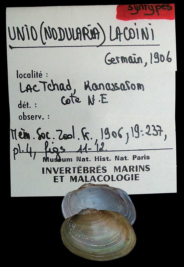
MNHN_MP_0146
Lac Tchad, Kanassarom (Cote N.E.)
| 
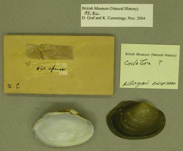
BMNH_MP_511
Lake Chad
| 
BMNH_1924-2-16-71-75
Lake Chad, Sudan
| 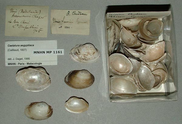
MNHN_MP_1161
Le Bas Chari
| 
MNHN_MP_1165
Le Bas Chari
| 
MNHN_MP_1165
Le Bas Chari
| 
MNHN_MP_1164
Lere, Tchad
| 
MNHN_MP_1175
Logone village Lai, Chari
| 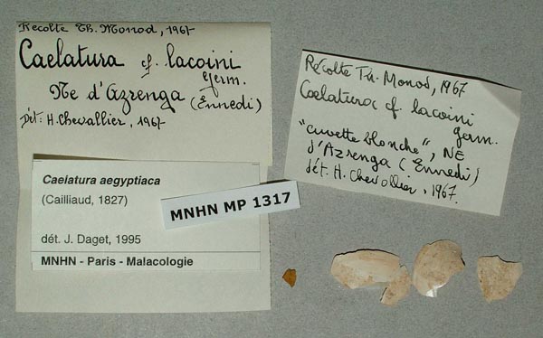
MNHN_MP_1317
NE d’Azrenga, Ennedi
| 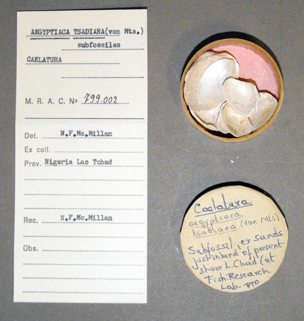
MRAC_799002
Nigeria Lac Tchad
| 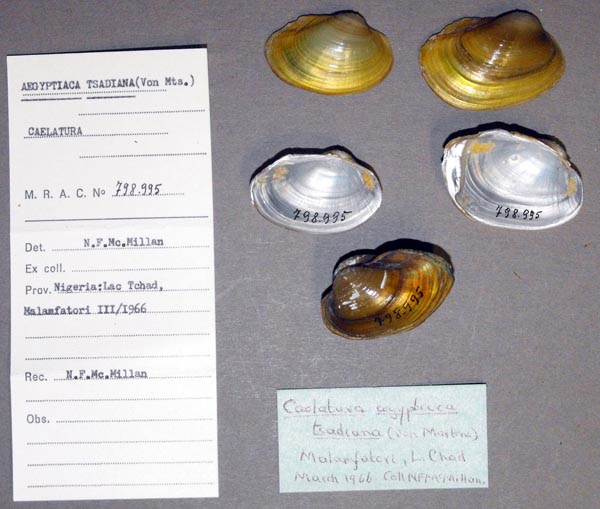
MRAC_798995
Nigeria: Lac Tchad, Malamfatori
| 
MRAC_799001
Nigeria: Lac Tchad, Malamfatori
| 
ZMB_55358
Sudufer des Tsadsees
| 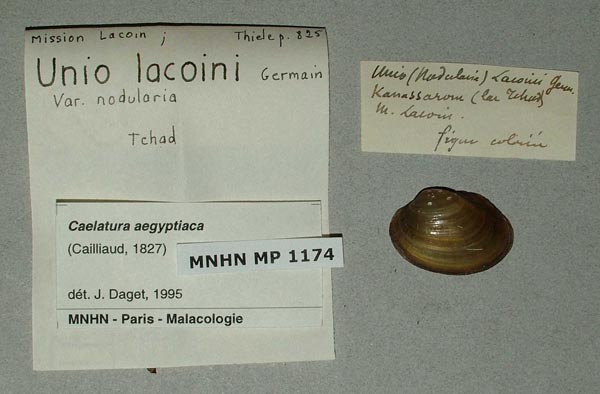
MNHN_MP_1174
Tchad
| 
MNHN_MP_1174
Tchad
| 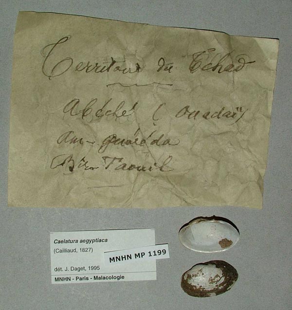
MNHN_MP_1199
Tchad ......
| 
MNHN_MP_1199
Tchad ......
| 
MNHN_MP_1105
Tibesti: Enneri Fodo, affluent rive de l’ Enneri Ogou ....
| 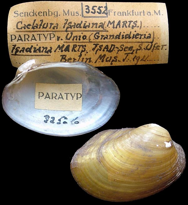
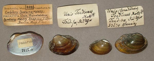
SMF_3552
Tsad See, S Ufer
| 
SMF_3552
Tsad See, S Ufer
|
Congo (DRC)
Côte d'Ivoire
MNHN_MP_1209
affluent Sassandra,Tiemba, Cote d’Ivoire
| 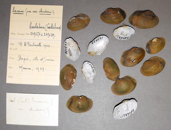
MRAC_249674
Bagoi, Côte de’Ivoire
| 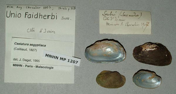
MNHN_MP_1207
Côte d’Ivoire
| 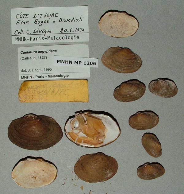
MNHN_MP_1206
Riviere Bagoe a Boundiali, Cote d’Ivoire
| 
MNHN_MP_1210
Riviere Bagoe a Boundiali, Cote d’Ivoire
| 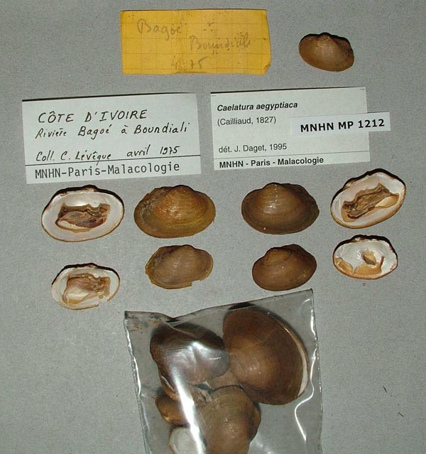
MNHN_MP_1212
Riviere Bagoe a Boundiali, Cote d’Ivoire
| 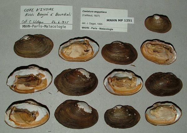
MNHN_MP_1251
Riviere Bagoe a Boundiali, Cote d’Ivoire
| 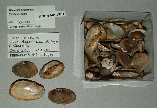
MNHN_MP_1201
Riviere Bagoe, a Kanakoro, Cote d’Ivoire, (basin Niger)
| 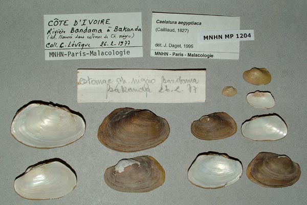
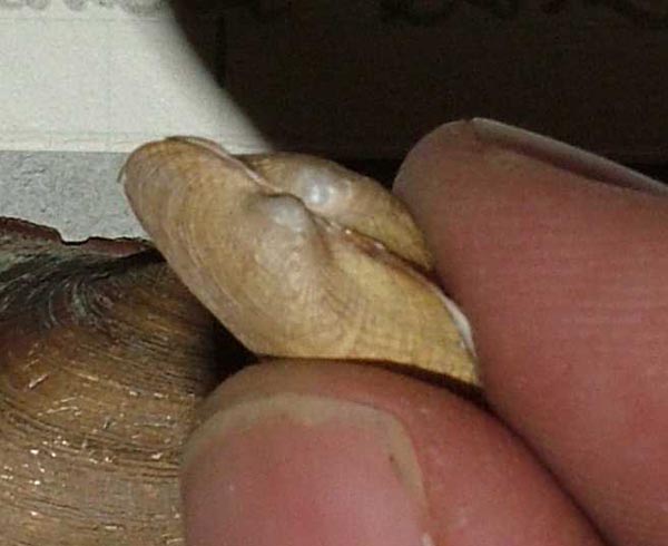
MNHN_MP_1204
Riviere Bandama, a Bakanda (Cote d’Ivoire)
| 
MNHN_MP_1204
Riviere Bandama, a Bakanda (Cote d’Ivoire)
| 
MNHN_MP_1213
Riviere Bandama, a Bakanda (Cote d’Ivoire)
| 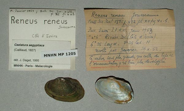
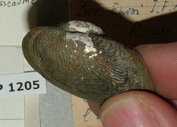
MNHN_MP_1205
Riviere Dé (Cote d’Ivoire), 6° 25 long W. 7° 25 lat. N
| 
MNHN_MP_1205
Riviere Dé (Cote d’Ivoire), 6° 25 long W. 7° 25 lat. N
| 
MNHN_MP_1215
Riviere Maraoue, bassin du Bandama, a Niondjie, Cote d’Ivoire
| 
MNHN_MP_1249
Riviere N’Zi a Dimbokro, Cote d’Ivoire
| 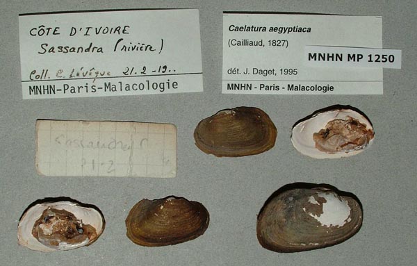
MNHN_MP_1250
riviere Sassandra, Cote d’IvoirE
| 
MNHN_MP_1211
riviere Sassandra, Dioubatiedougou, Cote d’Ivoire
| 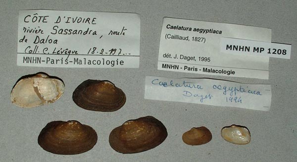
MNHN_MP_1208
riviere Sassandra, route de Daloa, Cote d’Ivoire
| 
MNHN_MP_1214
Semien, Cote d’Ivoire
|
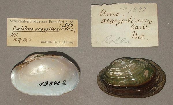
Egypt
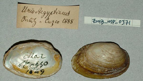
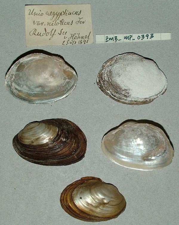
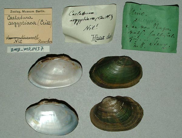
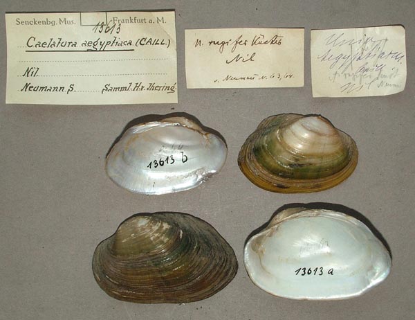
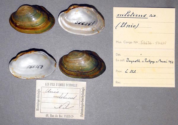
ZMB_MP_0368
.....Nuu Fajed
| 
USNM_637226
1 mi W Imbaba, Giza Prov., Egypt; NAMRU-3
| 
USNM_637226
1 mi W Imbaba, Giza Prov., Egypt; NAMRU-3
| 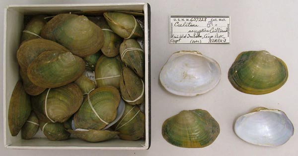
USNM_637228
1 mi W Imbaba, Giza Prov., Egypt; NAMRU-3
| 
USNM_637228
1 mi W Imbaba, Giza Prov., Egypt; NAMRU-3
| 
USNM_637229
1 mi W Imbaba, Giza Prov., Egypt; NAMRU-3
| 
USNM_637229
1 mi W Imbaba, Giza Prov., Egypt; NAMRU-3
| 
USNM_637225
1 mi W Imbaba, Giza Prov., Egypt; NAMRU-3
| 
UF_125928
1 mi W Imbala, 5-7 mi NW Cairo, Giza Province, Egypt
| 
UF_125928
1 mi W Imbala, 5-7 mi NW Cairo, Giza Province, Egypt
| 
MCZ_294669
1 mi W Imbala, 5-7 mi NW Cairo, Giza Province, Egypt
| 
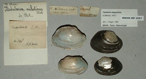
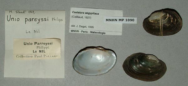
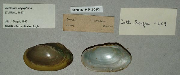
MNHN_MP_1093
10 km Se Fayoum ....
| 
BMNH_72-12-12-5
a small stream at Suez
| 
BMNH_72-12-12-5
a small stream at Suez
| 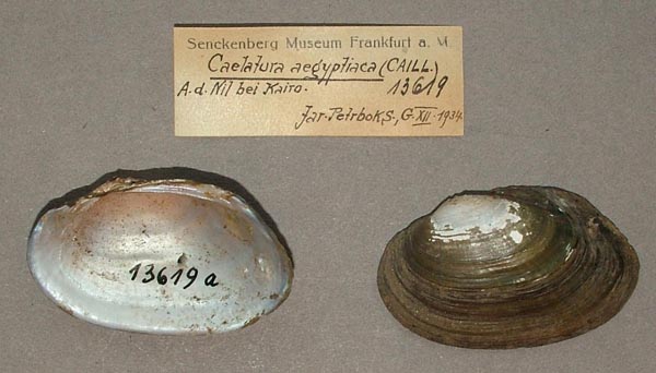
SMF_13619
A.d. Nil bei Kairo
| 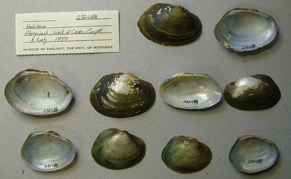
UMMZ_232488
Aberawash, West of Cairo, Egypt
| 
USNM_801994
Abu Rauwash, Giza, Egypt
| 
USNM_637233
Abu Rauwash, near Giza, Egypt
| 
USNM_637234
Abu Rauwash, near Giza, Egypt
| 
USNM_637234
Abu Rauwash, near Giza, Egypt
| 
USNM_637235
Abu Rauwash, near Giza, Egypt
| 
USNM_637235
Abu Rauwash, near Giza, Egypt
| 
USNM_637236
Abu Rauwash, near Giza, Egypt
| 
USNM_637236
Abu Rauwash, near Giza, Egypt
| 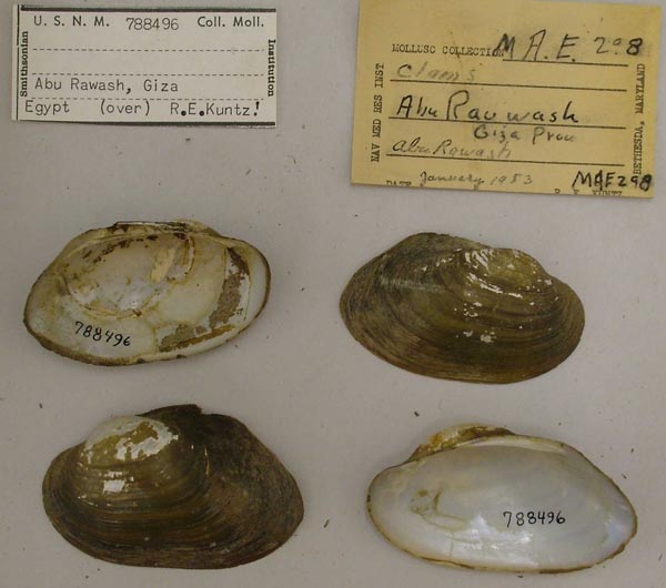
USNM_788496
Abu Rauwash, near Giza, Egypt
| 
USNM_797691
Abu Rauwash, near Giza, Egypt
| 
USNM_797691
Abu Rauwash, near Giza, Egypt
| 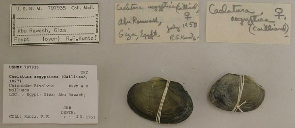
USNM_797935
Abu Rauwash, near Giza, Egypt
| 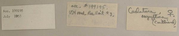
USNM_797935
Abu Rauwash, near Giza, Egypt
| 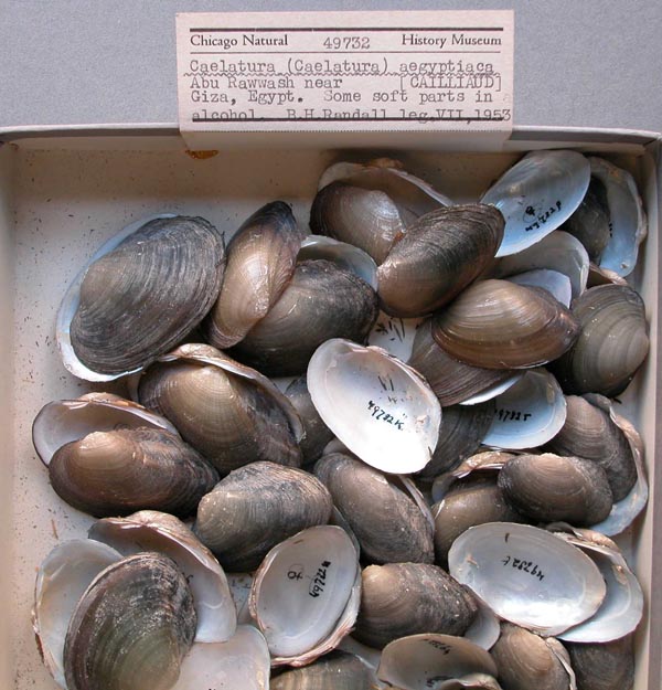
FMNH_49732
Abu Rauwash, near Giza, Egypt
| 
USNM_794136
Abu Rauwash, near Giza, Egypt
| 
USNM_794136
Abu Rauwash, near Giza, Egypt
| 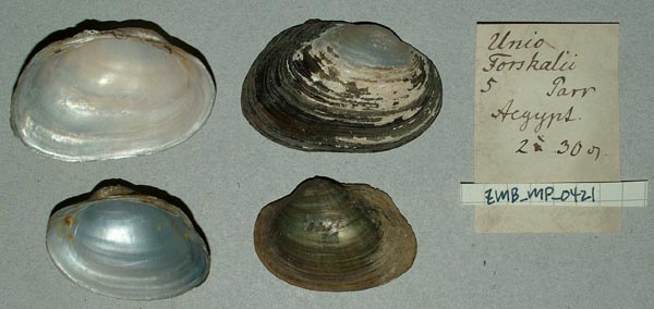
ZMB_MP_0421
Aegypt
| 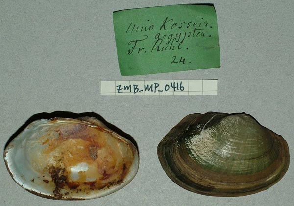
ZMB_MP_0416
Aegypten
| 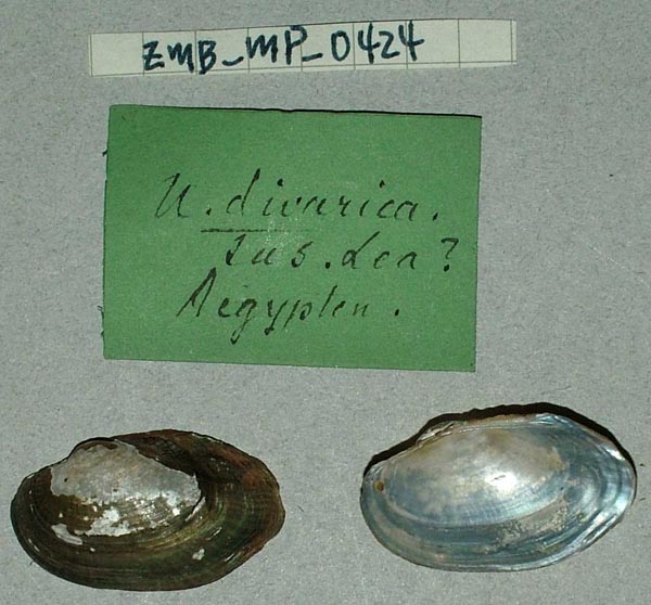
ZMB_MP_0424
Aegypten
| 
ZMB_MP_0424
Aegypten
| 
ZMB_9100
Aegypten
| 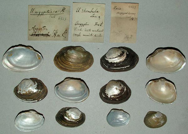
ZMB_4843
Aegypten
| 
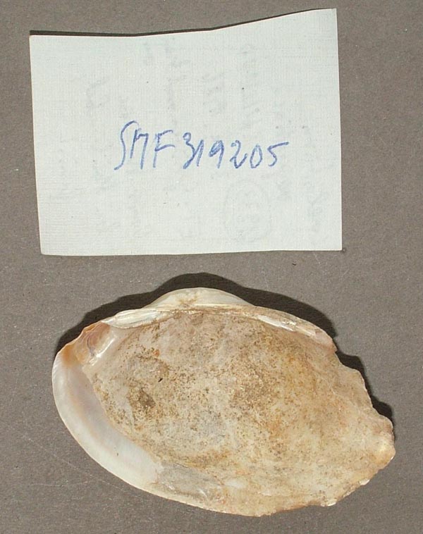
SMF_319212
Aegypten. Abu Simbil, strand der Nasser-Stomsees
| 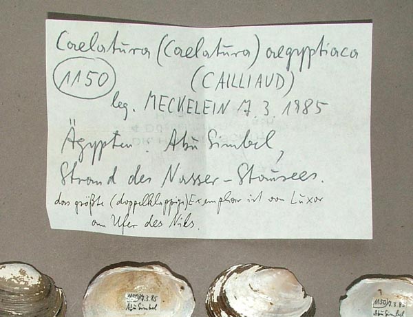
SMF_319212
Aegypten. Abu Simbil, strand der Nasser-Stomsees
| 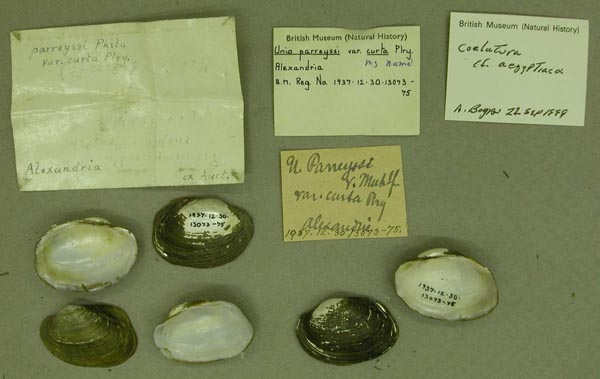
BMNH_1937-12-30-13073-13075
Alexandria
| 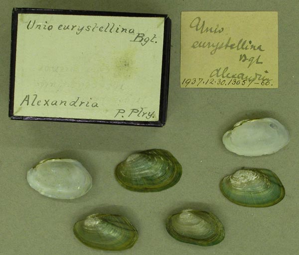
BMNH_1937-12-30-13057-13060
Alexandria
| 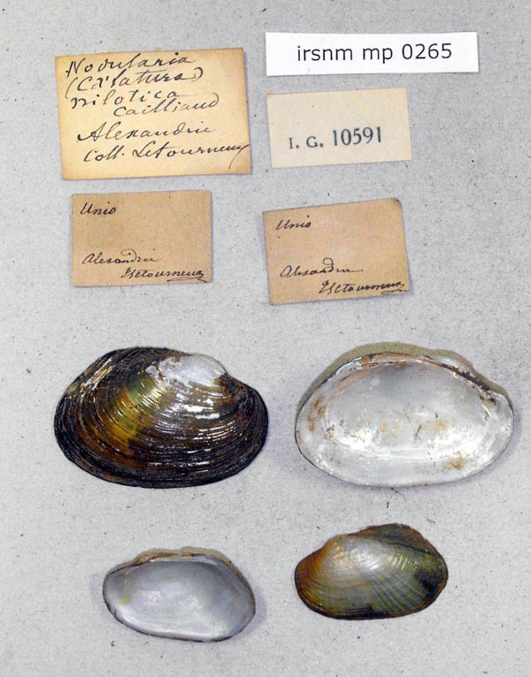
IRSNB_MP_0265
Alexandria
| 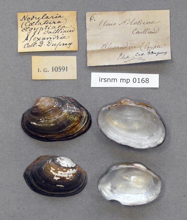
IRSNB_MP_0168
Alexandria
| 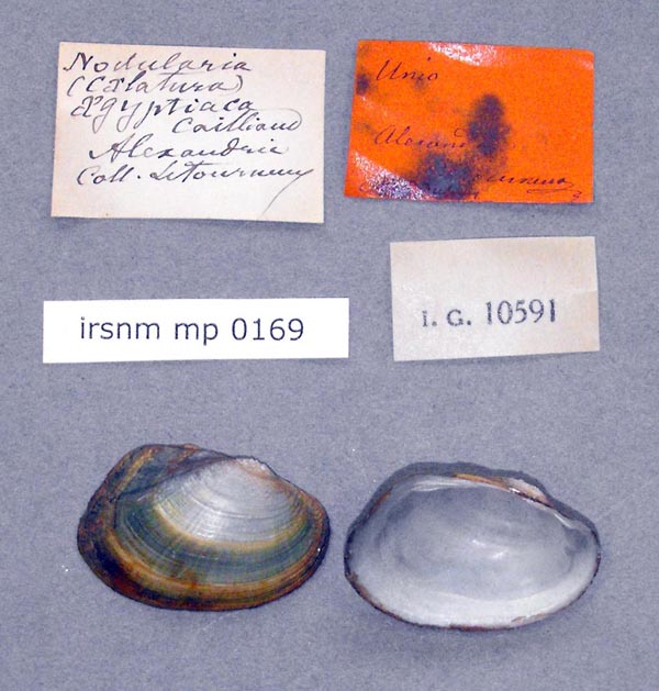
IRSNB_MP_0169
Alexandria
| 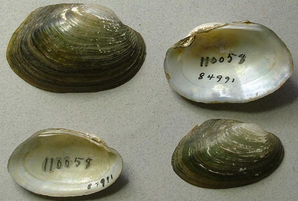
UMMZ_110058
Alexandria, Egypt
| 
UMMZ_110058
Alexandria, Egypt
| 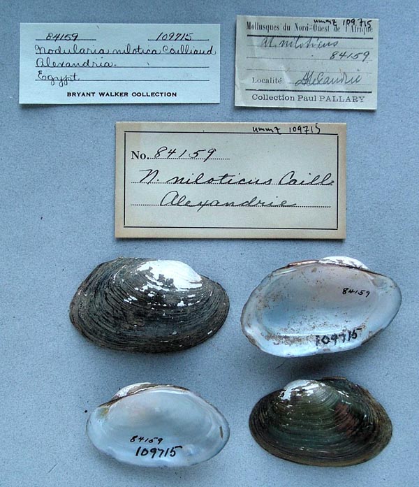
UMMZ_109715
Alexandria, Egypt
| 
UMMZ_110066
Alexandria, Egypt
| 
USNM_126469
Alexandria, Lhotelliere, Egypt
| 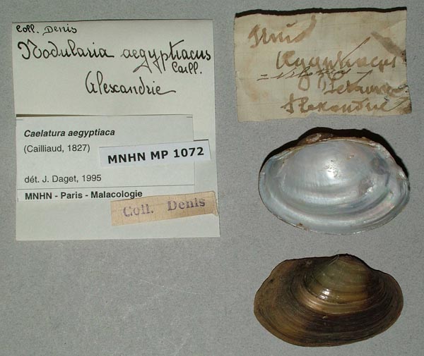
MNHN_MP_1072
Alexandrie
| 
MNHN_MP_1073
Alexandrie
| 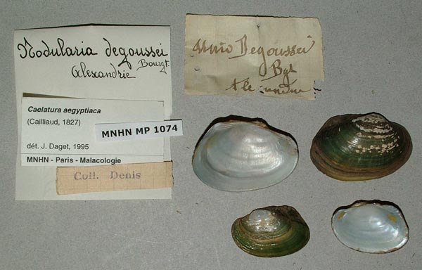
MNHN_MP_1074
Alexandrie
| 
MNHN_MP_1077
Alexandrie
| 
MNHN_MP_1081
Alexandrie
| 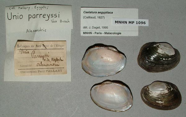
MNHN_MP_1096
Alexandrie
| 
MNHN_MP_1070
Alexandrie, Egypte
| 
SMF_13589
Alexandrien
| 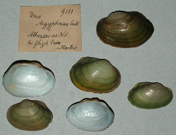
ZMB_9101
Altowasser Nil bei Gizeh, Cairo
| 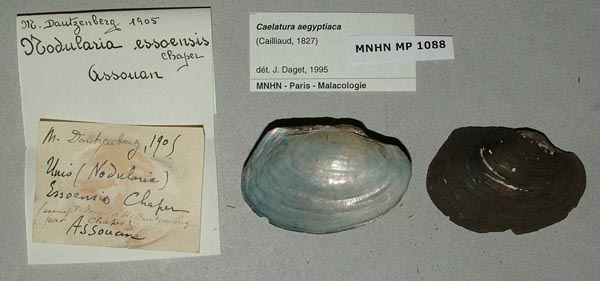
MNHN_MP_1088
Assauan
| 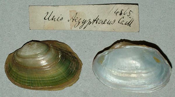
ZMB_4865
Aswan ....[?]
| 
BMNH_MP_470
Aswan, above the dam
| 
BMNH_MP_471
Aswan, below 1st cataract
| 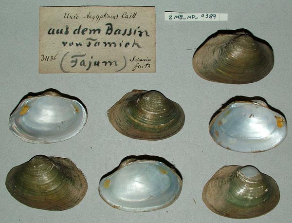
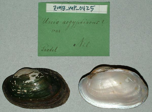
ZMB_MP_0389
aus dem Bassin van Tamieh, Fajum
| 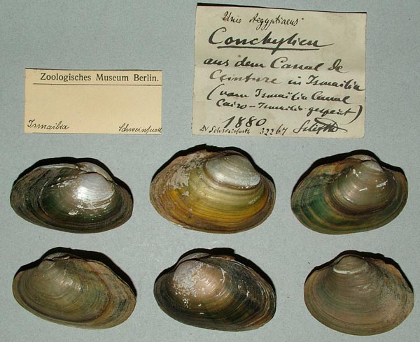
ZMB_32267
aus deu canal de Ceinture in Ismailia
| 
BMNH_1937-12-30-13068
Bals Drain, Birket el Qurun
| 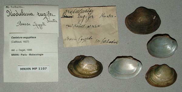
MNHN_MP_1107
Basse Egypte
| 
BMNH_1937-12-30-13076-13077
Cairo
| 
BMNH_1906-4-23-1-3
Cairo, Egypt
| 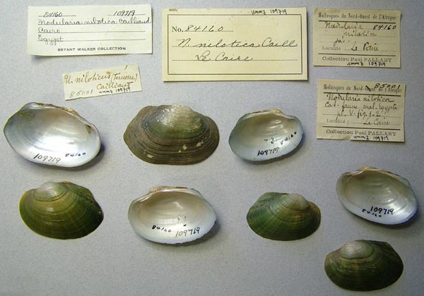
UMMZ_109719
Cairo, Egypt
| 
BMNH_MP_529
Cairo, Egypt
| 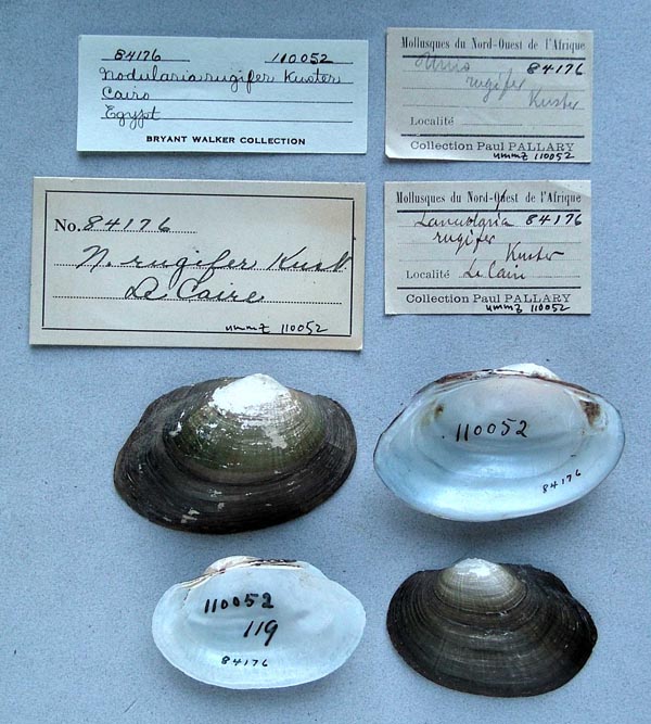
UMMZ_110052
Cairo, Egypt
| 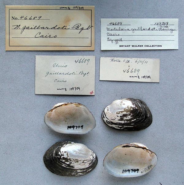
UMMZ_109709
Cairo, Egypt
| 
UMMZ_109709
Cairo, Egypt
| 
ZMB_23224
Cairo....Gizeh
| 
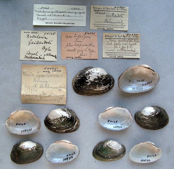
MNHN_MP_1117
canal Alexandrie
| 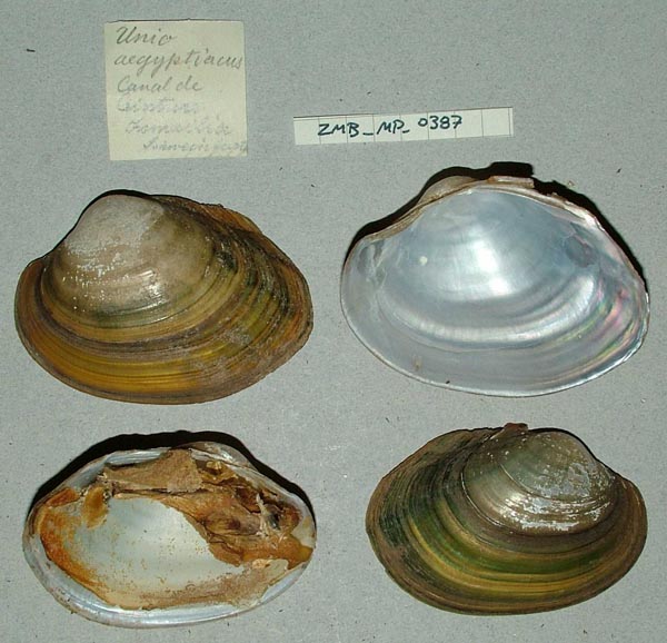
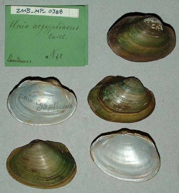
ZMB_MP_0387
canal de Ceinture Ismalia
| 
UMMZ_109635
canal de Mahmoudie, Alexandia
| 
IRSNB_MP_0274
Canal de Suez
| 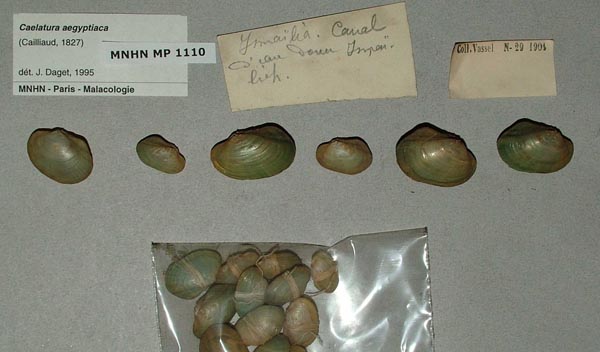
MNHN_MP_1110
Canal Ismailia
| 
MNHN_MP_1110
Canal Ismailia
| 
MNHN_MP_1110
Canal Ismailia
| 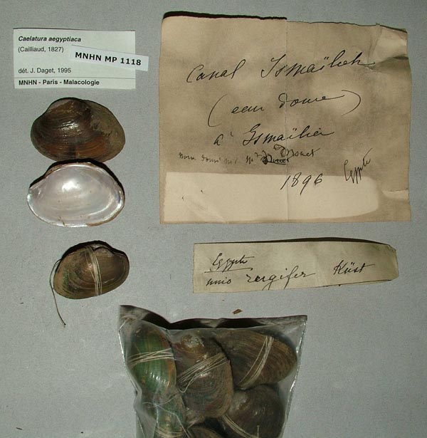
MNHN_MP_1118
Canal Ismailia
| 
IRSNB_MP_0830
Canal Joseph (Egypte)
| 
IRSNB_MP_0275
Canal l’eau douce à Ismailia
| 
UMMZ_109710
Canal Mahmoudhich, Alexandria, Egypt
| 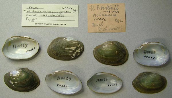
UMMZ_110069
Canal Mahmoudich, Egypt
| 
UMMZ_110064
Canal Mahmoudich, Egypt
| 
UMMZ_110026
Canal Mahmoudich, Egypt
| 
UMMZ_110027
Canal Mahmoudich, Egypt
| 
UMMZ_110059
Canal Mahmoudich, lower Egypt
| 
UMMZ_109721
Canal Mahmoudich, Lower Egypt
| 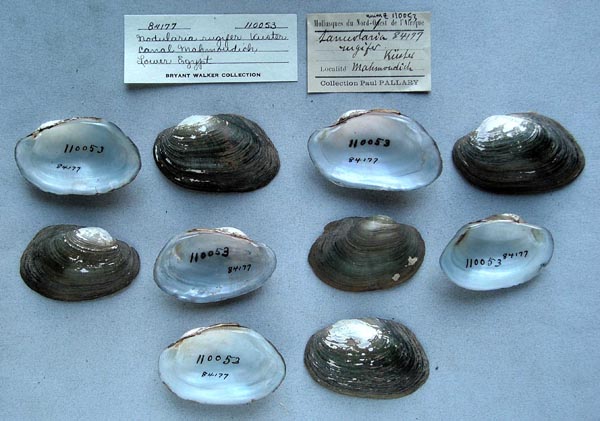
UMMZ_110053
Canal Mahmoudich, Lower Egypt
| 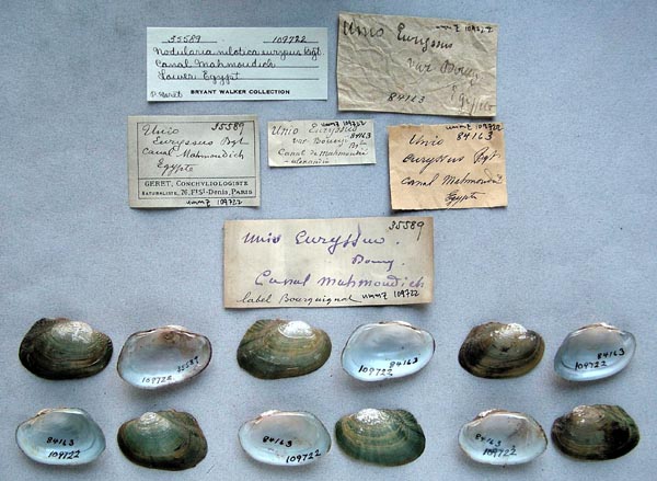
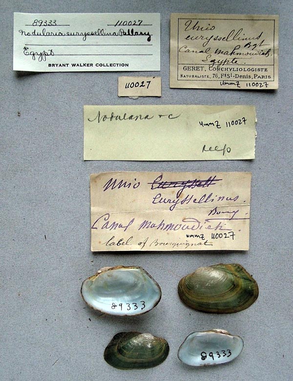
UMMZ_109722
Canal Mahmoudich, Lower Egypt
| 
UMMZ_110039
Canal Mahmoudich, Lower Egypt
| 
UMMZ_110067
Canal Mahmoudich, Lower Egypt
| 
BMNH_71-9-8-3
Canal, Cairo
| 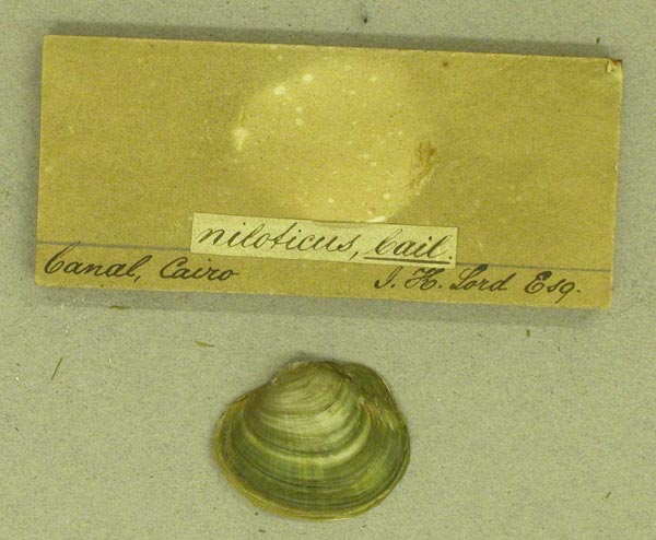
BMNH_71-9-8-3
Canal, Cairo
| 
UMMZ_109713
Canal, pres de Suez
| 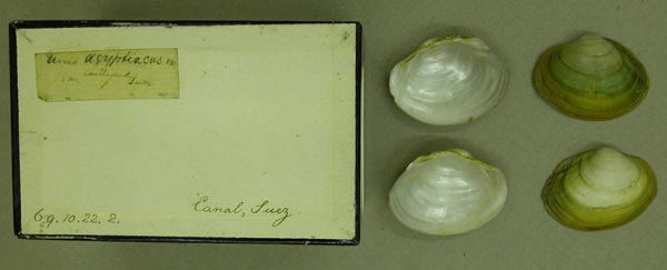
BMNH_69-10-22-2
Canal, Suez
| 
USNM_125815A
Damietta, branch of NIle
| 
USNM_125815A
Damietta, branch of NIle
| 
USNM_125815
Damietta, branch of the Nile
| 
ANSP_366277
Damietta, branch of the Nile River
| 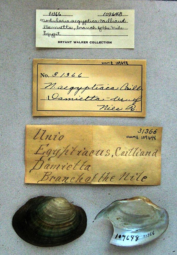
UMMZ_109648
Damietta, branch of the Nile, Egypt
| 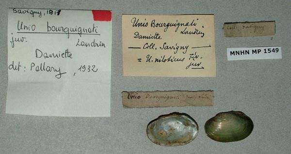
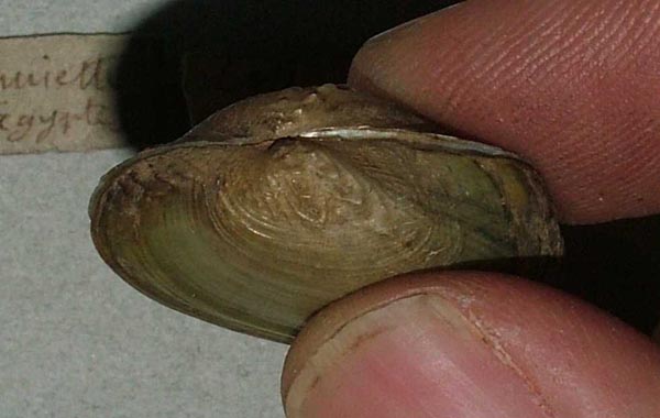
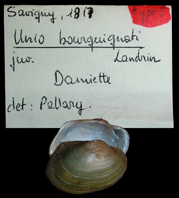
MNHN_MP_1549
Damiette
| 
MNHN_MP_1548
Damiette
| 
MNHN_MP_1548
Damiette
| 
MNHN_MP_1548
Damiette
| 
MNHN_MP_1550
Damiette
| 
MNHN_MP_1550
Damiette
| 
MNHN_MP_1550
Damiette
| 
SMF_83178
Damiette, Egypten
| 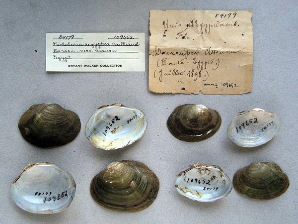
UMMZ_109652
Daraon, near Assam, Haute Egypt
| 
USNM_797895
drainage canal, Tukh, 15 mi N of Qalyoub, Egypt
| 
USNM_797895
drainage canal, Tukh, 15 mi N of Qalyoub, Egypt
| 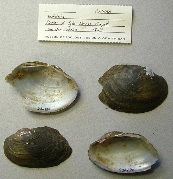
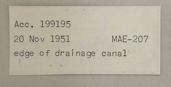
UMMZ_232486
Drains of Ezba Noccas, Egypt
| 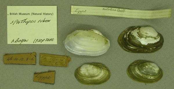
BMNH_46-10-12-5-6
Egypt
| 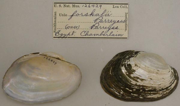
USNM_126429
Egypt
| 
USNM_126429
Egypt
| 
FMNH_21723
Egypt
| 
FMNH_142750
Egypt
| 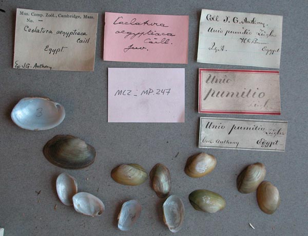
MCZ_MP.247
Egypt
| 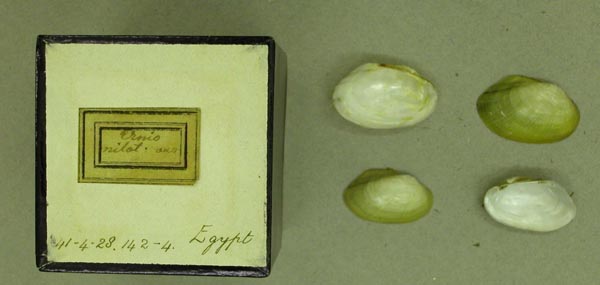
BMNH_41-4-28-142-144
Egypt
| 
BMNH_MP_495
Egypt
| 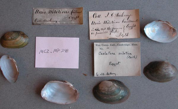
MCZ_MP.248
Egypt
| 
BMNH_41-4-28-145
Egypt
| 
BMNH_58-6-9-8
Egypt
| 
USNM_85346
Egypt
| 
UMMZ_109646
Egypt
| 
UMMZ_109646
Egypt
| 
BMNH_1907-10-28-173
Egypt
| 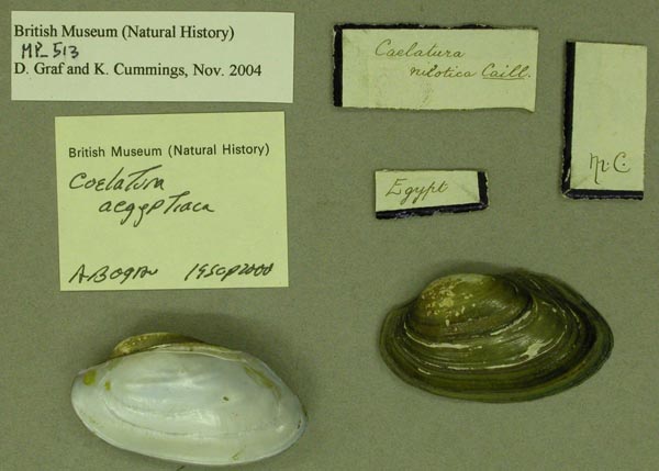
BMNH_MP_513
Egypt
| 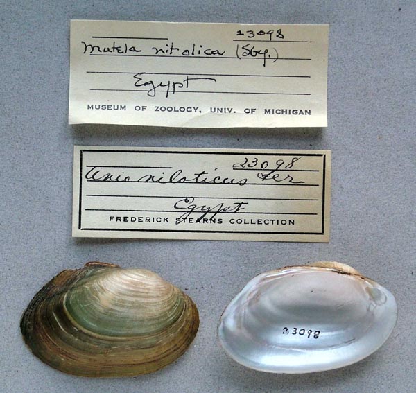
UMMZ_23098
Egypt
| 
UMMZ_232490
Egypt
| 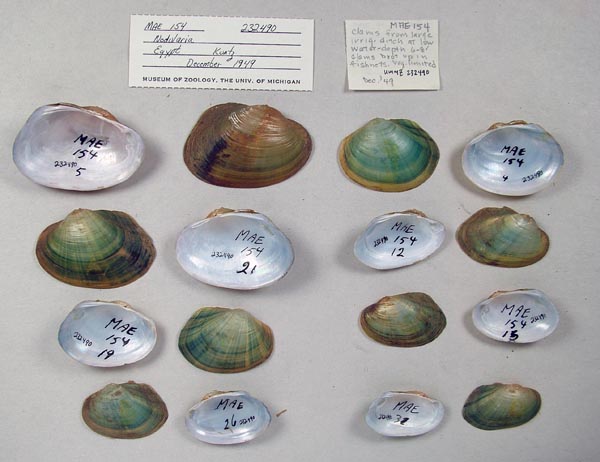
UMMZ_232490
Egypt
| 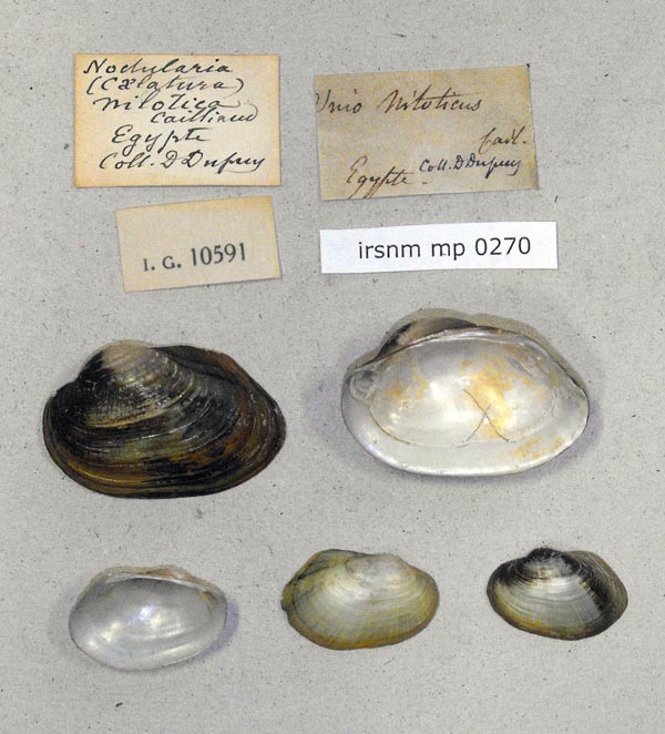
IRSNB_MP_0270
Egypte
| 
IRSNB_MP_0271
Egypte
| 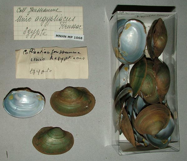
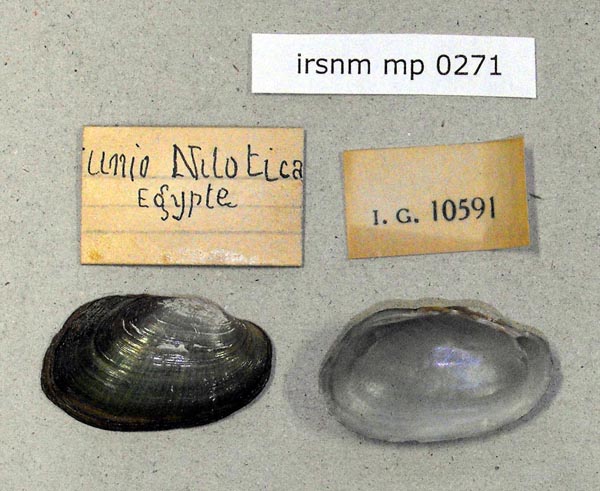
MNHN_MP_1068
Egypte
| 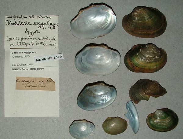
MNHN_MP_1079
Egypte
| 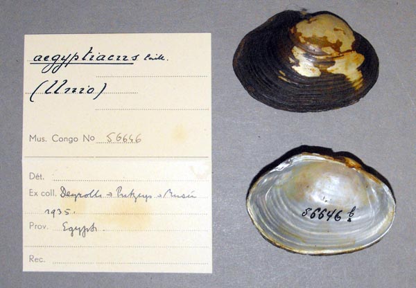
MRAC_56646
Egypte
| 
MNHN_MP_1095
Egypte
| 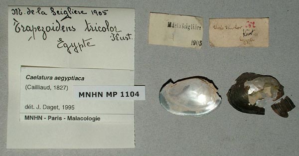
MNHN_MP_1104
Egypte
| 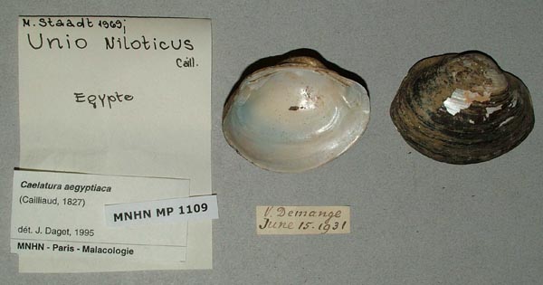
MNHN_MP_1109
Egypte
| 
MNHN_MP_1115
Egypte
| 
MRAC_56803
Egypte: le Nil
| 
MRAC_55581
Egypte: le Nil
| 
MRAC_56637
Egypte: Nil
| 
SMF_13591
Egypten
| 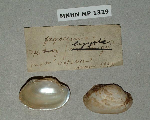
MNHN_MP_1329
Fayoum, Egypte
| 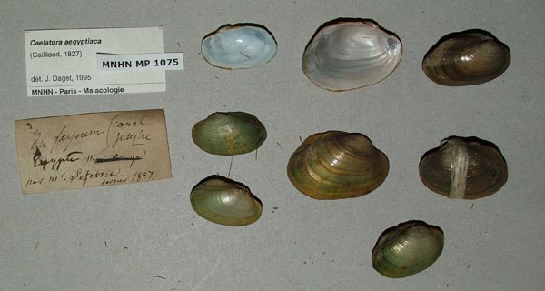
MNHN_MP_1075_01
Fayoum, Egypte
| 
MNHN_MP_1075_01
Fayoum, Egypte
| 
MNHN_MP_1075_02
Fayoum, Egypte
| 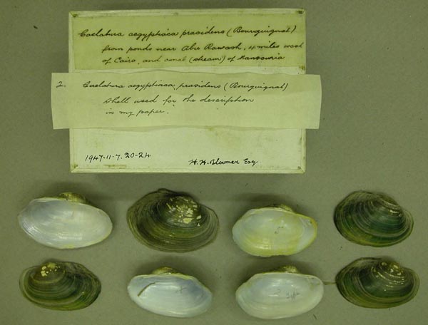
BMNH_1947-11-7-20-24
from ponds near Abu Rauwash, 4 miles west of Cairo and canal (stream) of Mansouria
| 
MRAC_531626
Garagos, Hte Egypte
| 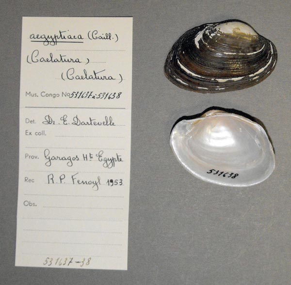
MRAC_531637
Garagos, Hte Egypte
| 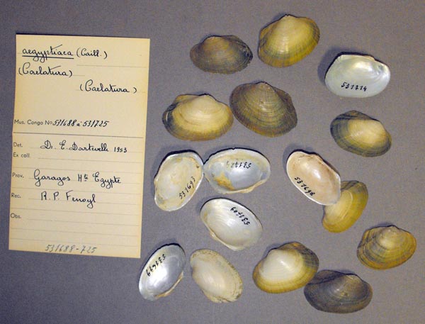
MRAC_531688
Garagos, Hte Egypte
| 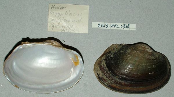
ZMB_MP_0369
Gizeh ud Pyramiden
| 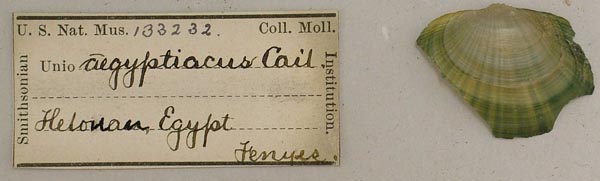
USNM_133232
Helonan, Egypt
| 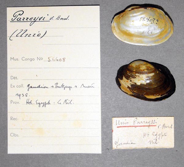
MRAC_56408
Ht. Egypt: Le Nil
| 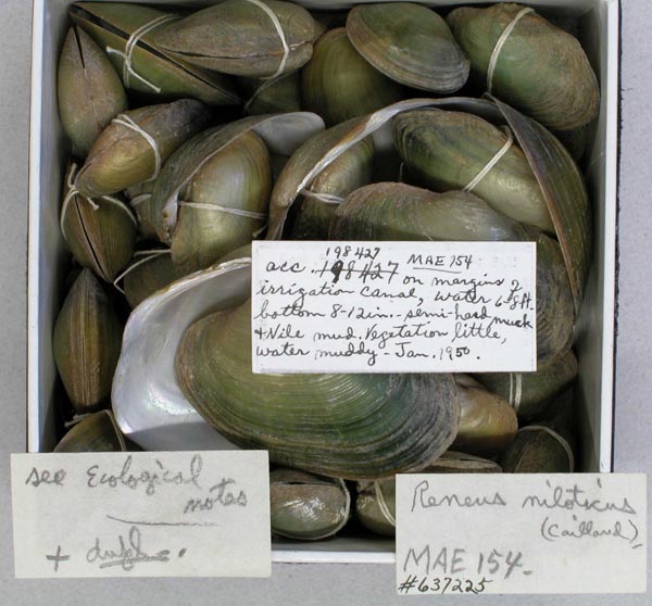
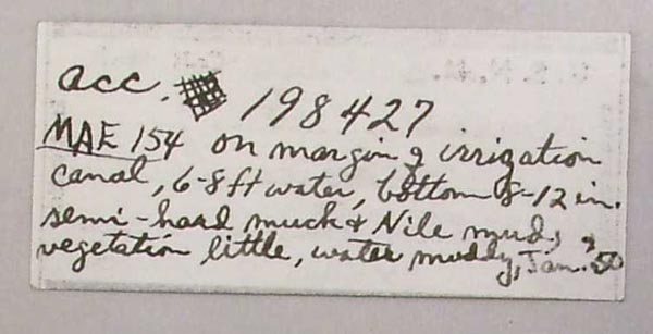
USNM_198427
irrigation canal, Nile
| 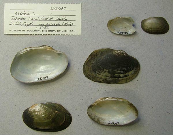
UMMZ_232487
Iskander Canal, East of Hallaba, Ialiub, Egypt
| 
SMF_13588
Ismailia
| 
SMF_13615
Ismailia
| 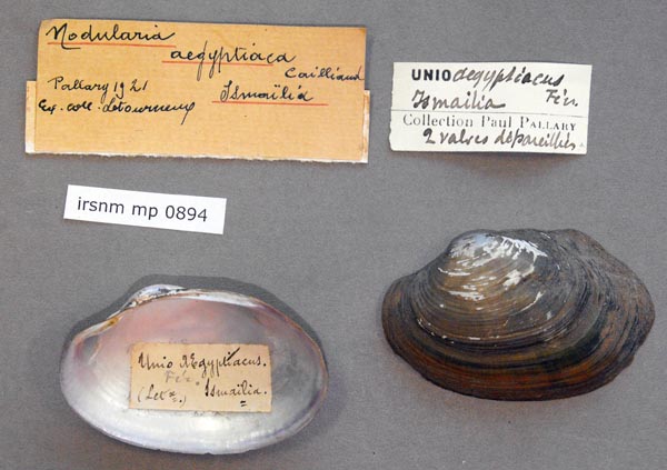
IRSNB_MP_0894
Ismailia
| 
MNHN_MP_1094
Ismailia
| 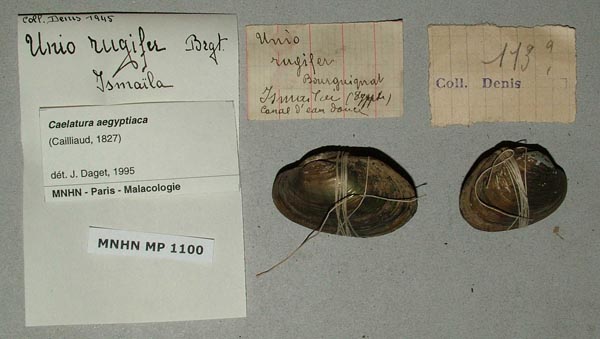
MNHN_MP_1100
Ismailia
| 
MNHN_MP_1116
Ismailia
| 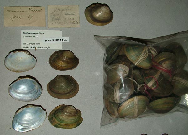
MNHN_MP_1101
Ismailia canal
| 
MNHN_MP_1102
Ismailia canal
| 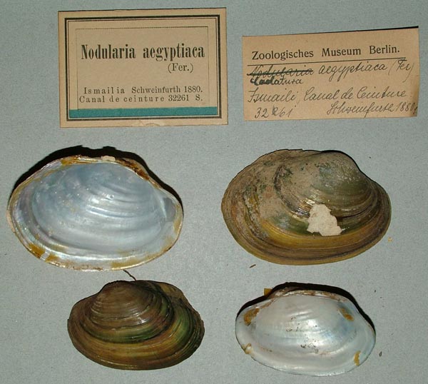
ZMB_32261
Ismailia, Canal de ceinture
| 
BMNH_MP_480
Ismailia, Egypt
| 
MCZ_63254
Ismailia, Egypt
| 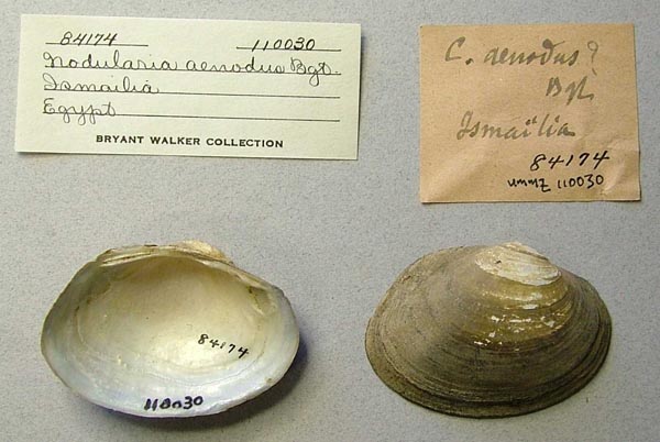
UMMZ_110030
Ismailia, Egypt
| 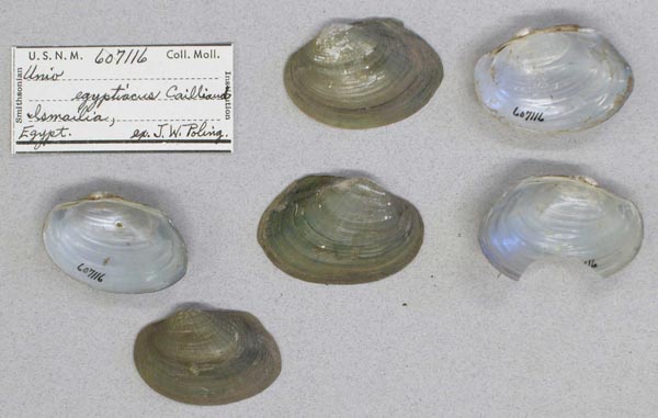
USNM_607116
Ismailia, Egypt
| 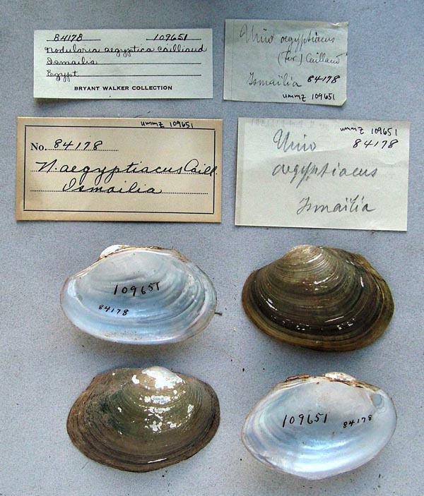
UMMZ_109651
Ismalia, Egypt
| 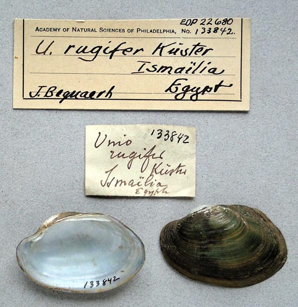
ANSP_133842
Ismalia, Egypt
| 
MNHN_MP_1069
Ismaliah
| 
MNHN_MP_1089
Ismaliah
| 
SMF_10388
Kairo
| 
SMF_83183
Kairo
| 
UMMZ_57495
Lake Karun, outcrops near Kanamis, Fayum District, Egypt
| 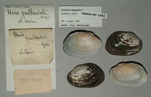
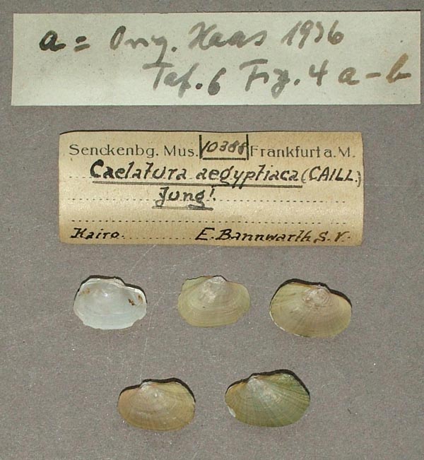
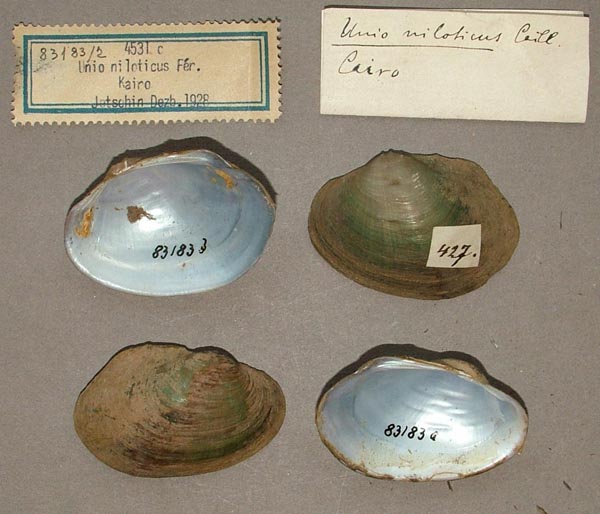
MNHN_MP_1082
Le Caire
| 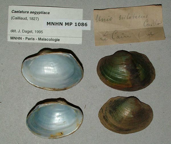
MNHN_MP_1086
Le Caire
| 
MRAC_56630
Le Nil (Egypt)
| 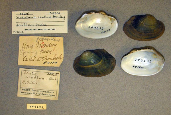
UMMZ_109632_01
Le Nil a Choubreh
| 
IRSNB_MP_0836
Le Nil Egypt
| 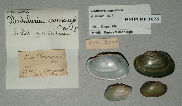
MNHN_MP_1076
Le Nil, pres du Caire
| 
MNHN_MP_1076
Le Nil, pres du Caire
| 
MNHN_MP_1085
Le Nil, pres du Caire
| 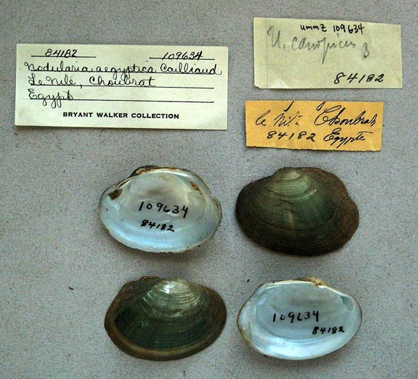
UMMZ_109634
Le Nile, Choubrah, Egypt
| 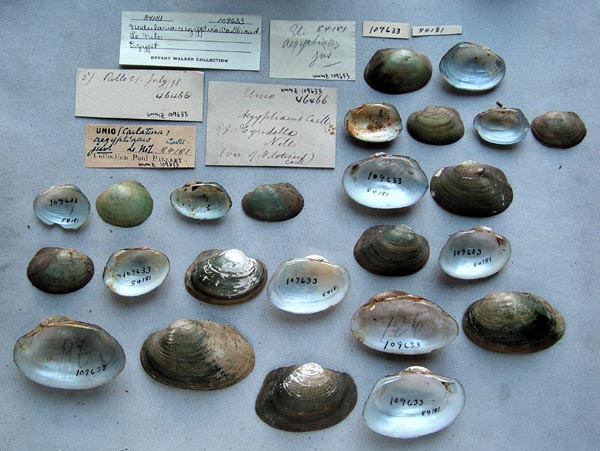
UMMZ_109633
Le Nile, Egypt
| 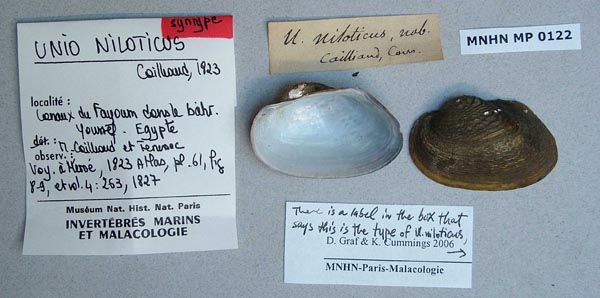
MNHN_MP_0122
Lennaux du Fayoum dans la Bahr Yousef Egypte
| 
MNHN_MP_0122
Lennaux du Fayoum dans la Bahr Yousef Egypte
| 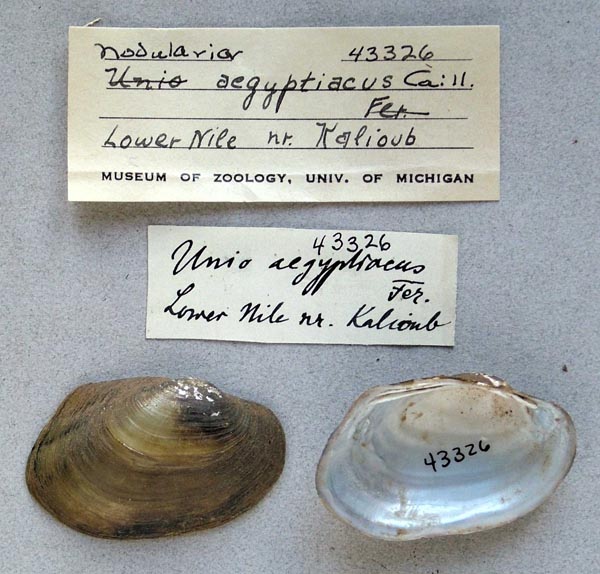
UMMZ_43326
Lower Nile, nr. Kalioub
| 
MCZ_172119
Luxor, Egypt
| 
AMNH_35362
Luxor, Egypt
| 
SMF_13621
Lybische Wüste bei Kairo
| 
MCZ_173723
Mahmoudieh Canal, near Alexandria, Egypt
| 
SMF_13601
Mahmudie-Kanal bei Kairo
| 
SMF_13602
Mahmudie-Kanal Egypten
| 
SMF_13594
Mahmudie-Kanal, bei Alexandrien
| 
SMF_13593
Mahmudie-Kanal, Egypten
| 
SMF_13600
Mahmudie-Kanal, Egypten
| 
BMNH_MP_500
Manshiya
| 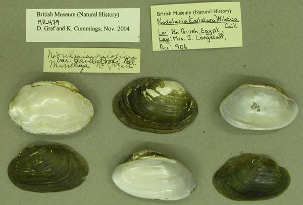
BMNH_MP_479B
Manshiya [?], near Gizeh, Egypt
| 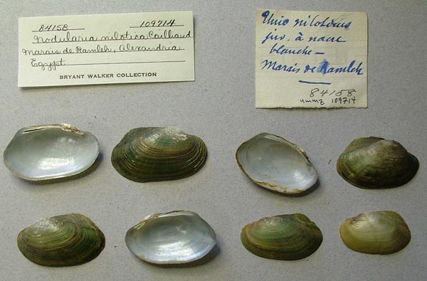
UMMZ_109714
Marais de Ramleh, Alexandria, Egypt
| 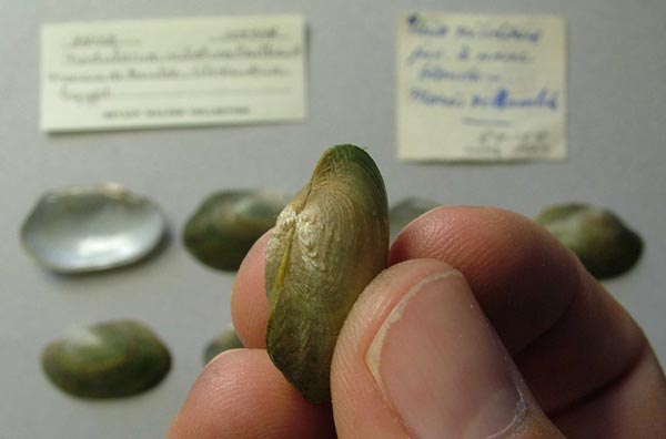
UMMZ_109714
Marais de Ramleh, Alexandria, Egypt
| 
SMF_10389
Menzalieh-See, U. Egypten
| 
USNM_797810
near Cairo, Egypt
| 
USNM_797810
near Cairo, Egypt
| 
ZMB_76514
Nil bei [Türrah] 10 km sudl. Kairo
| 
SMF_13618
Nil bei Bahr el Karun, Fayum
| 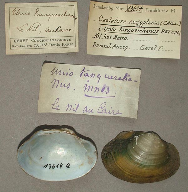
SMF_13614
Nil bei Kairo
| 
SMF_13610
Nil bei Korosko, Ob. Egypten
| 
SMF_13595
Nil bei Schubrah
| 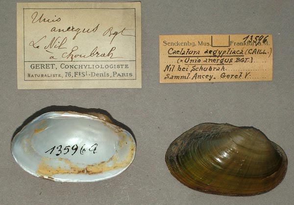
SMF_13596
Nil bei Schubrah
| 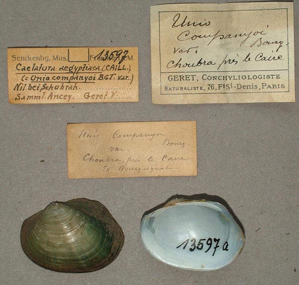
SMF_13597
Nil bei Schubrah
| 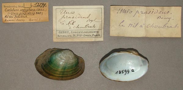
SMF_13599
Nil bei Schubrah
| 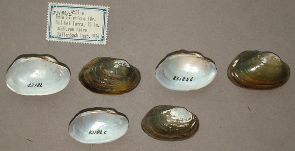
SMF_83182
Nil bei Turra, 15 km sudl von Kairo
| 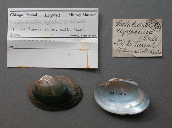
FMNH_115970
Nil bei Turrah, 10 km sudl, Kairo, Egypt
| 
IRSNB_MP_0162
Nil envoi He’ron
| 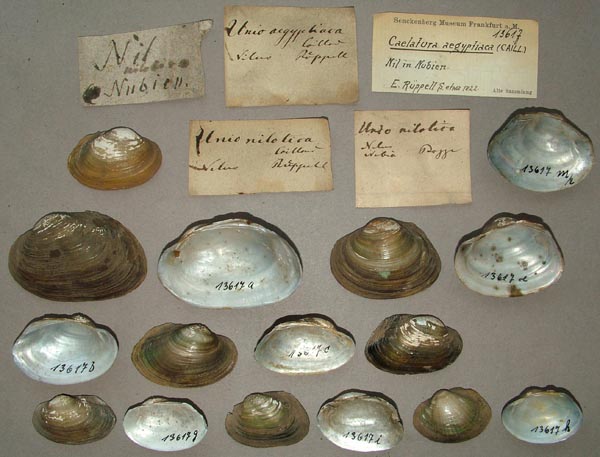
SMF_13617
Nil in Nubien
| 
ZMB_MP_0357
Nil Insel Roda vis-a-vis Cairo
| 
SMF_13598
Nil unt. [lower] d. Insel Philae
| 
ZMB_MP_0439
Nil, Africa Kotschy
| 
SMF_83176
Nil, zw l. Katarakt v. Insel Elephantine
| 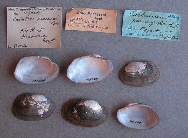
MCZ_109229
Nile River, Alexandria, Egypt
| 
MCZ_134114
Nile River, Cairo, Egypt
| 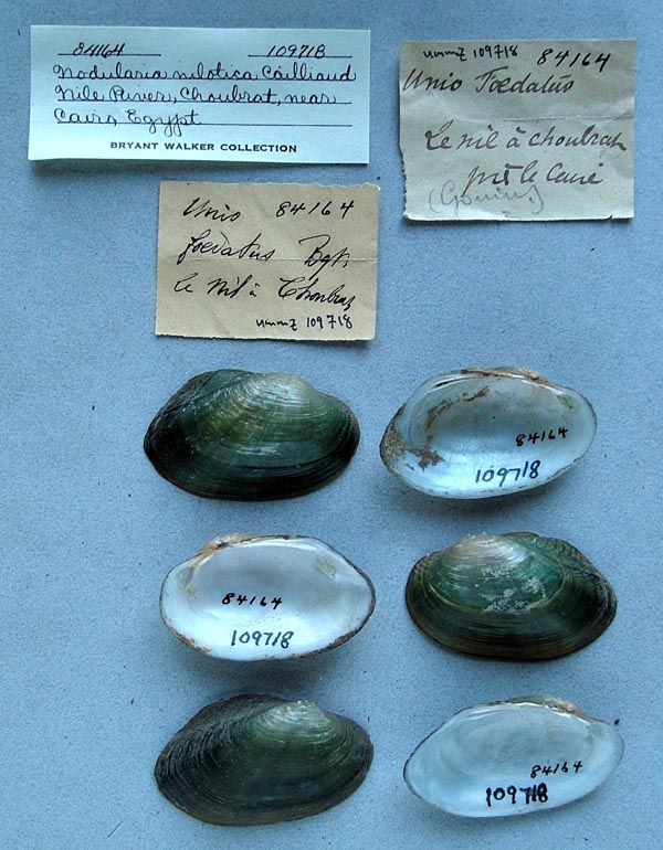
UMMZ_109718
Nile River, Choubrah, Cairo, Egypt
| 
UMMZ_51787
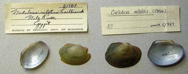
Nile River, Egypt
| 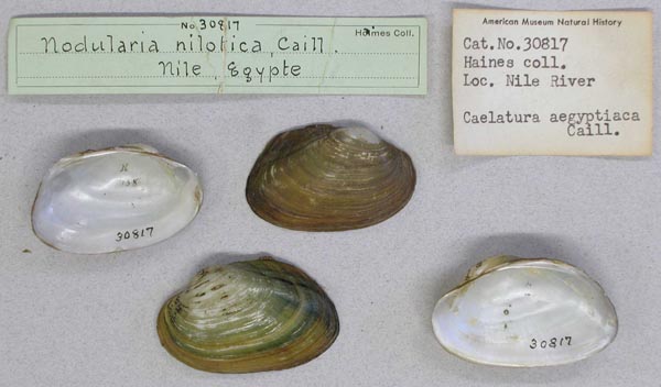
AMNH_30817
Nile River, Egypt
| 
MCZ_MP.252
Nile River, Egypt
| 
BMNH_92-11-12-2
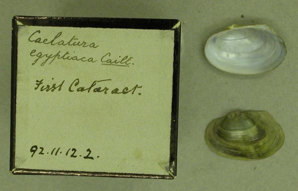
Nile River, first cataract
| 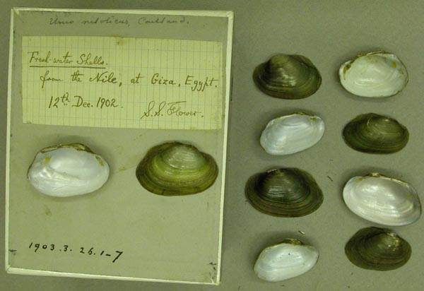
BMNH_1903-3-26-1-7
Nile River, Giza, Egypt
| 
MCZ_109259
Nile River, Mahmoudieh, Egypt
| 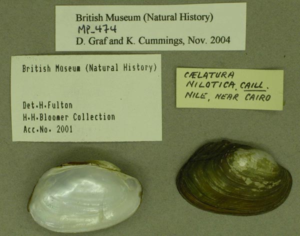
BMNH_MP_474
Nile River, near Cairo
| 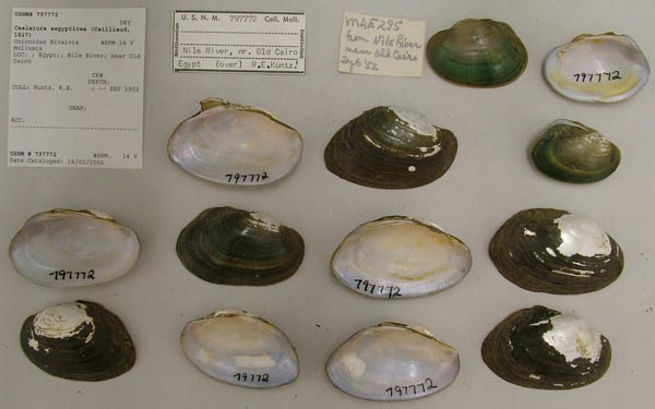
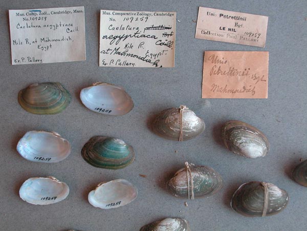
USNM_797772
Nile River, near Old Cairo
| 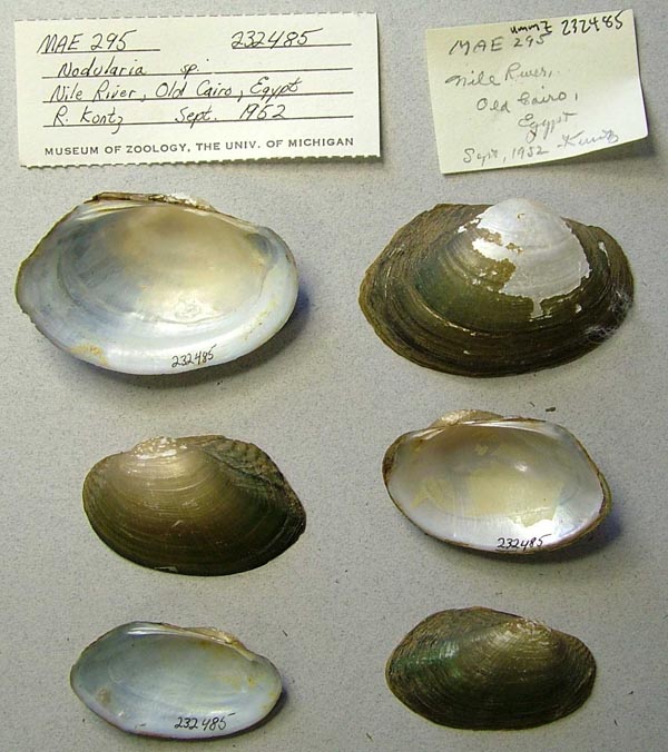
UMMZ_232485
Nile River, Old Cairo, Egypt
| 
UMMZ_232485
Nile River, Old Cairo, Egypt
| 
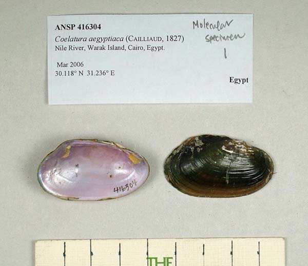
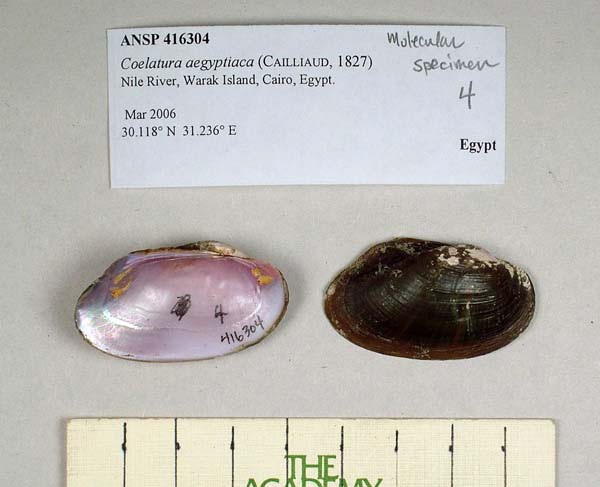
ANSP_416304
Nile River, Warak Island, Cairo, Egypt
| 
ANSP_416304
Nile River, Warak Island, Cairo, Egypt
| 
ANSP_416304
Nile River, Warak Island, Cairo, Egypt
| 
ANSP_416304
Nile River, Warak Island, Cairo, Egypt
| 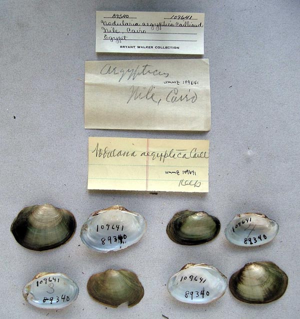
UMMZ_109641
Nile, Cairo, Egypt
| 
IRSNB_MP_0147
NIle, emouchure de Rosette envoi He’ron
| 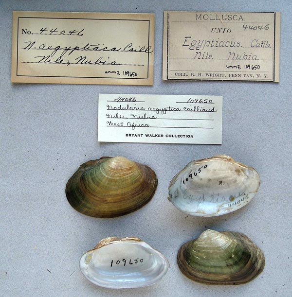
UMMZ_109650
Nile, Nubia
| 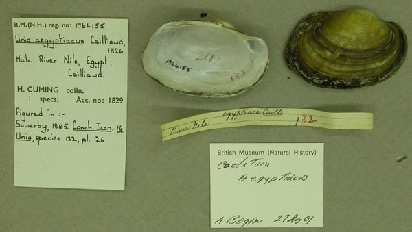
BMNH_1964155
River Nile, Egypt
| 
USNM_797950
SE and above Fostat, Egypt
| 
BMNH_MP_483
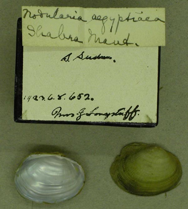
Shabra Maut, nr Gizeh
| 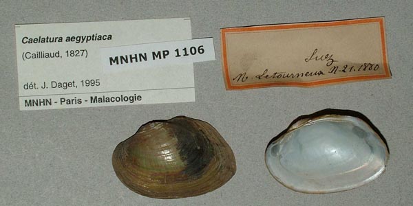
MNHN_MP_1106
Suez
| 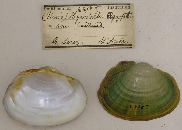
USNM_23185
Suez
| 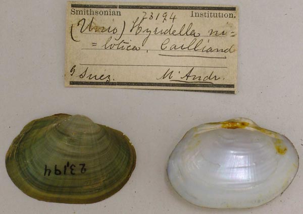
USNM_23194
Suez
| 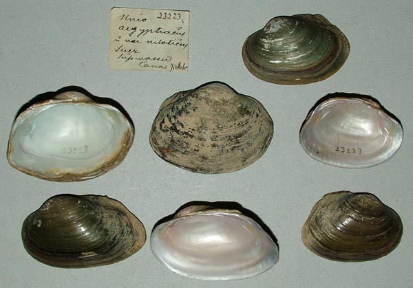
ZMB_23223
Suez Supwasser Canal
| 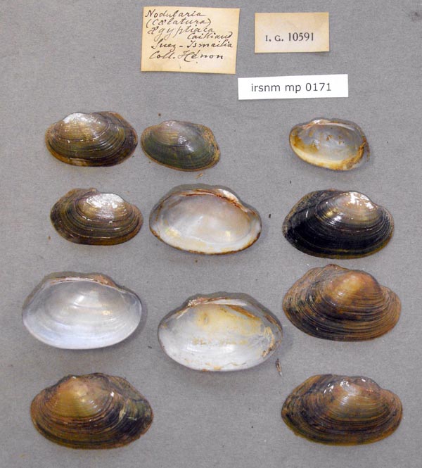
IRSNB_MP_0171
Suez-Ismailia
| 
SMF_13606
Süsswasser-Kanal bei Suez
| 
SMF_13607
Süsswasser-Kanal bei Suez
| 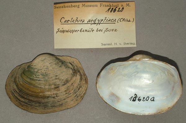
SMF_13620
Süsswasser-Kanäle bei Suez
| 
SMF_13587
Süsswasserkanal bei Ismailia
| 
BMNH_93-6-30-2-4
Sweetwater canal, Suez
| 
ZMB_31136
Tamieh Fajum
| 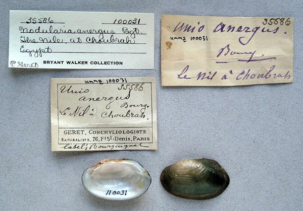
UMMZ_100031
The Nile, at Choubrah, Egypt
| 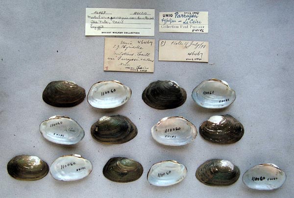
UMMZ_110060
The Nile, Cairo, Egypt
| 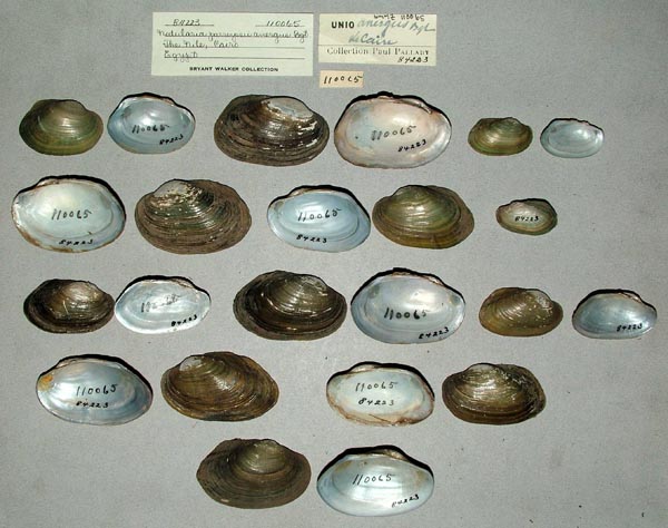
UMMZ_110065
The Nile, Cairo, Egypt
| 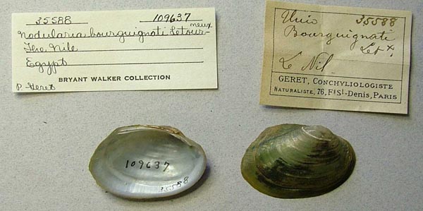
UMMZ_109637
The Nile, Egypt
| 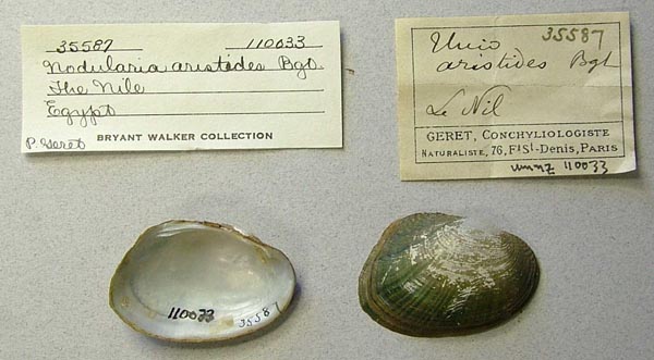
UMMZ_110033
The Nile, Egypt
| 
UMMZ_110042
The Nile, Egypt
| 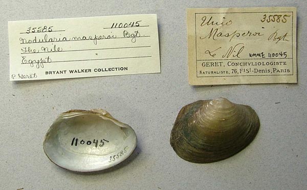
UMMZ_110045
The Nile, Egypt
| 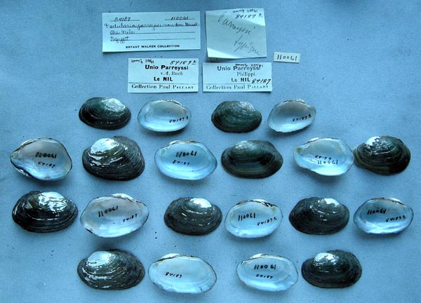
UMMZ_110061
The Nile, Egypt
| 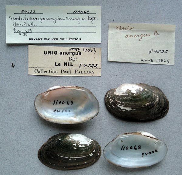
UMMZ_110063
The Nile, Egypt
| 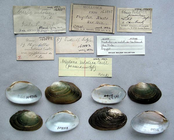
UMMZ_109712
The Nile, Egypt
| 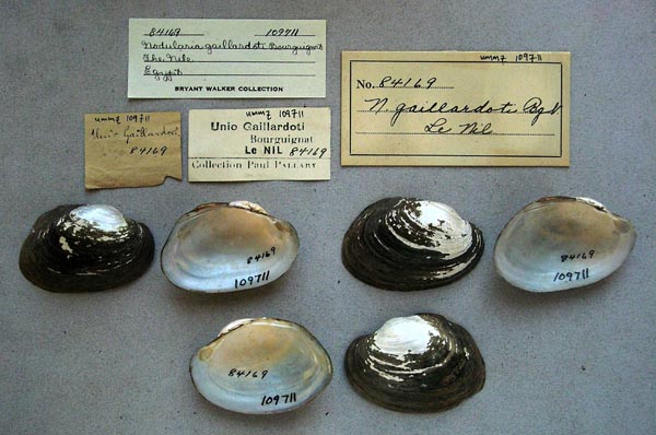
UMMZ_109711
The Nile, Egypt
| 
UMMZ_110034
The Nile, Egypt
| 
UMMZ_110036
The Nile, Egypt
| 
UMMZ_110068
The Nile, Egypt
| 
SMF_83177
Turra, 15 km sudl von Kairo
| 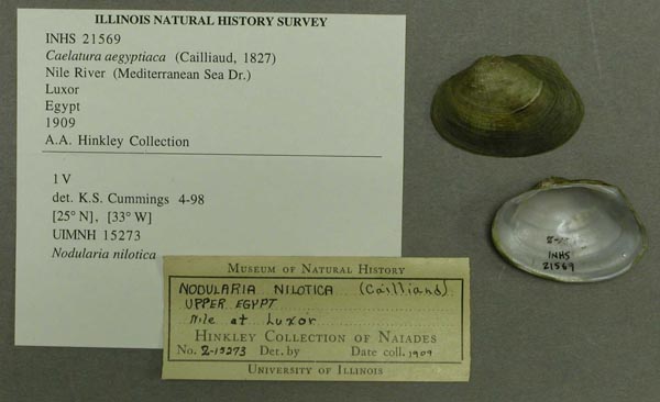
INHS_21569
Upper Egypt, Nile at Luxor
| 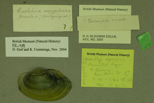
BMNH_MP_489
W Cairo
| 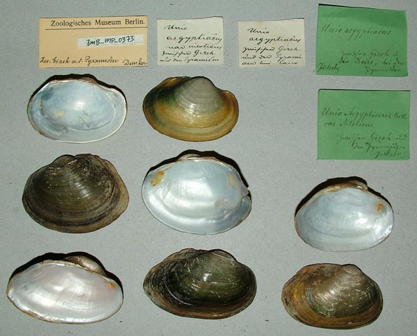
ZMB_MP_0373
Z...Gizeh n.d. Pyramiden
| 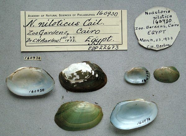
ANSP_160930
Zoo Gardens, Cairo, Egypt
| 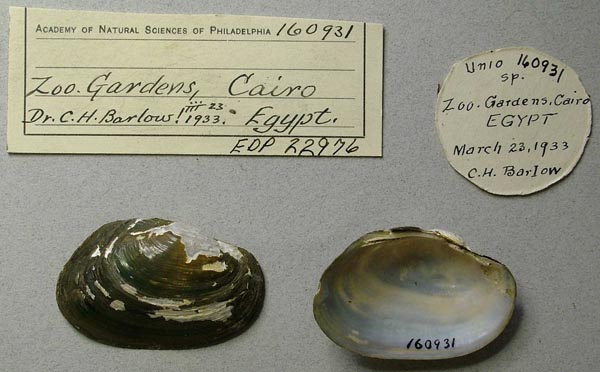
ANSP_160931
Zoo Gardens, Cairo, Egypt
| 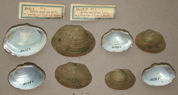
SMF_83175
zw. d. Pyramiden v. Gizeh, u. Abusir
|
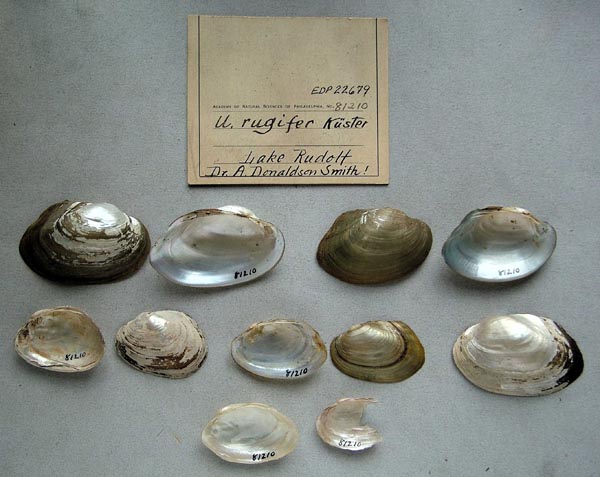
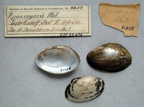
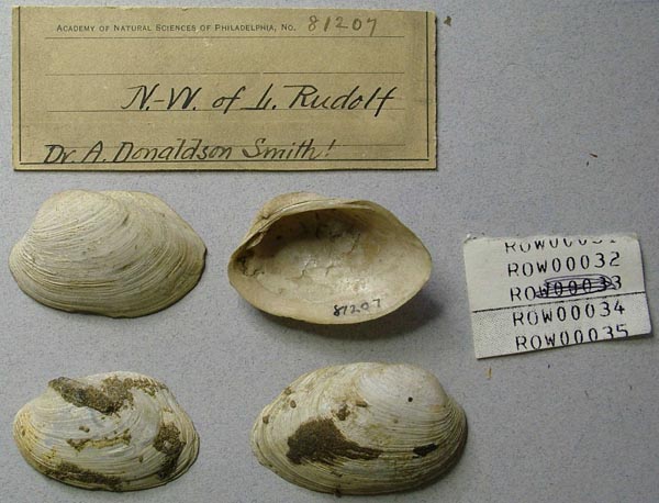
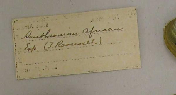
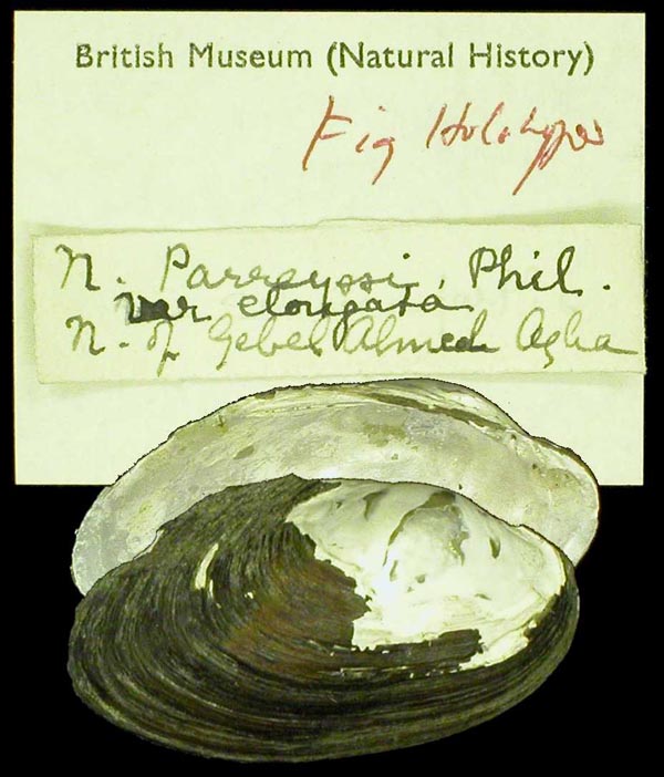
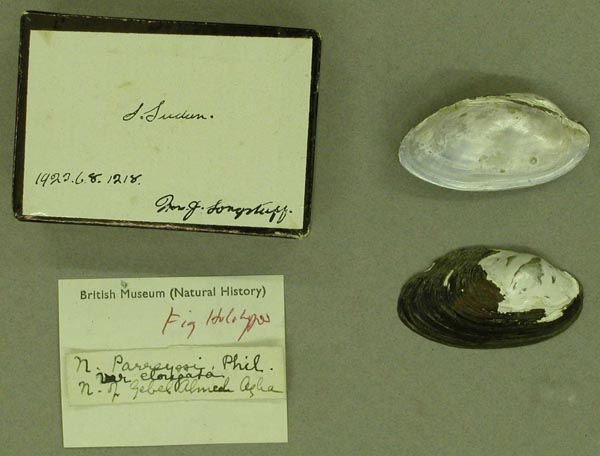
BMNH_MP_479. Aswan, above the dam
Ethiopia
Ghana
Guinea
MNHN_MP_1544
[no locality available - Africa - Guinea]
| 
MNHN_MP_1544
[no locality available - Africa - Guinea]
| 
MNHN_MP_1356
dans le haut Niger a Faranah
| 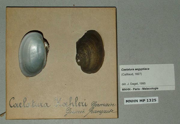
MNHN_MP_1325
Guinee Francaise
| 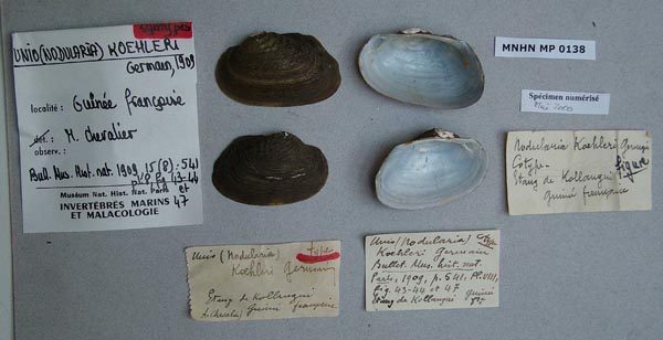
MNHN_MP_0138
Guinee Francaise
| 
MNHN_MP_0138
Guinee Francaise
| 
MNHN_MP_0138
Guinee Francaise
| 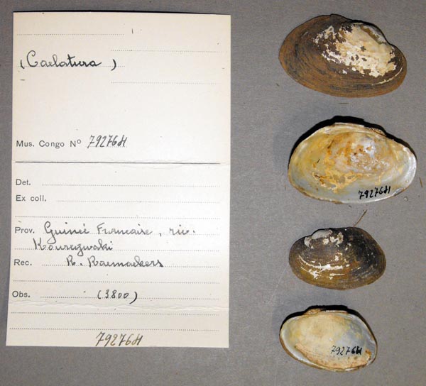
MRAC_792764
Guineé Française, riv. Kouregnaki
| 
MRAC_792766
Guineé Française, riv. Kouregnaki
| 
MRAC_792848
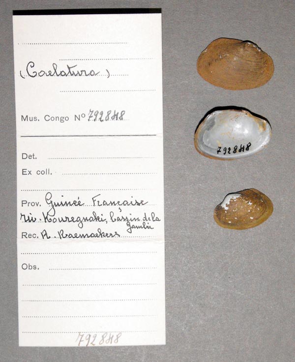
Guineé Française, riv. Kouregnaki, Basins de la Gambia
| 
MRAC_792776
Guineé Française, riv. Kouregnaki, Basins Gambia
| 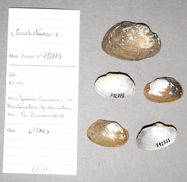
MRAC_792773
Guineé Française, riv. Kouregnaki, Youkountou
| 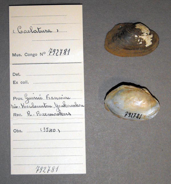
MRAC_792781
Guineé Française, riv. Kouregnaki, Youkountou
|
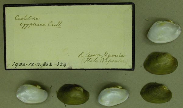
Kenya
Mali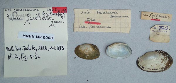
MNHN_MP_0008
[no locality available - Africa - Mali]
| 
MNHN_MP_0008
[no locality available - Africa - Mali]
| 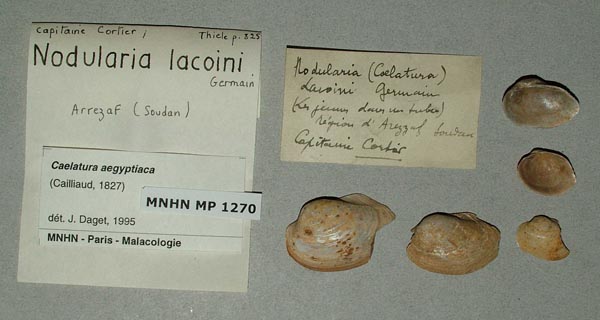
MNHN_MP_1270
Arrezaf, Soudan
| 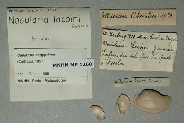
MNHN_MP_1260
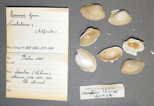
Asselar
| 
MRAC_355138
Asselar (Sahara)
| 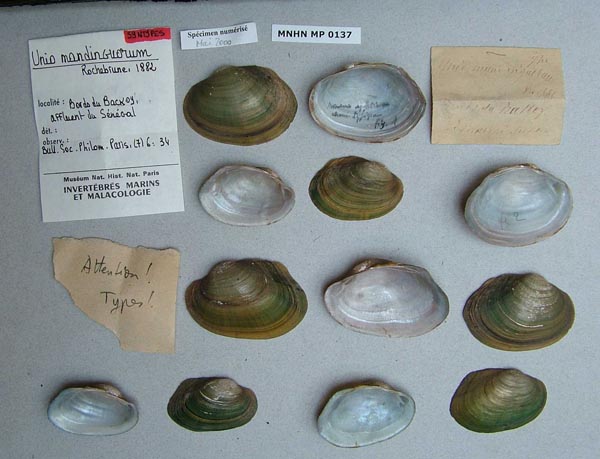
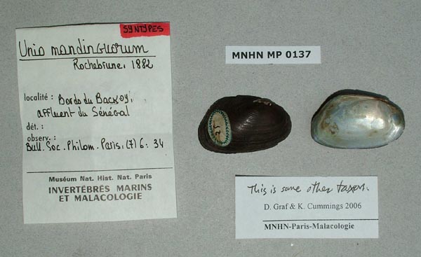
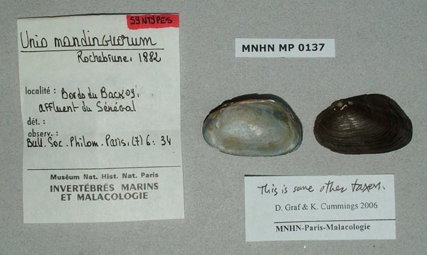
MNHN_MP_0137
bords du Backoy, affluent du Senegal
| 
MNHN_MP_0137
bords du Backoy, affluent du Senegal
| 
MNHN_MP_0137
bords du Backoy, affluent du Senegal
| 
MNHN_MP_0137
bords du Backoy, affluent du Senegal
| 
MNHN_MP_0137B
bords du Backoy, affluent du Senegal
| 
MNHN_MP_0137B
bords du Backoy, affluent du Senegal
| 
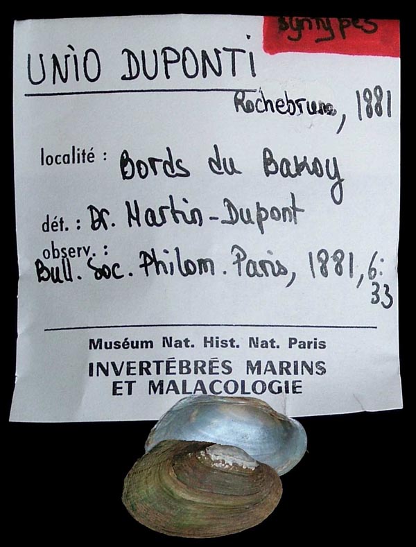
MNHN_MP_0053
bords du Bakoy
| 
MNHN_MP_0053
bords du Bakoy
| 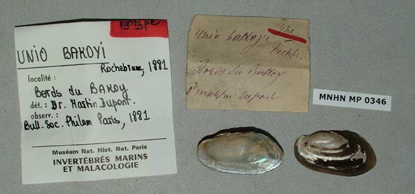
MNHN_MP_0346
bords du Bakoy
| 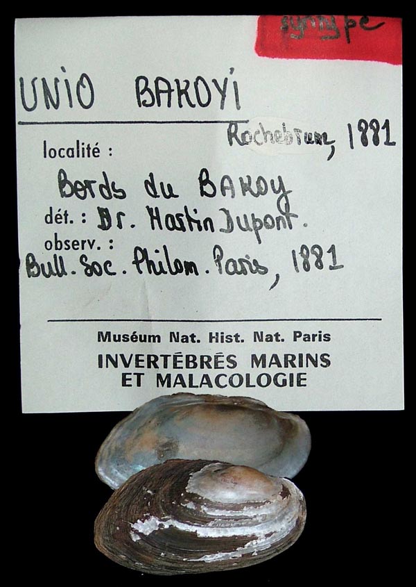
MNHN_MP_0346
bords du Bakoy
| 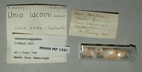
MNHN_MP_1261
Chemal d’ Askia, Tombouctou
| 
MNHN_MP_1257
en aval de Tosaga, Niger
| 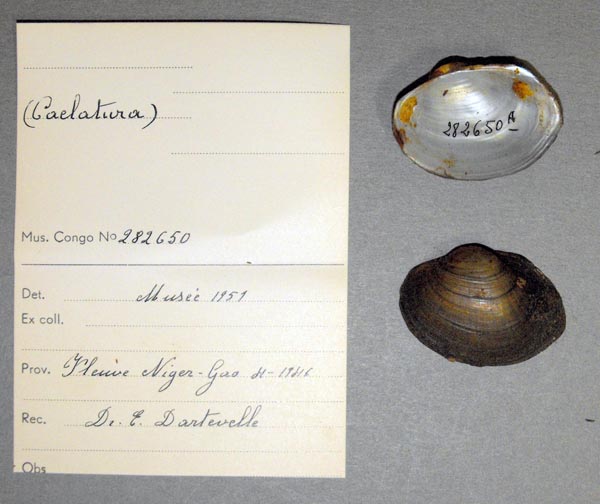
MRAC_282650
Flueve Niger Gao
| 
MRAC_282651
Flueve Niger Gao
| 
MRAC_282652
Flueve Niger Gao
| 
MNHN_MP_1275
Gao, Niger
| 
MNHN_MP_1277_01
Goa, Niger
| 
MNHN_MP_1277_02
Goa, Niger
| 
MNHN_MP_1268
Goundam, Niger
| 
MNHN_MP_1269
L’ Azaouad pres de Tombouctou
| 
MNHN_MP_1276
L’ Azouad, Tombouctou
| 
MNHN_MP_1320
Lac Faguibine, bord Nord
| 
MNHN_MP_1280
Niger a Mopti
| 
MNHN_MP_1200
Rives du lac Dabo, Soudan
| 
MNHN_MP_1203
Rives du lac Dabo, Soudan
| 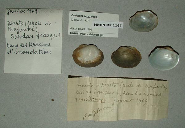
MNHN_MP_1167
Soudan francias
| 
MNHN_MP_1267
Tosaga, Niger
| 
MNHN_MP_1267
Tosaga, Niger
|
Mauritania
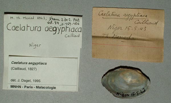
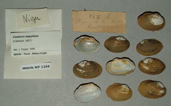
Niger
Nigeria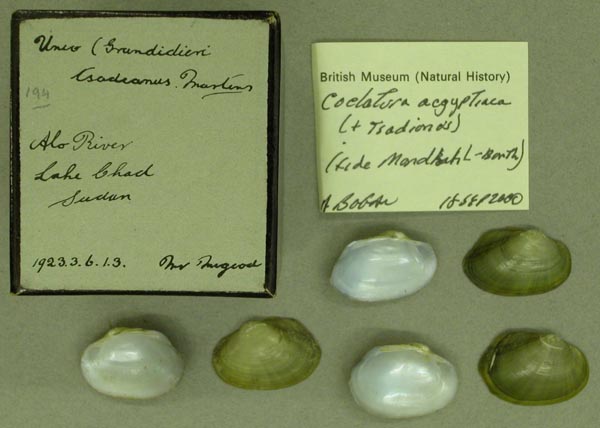
BMNH_1923-3-6-1-3
Alo River, Lake Chad, Sudan
| 
MNHN_MP_1163
Baga Kawa, Lac Tchad
| 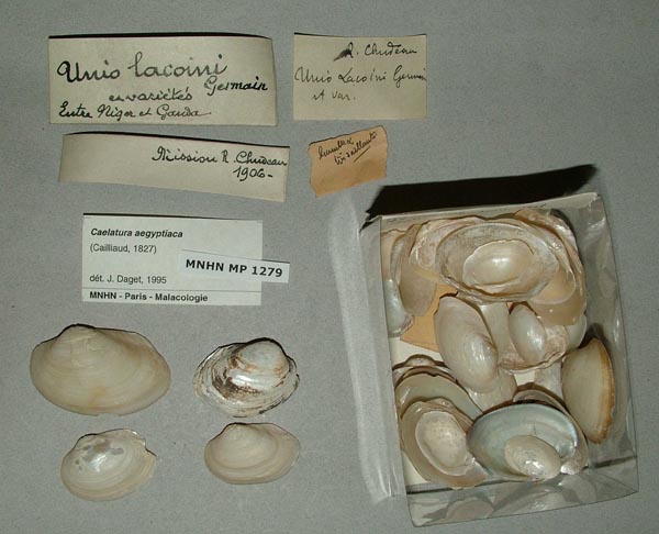
MNHN_MP_1279
Entre Niger et Gauda
| 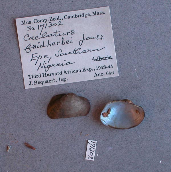
MCZ_171302
Epe, Southern Nigeria
| 
BMNH_MP_467
Gongola River, Shillem, N Nigeria
| 
USNM_272928
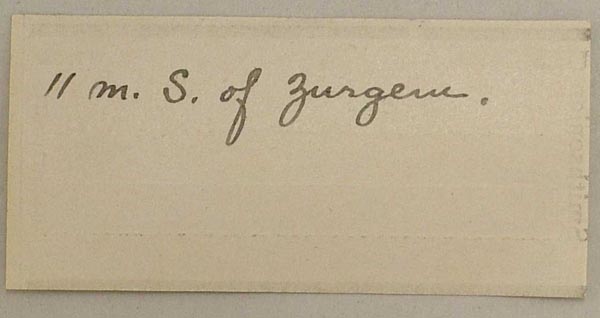
Kaduna R., Wushishi, 11 mi S Zurgem, North Nigeria
| 
USNM_272928
Kaduna R., Wushishi, 11 mi S Zurgem, North Nigeria
| 
USNM_272927
Kaduna R., Wushishi, 11 mi S Zurgem, North Nigeria
| 
USNM_272927
Kaduna R., Wushishi, 11 mi S Zurgem, North Nigeria
| 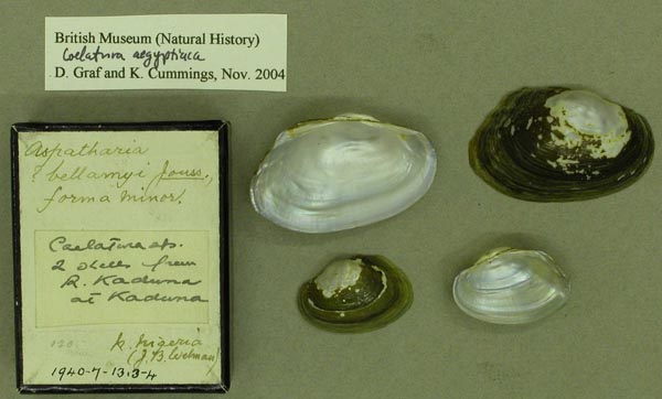
BMNH_1940-7-13-3-4
Kaduna River, Kaduna, N Nigeria
| 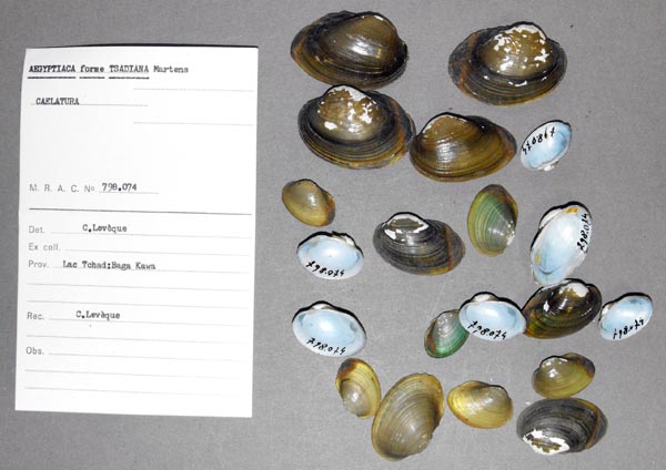
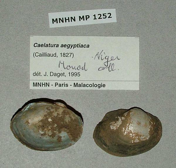
MRAC_798074
Lac Tchad: Baga Kawa
| 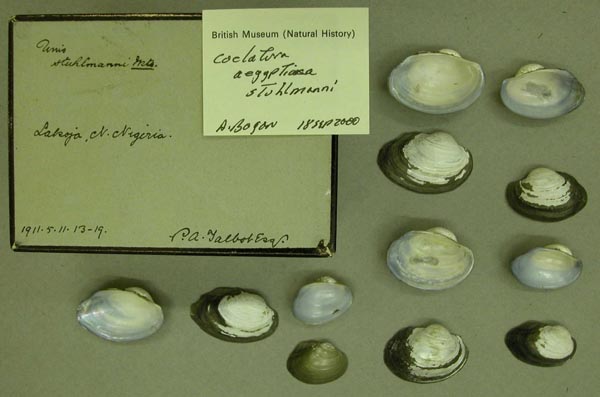
BMNH_1911-5-11-13-19
Lakoja, N Nigeria
| 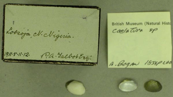
BMNH_1911-5-11-12
Lokoja, N Nigeria
| 
BMNH_1905-1-30-8
N. Nigeria
| 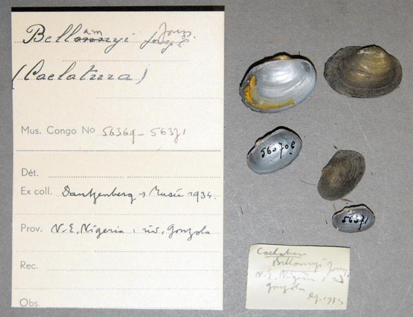
MRAC_56369
N.E. Nigeria: riv. Gongola
| 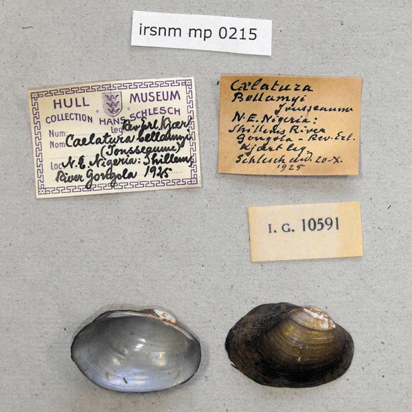
IRSNB_MP_0215
N.E. Nigeria: River Gongola Shillem
| 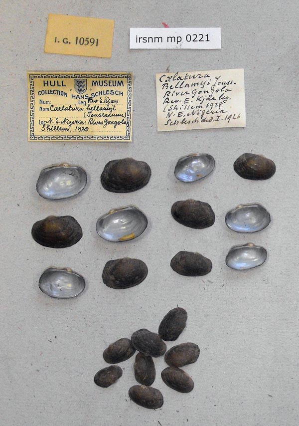
IRSNB_MP_0221
N.E. Nigeria: River Gongola Shillem
| 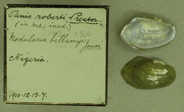
BMNH_1910-12-13-7
Nigeria
| 
MRAC_56405
Nigeria
| 
MRAC_56405
Nigeria
| 
UMMZ_110051
Nigeria
| 
UMMZ_110051
Nigeria
| 
UMMZ_110051
Nigeria
| 
MRAC_799006
Nigeria Lac Tchad, Yobe river at Yau W. Shore
| 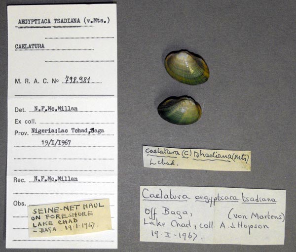
MRAC_798981
Nigeria: Lac Tchad. Baga
| 
MRAC_798982
Nigeria: Lac Tchad. Baga
| 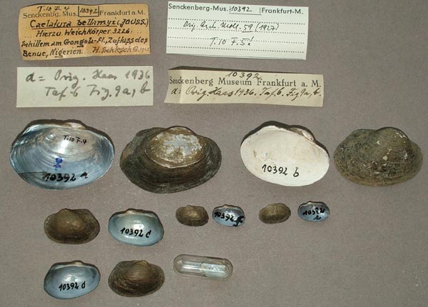
SMF_10392
Schillem am Gongola-Fl. Zufluss des Benue, Nigerien
| 
ANSP_139952
Shillem, Gongola River, N.E. Nigeria
| 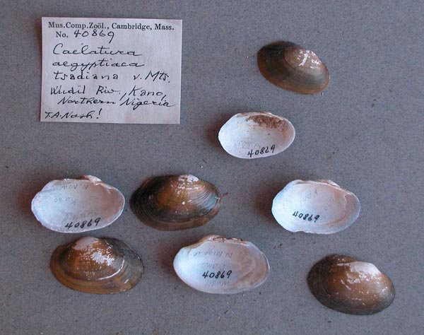
MCZ_40869
Wudil River, Kano, Northern Nigeria
|
Senegal
SMF_13558
A.d. Senegal
| 
IRSNB_MP_0165
Casamance
| 
MNHN_MP_1191
Côte d’ Afrique, Senegal
| 
MNHN_MP_1191
Côte d’ Afrique, Senegal
| 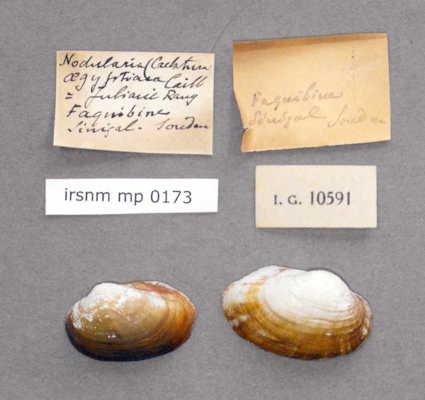
IRSNB_MP_0173
Faquibine Senegal
| 
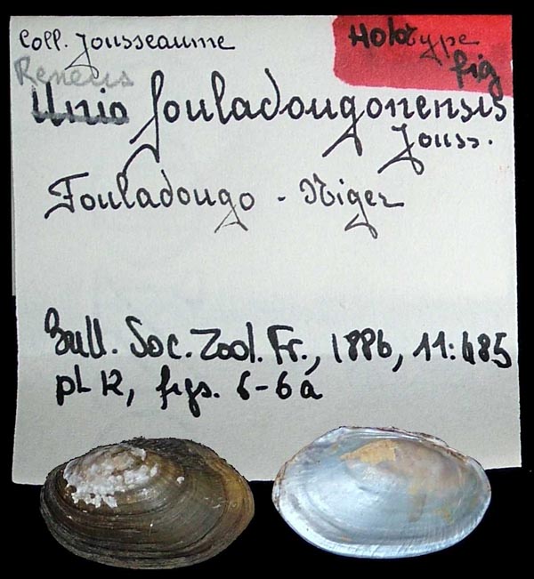
MNHN_MP_0063
Fouladougo, Niger
| 
MNHN_MP_0063
Fouladougo, Niger
| 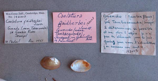
MCZ_192003
Gambia River, Guendo, near Tabacounda, Senegal
| 
MNHN_MP_1181
Haut Senegal
| 
MNHN_MP_1182
Haut Senegal
| 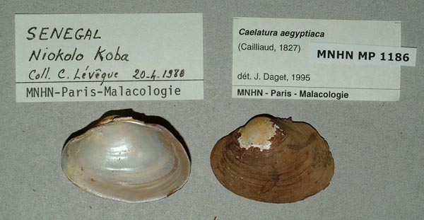
MNHN_MP_1186
Niokolo Koba, Senegal
| 
MNHN_MP_1188
Niokolo Koba, Senegal
| 
MNHN_MP_1188
Niokolo Koba, Senegal
| 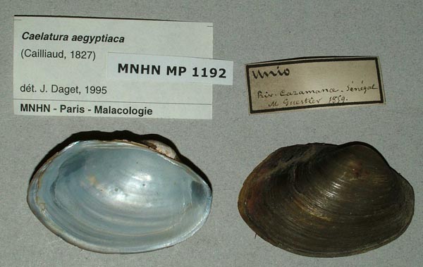
MNHN_MP_1192
Riv. Cazamance, Senegal
| 
MNHN_MP_1196
Riv. Cazamance, Senegal
| 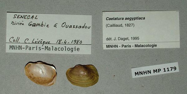
MNHN_MP_1179
riviere Gambie a Ouassadou, Senegal
| 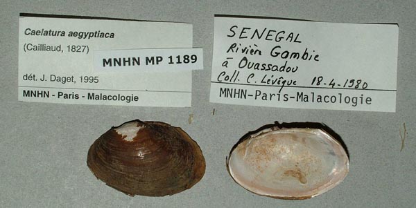
MNHN_MP_1189
riviere Gambie a Ouassadou, Senegal
| 
MNHN_MP_1194
riviere Gambie a Ouassadou, Senegal
| 
BMNH_MP_468
Senegal
| 
ZMB_MP_0409
Senegal
| 
SMF_13556
Senegal
| 
SMF_13557
Senegal
| 
MNHN_MP_0143
Senegal
| 
MNHN_MP_0143
Senegal
| 
USNM_126987
Senegal
| 
USNM_126987
Senegal
| 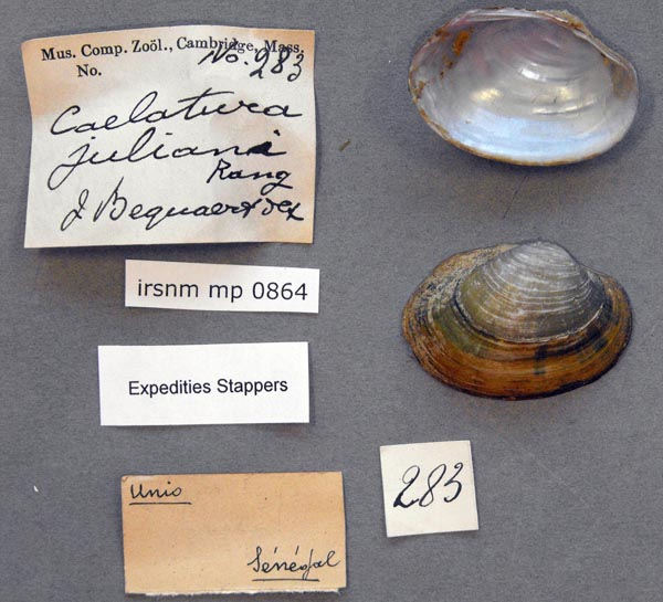
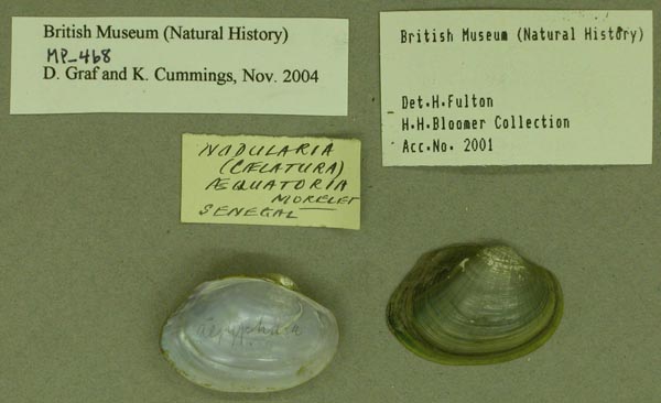
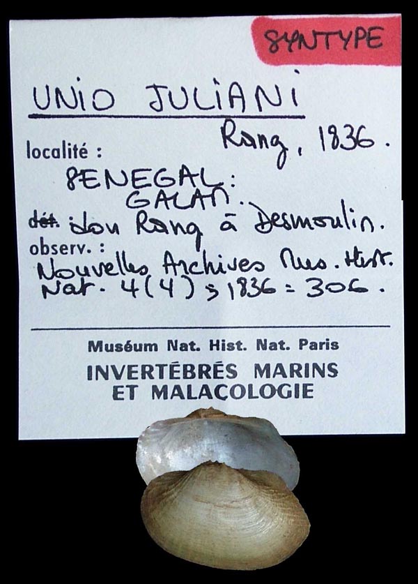
IRSNB_MP_0864
Senegal
| 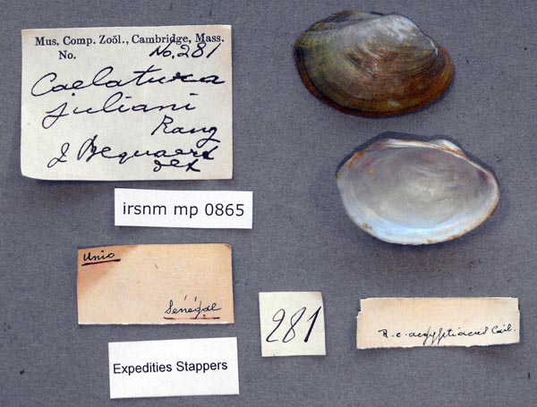
IRSNB_MP_0865
Senegal
| 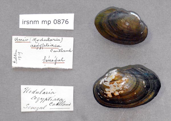
IRSNB_MP_0876
Senegal
| 
UMMZ_109640
Senegal
| 
IRSNB_MP_0149
Senegal
| 
AMS_127041
Senegal
| 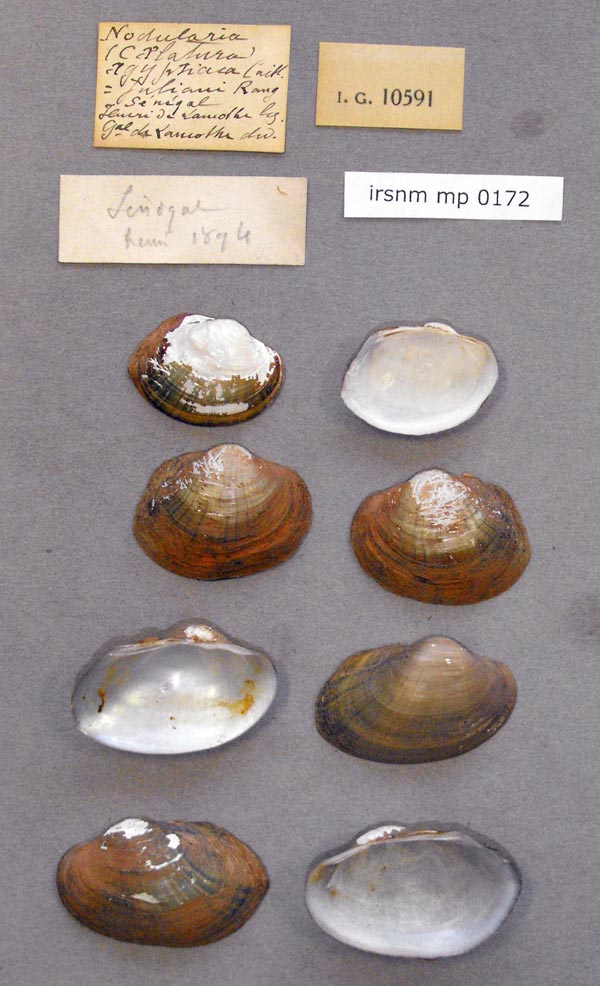
IRSNB_MP_0172
Senegal
| 
IRSNB_MP_0174
Senegal
| 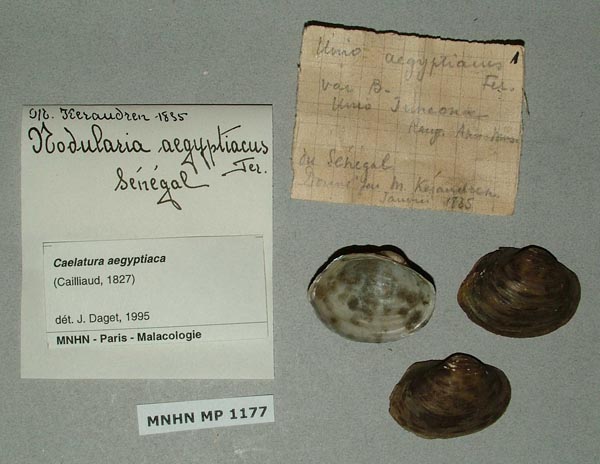
MNHN_MP_1177
Senegal
| 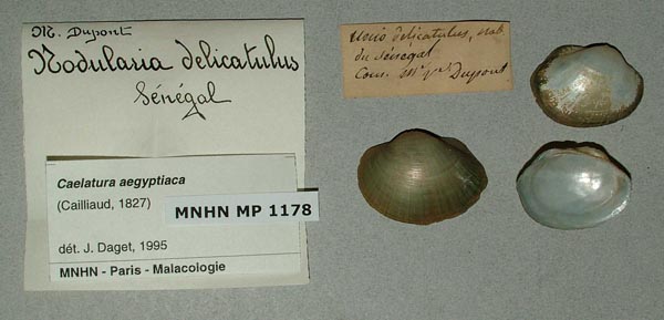
MNHN_MP_1178
Senegal
| 
MNHN_MP_1180
Senegal
| 
MNHN_MP_1183
Senegal
| 
MNHN_MP_1183
Senegal
| 
MNHN_MP_1187
Senegal
| 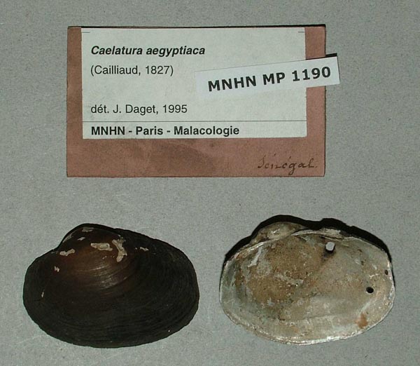
MNHN_MP_1190
Senegal
| 
MNHN_MP_1193
Senegal
| 
MNHN_MP_1195
Senegal
| 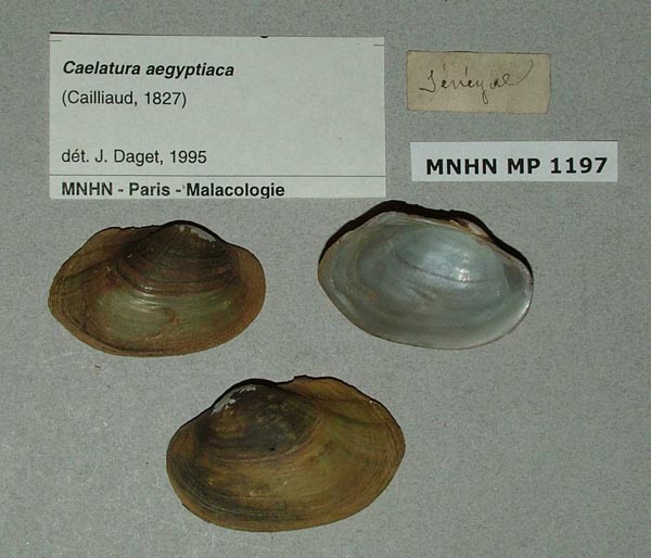
MNHN_MP_1197
Senegal
| 
MNHN_MP_1198
Senegal
| 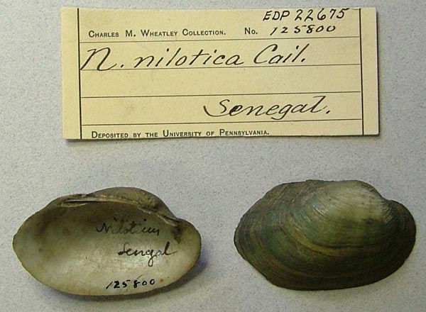
ANSP_125800
Senegal
| 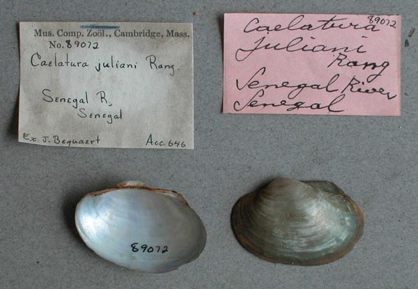
MCZ_89072
Senegal River, Senegal
| 
UMMZ_109649
Senegal, West Africa
| 
UMMZ_110077
Senegal, West Africa
| 
ANSP_41684
Senegambia
|
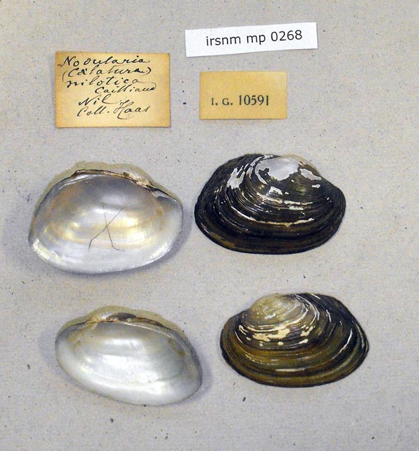
Sudan
ZMB_23718
“Novitat” [no locality available; “Tondjflusse” mentioned in the original description]
| 
UMMZ_248934
15 miles S of Kosti bridge, White Nile, east bank receding water
| 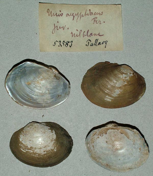
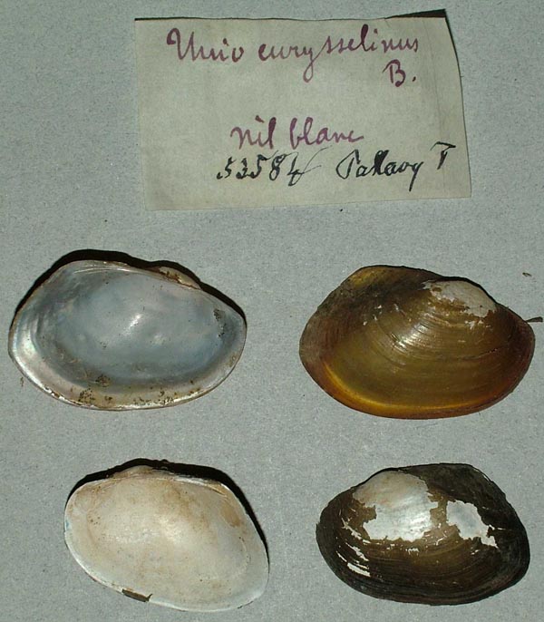
ZMB_53583
A Nil Blanc
| 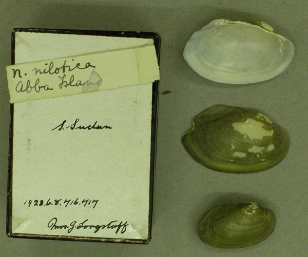
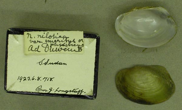
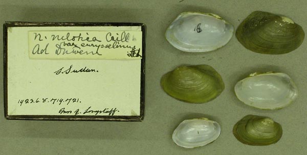
BMNH_1923-6-8-716-717
Abba Island, S Sudan
| 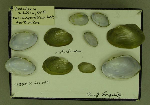
BMNH_1923-6-8-656-665
Ad-Duwem, S. Sudan
| 
BMNH_1923-6-8-737-746
Ad-Duwem, S. Sudan
| 
BMNH_1923-6-8-1213
Ad-Duwem, S. Sudan
| 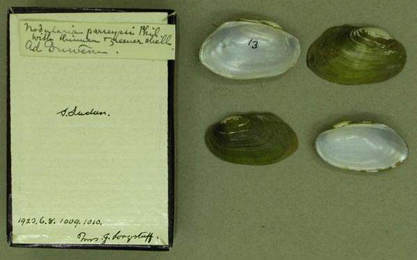
BMNH_1923-6-8-1009-1010
Ad-Duwem, S. Sudan
| 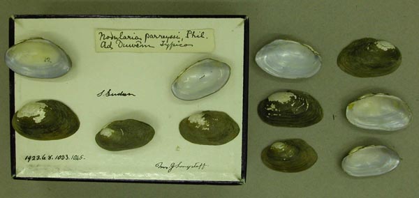
BMNH_1923-6-8-1033-1045
Ad-Duwem, S. Sudan
| 
BMNH_1923-6-8-718
Ad-Duwem, S. Sudan
| 
BMNH_1923-6-8-719-721
Ad-Duwem, S. Sudan
| 
BMNH_1923-6-8-977-978
Ad-Duwem, S. Sudan
| 
BMNH_MP_472
Ad-Duwem, S. Sudan
| 
USNM_215141
Bahr el Ghazal, Sudan
| 
USNM_215141
Bahr el Ghazal, Sudan
| 
USNM_215143
Bahr el Ghazal, Sudan
| 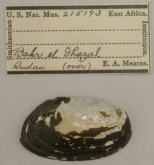
USNM_215193
Bahr el Ghazal, Sudan
| 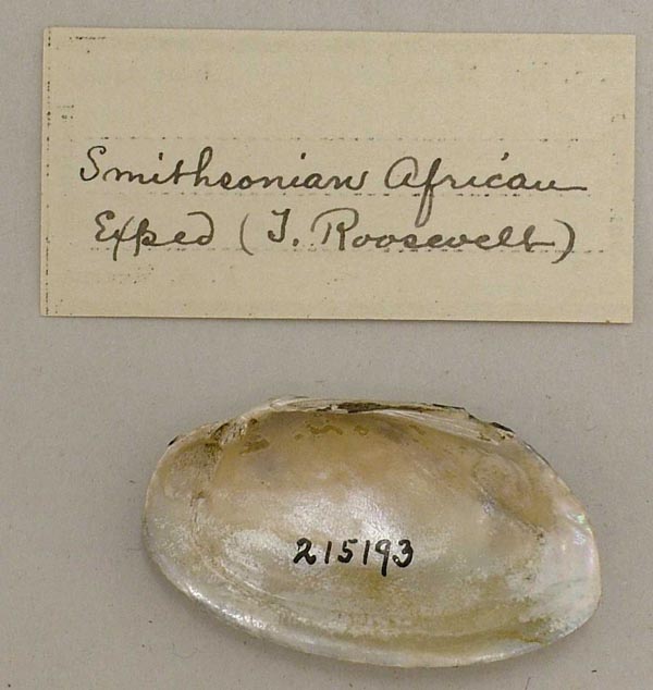
USNM_215193
Bahr el Ghazal, Sudan
| 
SMF_83191
Blauer Nil Nil Blanc
| 
MCZ_20899
Blue Nile River, Anglo-Egyptian Sudan
| 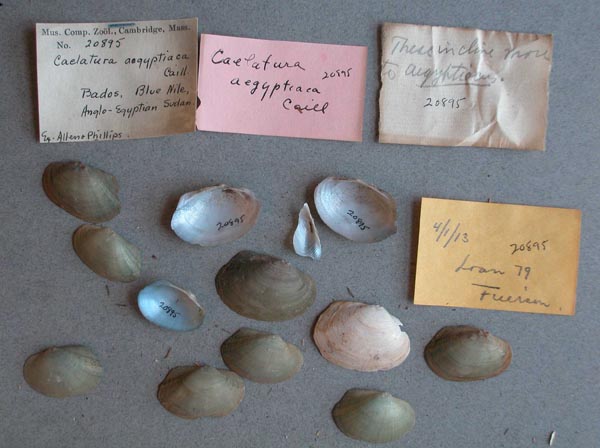
MCZ_20895
Blue Nile, Bados, Anglo-Egyptian Sudan
| 
MCZ_20895
Blue Nile, Bados, Anglo-Egyptian Sudan
| 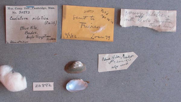
MCZ_20892
Blue Nile, Bados, Anglo-Egyptian Sudan
| 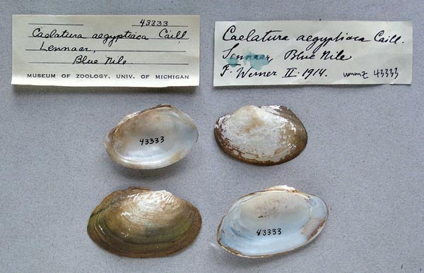
UMMZ_43333
Blue Nile, Sennaar
| 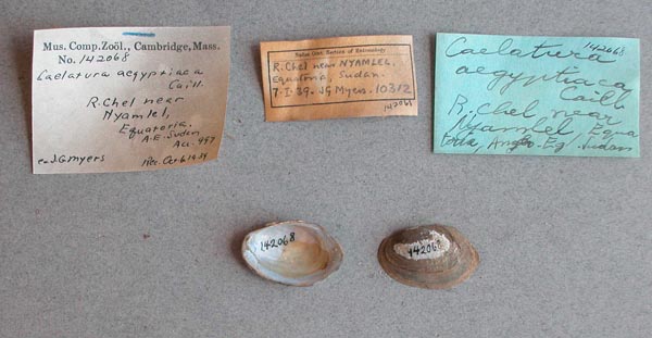
MCZ_142068
Chel River, near Nyamlel, Equatoria, Anglo-Egyptian Sudan
| 
SMF_1000
Djebel Auel [Jebel Aulia], Bahr-el-Abiad [Bahr al-Abiad = Weißer Nil]
| 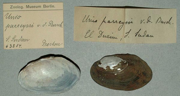
ZMB_63814
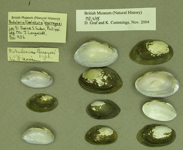
El Dueim, S Sudan
| 
USNM_215133
El Dueim, Sudan
| 
USNM_215133
El Dueim, Sudan
| 
UMMZ_110062
El Duem, Egypt
| 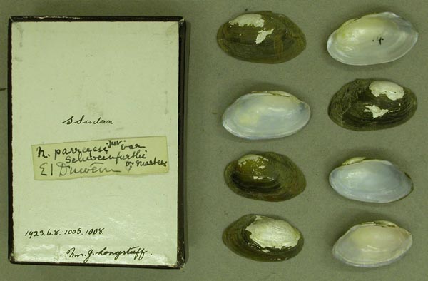
BMNH_1923-6-8-1005-1008
El Duem, S. Sudan
| 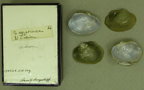
BMNH_1923-6-8-638-639
El Duem, S. Sudan
| 
BMNH_MP_478
El Duem, S. Sudan
| 
IRSNB_MP_0267
Fachoda
| 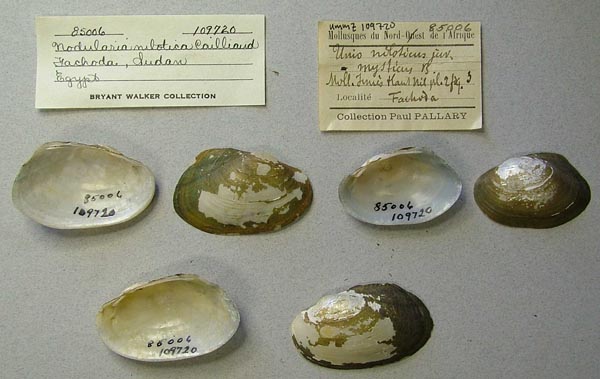
UMMZ_109720
Fachoda, Sudan, Egypt
| 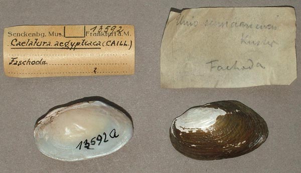
SMF_13592
Faschoda
| 
UMMZ_110044
Fashoda, Sudan
| 
UMMZ_110048
Fashoda, Sudan
| 
UMMZ_110071
Fashoda, Sudan
| 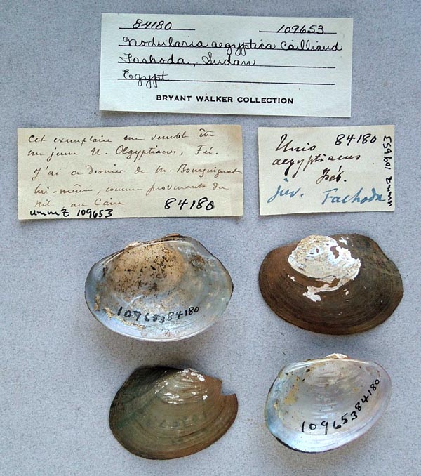
UMMZ_109653
Fashoda, Sudan, Egypt
| 
UMMZ_110029
Fashoda, Sudan, Egypt
| 
BMNH_65-1-3-14
from the Nile region between 3° to 14° N lat.
| 
BMNH_65-1-3-14
from the Nile region between 3° to 14° N lat.
| 
BMNH_1923-6-8-999-1003
Gebel En, S Sudan
| 
SMF_999
Goz Abu Guma, Bahr el-Abiad
| 
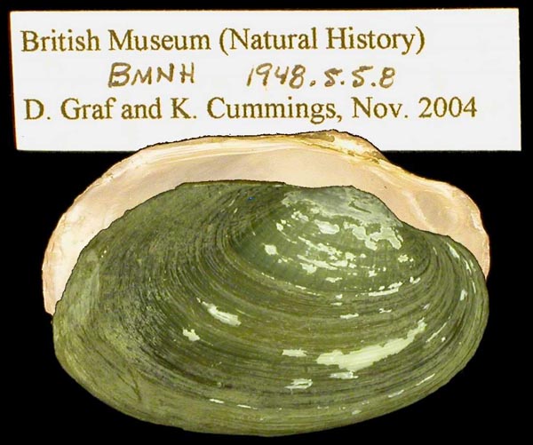
BMNH_1948-5-5-6
Hag Abdalla, nord de Sennaar (Sudan).
| 
BMNH_1948-5-5-6
Hag Abdalla, nord de Sennaar (Sudan).
| 
BMNH_1923-6-8-759
Hillel Abbas, S. Sudan
| 
USNM_426721
Kaka, Anglo-Egyptian Sudan
| 
IRSNB_MP_0266
Khartoum
| 
BMNH_1937-12-30-13066-13067
Khartoum
| 
SMF_13608
Khartum, Sudan
| 
ZMB_77703
Khartum, Weisser Nil
| 
SMF_996
Khor Adar, Bahr el-Abiad
| 
UMMZ_43366
Khor Altar, White Nile
| 
MCZ_62926
Khor Pini, near Mt. Miri, Amadi Rd., Equitoria, Anglo-Egyptian Sudan
| 
BMNH_1923-6-8-1004
Kor Surlmeb [?], S Sudan
| 
SMF_13605
Kordofan
| 
BMNH_1923-6-8-641
Kosti, S Sudan
| 
BMNH_1923-6-8-711
Kosti, S Sudan
| 
BMNH_1923-6-8-1214-1216
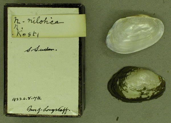
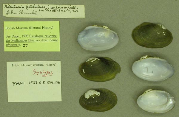
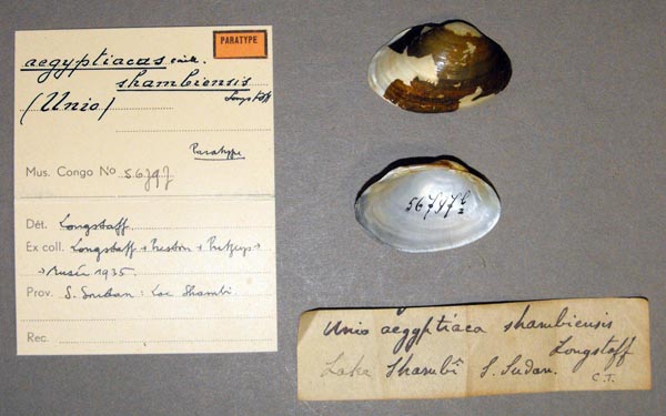
Lake Shambe, [Bahrel-Gebel] Southern Sudan.
| 
BMNH_1923-6-8-635-637
Lake Shambe, S. Sudan
| 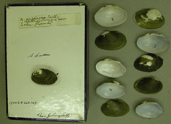
BMNH_1923-6-8-642-649
Lake Shambe, S. Sudan
| 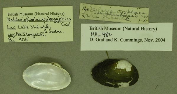
BMNH_MP_482
Lake Shambe, S. Sudan
| 
UMMZ_109636
Lake Shambi, Egypt
| 
MRAC_56797
Lake Shambi, S. Sudan
| 
MCZ_142067
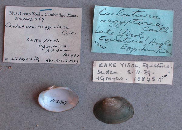
Lake Yirol, Equitoria, Anglo-Egyptian Sudan
| 
BMNH_1923-6-8-1204-1209
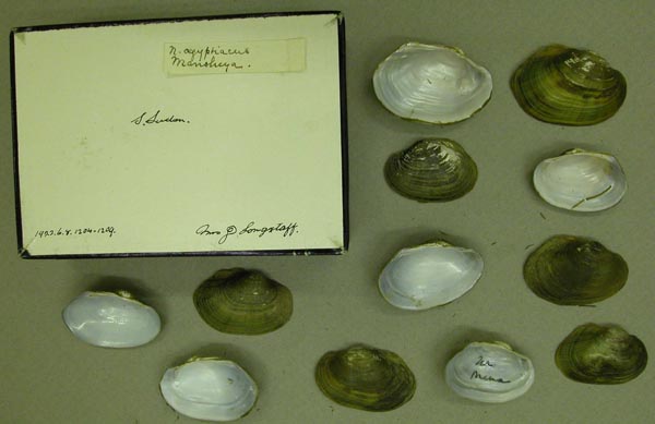
Manshiya, S Sudan
| 
BMNH_1923-6-8-1198-1203
Manshiya, S Sudan
| 
BMNH_1923-6-8-1193-1197
Manshiya, S Sudan
| 
BMNH_1923-6-8-1191-1192
Manshiya, S Sudan
| 
BMNH_1923-6-8-1183-1186
Manshiya, S Sudan
| 
BMNH_1923-6-8-1177-1182
Manshiya, S Sudan
| 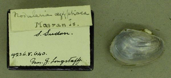
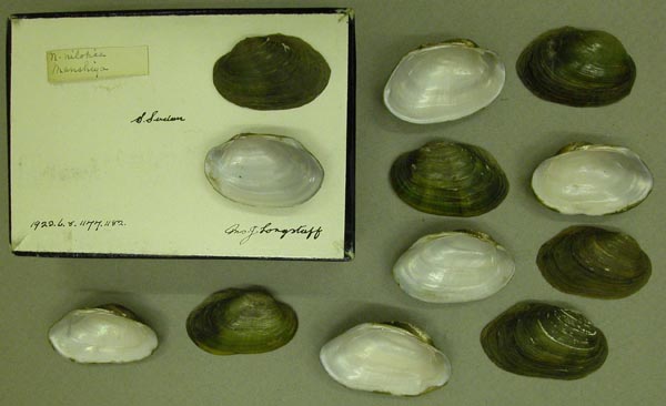
BMNH_1923-6-8-640
Masran Is., S Sudan
| 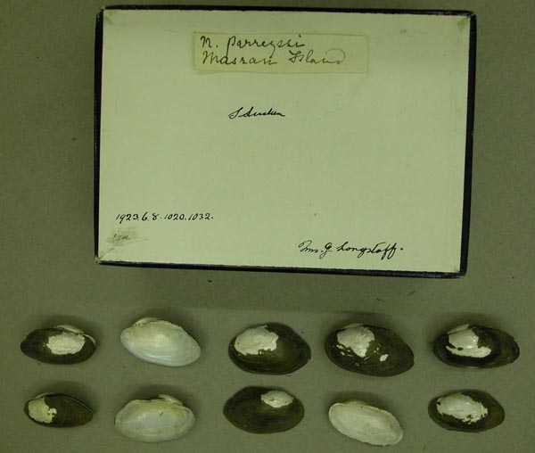
BMNH_1923-6-8-1020-1032
Masran, S. Sudan
| 
BMNH_1923-6-8-988
Meshra Zeraf Wood Station
| 
BMNH_MP_520
mouth of the White Nile, Sudan
| 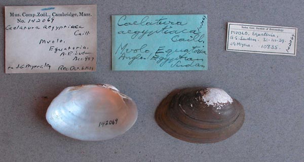
MCZ_142069
Mvolo, Equitoria, Anglo-Egyptian Sudan
| 
BMNH_1922-6-8-1218
N of Gebel Ahmed, S. Sudan
| 
BMNH_1922-6-8-1218
N of Gebel Ahmed, S. Sudan
| 
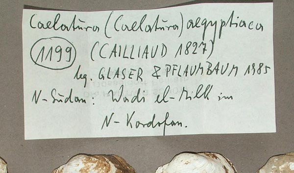
SMF_319211
N-Sudan: Wadi el-rill im N Kordofan
| 
SMF_319211
N-Sudan: Wadi el-rill im N Kordofan
| 
UMMZ_110028
near Khartum, Egypt
| 
ZMB_53584
Nil Blanc
| 
MRAC_56599
Nil Blanc
| 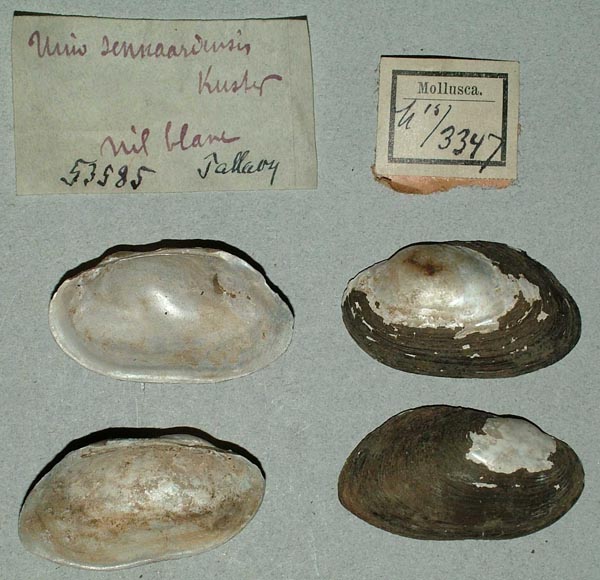
ZMB_53585
Nil Blanc
| 
MRAC_56640
Nil Blanc
| 
MNHN_MP_1078
Nil Bleu, Soudan, Anglo Egyptien
| 
MNHN_MP_1080
Nil Bleu, Soudan, Anglo Egyptien
| 
BMNH_1937-12-30-13061
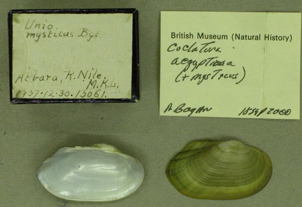
Nile River, Atbara, M.K.L.
| 
BMNH_1956-6-9-21-24
Nile River, Hag Abdalla, A-E Sudan, from Canals
| 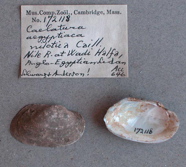
MCZ_172118
Nile River, Wadi Halfa, Anglo-Egyptian Sudan
| 
BMNH_1923-6-8-695-708
nr Mogran, S Sudan
| 
BMNH_1923-6-8-722-732
nr Mogran, S Sudan
| 
BMNH_1923-6-8-722-732
nr Mogran, S Sudan
| 
BMNH_1923-6-8-666-680
nr Mogran, S Sudan
| 
BMNH_1923-6-8-747-758
nr Mogran, S Sudan
| 
BMNH_1923-6-8-747-758
nr Mogran, S Sudan
| 
BMNH_1923-6-8-982-987
nr Mogran, S Sudan
| 
BMNH_1923-6-8-733-735
nr Mogran, S Sudan
| 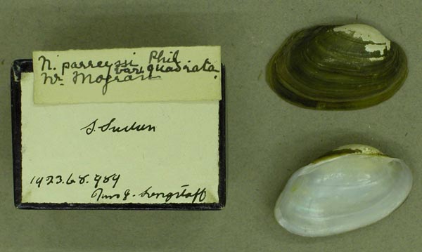
BMNH_1923-6-8-989
nr Mogran, S Sudan
| 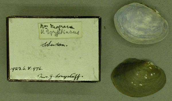
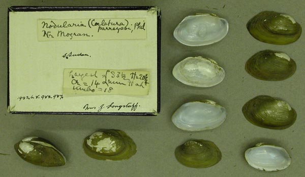
BMNH_1923-6-8-976
nr Mogran, S Sudan
| 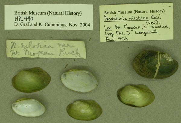
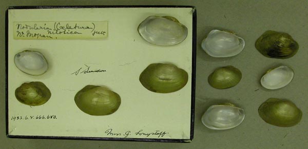
BMNH_MP_490
nr Mogran, S Sudan
| 
BMNH_MP_491
nr Mogran, S Sudan
| 
BMNH_MP_492
nr Mogran, S Sudan
| 
BMNH_MP_493
nr Mogran, S Sudan
| 
ZMB_4842
Oberer Nil
| 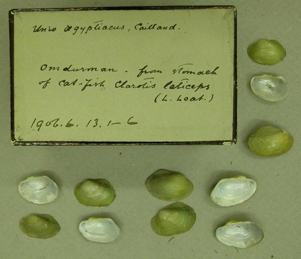
BMNH_1906-6-13-1-6
Omdurman, from stomach of cat-fish, Clarotis laticeps
| 
MNHN_MP_1083
rivieires Soudan Egyptien
| 
MNHN_MP_1084
rivieires Soudan Egyptien
| 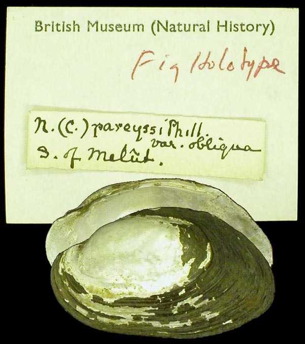
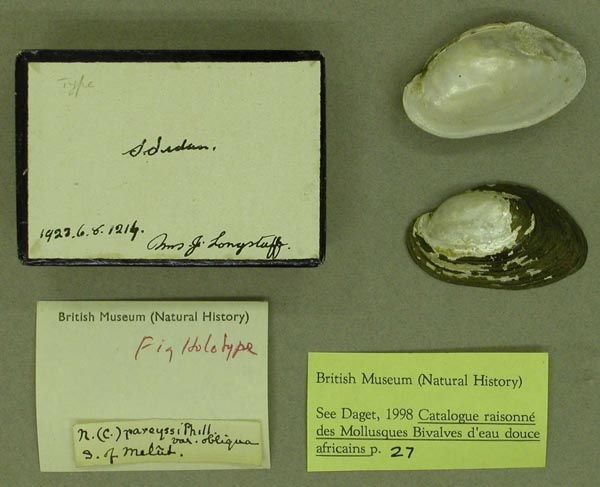
BMNH_1922-6-8-1214
S of Melut, S Sudan
| 
BMNH_1922-6-8-1214
S of Melut, S Sudan
| 
BMNH_1923-6-8-712-716
S of Melut, S Sudan
| 
BMNH_1923-6-8-1046-1056
S of Melut, S Sudan
| 
BMNH_1923-6-8-1046-1056
S of Melut, S Sudan
| 
BMNH_1923-6-8-991-996
S of Melut, S Sudan
| 
MRAC_56409
S of Melut, S Sudan
| 
MRAC_56799
S. Soudan: Soba
| 
BMNH_1923-6-8-681-694
S. Sudan
| 
BMNH_1923-6-8-997
S. Sudan
| 
UMMZ_109723
Sennaar, Africa
| 
UMMZ_109723
Sennaar, Africa
| 
BMNH_1923-6-8-1189-1190
Shabra Meut, S. Sudan
| 
BMNH_1923-6-8-652
Shabra Meut, S. Sudan
| 
UMMZ_109725
Soba, Blue Nile, Egypt
| 
BMNH_1923-6-8-1210
Soba, Blue Nile, S. Sudan
| 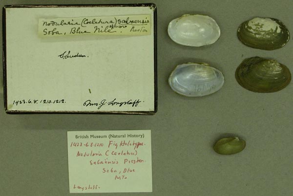
BMNH_1923-6-8-1210
Soba, Blue Nile, S. Sudan
| 
ZMB_4844
Sobat fluss
| 
MRAC_799136
Soudan rive gauche du Nil à Eyzumar près du Village de Tabo Northern Prov.
| 
MRAC_97665
Soudan: Bahr el Abiad ...
| 
MRAC_97720
Soudan: Bahr el Abiad ...
| 
MRAC_97721
Soudan: Bahr el Abiad ...
| 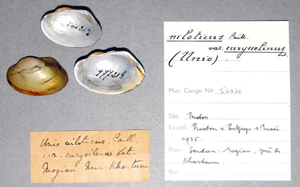
MRAC_56636
Soudan: mogian pres de Khartoum
| 
UMMZ_109724
Sudan, Egypt
| 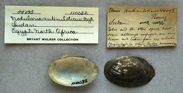
UMMZ_110032
Sudan, Egypt, North Africa
| 
MCZ_62925
Tapari River, Amadi Terabake Rd., Equatoria, Anglo-Egyptian Sudan
| 
BMNH_1923-6-8-651
Taufihia, S Sudan
| 
BMNH_MP_249
Taufihia, S Sudan [Tanganyika according to Art Bogan ]
| 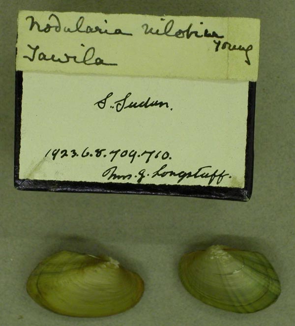
BMNH_1923-6-8-709-710
Tawila, S Sudan
| 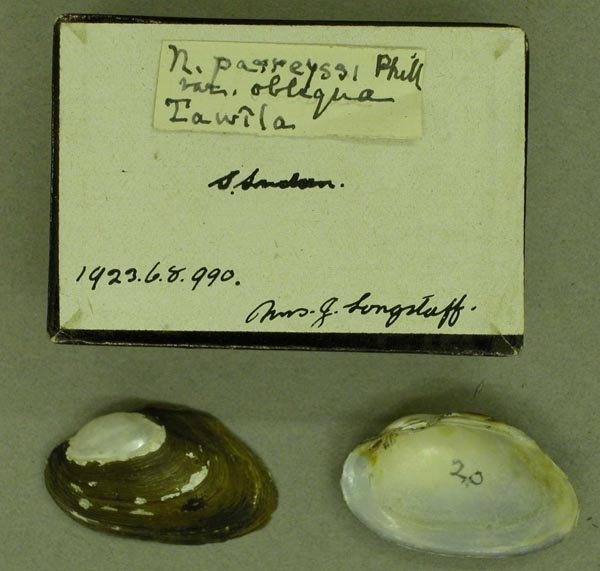
BMNH_1923-6-8-990
Tawila, S Sudan
| 
BMNH_1923-6-8-979-981
Tawila, S Sudan
| 
BMNH_1923-6-8-1011-1019
Tawila, S Sudan
| 
BMNH_1923-6-8-650
Tawila, S Sudan
| 
UMMZ_110037
The Nile, between two cataracts, Egypt
| 
ZMB_20605
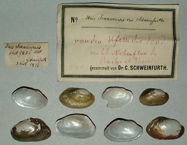
Uferu der Tondji, reicht. Nebenfluss du Bahr el [Ghazal]
| 
USNM_125700
Upper Nile
| 
USNM_125700
Upper Nile
| 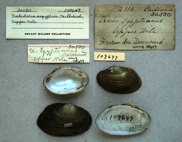
UMMZ_109647
Upper Nile
| 
BMNH_90-9-12-19
Upper Nile River
| 
UMMZ_110516
Upper Nile, Gondokoro
| 
BMNH_65-1-3-13
Victoria Nyanza or Nile above 14° N lat.
| 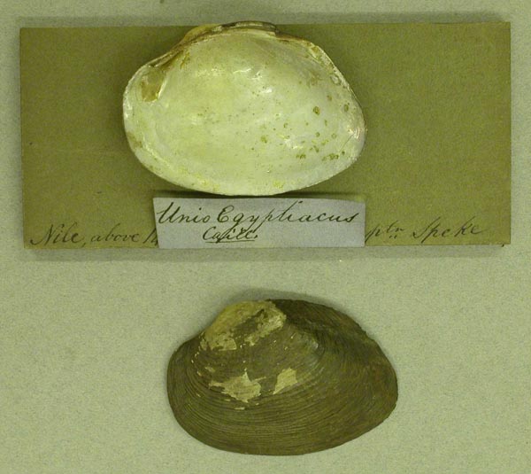
BMNH_65-1-3-13
Victoria Nyanza or Nile above 14° N lat.
| 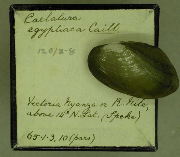
BMNH_65-1-3-10-120-2-8
Victoria Nyanza or Nile above 14° N lat.
| 
BMNH_1948-5-5-8
Wad Figda, canal between Khartoum and Sennaar, Sudan.
| 
BMNH_1948-5-5-8
Wad Figda, canal between Khartoum and Sennaar, Sudan.
| 
BMNH_1923-6-8-658
Wau, S Sudan
| 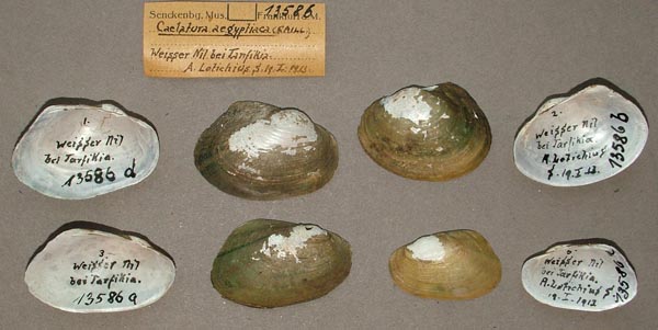
SMF_13586
Weisser Nil, bei Tarfikia
| 
IRSNB_MP_0870
White Nile Khartoum
| 
BMNH_1950-4-25-85-86
White Nile River, Ed Duein, Sudan
| 
UMMZ_248933
White Nile River, swampy area N of Kosti bridge, Sudan
| 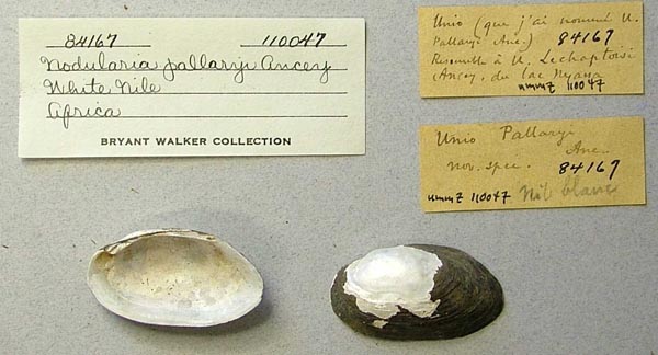
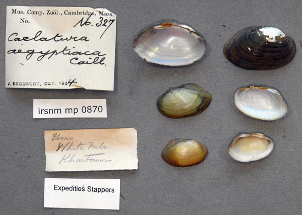
UMMZ_110047
White Nile, Africa
| 
UMMZ_110070
White Nile, Egypt
| 
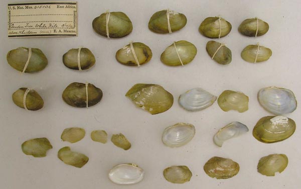
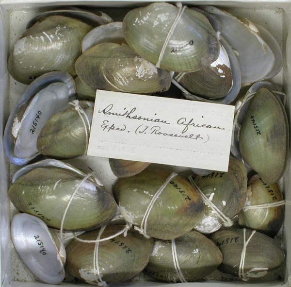
USNM_215142
White Nile, Gordon Tree, above Khartoum
| 
USNM_215142
White Nile, Gordon Tree, above Khartoum
| 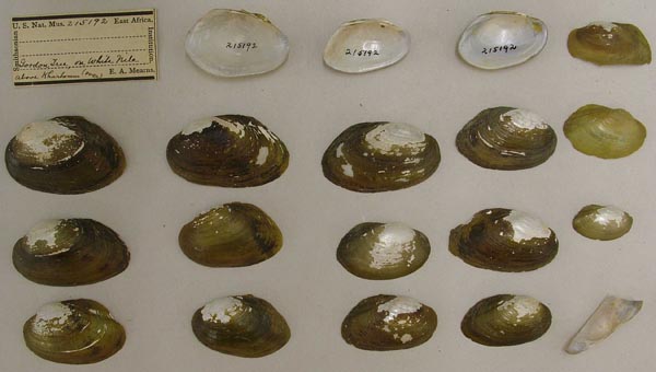
USNM_215192
White Nile, Gordon Tree, above Khartoum
| 
USNM_215192
White Nile, Gordon Tree, above Khartoum
| 
USNM_215211
White Nile, Gordon Tree, above Khartoum
| 
USNM_215211
White Nile, Gordon Tree, above Khartoum
| 
USNM_215136
White Nile, Gordon Tree, above Khartoum
| 
USNM_215136
White Nile, Gordon Tree, above Khartoum
| 
USNM_215201
White Nile, Gordon Tree, above Khartoum
| 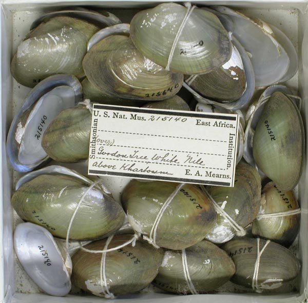
USNM_215140
White Nile, Gwodon [?] Tree, above Khartoum
| 
USNM_215140
White Nile, Gwodon [?] Tree, above Khartoum
| 
BMNH_MP_481
White Nile, Khartoum
| 
MCZ_289027
White Nile, Khartoum, Sudan
| 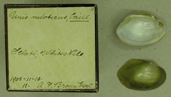
BMNH_1903-11-10-11
White Nile, Selaki [?]
| 
MCZ_62927
Yei River, Amadi, Equitoria, Anglo-Egyptian Sudan
|
BMNH_1923-6-8-1211-1212. Soba, Blue Nile
Uganda
unknownAMS_0. Georeferenced Genbank Vouchers
EgyptMp_4459_Caeg. (COI: MK764009, go to Genbank) Bahr Shebin irrigation canal in Shebin El-Kom City, Menoufia governate, Egypt (30.58100 N 31.01558 E). ANSP_416304. (16S: KF011264, 16S: KP795045, ND1: KF011254, go to Genbank) Nile River, Warak Island, Cairo, Egypt. ANSP_416304-Bd. (28S: JN243870, COI: JN243892, go to Genbank) ditto. ANSP_416304-Be. (28S: JN243871, COI: JN243893, go to Genbank) ditto. ANSP_416304-Bf. (COI: KJ081162, go to Genbank) ditto. ANSP_416304-Bg. (COI: KJ081163, go to Genbank) ditto. ANSP_416304-Ch. (28S: JN243872, COI: JN243894, go to Genbank) ditto. |