| Page last updated
Thu 3 September 2025 |
The Freshwater Mussels (Unionoida) of the World (and other less consequential bivalves)
FM(U)otW(aolcb) is the web version of the MUSSEL Project Database. Follow the links to browse the data or use the custom Google search field. Either way, you win!
Search the database pages:
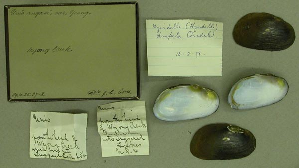
Bivalvia | Unionida | Hyrioidea | Hyriidae | Hyriinae | Hyridellini | Hyridella species Hyridella drapeta (Iredale, 1934): specimens
4 available nominal species synonyms (5 total synonyms) Recent Taxonomic OpinionsHyridella (s.s.) drapeta — Graf & Cummings (2007)
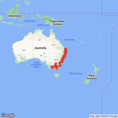
Hyridella drapeta — Bogan (2010), Walker et al. (2014), Graf et al. (2015), Santos-Neto et al. (2016), Huang et al. (2019), Graf & Cummings (2021), Campbell & Lydeard (2026) RangeQueensland south to Victoria, eastern Australia. Map of Georeferenced Specimens
Australia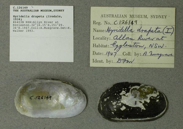
AMS_126149
Allyn River at Eccleston, New South Wales, Australia [-32.269, 151.489 ± 1 km]
| 
ZMB_MP_0431
Australia
| 
ZMB_MP_0433
Australia
| 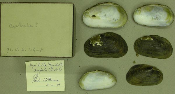
BMNH_91-11-6-106
Australia
| 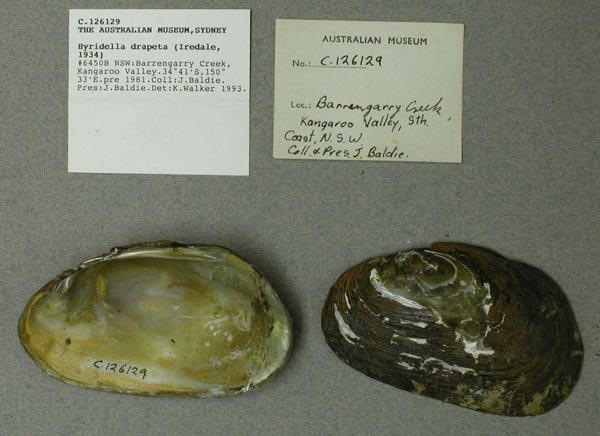
AMS_126129
Barrengarry Creek, Kangaroo Valley, New South Wales, Australia [-34.683, 150.55 ± 10 km]
| 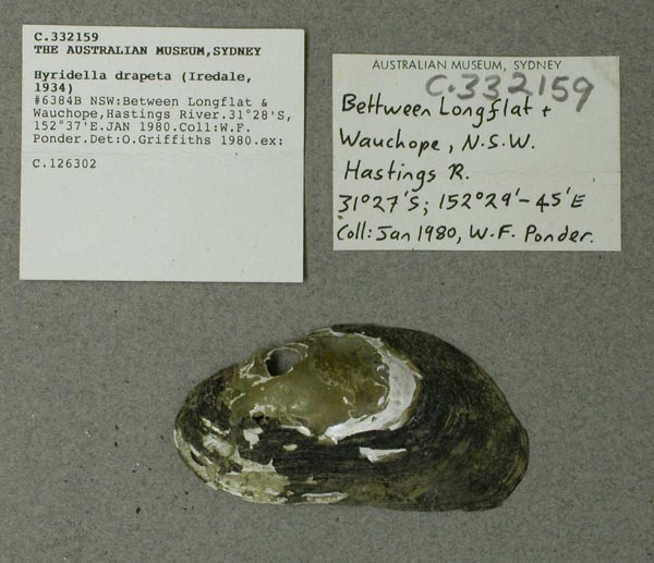
AMS_332159
between Longflat & Wauchope, Hastings River, New South Wales, Australia [-31.467, 152.617 ± 10 km]
| 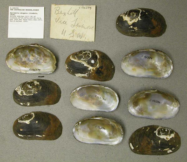
AMS_126374
Bex Hill NE of Lismore, New South Wales, Australia [-28.766, 153.346 ± 1 km]
| 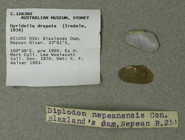
AMS_126300
Blaxlands Dam, Nepean River, New South Wales, Australia [-33.85, 150.633 ± 1 km]
| 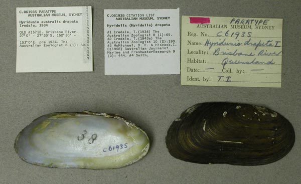
AMS_61935
Brisbane River, Queensland, Australia [-27.583, 152.917 ± 100 km]
| 
AMS_61934
Brisbane River, Queensland, Australia [-27.583, 152.917 ± 100 km]
| 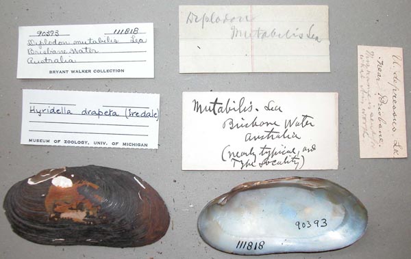
UMMZ_111818
Brisbane Water, Australia
| 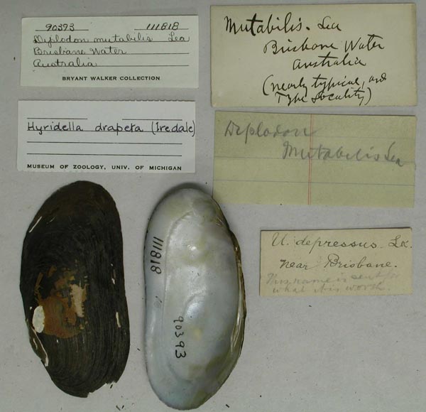
UMMZ_111818
Brisbane Water, Australia
| 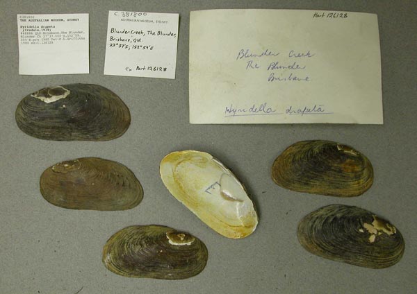
AMS_381800
Brisbane, The Blunder, Blunder Ck, Queensland, Australia [-27.617, 152.983 ± 10 km]
| 
AMS_62018
Broken R. at Nalinga, Victoria, Australia [-36.433, 145.733 ± 10 km]
| 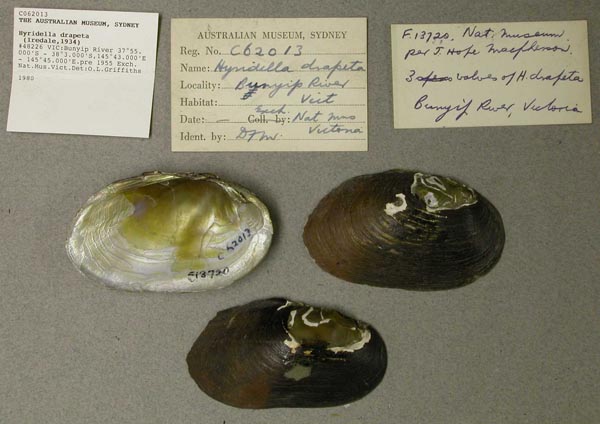
AMS_62013
Bunyip River, Victoria, Australia [-37.917, 145.717 > ± 100 km]
| 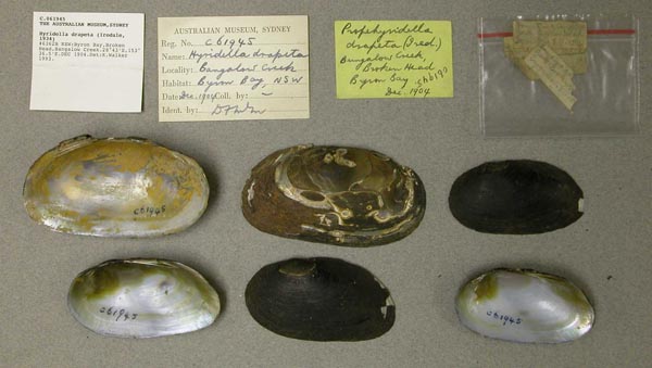
AMS_61945
Byron Bay, Broken Head, Bangalow Creek, New South Wales, Australia [-28.717, 153.608 ± 1 km]
| 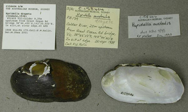
AMS_158404
Calder R, 25m upstream from Great Ocean Rd bridge (In silt, at river edge), Victoria, Australia [-38.774, 143.508 ± 1 km]
| 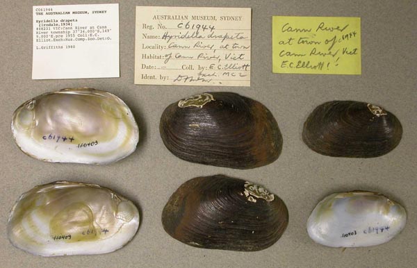
AMS_61944
Cann River at Cann River township, Victoria, Australia [-37.567, 149.15 ± 10 km]
| 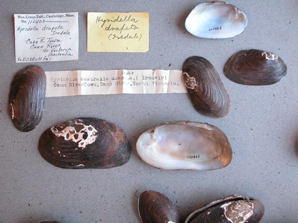
MCZ_110403
Cann River, Cann River Town, North Victoria, Australia
| 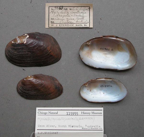
FMNH_115955
Cann River, North Victoria, Australia
| 
MNHN_MP_1480
Cann River, S. Australia
| 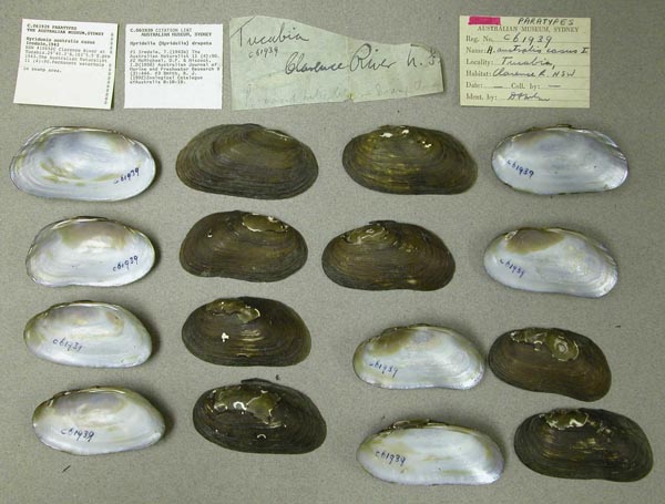
AMS_61939
Clarence River at Tucabia (Permanent waterhole in swamp area), New South Wales, Australia [-29.672, 153.092 ± 10 km]
| 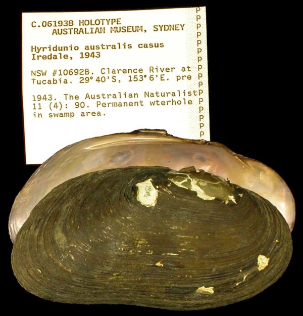
AMS_61938
Clarence River at Tucabia (Permanent waterhole in swamp area), New South Wales, Australia [-29.672, 153.092 ± 10 km]
| 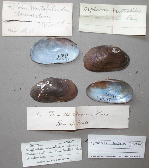
UMMZ_111817
Clarence River, New South Wales, Australia
| 
UMMZ_111817
Clarence River, New South Wales, Australia
| 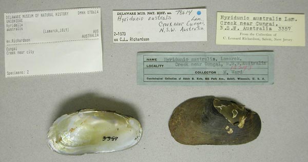
DMNH_78614
creek near Cungai, New South Wales, Australia
| 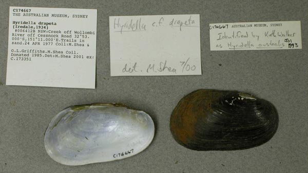
AMS_174667
Creek off Wollombi River off Cessnock Road (Trails in sand), New South Wales, Australia [-32.883, 151.183 ± 10 km]
| 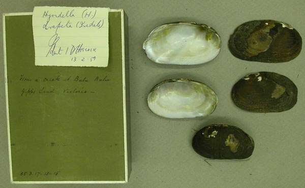
BMNH_85-3-17-13-15
creek, Bulu Bulu, Gippsland, Victoria
| 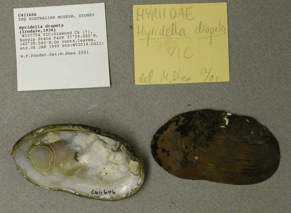
AMS_411606
Diamond Ck (?), Bunyip State Park (On roots, leaves, etc), Victoria, Australia [-37.985, 145.643 ± 100 m]
| 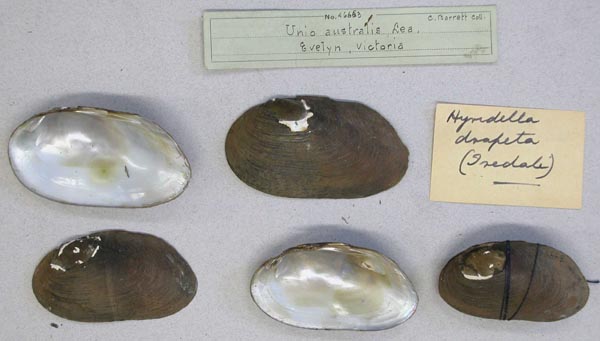
AMNH_46663
Evelyn, Victoria
| 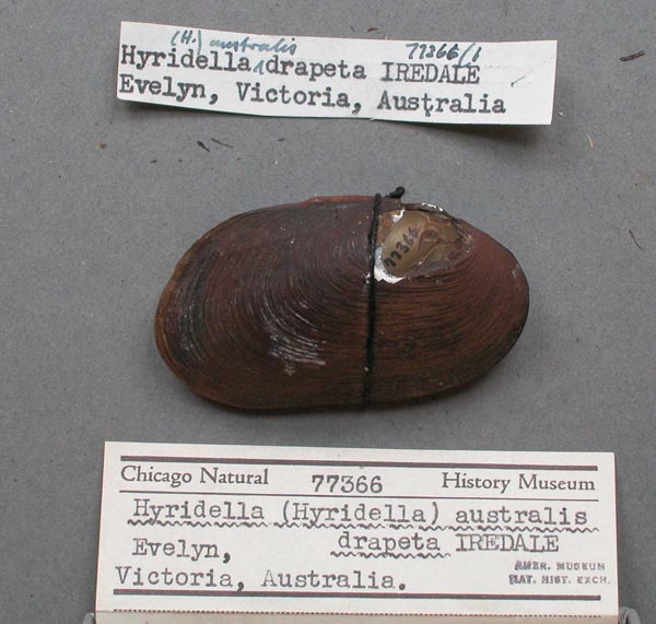
FMNH_77366
Evelyn, Victoria, Australia
| 
AMS_168579
Franklin R, at Princes Hwy, E of Foster (River bank), Victoria, Australia [-38.655, 146.296 ± 1 km]
| 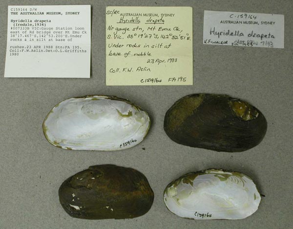
AMS_159164
Gauge Station 100m east of Rd bridge over Mt Emu Ck (Under rocks & in silt at base of rushes), Victoria, Australia [-38.307, 142.887 ± 1 km]
| 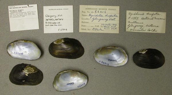
AMS_62016
Glengarry, Victoria, Australia [-38.133, 146.583 ± 10 km]
| 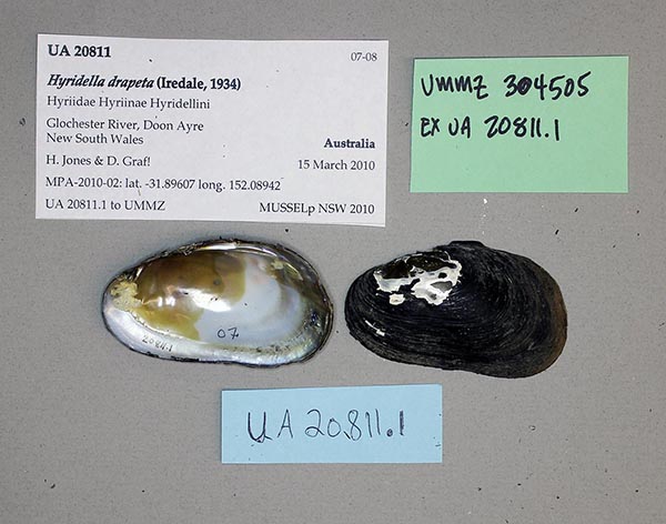
UMMZ_304505
Glochester River, Doon Ayre, New South Wales, Australia, -31.89607°, 152.08942°
| 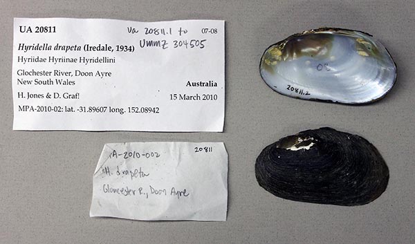
UA_20811
Glochester River, Doon Ayre, New South Wales, Australia, -31.89607°, 152.08942°
| 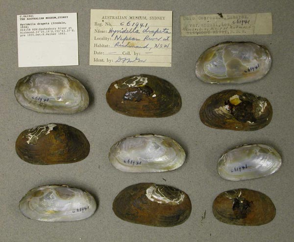
AMS_61941
Hawkesbury River at Richmond, New South Wales, Australia [-33.587, 150.723 ± 10 km]
| 
HYR003
Karuah River at Booral
| 
HYR006
Karuah River at Booral
| 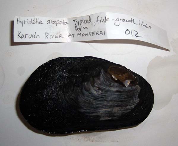
HYR012
Karuah River at Monkerai
| 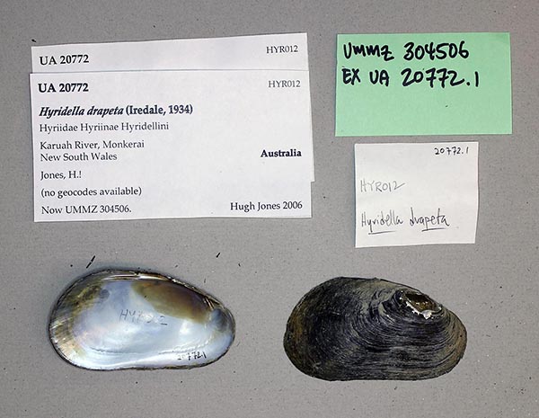
UMMZ_304506
Karuah River, Monkerai, New South Wales, Australia
| 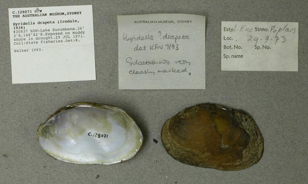
AMS_128071
Lake Eucumbene, Poplars, New South Wales, Australia [-36.05, 148.7 ± 10 km]
| 
AMNH_305992
Lansdown River, 14 m. from “Larce”, New South Wales, Australia
| 
AMS_61936
Latrobe River, Gippsland, Victoria, Australia [-38.15, 146.783 ± 100 km]
| 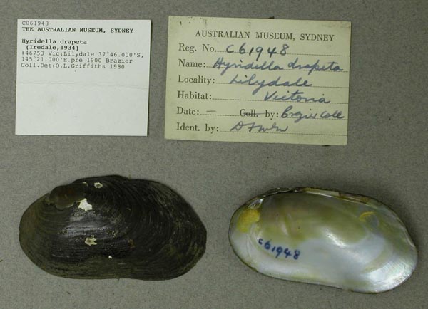
AMS_61948
Lilydale, Victoria, Australia [-37.767, 145.35 ± 10 km]
| 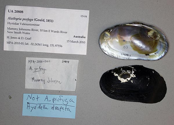
UA_20808
Mammy Johnson River, 10 km E Wards River, New South Wales, Australia, -32.24361°, 151.97556°
| 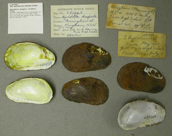
AMS_61946
Manning R, Wingham, New South Wales, Australia [-31.876, 152.369 ± 1 km]
| 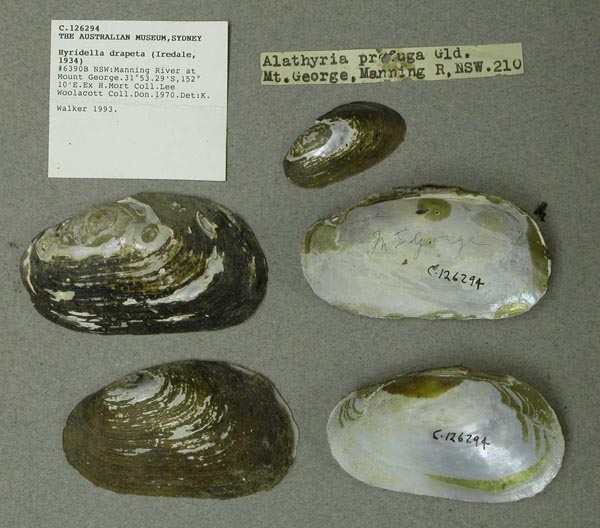
AMS_126294
Manning River at Mount George, New South Wales, Australia [-31.888, 152.167 ± 1 km]
| 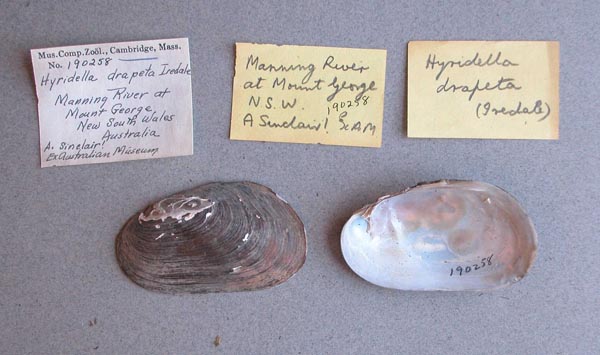
MCZ_190258
Manning River, Mount George, New South Wales, Australia
| 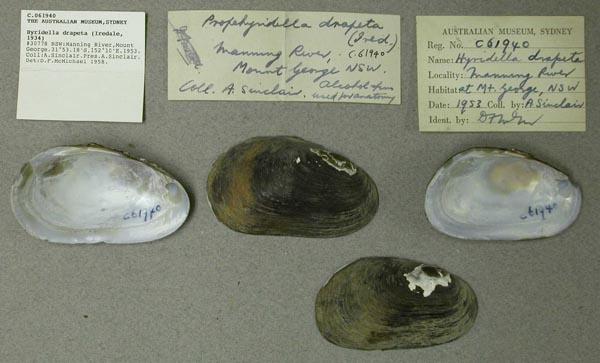
AMS_61940
Manning River, Mount George, New South Wales, Australia [-31.886, 152.167 ± 1 km]
| 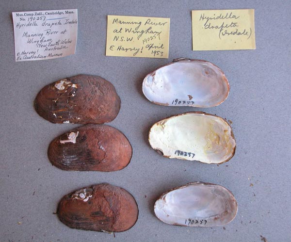
MCZ_190257
Manning River, Wingham, New South Wales, Australia
| 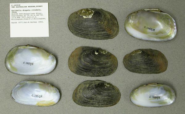
AMS_105918
Mongarlowe River, Charleyong, New South Wales, Australia [-35.253, 149.919 ± 1 km]
| 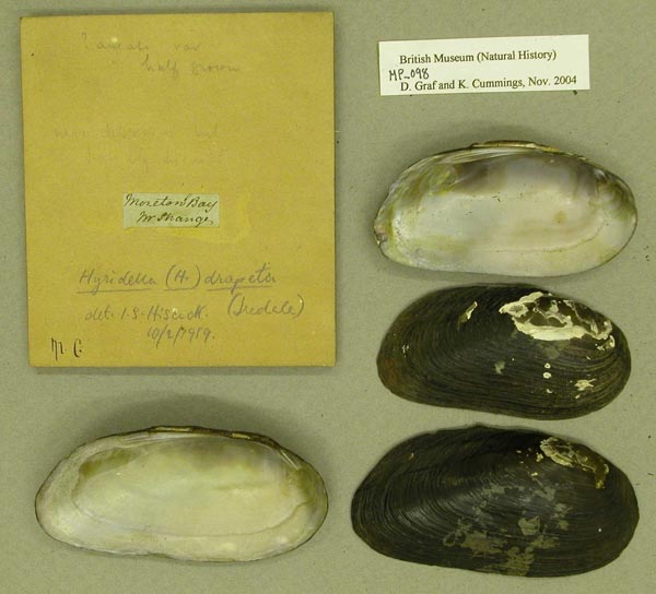
BMNH_MP_098
Moreton Bay
| 
AMS_61947
Mt Evelyn (Creek), Victoria, Australia [-37.783, 145.383 ± 10 km]
| 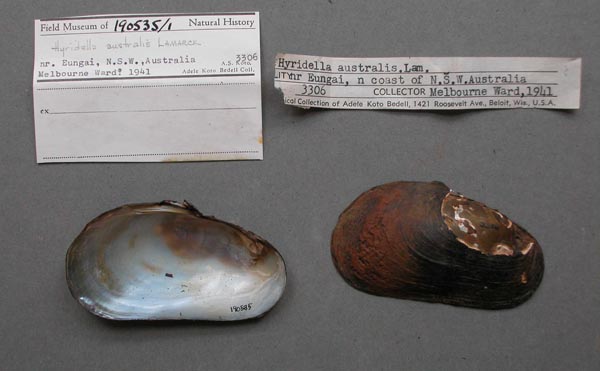
FMNH_190535
near Eungai, north coast of New South Wales, Australia
| 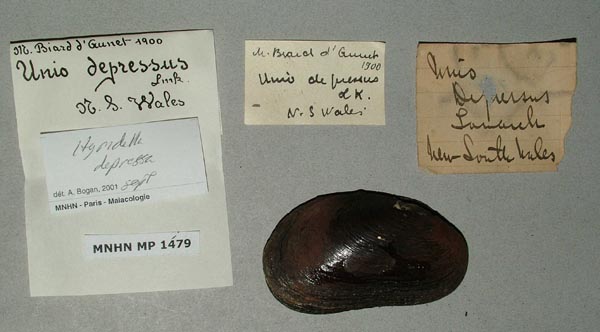
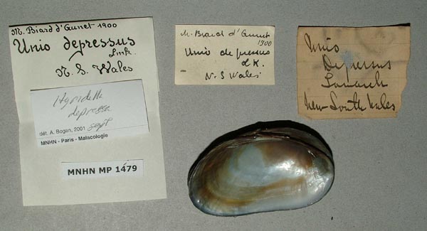
MNHN_MP_1479
New South Wales
| 
MNHN_MP_1479
New South Wales
| 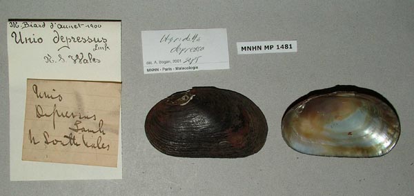
MNHN_MP_1481
New South Wales
| 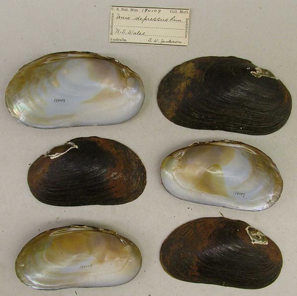
USNM_170109
New South Wales, Australia
| 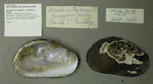
AMS_173135
NNW of Nowra, Kangaroo Valley, New South Wales, Australia [-34.737, 150.533 ± 10 km]
| 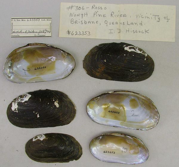
USNM_623353
North Pine R., vicinity of Brisbane, Queensland, Australia
| 
USNM_623353
North Pine R., vicinity of Brisbane, Queensland, Australia
| 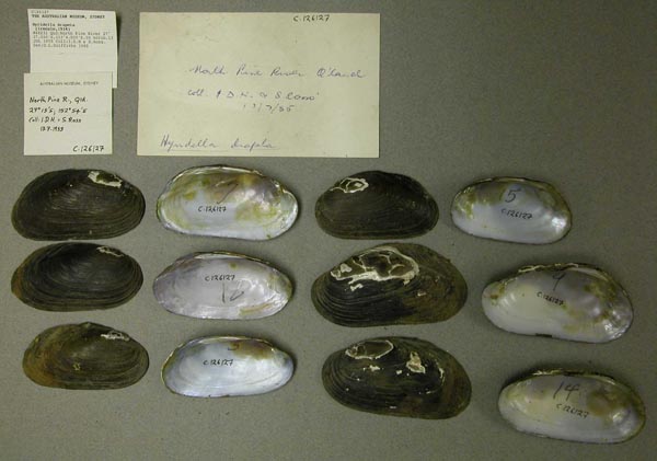
AMS_126127
North Pine River (In scrub), Queensland, Australia [-27.283, 153.067 ± 100 km]
| 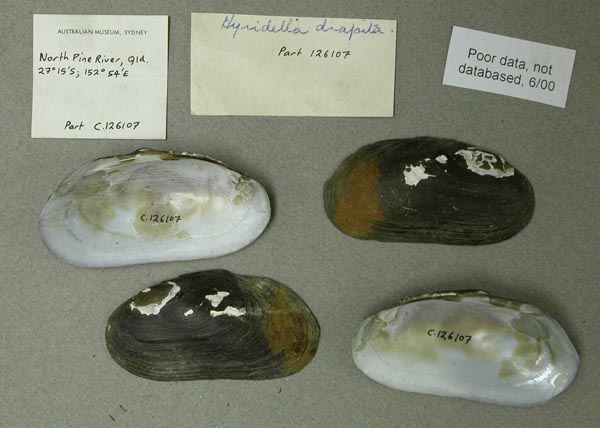
AMS_126107B
North Pine River, Queensland; 27°15’S, 152°54’E
| 
DMNH_172989
Olinda Creek, Evelyn, Victoria, Australia
| 
DMNH_172995
Olinda Creek, Evelyn, Victoria, Australia
| 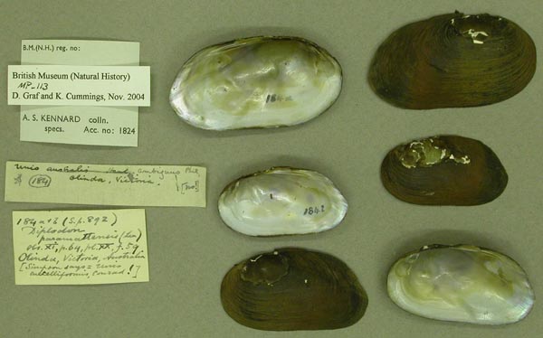
BMNH_MP_113
Olinda, Victoria, Australia
| 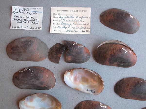
MCZ_210898
Pearce’s Creek, Booyong, Richmond R., New South Wales, Australia
| 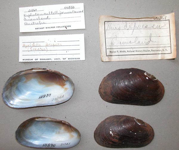
UMMZ_111830
Queensland, Australia
| 
UMMZ_111830
Queensland, Australia
| 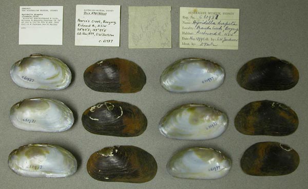
AMS_61937
Richmond R trib., Wilsons R, Booyong, Pearces Ck, New South Wales, Australia [-28.75, 153.448 ± 1 km]
| 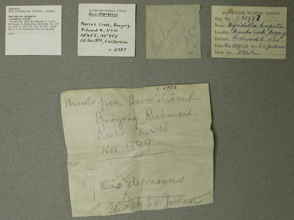
AMS_61937
Richmond R trib., Wilsons R, Booyong, Pearces Ck, New South Wales, Australia [-28.75, 153.448 ± 1 km]
| 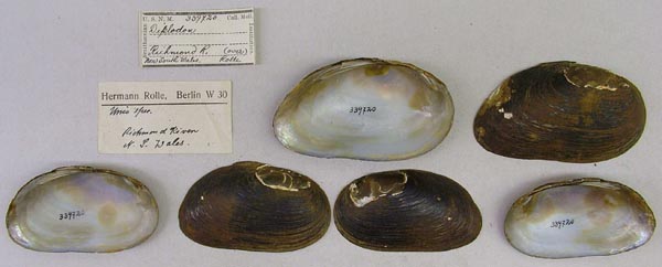
USNM_339720
Richmond R., New South Wales, Australia
| 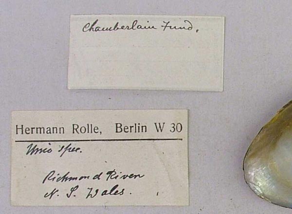
USNM_339720
Richmond R., New South Wales, Australia
| 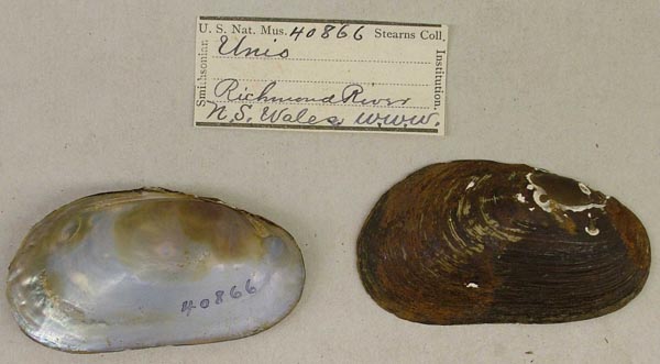
USNM_40866
Richmond River, N.S. Wales, Australia
| 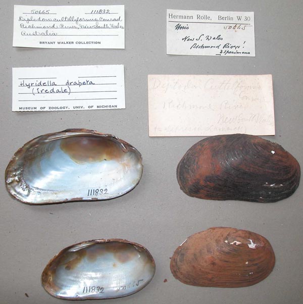
UMMZ_111832
Richmond River, New South Wales, Australia
| 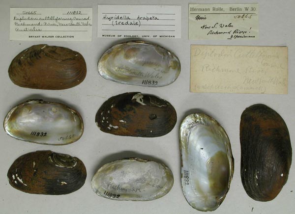
UMMZ_111832
Richmond River, New South Wales, Australia
| 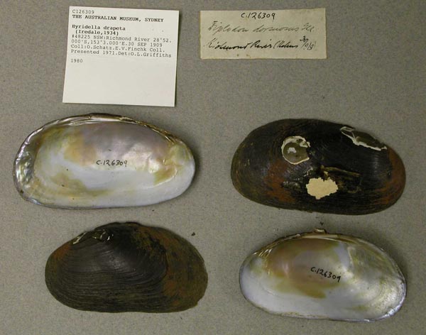
AMS_126309
Richmond River, New South Wales, Australia [-28.867, 153.05 ± 100 km]
| 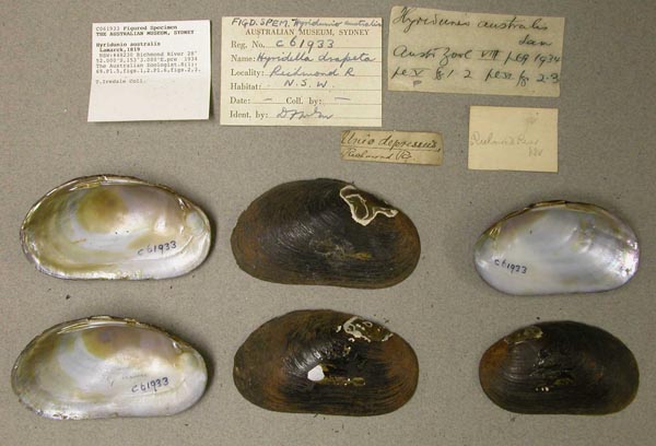
AMS_61933
Richmond River, New South Wales, Australia [-28.867, 153.05 ± 100 km]
| 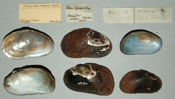
ZMB_19078
Richmond River, NS Wales
| 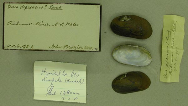
BMNH_91-11-6-198-199
Richmond River, NSW
| 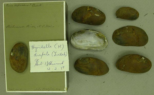
BMNH_91-11-6-190-195
Richmond River, NSW
| 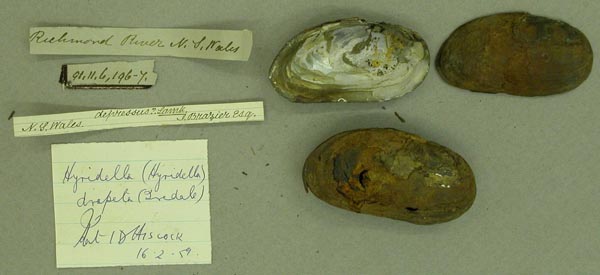
BMNH_91-11-6-196-197
Richmond River, NSW
| 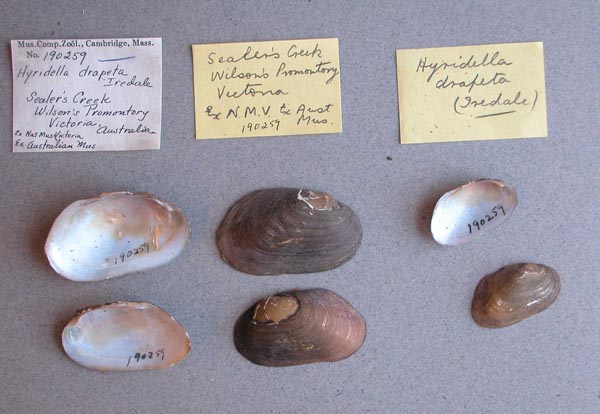
MCZ_190259
Sealers Creek, Wilson’s Promontory, Victoria, Australia
| 
BMNH_89-10-25-11-23
Shoalhaven River
| 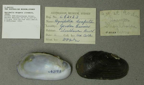
AMS_62153
Shoalhaven River, Gordon Barrier, New South Wales, Australia [-34.883, 150.458 ± 10 km]
| 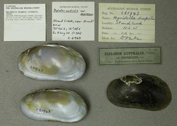
AMS_61943
Stroud Creek, Stroud, New South Wales, Australia [-32.408, 151.967 ± 100 km]
| 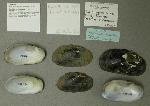
AMS_132197
SW Tuggerah Lakes, New South Wales, Australia [-33.333, 151.467 ± 10 km]
| 
AMS_62023
Tarra River at Port Albert, Victoria, Australia [-38.65, 146.717 ± 10 km]
| 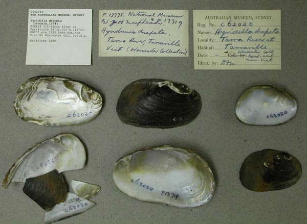
AMS_62020
Tarra River at Tarraville, Victoria, Australia [-38.633, 146.717 ± 10 km]
| 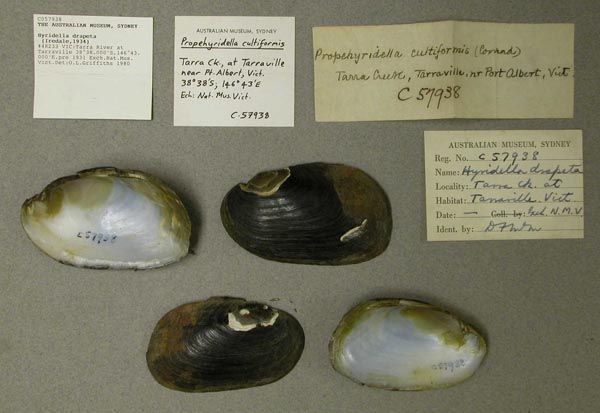
AMS_57938
Tarra River at Tarraville, Victoria, Australia [-38.633, 146.717 ± 10 km]
| 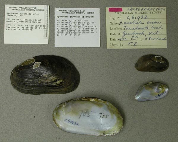
AMS_61932
Tomahawk Creek, Gembrook, Dandenong Ranges, Victoria, Australia [-37.95, 145.55 ± 10 km]
| 
AMS_61931
Tomahawk Creek, Gembrook, Dandenong Ranges, Victoria, Australia [-37.95, 145.55 ± 10 km]
| 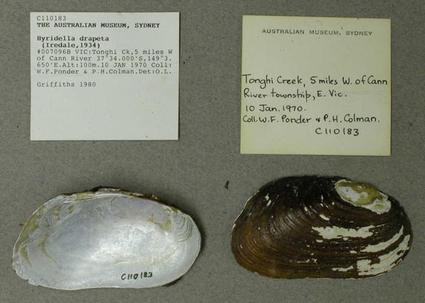
AMS_110183
Tonghi Ck, 5 miles W of Cann River, Victoria, Australia [-37.567, 149.061 ± 1 km]
| 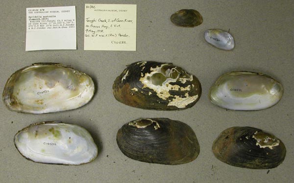
AMS_110532
Tonghi Ck, 5 miles W of Cann River, Victoria, Australia [-37.567, 149.061 ± 1 km]
| 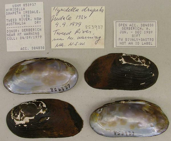
USNM_853937
Tweed River, near Mt. Warning, New South Wales, Australia
| 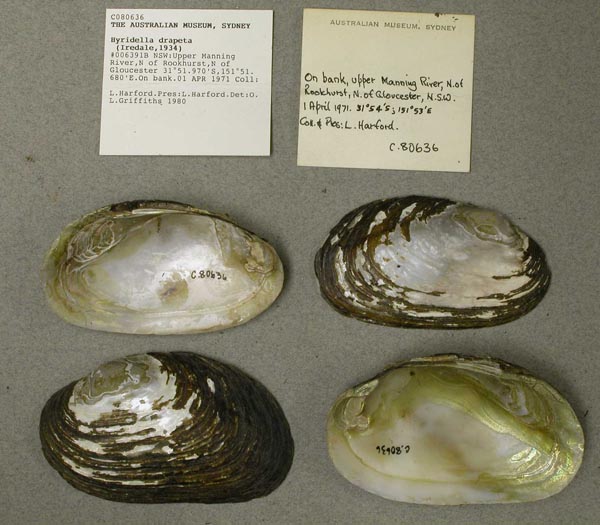
AMS_80636
Upper Manning River, N of Rookhurst, N of Gloucester (On bank), New South Wales, Australia [-31.866, 151.861 ± 10 km]
| 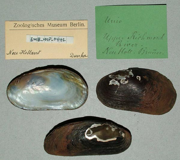
ZMB_MP_0442
Upper Richmond River, New Holland
| 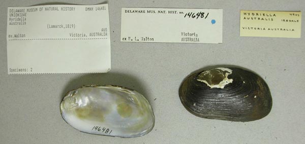
DMNH_146481
Victoria, Australia
| 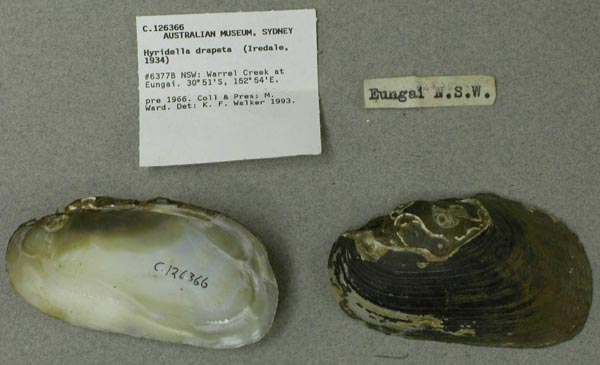
AMS_126366
Warrel Creek at Eungai, New South Wales, Australia [-30.853, 152.898 ± 1 km]
| 
AMS_61942
Warrel Creek at Eungai, New South Wales, Australia [-30.853, 152.898 ± 1 km]
| 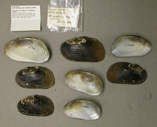
AMS_126336
Warrel Creek at Eungai, New South Wales, Australia [-30.853, 152.898 ± 1 km]
| 
MCZ_190256
Warrel Creek, trib. of Nambucca River System, Eungai, New South Wales, Australia
| 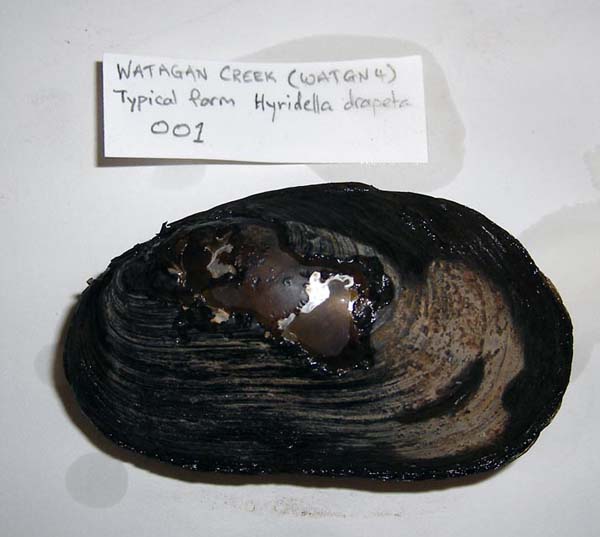
HYR001
Watagan Creek
| 
HYR002
Watagan Creek
| 
FMNH_21735
Watson’s Creek, Victoria, Australia
| 
AMS_332170
Williams River at Dungog, New South Wales, Australia [-32.398, 151.763 ± 10 km]
| 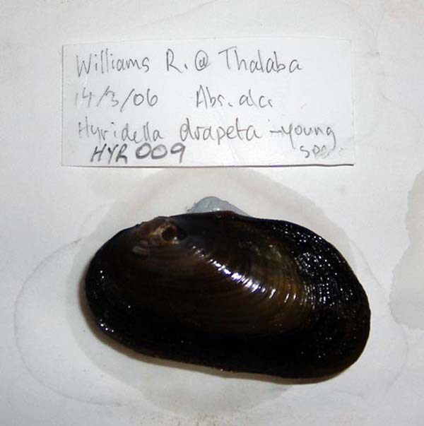
HYR009
Williams River at Thalaba
| 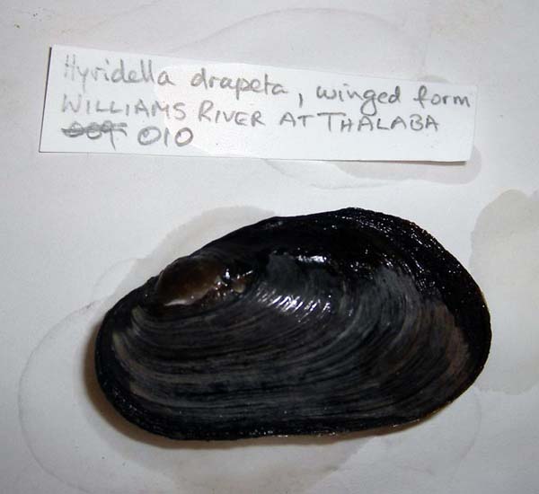
HYR010
Williams River at Thalaba
| 
HYR011
Williams River at Thalaba
| 
AMS_62021
Wilsons Prom, Sealers Ck, Victoria, Australia [-39.017, 146.383 ± 10 km]
| 
AMS_168578
Wilsons Prom. NP, Growler Ck, at bridge (In mud under bridge), Victoria, Australia [-39.063, 146.374 ± 100 m]
| 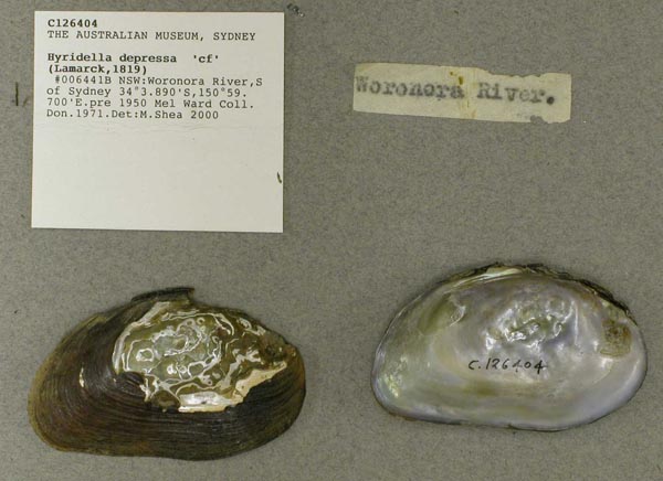
AMS_126404
Woronora River, S of Sydney, New South Wales, Australia [-34.065, 150.995 ± 10 km]
| 
BMNH_89-10-25-27-28
Wyong Creek
|
AMS_173164. Dunbible Creek, Murwillumbah, New South Wales, Australia [-28.352, 153.393 ± 10 km] AMS_421938. Dungog, Williams R between railway bridge and rd bridge beside park, New South Wales, Australia [-32.397, 151.762 ± 100 m] AMS_173159. Eungai, New South Wales, Australia [-30.835, 152.893 ± 10 km] AMS_432169. Hunter Region, Williams R at Bandon Grove Park, Chichester Dam rd crossing nr bank (Moderate flow, gravelly/rock bottom), New South Wales, Australia [-32.301, 151.719 ± 100 m] AMS_424072. Lake Eucumbene, Poplars, New South Wales, Australia [-36.05, 148.7 ± 10 km] AMS_424073. Manning R, Wingham, New South Wales, Australia [-31.876, 152.369 ± 1 km] AMS_173158. Mill Creek, Stroud, New South Wales, Australia [-32.411, 151.959 ± 10 km] AMS_431976. Millers Ck, on Bunkers Hill Rd, trib of Barrengary Ck, New South Wales, Australia [-34.683, 150.53 ± 1 km] AMS_174787. near Cessnock, W of Milfield, Wollombi Rd, Wollombi Brook N Arm, at Cedar Rd crossing, New South Wales, Australia [-32.937, 151.14 ± 1 km] AMS_174666. Nepean River at Douglas Park (In sandy mud), New South Wales, Australia [-34.194, 150.712 ± 10 km] AMS_174669. Nepean River, Camden, New South Wales, Australia [-34.073, 150.699 ± 10 km] AMS_422341. Sandy Ck, at Gellibrand R rd bridge, SW of Carlisle R (In mud), Victoria, Australia [-38.591, 143.354 ± 1 km] AMS_358673. Tucabia via Ulmarra, Carence River district, New South Wales, Australia [-29.667, 153.1 ± 10 km] AMS_173154. Tucabia via Ulmarra, New South Wales, Australia [-29.667, 153.1 ± 10 km] AMS_332476. Williams River, Dungog (In mud), New South Wales, Australia [-32.398, 151.763 ± 10 km] AMS_422340. Wilsons Prom, Growler Ck, at rd bridge (=EV25) (In mud, roots & debris on ck bed), Victoria, Australia [-39.063, 146.374 ± 1 km] AMS_424071. Wollombi, New South Wales, Australia [-32.933, 151.15 ± 10 km] AMS_126345. Woronora River near Engadine, New South Wales, Australia [-34.065, 150.995 ± 10 km] AMS_173132. Woronora River near Engadine, New South Wales, Australia [-34.065, 150.995 ± 10 km] |