| Page last updated
Thu 3 September 2025 |
The Freshwater Mussels (Unionoida) of the World (and other less consequential bivalves)
FM(U)otW(aolcb) is the web version of the MUSSEL Project Database. Follow the links to browse the data or use the custom Google search field. Either way, you win!
Search the database pages:
Bivalvia | Unionida | Hyrioidea | Hyriidae | Hyriinae | Hyridellini | Hyridella species Hyridella depressa (Lamarck, 1819): specimens
8 available nominal species synonyms (10 total synonyms) Recent Taxonomic OpinionsHyridella (s.s.) depressa — Graf & Cummings (2007)
Hyridella depressa — Graf & Cummings (2009), Hoeh et al. (2009), Bogan (2010), Walker et al. (2014), Graf et al. (2015), ... Araujo et al. (2017), Huang et al. (2019), Lopes-Lima et al. (2020), Graf & Cummings (2021), Campbell & Lydeard (2026)
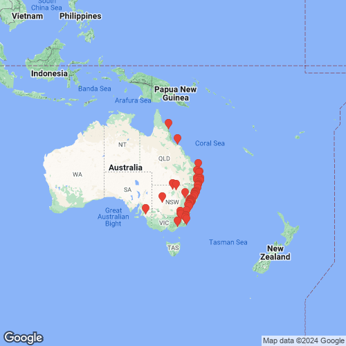
Hyridella (Echyridella) depressa — Santos-Neto et al. (2016) RangeQueensland south to Victoria, eastern Australia. Map of Georeferenced Specimens
Australia
AMS_47311
“North Australia”
| 
BMNH_MP_069
[no locality available - Australia]
| 
BMNH_40-2-22-24-25
[no locality available - Australia]
| 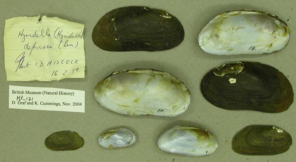
BMNH_MP_131
[no locality available - Australia]
| 
ANSP_125835
Auckland [Australia]
| 
ANSP_125849
Auckland, N.S.W.
| 
ZMB_9201
Australia
| 
BMNH_MP_414
Australia
| 
UMMZ_111828
Australia
| 
UMMZ_111828
Australia
| 
UMMZ_111828
Australia
| 
ANSP_125823
Australia
| 
ANSP_125858
Australia
| 
USNM_40872
Australia
| 
AMS_208
Barwan River, New South Wales, Australia
| 
AMS_MP-004
Barwon River, New South Wales
| 
AMS_420382
Belgrave Falls, Macleay River, New South Wales, Australia [-31.088, 152.745 ± 100 m]
| 
AMS_61962
Berowra Creek near Hornsby, New South Wales, Australia [-33.631, 151.102 ± 10 km]
| 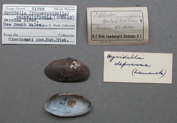
FMNH_21729
Berrima River, New South Wales, Australia
| 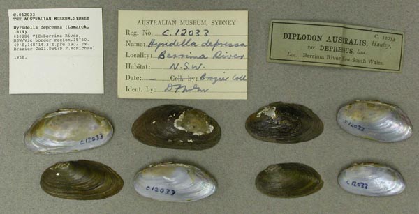
AMS_12033
Berrima River, NSW/Vic border region, Victoria, Australia [-35.841, 148.238 ± 10 km]
| 
AMS_61963
Berrima, New South Wales, Australia [-34.493, 150.331 ± 1 km]
| 
MCZ_MP.239
Berrnia ? River, New South Wales, Australia
| 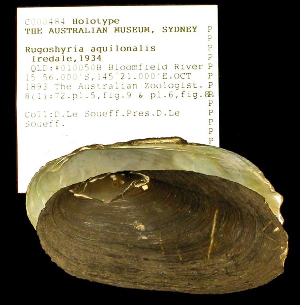
AMS_484
Bloomfield River, Queensland, Australia [-15.95, 145.333 ± 10 km]
| 
ANSP_41808A
Bogan River, Australia
| 
BMNH_50-12-28-15
Bogan River, Australia
| 
ANSP_41808
Bogan River, Australia
| 
AMS_61964
Bong Bong (=Bowenbong) Creek, New South Wales, Australia [-31.933, 149.583 ± 10 km]
| 
UMMZ_111831
Bong Bong River near Mossvale, New South Wales, Australia
| 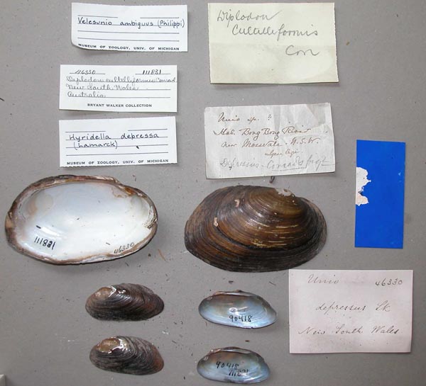
UMMZ_111831
Bong Bong River near Mossvale, New South Wales, Australia
| 
UMMZ_111831
Bong Bong River near Mossvale, New South Wales, Australia
| 
UMMZ_111831
Bong Bong River near Mossvale, New South Wales, Australia
| 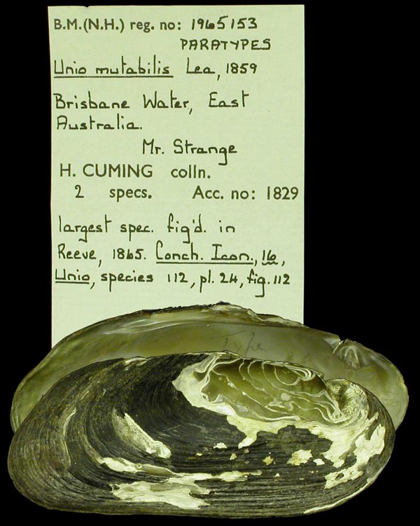
BMNH_1965153
Brisbane Water, East Australia
| 
BMNH_1965153
Brisbane Water, East Australia
| 
ZMB_47540
Brisbane, Queensland
| 
AMS_62174
Burdekin River, Queensland; 19°39’-20°15’S, 145°53’-147°19’E
| 
AMS_24488
Cataract River, New South Wales, Australia [-28.867, 152.283 ± 100 km]
| 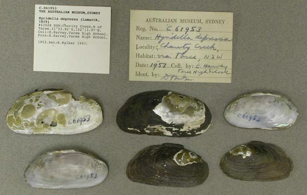
AMS_61953
Charity Creek, W of Taree, New South Wales, Australia [-31.898, 152.233 ± 1 km]
| 
UMMZ_111895
Clarence River, “New Zealand”
| 
UMMZ_111895
Clarence River, “New Zealand”
| 
ANSP_334436
Clarence River, Australia
| 
BMNH_46-9-16-74
Clarence River, NSW
| 
CM_61.1534(2)
East coast of Australia
| 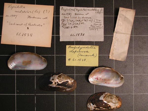
CM_61.1538
East coast of Australia
| 
AMS_419708
Engadine Ck, near Engadine, New South Wales, Australia [-34.083, 151.033 ± 10 km]
| 
AMS_61956
Fish Ponds Creek near Hornsby, Sydney, New South Wales, Australia [-33.692, 151.083 ± 1 km]
| 
MCZ_190262
Fishponds Creek, near Sydney, New South Wales, Australia
| 
AMS_126407
Georges River near Sydney, New South Wales, Australia [-33.95, 150.8 ± 100 km]
| 
MCZ_MP.242
Georges River, New South Wales, Australia
| 
AMS_30328
Georges River, Sydney, New South Wales, Australia [-33.933, 150.978 ± 10 km]
| 
USNM_853902
Geoysi R., New South Wales, Australia
| 
UMMZ_304504
Glochester River, Doon Ayre, New South Wales, Australia
| 
HYR007
Gloucester River at Doon Ayre
| 
AMS_419707
Gloucester. Creek west side of town adjacent to camping area, New South Wales, Australia [-32.005, 151.968 ± 10 km]
| 
MCZ_190260
Grosse’s Plain Creek, Mount Kosciusko, New South Wales, Australia
| 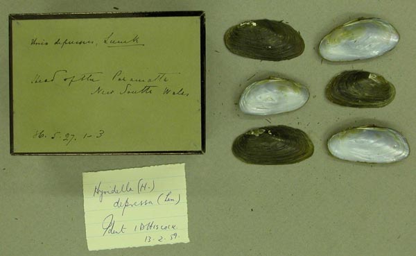
BMNH_86-5-27-1-3
head of the Paramatta River, NSW
| 
AMS_126283
Hunter River, New South Wales
| 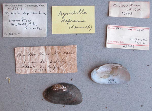
MCZ_37303
Hunters River, New South Wales, Australia
| 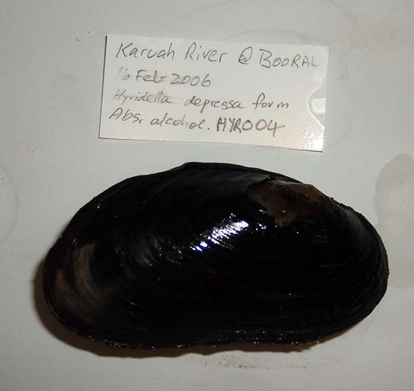
HYR004
Karuah River at Booral
| 
AMS_79
Kosciusko, Grosse's Plain Creek, Moonbar Run (Moonbah), New South Wales, Australia [-36.519, 148.513 ± 1 km]
| 
AMS_61952
Kosciusko, Grosse's Plain Creek, Moonbar Run (Moonbah), New South Wales, Australia [-36.519, 148.513 ± 1 km]
| 
AMS_311235
Little Manning R. at crossing on Nowendoc Rd. N. of Gloucester (Med. river with sand, gravel, boulders, mud.), New South Wales, Australia [-31.842, 151.883 ± 100 m]
| 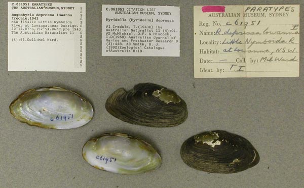
AMS_61951
Little Nymboida River at Lowanna, near Dorrigo, New South Wales, Australia [-30.215, 152.901 ± 1 km]
| 
AMS_61950
Little Nymboida River at Lowanna, near Dorrigo, New South Wales, Australia [-30.215, 152.901 ± 1 km]
| 
AMS_61966
Little Nymboida River, near Timmsvale (Under stones, running stream), New South Wales, Australia [-30.222, 152.872 ± 1 km]
| 
AMS_173163
Little Nymboida River, Timmsvale near Dorrigo, New South Wales, Australia [-30.222, 152.872 ± 1 km]
| 
UMMZ_304503
Mammy Johnson River, 10 km E Wards River, New South Wales, Australia, -32.24361°, 151.97556°
| 
UA_20806
Mammy Johnson River, 10 km E Wards River, New South Wales, Australia, -32.24361°, 151.97556°
| 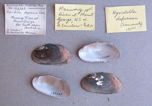
MCZ_190263
Manning River, Mount George, New South Wales, Australia
| 
AMS_61957
Manning River, Mount George, New South Wales, Australia [-31.886, 152.183 ± 1 km]
| 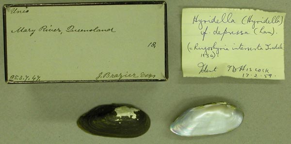
BMNH_95-3-7-47
Mary River, Queensland
| 
AMS_62022
Mataganah Creek, W of Pambula, New South Wales, Australia [-36.925, 149.633 ± 10 km]
| 
AMS_400660
McPhersons Crossing, New South Wales, Australia [-29.817, 152.912 ± 100 m]
| 
AMS_170737
Mitchell River at Bairnsdale, Gippsland, Victoria, Australia [-37.833, 147.617 ± 10 km]
| 
AMS_57939
Mitchell River at Bairnsdale, Gippsland, Victoria, Australia [-37.833, 147.617 ± 10 km]
| 
BMNH_89-10-25-26
Mitchell River, Bairnsdale
| 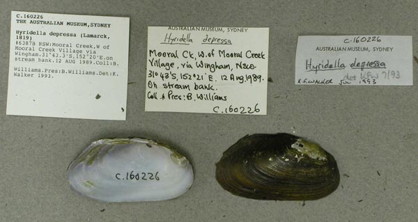
AMS_160226
Mooral Creek, W of Mooral Creek Village via Wingham (On stream bank), New South Wales, Australia [-31.722, 152.333 ± 1 km]
| 
AMS_332270
Mount George, New South Wales, Australia [-31.883, 152.183 ± 10 km]
| 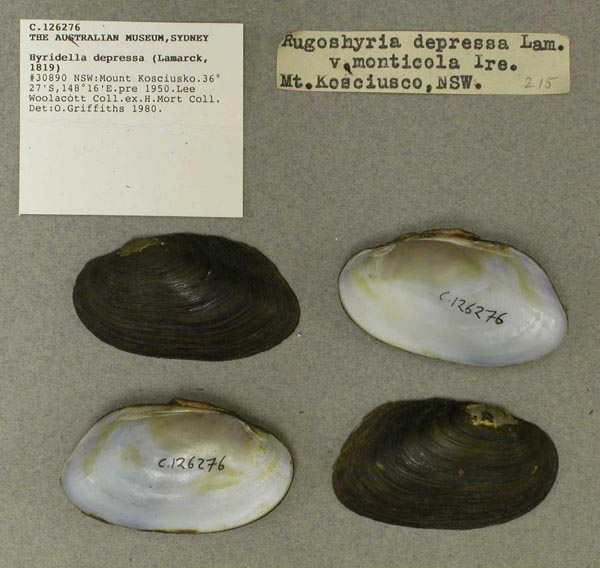
AMS_126276
Mount Kosciusko, New South Wales, Australia [-36.457, 148.26 ± 10 km]
| 
UF_8123
Murray River, Tailem Bend, Australia
| 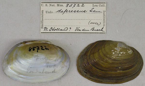
USNM_85722
N. Holland
| 
USNM_85722
N. Holland
| 
ZMB_19417
N.S. Wales
| 
AMS_173145
NE of Dorrigo, Lowanna, New South Wales, Australia [-30.211, 152.898 ± 1 km]
| 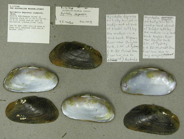
AMS_173348
Nepean River at Douglas Park (In sandy mud), New South Wales, Australia [-34.194, 150.712 ± 10 km]
| 
AMS_127324
Nepean River just above Douglas Park (On surface of sand), New South Wales, Australia [-34.194, 150.707 ± 1 km]
| 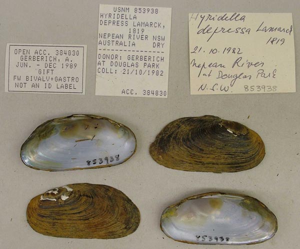
USNM_853938
Nepean River, at Douglas Park, New South Wales, Australia
| 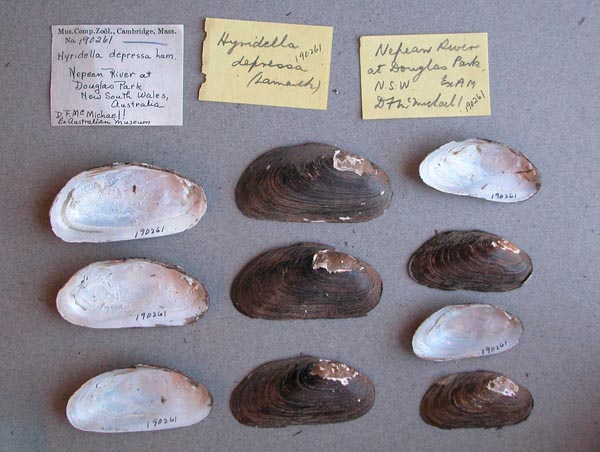
MCZ_190261
Nepean River, at Douglas Park, New South Wales, Australia
| 
MCZ_210903
Nepean River, at Douglas Park, New South Wales, Australia
| 
BMNH_88-3-23-23-28
Nepean River, County of Cumberland, NSW
| 
AMS_61965
Nepean River, Douglas Park, New South Wales, Australia [-34.194, 150.71 ± 10 km]
| 
ANSP_41805
Nepean River, N.S.W.
| 
AMS_61961
Nepean River, New South Wales, Australia [-34.073, 150.699 ± 100 km]
| 
AMS_47306
Nepean River, New South Wales, Australia [-34.073, 150.699 ± 100 km]
| 
AMS_47319
Nepean River, New South Wales, Australia [-34.073, 150.699 ± 100 km]
| 
AMS_144822
Nepean River, W of Richmond, New South Wales, Australia [-33.625, 150.683 ± 1 km]
| 
ZMB_9202
New Holland
| 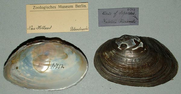
ZMB_4712B
New Holland
| 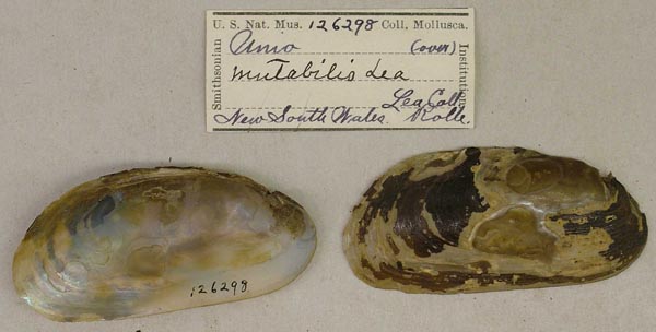
USNM_126298
New South Wales, Australia
| 
USNM_126298
New South Wales, Australia
| 
USNM_170112
New South Wales, Australia
| 
USNM_85615
New Zealand [probably actually Australia]
| 
AMS_126147
North Side of Nadgee Hut, Nadgee Fauna Reserve, New South Wales, Australia [-37.431, 149.939 ± 1 km]
| 
BMNH_86-4-26-325-329
Norton’s Basin, Nepean River, NSW
| 
MNHN_4088
Nouvelle Hollande
| 
MNHN_4088
Nouvelle Hollande
| 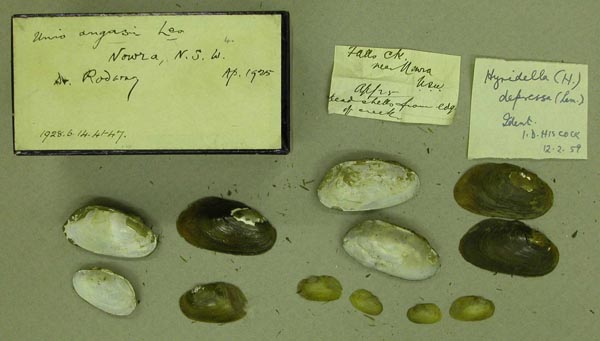
BMNH_1928-6-14-41-47
Nowra, NSW
| 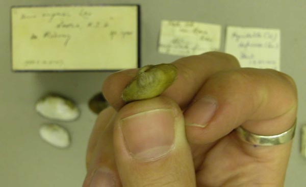
BMNH_1928-6-14-41-47
Nowra, NSW
| 
AMS_126145
NW of Wyong, N of Yarramalong, Cedar Brush Creek (= Brush Ck), New South Wales, Australia [-33.153, 151.267 ± 10 km]
| 
MCZ_17015
Paramamatta River, New South Wales, Australia
| 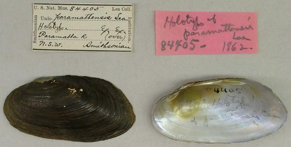
USNM_84405
Paramatta R., N.S.W.
| 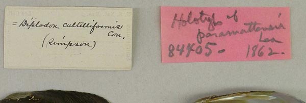
USNM_84405
Paramatta R., N.S.W.
| 
USNM_84405
Paramatta R., N.S.W.
| 
USNM_25744
Paramatta R., N.S.W.
| 
USNM_84405A
Paramatta R., New South Wales
| 
MNHN_MP_1478
Paramatta R., Sydney, Aust.
| 
BMNH_96-7-26-313-320
Paramatta River, NSW
| 
DMNH_78598
Paramatta, Australia
| 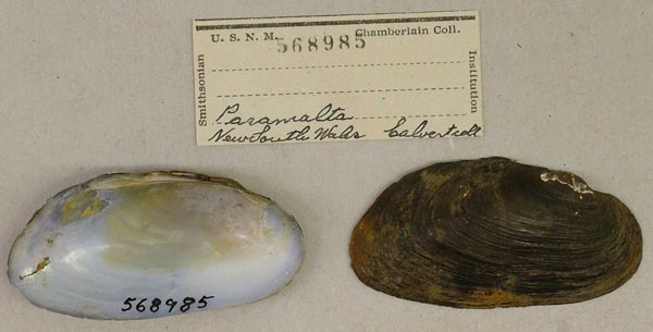
USNM_568985
Paramatta, New South Wales, Australia
| 
MCZ_37434
Parramatta
| 
BMNH_86-12-3-69-72
Parramatta Park, Parramatta, NSW
| 
BMNH_88-3-23-37-44
Parramatta River, NSW
| 
BMNH_86-7-26-309-312
Parramatta River, NSW
| 
ANSP_41804
Parramatta, N.S.W.
| 
UMMZ_111833
Picton, New South Wales, Australia
| 
UMMZ_111833
Picton, New South Wales, Australia
| 
BMNH_MP_081
ponds in Parramatta Park, Parramatta, NSW
| 
MCZ_37572
R. Parramatta
| 
AMS_61970
Richmond R trib., Wilsons R, Booyong (Creek), New South Wales, Australia [-28.748, 153.448 ± 1 km]
| 
BMNH_60-3-30-9
Richmond River
| 
AMS_167442
Richmond River at Casino, upstream from Irving Bridge (Gravel & small rock pools), New South Wales, Australia [-28.869, 153.042 ± 1 km]
| 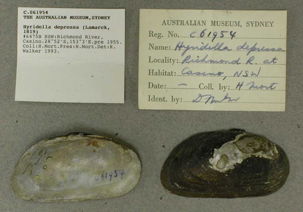
AMS_61954
Richmond River, Casino, New South Wales, Australia [-28.867, 153.05 ± 10 km]
| 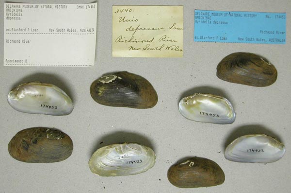
DMNH_174453
Richmond River, New South Wales, Australia
| 
AMS_126307
Richmond River, New South Wales, Australia [-28.867, 153.05 ± 100 km]
| 
USNM_85721
Rockentown, Australia
| 
AMS_61959
Salamanca River, New South Wales
| 
AMS_126148
SE of Sydney, Woronora Dam, Woronora River (sandy terraces by dam wall), New South Wales, Australia [-34.116, 150.935 ± 100 m]
| 
AMS_61958
South Creek near Sydney, New South Wales, Australia [-33.817, 150.767 ± 100 km]
| 
BMNH_88-3-23-29-33
South Creek, County of Cumberland, NSW
| 
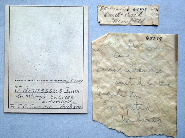
ANSP_65249
St. Marys, South Creek, E. Blomfield, Australia
| 
ANSP_65249
St. Marys, South Creek, E. Blomfield, Australia
| 
AMS_126284
Stanley R, 50 mls NW of Brisbane, Queensland, Australia [-27.133, 152.55 ± 100 km]
| 
AMS_118183
stream near Lowanna, Dorrigo, New South Wales, Australia [-30.213, 152.898 ± 1 km]
| 
AMS_126313
SW of Wollongong, Moss Vale, New South Wales, Australia [-34.553, 150.372 ± 10 km]
| 
USNM_85616
Swan R. Australia
| 
AMS_168584
Sydney S, Royal Nat. Park, Hacking River at Audley Weir, New South Wales, Australia [-34.075, 151.061 ± 1 km]
| 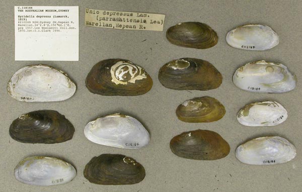
AMS_118184
Sydney SW, Nepean R, Narellan, New South Wales, Australia [-34.047, 150.735 ± 1 km]
| 
AMS_126268
Sydney W, Nepean River near bridge, New South Wales, Australia [-33.75, 150.675 ± 100 km]
| 
AMS_350758
Sydney W, Nepean River, Wallacia, Nortons Basin (River bank.), New South Wales, Australia [-33.859, 150.617 ± 1 km]
| 
AMS_350756
Sydney W, Nepean River, Wallacia, Nortons Basin (River bank.), New South Wales, Australia [-33.859, 150.617 ± 1 km]
| 
AMS_47318
Sydney, Parramatta River, New South Wales, Australia [-33.825, 151.067 ± 10 km]
| 
AMS_126322
Sydney, Parramatta River, New South Wales, Australia [-33.825, 151.083 ± 10 km]
| 
AMS_170812
Tantawanglo River, tributary of Bega River, New South Wales, Australia [-36.742, 149.647 ± 10 km]
| 
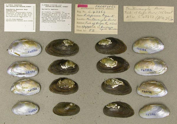
AMS_43362
Tantawanglo River, tributary of Bega River, New South Wales, Australia [-36.742, 149.647 ± 10 km]
| 
AMS_68574
Tributary of Nungatta Creek, Genoa River, on Towamba to Rockton backroad inland from Eden, New South Wales, Australia [-37.169, 149.459 ± 10 km]
| 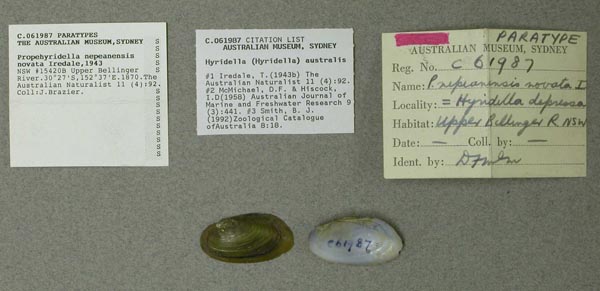
AMS_61987
Upper Bellinger River, New South Wales, Australia [-30.45, 152.617 ± 100 km]
| 
AMS_61960
Wallacia Weir, Nepean River, New South Wales, Australia [-33.863, 150.628 ± 100 m]
| 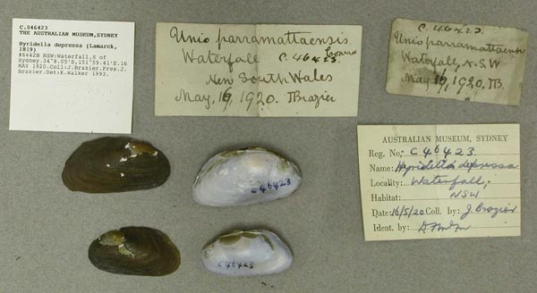
AMS_46423
Waterfall, S of Sydney, New South Wales, Australia [-34.134, 150.99 ± 1 km]
| 
AMS_126229
Williams River, Dungog, New South Wales, Australia [-32.398, 151.763 ± 1 km]
| 
AMS_173347
Wingecarribee River, upstream of Berrima bridge Hume Highway (rock ledge), New South Wales, Australia [-34.493, 150.331 ± 1 km]
| 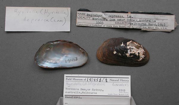
FMNH_191458
Woronora Dam, nr Sydney, Australia
| 
AMS_61955
Woronora River near Heathcote, New South Wales, Australia [-34.065, 150.995 ± 1 km]
| 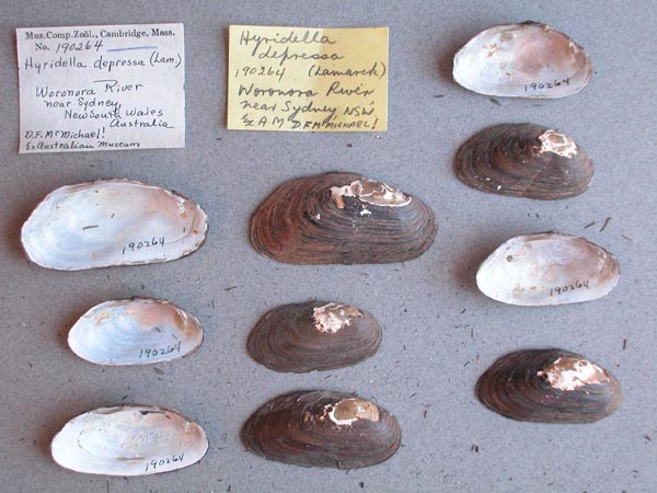
MCZ_190264
Woronora River, near Sydney, New South Wales, Australia
| 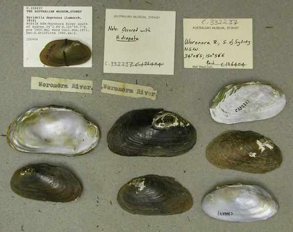
AMS_332237
Woronora River, S of Sydney, New South Wales, Australia [-34.065, 150.995 ± 10 km]
|
BMNH_1965153B. Brisbane Water, East Australia AMS_421933. Chichester SF, Telegherry Forest Park, rainforest at Telegherry R crossing, New South Wales, Australia [-32.207, 151.741 ± 100 m] AMS_435775. Clarence R, at Baryulgil crossing, New South Wales, Australia [-29.217, 152.562 ± 1 km] AMS_424083. Colo R, ca 10km (6mls) upstream from Putty Rd crossing, New South Wales, Australia [-33.413, 150.766 ± 1 km] AMS_424084. Deua R, at Kennys Ck, S of Merricumbene on Moruya-Braidwood Rd, New South Wales, Australia [-35.753, 149.928 ± 1 km] AMS_173148. Georges River near Campbelltown, New South Wales, Australia [-34.095, 150.833 ± 10 km] AMS_432616. Nepean R, Menangle Bridge, New South Wales, Australia [-34.119, 150.739 ± 100 m] AMS_432613. Nepean River at Douglas Park, New South Wales, Australia [-34.194, 150.712 ± 10 km] AMS_173157. Nepean River, Camden, New South Wales, Australia [-34.073, 150.699 ± 10 km] AMS_358666. Nepean River, Menangle, New South Wales, Australia [-34.119, 150.737 ± 10 km] AMS_173133. Nepean River, Menangle, New South Wales, Australia [-34.12, 150.74 ± 1 km] AMS_173139. Nepean River, Menangle, New South Wales, Australia [-34.12, 150.74 ± 1 km] AMS_173152. Nepean River, Wallacia, New South Wales, Australia [-33.867, 150.636 ± 1 km] AMS_420366. Paddys R, under freeway bridge (=Hume Hwy bridge?) (Silt on pool bottom), New South Wales, Australia [-34.643, 150.125 ± 1 km] AMS_396499. SE of Sydney, Woronora Dam, Woronora River, New South Wales, Australia [-34.117, 150.933 ± 1 km] AMS_173354. Sydney W, Nepean River, near Mulgoa, Nortons Basin (Around shores), New South Wales, Australia [-33.859, 150.617 ± 1 km] AMS_396498. Woronora River, SW of Sydney, New South Wales, Australia [-34.065, 150.995 ± 100 km] Georeferenced Genbank Vouchers
AustraliaUMMZ_265691. (COI: AF156496, go to Genbank) Australia. |