| Page last updated
Thu 3 September 2025 |
The Freshwater Mussels (Unionoida) of the World (and other less consequential bivalves)
FM(U)otW(aolcb) is the web version of the MUSSEL Project Database. Follow the links to browse the data or use the custom Google search field. Either way, you win!
Search the database pages:
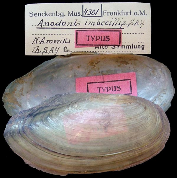
Bivalvia | ... | Unionoidea | Unionidae | Unioninae | Anodontini | Alasmidontina | Utterbackia species Utterbackia imbecillis (Say, 1829): specimens
6 available nominal species synonyms (11 total synonyms) Recent Taxonomic OpinionsUtterbackia imbecillis — Graf & Cummings (2007), Zanatta et al. (2007), Tiemann et al. (2007), Williams et al. (2008), Anonymous (2008), ... Cummings et al. (2025), Hou et al. (2025), Wang et al. (2025), Campbell & Lydeard (2026), Wu et al. (2026)
Anodonta imbecillis — ITIS (2012)
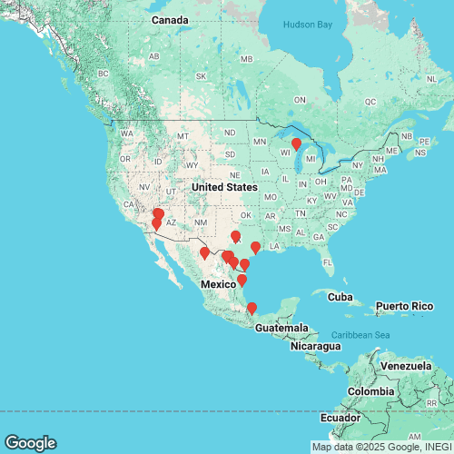
U. imbecillis — Marshall et al. (2018) RangeWidespread in the Interior, Great Lakes, Gulf Coastal, and Atlantic slope basins, North America. Introduced to peninsular Florida and Mexico. Map of Georeferenced Specimens
Mexico
AMS_102107
canal, 20.5 mi WNW Anahuac, Nuevo Leon, Mexico
| 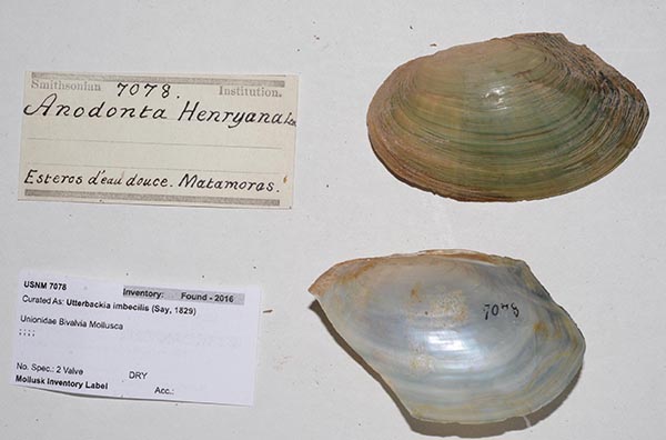
USNM_7078
Esteros d’eau douce. Matamoras.
| 
UF_41350
lake in the middele of a pasture, 1.6 mi SW Agualeguas, Nuevo Leon, Mexico
| 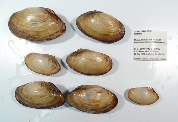
UF_41351
lake in the middele of a pasture, 1.6 mi SW Agualeguas, Nuevo Leon, Mexico
| 
USNM_86692
Matamoras, Mexico
| 
USNM_86692B
Matamoras, Mexico
| 
USNM_25975
Matamoras, Mexico
| 
USNM_1282735
Mexico: Coahuila. Rio Salado de Nadadores, 0.5 mi S Progresso on road to HW 57 [distance from HW 57 is 14.6 mi]
| 
USNM_903964
Rio Conchos, Saucillo, downstream from large cobble riffles, Chihuahua, Mexico
| 
USNM_1282737
Tamaulipas, Rio Carrizal at Rt. Mex. 180 in Nuevo Progreso, ca. 20.8 mi N of road divergence (on Rt. Mex. 180) to Aldma and Est. Manuel
| 
USNM_1282739
Veracruz, Rio Papaloapan off road from Ciudad Aleman to Tuxtepec; ca. 0.5 roadmiles by dirt road to river; dirt road entrance to Aleman-Tuxtepec road is ca. 2.4 roadmiles W of divergence of roads to Ciudad Aleman and Cosamaloapan
|
unknown
USA
TMYERS_001
Bill Williams River, Bill Williams River National Wildlife Refuge, S of Cattail Marsh Near Lake Havasu, La Paz Co., Arizona, USA
| 
USNM_892027
Bill Williams River, Bill Williams River National Wildlife Refuge, S of Cattail Marsh Near Lake Havasu, Mohave Co., Arizona, USA
| 
USNM_892027
Bill Williams River, Bill Williams River National Wildlife Refuge, S of Cattail Marsh Near Lake Havasu, Mohave Co., Arizona, USA
| 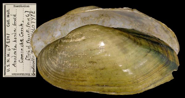
USNM_678301
Comanche Creek, [trib. of Pecos R., Pecos Co.], Texas
| 
BMNH_196465
Comanche Creek, Texas
| 
TMYERS_007
Lake Havasu, at Lake Havasu City, in a small cove off peninnsula into the Colorado River, Mohave Co., Arizona
| 
TMYERS_007
Lake Havasu, at Lake Havasu City, in a small cove off peninnsula into the Colorado River, Mohave Co., Arizona
| 
USNM_25606
Ohio
| 
UMMZ_209141
Sturgeon Bay, Wisc.
|
TMYERS_0000. Mittry Lake, Yuma Co., Arizona, USA Georeferenced Genbank Vouchers
USAUF_439469. (16S: PQ238813, go to Genbank) USA: Texas, Brazos River. |