| Page last updated
Thu 3 September 2025 |
The Freshwater Mussels (Unionoida) of the World (and other less consequential bivalves)
FM(U)otW(aolcb) is the web version of the MUSSEL Project Database. Follow the links to browse the data or use the custom Google search field. Either way, you win!
Search the database pages:
Bivalvia | ... | Unionoidea | Unionidae | Unioninae | Anodontini | Alasmidontina | Strophitus species Strophitus undulatus (Say, 1817): specimens
21 available nominal species synonyms (33 total synonyms) Recent Taxonomic OpinionsStrophitus undulatus — Graf & Cummings (2007), Kneeland & Rhymer (2007), Tiemann et al. (2007), Williams et al. (2008), Chong et al. (2008), ... Hopper et al. (2023), Wu et al. (2023), Perkins et al. (2025), FMCS (2025), Campbell & Lydeard (2026)
Strophitus undulatus undulatus — ITIS (2012)
Strophitus undulatus tennesseensis — ITIS (2012)
S. undulatus — Marshall et al. (2018)
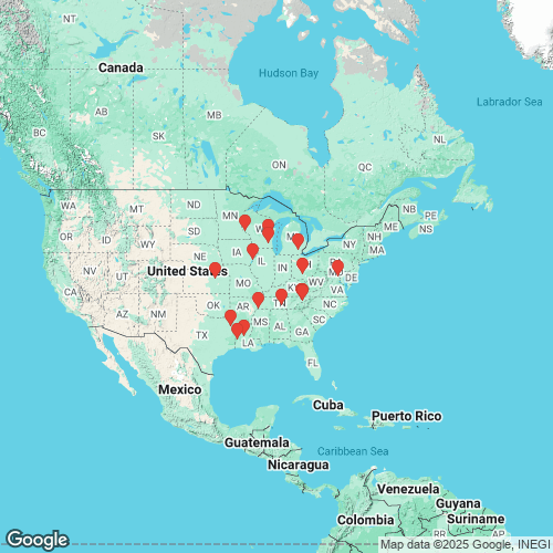
Strophitus undulata — Williams et al. (2022) RangeWidespread in the Nelson, Interior, Great Lakes, Atlantic Slope basins, and Gulf Coastal Plain, North America. Map of Georeferenced Specimens
USA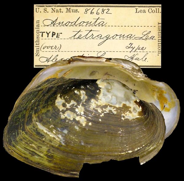
USNM_86682
Alexandria, La
| 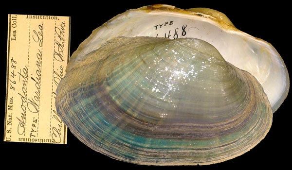
USNM_86488
Chillicothe, Ohio
| 
MNHN_MPL_0002
de Virginie
| 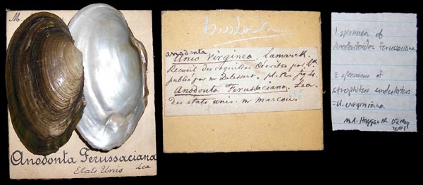
MNHN_MPL_0001
des Etats Unis. “Habite la rivière de Potowmac, en Virginie. Mon cabinet.”
| 
MCZ_16690
Duck River, Shelbyville, Rockford, Co., Tennessee
| 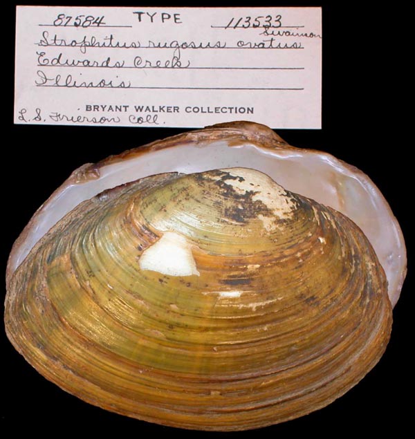
UMMZ_113533
Edwards River, Illinois
| 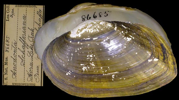
USNM_86685
Horn Lake Creek, Tenn
| 
UMMZ_209137
L. Pepin, Lake City, Wisc.
| 
UMMZ_209201
Lake Winnebago, Wisconsin
| 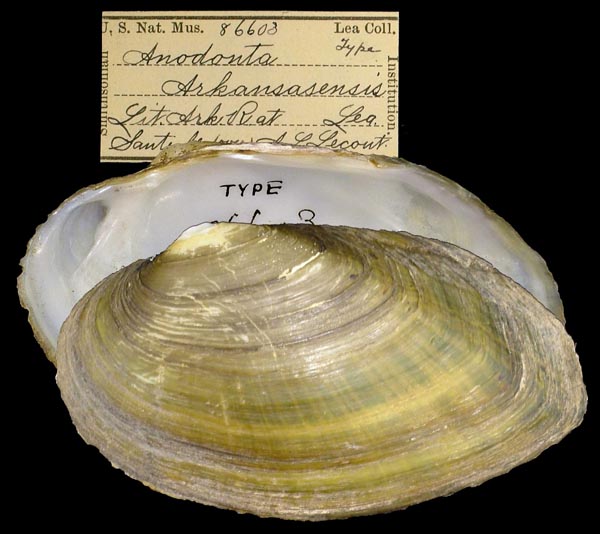
USNM_86603
Lit. Ark. R., at Santa Fe...
| 
USNM_86514
Little Beaver Cr., Ohio
| 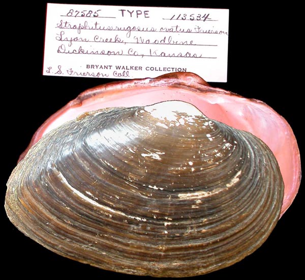
UMMZ_113534
Lyons Creek, Woodbine, Dickinson, Kansas
| 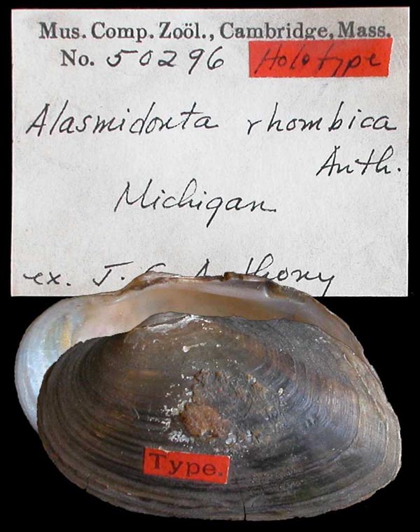
MCZ_50296
Michigan
| 
INHS_82463
Oconomowoc Lake, Waukesha Co., Wisconsin
| 
MCZ_150656
Potomac River, Virginia
|
Georeferenced Genbank Vouchers
USAUMMZ_265693. (16S: AY238491, 28S: DQ191415, COI: AF156505, go to Genbank) Michigan. UF_441166.SundSab001. (COI: OQ739067, ITS1: OQ745771, ND1: OQ744136, other_nuclear: OQ744083, go to Genbank) USA, Louisiana, Vernon County, Anacoco Bayou at Hawk Rd (30.9529677, -93.3529356). UF_438193.SundTen006. (5.8S, ITS1: MG199906, COI: MG199652, ND1: MG199779, other_nuclear: OQ744088, go to Genbank) USA, Tennessee, Cocke County, Nolichucky River at RM 8.5 (36.13527, -83.20188). UF_438193.SundTen007. (5.8S, ITS1: MG199907, COI: MG199653, ND1: MG199780, other_nuclear: OQ744089, go to Genbank) ditto. UF_438193.SundTen008. (COI: OQ739071, ITS1: OQ803594, ND1: OQ744140, other_nuclear: OQ744090, go to Genbank) ditto. UF_441285.SundNol002. (COI: OQ739068, ITS1: OQ745772, ND1: OQ744137, other_nuclear: OQ744084, go to Genbank) USA, Tennessee, Greene County, Nolichucky River near TWRA boat launch at Pate Hill (36.09284, -83.03545). UF_438196.SundTen012. (COI: OQ739072, ND1: OQ744141, go to Genbank) USA, Tennessee, Greene/Cocke County, Nolichucky River at Brier Thicket/Knob Creek Rd bridge, NRM 20.8 (36.122654, -83.125637). UF_438196.SundTen013. (COI: OQ739073, ITS1: OQ745775, ND1: OQ744142, other_nuclear: OQ744091, go to Genbank) ditto. UF_438969.SundRed020. (COI: OQ739076, ITS1: OQ745778, ND1: OQ744145, other_nuclear: OQ744098, go to Genbank) USA, Texas, Marion County, Big Cypress Bayou (just downstream from Hwy 59, near Jefferson, TX) (32.739928, -94.441666). UF_438969.SundRed021. (COI: OQ739077, ITS1: OQ745779, ND1: OQ744146, other_nuclear: OQ744099, go to Genbank) ditto. UF_438969.SundRed022. (COI: OQ739078, ITS1: OQ745780, ND1: OQ744147, other_nuclear: OQ744100, go to Genbank) ditto. UF_441166. (16S: PQ238827, go to Genbank) USA: Louisiana, Anacoco Bayou. |