| Page last updated
Thu 3 September 2025 |
The Freshwater Mussels (Unionoida) of the World (and other less consequential bivalves)
FM(U)otW(aolcb) is the web version of the MUSSEL Project Database. Follow the links to browse the data or use the custom Google search field. Either way, you win!
Search the database pages:
Bivalvia | ... | Unionoidea | Unionidae | Ambleminae | Quadrulini | Quadrulina | Pustulosa species Pustulosa kieneriana (Lea, 1852): specimens
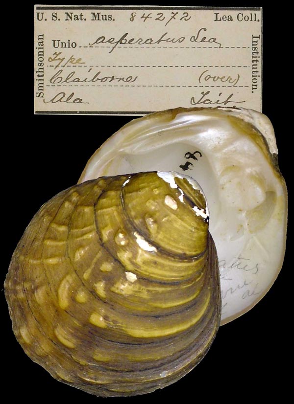
3 available nominal species synonyms (5 total synonyms) Recent Taxonomic OpinionsAmphinaias asperata — Graf & Cummings (2007), Cummings & Graf (2010)
Quadrula asperata — Zhou et al. (2007), Williams et al. (2008), Bogan (2010), ITIS (2012), Szumowski et al. (2012), Haag (2012)
Amphinaias archeri — Graf & Cummings (2007), Cummings & Graf (2010)
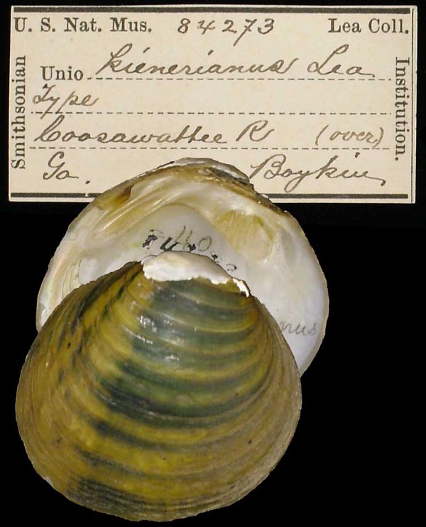
Quadrula kieneriana — Williams et al. (2008), Bogan (2010), Szumowski et al. (2012)
Amphinaias keineriana [sic] — ITIS (2013)
Cyclonaias kieneriana — Williams et al. (2017), Lopes-Lima et al. (2019), Bieler (2021), Graf & Cummings (2021), FMCS (2021), Hopper et al. (2023), Hauck et al. (2023)
Cyclonaias asperata — Williams et al. (2017), Johnson et al. (2018), Hauck et al. (2023)
Cyclonaias archeri — Williams et al. (2017), FMCS (2021), Hopper et al. (2023)
Cyclonaias pustulosa — Lopes-Lima et al. (2019), Graf & Cummings (2021)
Pustulosa kieneriana — Neemuchwala et al. (2023), FMCS (2025) RangeCoosa River basin, Alabama and Georgia, USA. Map of Georeferenced Specimens
USAGeoreferenced Genbank Vouchers
USAUAUC_784. (ND1: AY158758, go to Genbank) Alabama R., Wilcox Co., Alabama. UAUC_792. (ND1: AY158757, go to Genbank) Alabama R.,Wilcox Co., Alabama. UAUC_2503. (ND1: AY158806, go to Genbank) Coosa R., Elmore Co., Alabama. UAUC_333. (ND1: AY158779, go to Genbank) Coosawattee R., Gordon-Murray Co., Georgia. UAUC_334. (16S: AY655076, ND1: AY158769, go to Genbank) Coosawattee River, 2.5 mi upstream from Hwy 225 bridge, Gordon Co. GA. UAUC_2712. (ND1: AY158768, go to Genbank) Sucarnoochie Ck., Kemper Co., Mississippi. UF_438660. (SRA: SRR17818403, go to Genbank) USA, Alabama, Dallas County, Bogue Chitto Creek about 400 m above AL Hwy 22 crossing (32.31001, -87.27863). UF_438660 (QaspAla001). (5.8S: MH362453, COI: MH633608, ITS1: MH362453, ND1: MH633560, go to Genbank) ditto. UF_438660 (QaspAla002). (5.8S: MH362454, COI: MH633609, ITS1: MH362454, ND1: MH633561, go to Genbank) ditto. UF_438236 (QaspAla006). (5.8S: MH362462, COI: MH633611, ITS1: MH362462, ND1: MH633563, go to Genbank) USA, Alabama, Monroe County, Alabama River at RM 71, first bend in river downstream of Claiborne Lock & Dam; UTM Zone 16 3496668E, 447857N (31.603941, -87.54968). UF_438236 (QaspAla007). (5.8S: MH362463, COI: MH633612, ITS1: MH362463, ND1: MH633564, go to Genbank) ditto. UF_438236 (QaspAla008). (5.8S: MH362464, COI: MH633613, ITS1: MH362464, ND1: MH633565, go to Genbank) ditto. UF_438211 (QaspAla012). (5.8S: MH362661, COI: MH633655, ITS1: MH362661, ND1: MH633607, go to Genbank) USA, Alabama, Shelby County, Cahaba River at "Gate Shoals," 1.8 air miles NNW of Marvel, AL (33.17005, -87.01675). |