Page last updated
Thu 3 September 2025 |
The Freshwater Mussels (Unionoida) of the World (and other less consequential bivalves)
FM(U)otW(aolcb) is the web version of the MUSSEL Project Database. Follow the links to browse the data or use the custom Google search field. Either way, you win!
Search the database pages:
Bivalvia | Unionoida | Hyrioidea | Hyriidae | Velesunioninae | Alathyria species Alathyria profuga (Gould, 1850): specimens 2 available nominal species synonyms Recent Taxonomic OpinionsAlathyria profuga — Graf & Cummings (2007), Bogan (2010), Walker et al. (2014), Graf et al. (2015), Bolotov et al. (2016), Bolotov et al. (2017), Bolotov et al. (2017), Bolotov et al. (2018), Huang et al. (2019), Bolotov et al. (2019), Bolotov et al. (2020), Graf & Cummings (2021) RangeHunter and Shoalhaven rivers, New South Wales, Australia. Map of Georeferenced Specimens
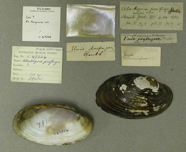
Australia AMS_47324 “?” [presumably Australia]
|  AMNH_30902 Australia
|  BMNH_42-11-16-1 Australia
|  AMS_36550 Barrington River, New South Wales, Australia [-31.967, 151.732 ± 100 km]
|  BMNH_MP_182 Bomaderry Creek, near Nowra, NSW
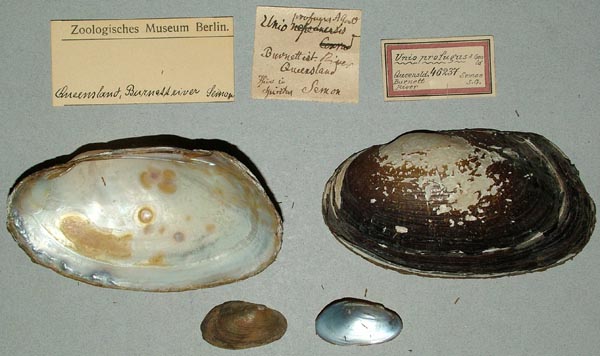
|  ZMB_46237 Burnett River, Queensland
|  ZMB_46237 Burnett River, Queensland
|  BMNH_88-11-28-1-3 Bylong [?] Creek head of Hunter Avon River, NSW
|  BMNH_MP_140 Clarence River, NSW
|  AMS_173351 Creek off Wollombi River off Cessnock Road (Trails in sand), New South Wales, Australia [-32.883, 151.183 ± 10 km]
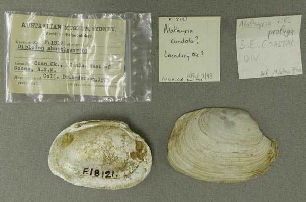
|  AMS_18121-F Cuan Creek, 20 mi W Scone, New South Wales
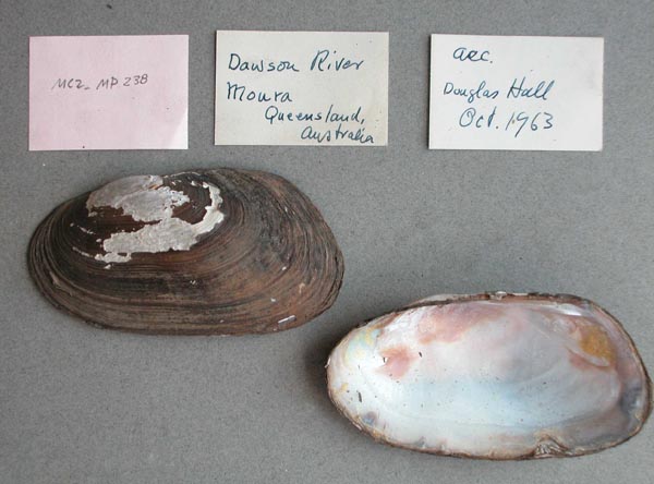
|  MCZ_MP.238 Dawson River, Moura, Queensland, Australia
|  AMS_174668 Gloucester. Creek west side of town adjacent to camping area, New South Wales, Australia [-32.005, 151.968 ± 10 km]
|  AMS_404244 Gloucester. Creek west side of town adjacent to camping area, New South Wales, Australia [-32.005, 151.968 ± 10 km]
|  ANSP_67782 Hunter River
|  AMS_61855 Hunter River at Muswellbrook, New South Wales, Australia [-32.267, 150.883 ± 10 km]
|  AMS_61904 Hunter River at Muswellbrook, New South Wales, Australia [-32.267, 150.883 ± 10 km]
|  AMS_61904 Hunter River at Muswellbrook, New South Wales, Australia [-32.267, 150.883 ± 10 km]
|  AMS_41284 Hunter River, New South Wales
|  AMS_47322 Hunter River, New South Wales, Australia [-32.467, 150.95 ± 100 km]
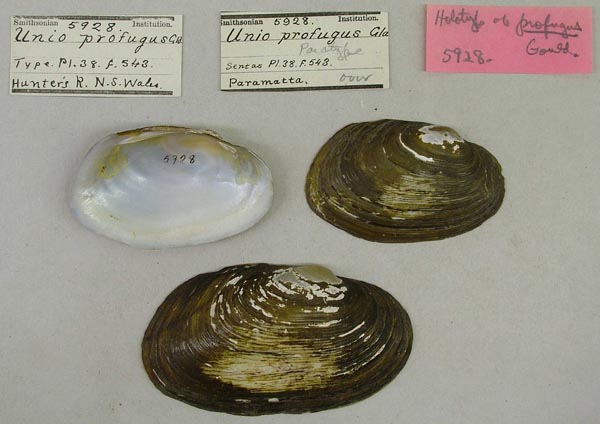
|  USNM_5928 Hunter’s R. N.S.Wales
|  USNM_5928 Hunter’s R. N.S.Wales
|  USNM_5928 Hunter’s R. N.S.Wales
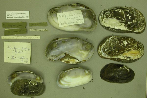
|  BMNH_89-10-25-5-7 Kangaroo River
|  AMS_12007 Kangaroo River, New South Wales, Australia [-34.683, 150.592 ± 100 km]
|  BMNH_MP_146 Kangaroo River, Wallongong, NSW
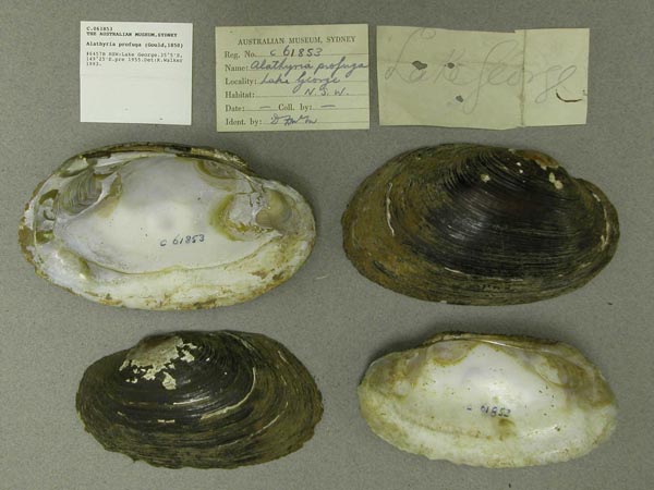
|  AMS_61853 Lake George, New South Wales, Australia [-35.083, 149.417 ± 10 km]
|  UMMZ_304513 Mammy Johnson River, 10 km E Wards River, New South Wales, Australia, -32.24361°, 151.97556°
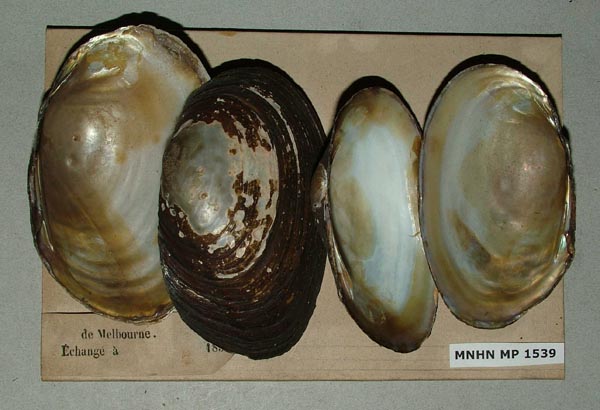
|  MNHN_MP_1539 Melbourne
|  AMS_126369 Muswellbrook, Hunter River, New South Wales, Australia [-32.267, 150.883 ± 10 km]
|  AMS_126343 Muswellbrook, Hunter River, New South Wales, Australia [-32.267, 150.9 ± 10 km]
|  ANSP_125851 N.S.W.
|  AMS_126246 NNW of Dungog, Williams River, on "Canningalla" property, Bandon Grove (Mud flats after floods), New South Wales, Australia [-32.311, 151.708 ± 1 km]
|  AMS_62147 NNW of Nowra, Kangaroo Valley, New South Wales, Australia [-34.737, 150.533 ± 10 km]
|  AMS_113810 Paterson River, Lostock Dam, Gulgong Shire, New South Wales, Australia [-32.331, 151.448 ± 1 km]
|  MCZ_191965 Paterson River, New South Wales, Australia
|  AMS_47323 Paterson River, New South Wales, Australia [-32.167, 151.417 ± 100 km]
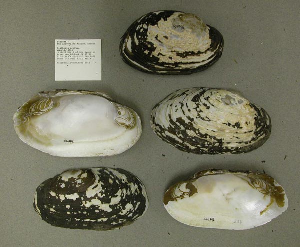
|  AMS_411896 S of Braidwood, on Krawarree Rd, Back Ck, New South Wales, Australia [-35.505, 149.698 ± 100 m]
|  SBMHN_367471 S of Rockhampton, Queensland
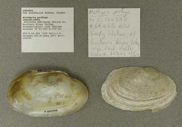
|  AMS_404243 Sandy Hollow #1, Goulburn River Valley, archaeological rock shelter surface, New South Wales, Australia [-32.333, 150.567 ± 10 km]
|  BMNH_MP_141 Shoalhaven River
|  AMS_47308 Shoalhaven River, New South Wales, Australia [-34.8, 150.317 > ± 100 km]
|  AMS_47310 Shoalhaven River, New South Wales, Australia [-34.8, 150.317 > ± 100 km]
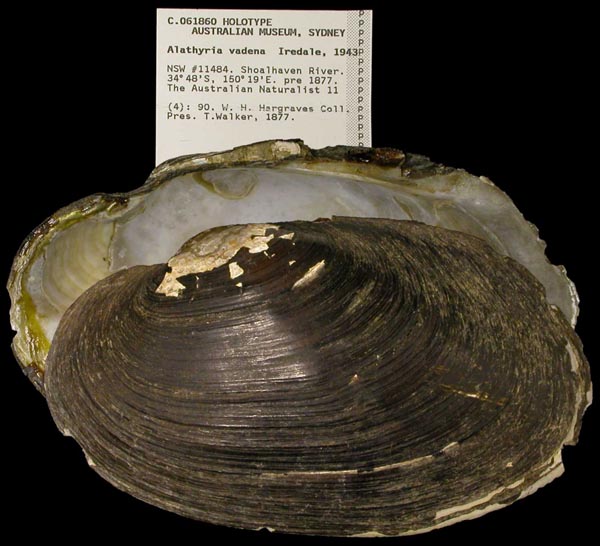
|  AMS_61860 Shoalhaven River, New South Wales, Australia [-34.8, 150.317 > ± 100 km]
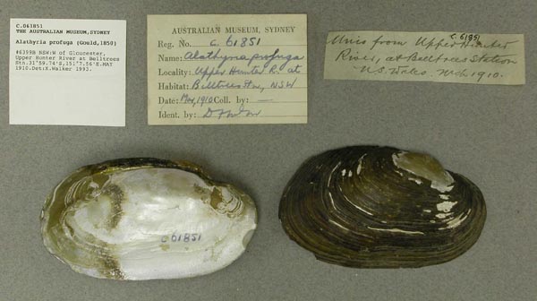
|  AMS_61851 W of Gloucester, upper Hunter River at Belltrees Stn, New South Wales, Australia [-31.996, 151.126 ± 1 km]
|  AMS_92303 W of Gloucester, upper Hunter River, Belltrees, New South Wales, Australia [-31.993, 151.125 ± 10 km]
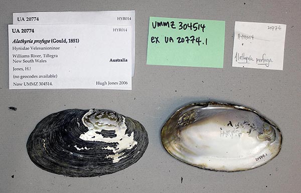
|  HYR014 Wiliams River at Tillegra
|  AMS_126104 Williams River at Dungog, New South Wales, Australia [-32.398, 151.763 ± 10 km]
|  MCZ_221445 Williams River, at Dungog, New South Wales, Australia
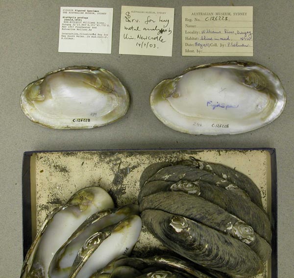
|  AMS_126228 Williams River, Dungog (In mud), New South Wales, Australia [-32.398, 151.763 ± 10 km]
|  AMS_126228B Williams River, Dungog, new south wales
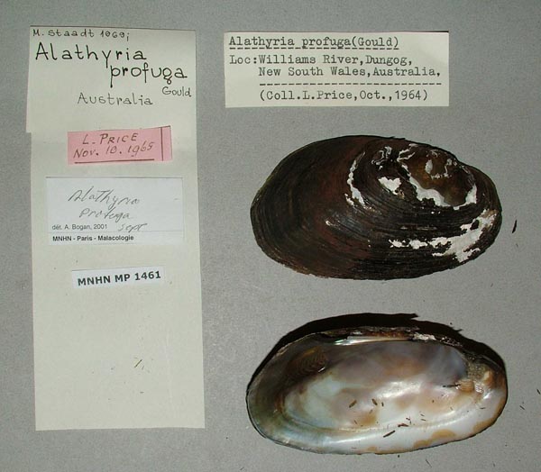
|  MNHN_MP_1461 Williams River, Dungog, New South Wales, Australia
|  UMMZ_304514 Williams River, Tillegra, New South Wales, Australia
|
AMS_421932. Dungog, Williams R between railway bridge and rd bridge beside park, New South Wales, Australia [-32.397, 151.762 ± 100 m] AMS_432165. Hunter Region, Glennies Ck, W of Singleton at New England Hwy crossing (Partly buried in muddy gravel near bank, moderate flow), New South Wales, Australia [-32.476, 151.087 ± 100 m] AMS_432166. Hunter Region, Stewarts Brook at Town Reserve and ford (Fast flowing, gravel bottom), New South Wales, Australia [-32.003, 151.309 ± 100 m] AMS_422533. Hunter region: Fal Brook at Bowmans Ck Rd (Goorangoola Rd) crossing at Mt Pleasant, N of Singleton (Partially buried in mud amongst rocks), New South Wales, Australia [-32.41, 151.193 ± 100 m] AMS_425849. Jerrys Plains Weir, New South Wales, Australia [-32.451, 150.934 ± 10 km] AMS_311583. Little Manning R. at crossing on Nowendoc Rd. N. of Gloucester (Med. river with sand, gravel, boulders, mud.), New South Wales, Australia [-31.842, 151.883 ± 100 m] AMS_431982. Millers Ck, on Bunkers Hill Rd, trib of Barrengary Ck, New South Wales, Australia [-34.683, 150.53 ± 1 km] AMS_423845. Mongarlowe River, Charleyong, New South Wales, Australia [-35.253, 149.919 ± 1 km] AMS_126388. Muscle Creek, Muswellbrook, New South Wales, Australia [-32.273, 150.893 ± 10 km] AMS_126449. Muswellbrook, Hunter River, New South Wales, Australia [-32.267, 150.883 ± 10 km] AMS_173165. Muswellbrook, Hunter River, New South Wales, Australia [-32.267, 150.883 ± 10 km] AMS_426821. near Cessnock, W of Milfield, Wollombi Rd, Wollombi Brook N Arm, at Cedar Rd crossing, New South Wales, Australia [-32.937, 151.14 ± 1 km] AMS_425868. Rouchel Brook, New South Wales, Australia [-32.133, 151.067 ± 100 km] AMS_405624. Shoalhaven River at ford on Wyanbene Caves Rd (Stony stream with some sand), New South Wales, Australia [-35.75, 149.65 ± 1 km] AMS_202379. Williams R between rail bridge & road bridge crossings, Dungog (On bank), New South Wales, Australia [-32.397, 151.764 ± 100 m] AMS_425882. Williams R, N of Clarence Town, Mill Flat Falls, New South Wales, Australia [-32.56, 151.8 ± 1 km] |