MUSSELpdb

Taxonomy
Species & Genus Richness of
freshwater mussels
by Taxonomy
Species & Genus Richness of
freshwater bivalves
by Family
Geography
Species Richness & Endemism of
freshwater mussels
by Geography
Bivalvia | Unionida | Unionoidea | Unionidae | Ambleminae | Popenaiadini | Popenaias
species Popenaias popeii (Lea, 1857): specimens
1 available nominal species synonym
Recent Taxonomic Opinions
“Popenaias popeii” ** — Graf & Cummings (2007)
Popenaias popeii — Chapman et al. (2008), Chapman et al. (2008), Bogan (2010), Cummings & Graf (2010), Campbell & Lydeard (2012), ... FMCS (2025), Cummings et al. (2025), Campbell & Lydeard (2026), Martínez et al. (2026), Barraza et al. (2026)
Popenaias popei — ITIS (2012), Haag (2012)
Range
Endemic to the Rio Grande Basin, Texas and Mexico. (North America: NA4)
Map of Georeferenced Specimens
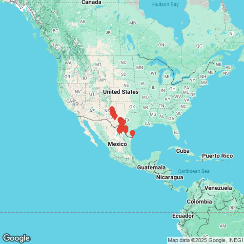
MUSSELp Specimen Records
Type Specimens

USNM_85895
Rio Salado, near Leon, Mexico
lectotype
Unio popeii Lea, 1857

USNM_85895B
Rio Salado, Nuevo Leon, Mexico
paralectotypes
Unio popeii Lea, 1857
Other Specimens by Collection | show by country
4 Specimens from ANSP
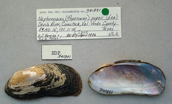
ANSP_341891
Devils River, Comstock, Val Verde Co., Texas

ANSP_91432
North Spring River, Roswell, N.M.
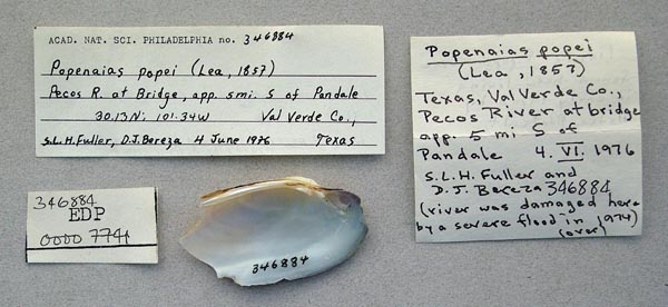
ANSP_346884
Pecos River, at bridge approx. 5 mi S Pandale, Val Verde Co., Texas
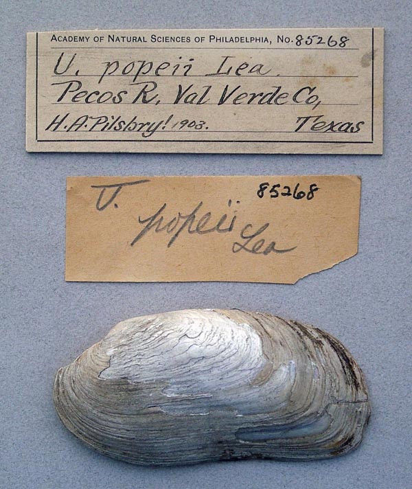
ANSP_85268
Pecos River, Val Verde Co., Texas
1 Specimens from DMNH
DMNH_150153. Pecos River, under Bataan Bridge, Carlsbad, Eddy County, New Mexico
1 Specimens from FMNH
FMNH_29672. Pecos River, Carlsbad, Eddy Co., New Mexico, USA
2 Specimens from INHS
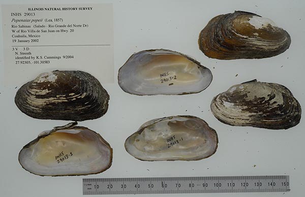
INHS_29013
Rio Sabinas, W of Rio Villa de San Juan on Hwy. 20, Coahuila, Mexico
INHS_29012. Rio Sabinas, Gulf of Mexico - Rio Grande del Norte - Salado, W of Rio Villa de San Juan on Hwy. 20, Coahuila, Mexico
1 Specimens from MCZ

MCZ_295007
Las Moras Creek, [Fort Clark] Kinney Co., Texas
2 Specimens from NCSM
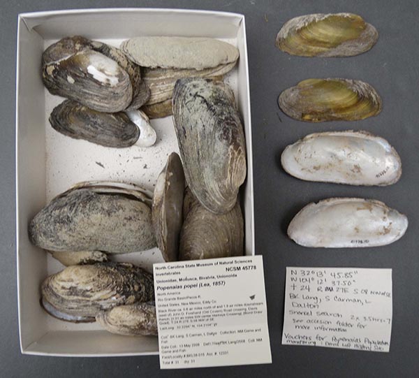
NCSM_45778
North America, Rio Grand Basin/Pecos R. United States, New Mexico, Eddy Co. Black River ca. 0.8 air miles north of and 1.9 air miles downstream (east of ) John D. Forehand (Old Covern) Road crossing, Davis Ranch. [1.01 air miles SW center Harkeys Crossing], [Bond Draw Quad]. T.24 R.27E S.08 NW or SE 32.2204° N, 104.2104° W

NCSM_35330
North America, Rio Grande Basin/Pecos R., United States, New Mexico, Eddy Co. Black River, found through a 7 km. reach between Black River Village and Carlsbad Irrigation District Dam, [point estimated at center of Black River Village ro 4.5 air miles NE center Black River Village, [Bond Draw and Black River Village Quads.] Lat/Long: Start:32.20196° N, 104.2506°W; End: 32.82084° N, 104.1958°W
1 Specimens from UF

UF_269336
Kinney Co., Texas
1 Specimens from UMMZ
UMMZ_172003. Pecos River, under Bataan Bridge, Carlsbad, Eddy County, New Mexico
17 Specimens from USNM
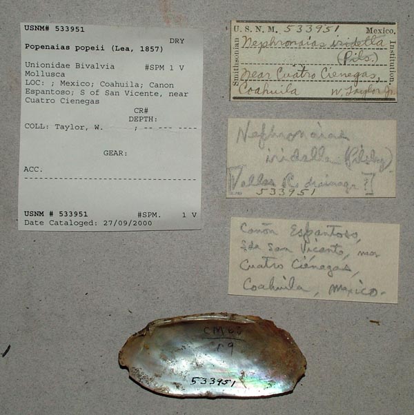
USNM_533951
Canon Espantoso, S of San Vicente, near Cuatro Cienegas, Coahuila, Mexico

USNM_1283220
Rio Salado, 8 km southwest of Progresso, Coahuila, Mexico
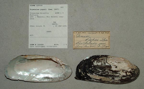
USNM_120920
Rio Salado, near Leon, Mexico
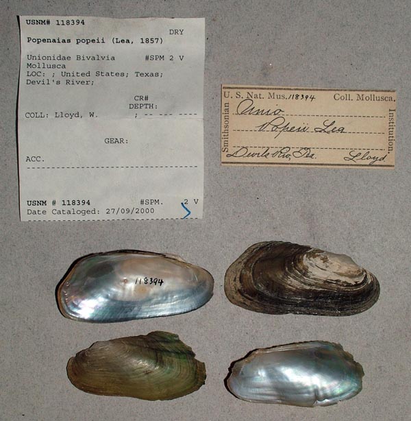
USNM_118394
Devils River, Texas
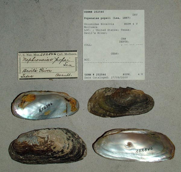
USNM_252546
Devils River, Texas
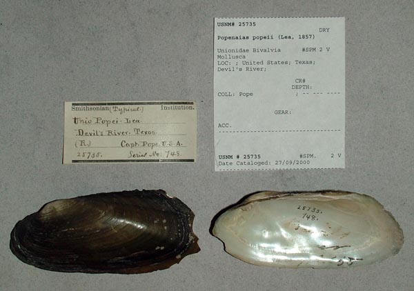
USNM_25735
Devils River, Texas
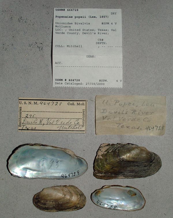
USNM_464728
Devils River, Val Verde Co., Texas
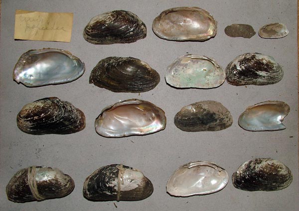
USNM_01
Las Moras Creek, Fort Clark, Kinney Co., Texas

USNM_130175
Las Moras Creek, Fort Clark, Kinney Co., Texas
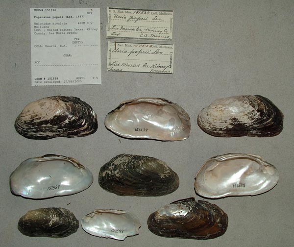
USNM_151538
Las Moras Creek, Fort Clark, Kinney Co., Texas
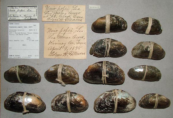
USNM_308943
Las Moras Creek, Fort Clark, Kinney Co., Texas

USNM_168765
North Spring River, Roswell, New Mexico, Pecos Valley, Alt. 3375 ft.

USNM_709228
Pecos River, about 5 mi SW Pandale and 0.3 mi n Bed Rock Crossing on road from Pandale to Langtry, Val Verde Co., Texas
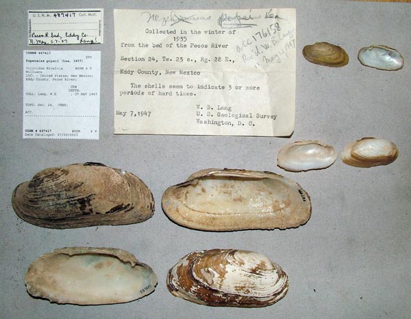
USNM_487417
Pecos River, Eddy County, T23S, R28E, sec. 24, New Mexico
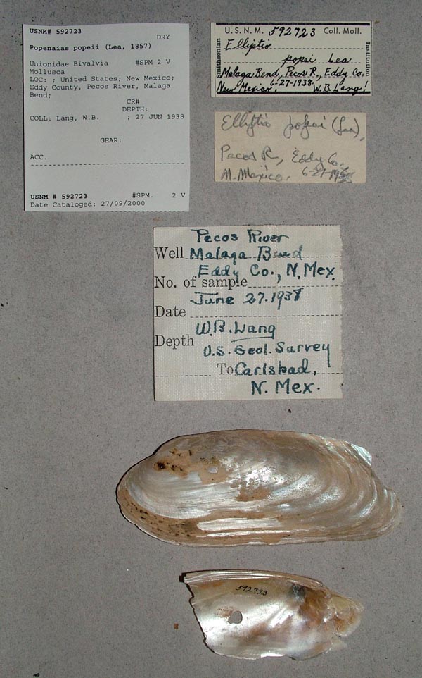
USNM_592723
Pecos River, Malaga Bend, Eddy County, New Mexico
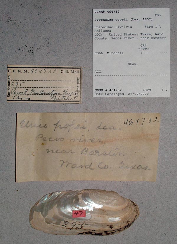
USNM_464732
Pecos River, near Barstow, Ward Co., Texas
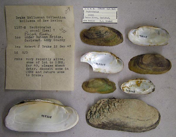
USNM_758208
Pecos River, under Bataan Bridge, Carlsbad, Eddy County, New Mexico
GenBank Vouchers
Georeferenced GenBank Vouchers
USA
Mp_2667_BKL980783g. (COI M-type: EF033294, COII M-type: EF033314, go to GenBank) Black River (Pecos River drainage), Eddy County, New Mexico.
Mp_2667_H1558. (COI: EF033257, COII: EF033277, go to GenBank) ditto.
UF_438742-6641. (28S: MK036109, COI: MK044941, ITS1, 5.8S: MK036192, ND1: MK045092, go to GenBank) Devils River, Rio Grande drainage (29.9036, -101.009).
UF_438742-6642. (28S: MK036110, COI: MK044942, ITS1, 5.8S: MK036193, ND1: MK045093, go to GenBank) ditto.
UF_438742-6643. (28S: MK036108, COI: MK044940, ITS1, 5.8S: MK036191, ND1: MK045091, go to GenBank) ditto.
UAUC_3161. (16S: AY655073, COI: AY655020, ITS1, 5.8S: KY207340, ND1: AY655118, go to GenBank) Rio Grande River, Lincoln-Juarez Bridge, Laredo, Webb Co. TX.
UF_438742. (SRA: SRX5278576, go to GenBank) USA, Texas, Val Verde County, Devils River, upstream of road access at Devils River State Natural Area (mussels from riffle 200 m upstream of Finegan Springs) (29.90364, -101.00903).
UF_438742 (ICH-02401). (16S: MK001785, 28S: MK001819, COI: MK001768, go to GenBank) ditto.
NRI_8696_1. (16S: MT561694, ANT: MT558907, COI: MT553976, go to GenBank) USA: Devils River, Texas.
NRI_8696_2. (16S: MT561695, ANT: MT558908, COI: MT553977, go to GenBank) ditto.
NRI_8696_3. (16S: MT561696, ANT: MT558909, COI: MT553978, go to GenBank) ditto.
NRI_8696_4. (16S: MT561697, ANT: MT558910, COI: MT553979, go to GenBank) ditto.
NRI_8696_5. (16S: MT561698, COI: MT553980, go to GenBank) ditto.
NRI_8696_6. (16S: MT561699, COI: MT553981, go to GenBank) ditto.
NRI_8696_7. (16S: MT561700, COI: MT553982, go to GenBank) ditto.
NRI_8696_8. (16S: MT561701, COI: MT553983, go to GenBank) ditto.
NRI_8204_1. (16S: MT561686, ANT: MT558904, COI: MT553968, go to GenBank) USA: Rio Grande, Texas.
NRI_8265_1. (16S: MT561687, ANT: MT558905, COI: MT553969, go to GenBank) ditto.
NRI_8385_1. (16S: MT561688, COI: MT553970, go to GenBank) ditto.
NRI_8385_2. (16S: MT561689, ANT: MT558906, COI: MT553971, go to GenBank) ditto.
NRI_8385_3. (16S: MT561690, COI: MT553972, go to GenBank) ditto.
NRI_8385_4. (16S: MT561691, COI: MT553973, go to GenBank) ditto.
NRI_8385_5. (16S: MT561692, COI: MT553974, go to GenBank) ditto.
NRI_8385_6. (16S: MT561693, COI: MT553975, go to GenBank) ditto.

