|

Data last updated
Mon 1 Dec 2025
|
Bivalvia
| Unionoida
| Unionoidea
| Unionidae
| Parreysiinae
| Leoparreysiini
| Leoparreysia
species Leoparreysia burmana (Blanford, 1869): specimens2 available nominal species synonyms (3 total synonyms)
Recent Taxonomic Opinions
Parreysia (s.s.) burmana — Graf & Cummings (2007)
Parreysia (s.s.) burmanus — Ramakrishna & Dey (2007)
Parreysia burmana — Bogan (2010), IUCN (2010), Ng et al. (2016), Zieritz et al. (2018)
Parreysia cf. burmana — Bolotov et al. (2017)
Leoparreysia burmana — Bolotov et al. (2017), Pfeiffer et al. (2018), Bolotov et al. (2019), Bolotov et al. (2020), Graf & Cummings (2021), Bolotov et al. (2022), Bolotov et al. (2022), Bolotov et al. (2022), Bolotov et al. (2024), Zieritz et al. (2024)
Radiatula burmana — Huang et al. (2019), Ortiz-Sepulveda et al. (2020), Wu et al. (2021)
Range
Irrawaddy and Salween rivers, Myanmar and adjacent Thailand.
Map of Georeferenced Specimens
MUSSELp Specimen Records
|

NCSM_46899
Asia, Salween Basin, Myanmar, Mandalay, Salween River [Thanlwin], local lakes deepr form Salween River to inland of Myanmar, into Burma (union of Myanmar), not far from Thailand NW Border, [point estimated close to NW border of Thailand at Wan Has-la] 20.42167° N, 98.6625° E
|
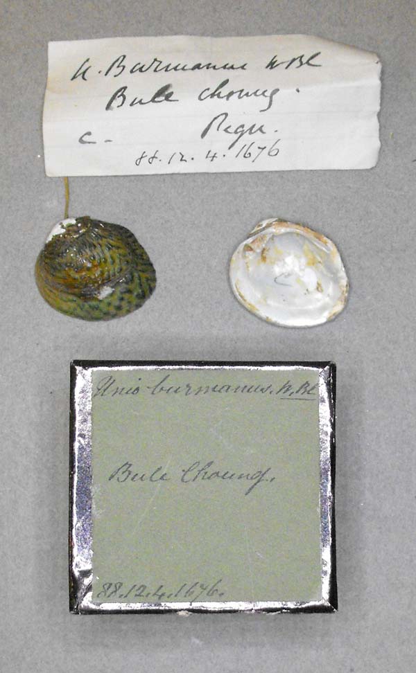
BMNH_88-12-4-1676
Bule Chaung, Pegu
|

BMNH_MP_D122
headwaters of Betwa, Bhopal
|
|

HMC_2752
Inle Lake> Pilu R> Salweeen R Just SSE of Taunggxi, Pogong, Myanmar, ~20o25'N, 96o45'E
|
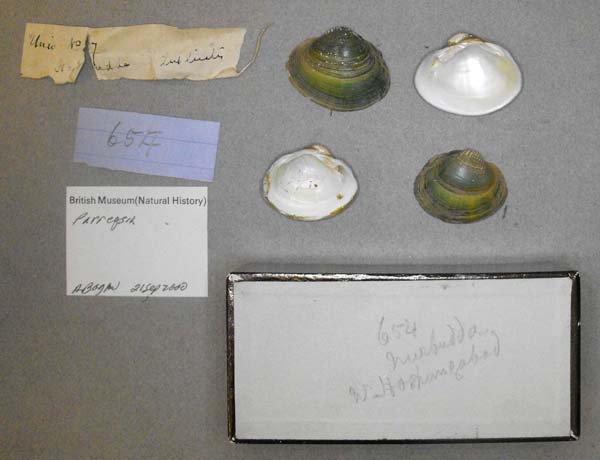
BMNH_MP_D120
Nurbudda, W Hora..gabad
|

SMF_13193
Upper Birmah
|
India
Laos
|
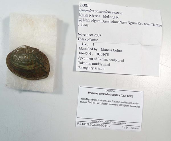
HMC_2538
Ngum River, Mekong R @ Nam Ngum Dam below Nam Ngum Res near Thinkeo, Laos
|
Myanmar
|

BMNH_1968628
Ava and Bhamo, India
|

CAS_180830
Ayeryarwaddy River, 1/2 mi SE Nyang-U, large sandbar, Mandalay Division, Burma. 21.2066, 94.90617
|

CAS_180820
Ayeryarwaddy River, across from Myint Gyant village.., Mandalay Division, Burma. 21.47327, 95.2973
|
|

CAS_180821
Ayeryarwaddy River, across from Myint Gyant village.., Mandalay Division, Burma. 21.47327, 95.2973
|
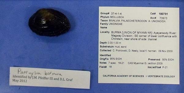
CAS_180791
Ayeryarwaddy River, confluence Chindwin, SE corner.., Magway Division, Burma. 21.49844, 95.26631
|

CAS_180795
Ayeryarwaddy River, confluence Chindwin, SE corner.., Magway Division, Burma. 21.49844, 95.26631
|
|
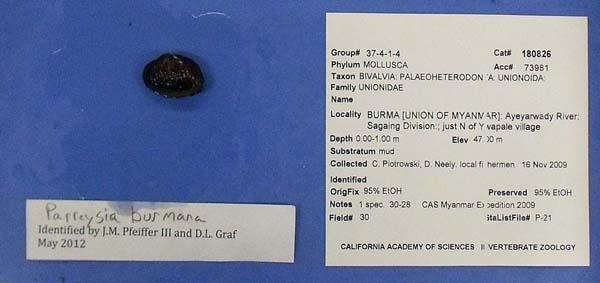
CAS_180826
Ayeryarwaddy River, just N Ywapale village, Sagaing Division, Burma. 21.67209, 95.36214
|

CAS_180816
Ayeryarwaddy River, mud bank on E side of river, Mandalay Division, Burma. 21.48187, 95.30501
|
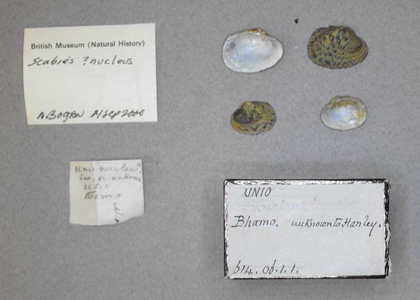
BMNH_614-06-1-1
Bhamo
|
|

UMMZ_110306_02
Bhamo, Burma
|
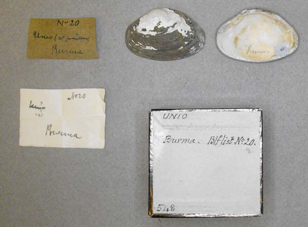
BMNH_MP_D405
Burma
|

UMMZ_110308_02
Burma
|
|

CAS_180805
BURMA [UNION OF MYANMAR]: Ayeyarwady River: Magway Division: large sandbar 1/2 mi SE of Nyaung-U 21.2066, 94.906183
|

CAS_180848
BURMA [UNION OF MYANMAR]: Ayeyarwady River: Magway Division: large sandbar 1/2 mi SE of Nyaung-U 21.2066, 94.906183
|
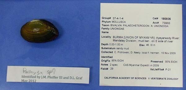
CAS_180806
BURMA [UNION OF MYANMAR]: Ayeyarwady River: Mandalay Division: mud bank on E side of river 21.48187, 95.30501
|
|
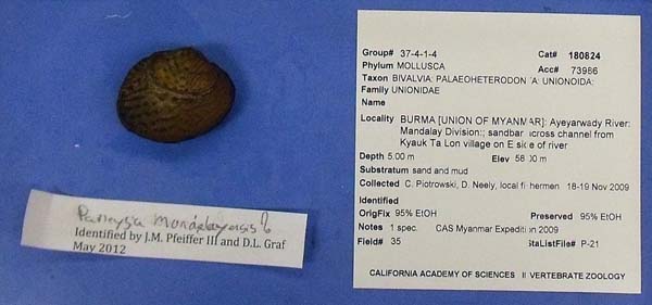
CAS_180824
BURMA [UNION OF MYANMAR]: Ayeyarwady River: Mandalay Division: sandbar across channel from Kyauk Ta Lon village on E side of river 21.91197, 95.77407
|

CAS_180831
BURMA [UNION OF MYANMAR]: Ayeyarwady River: Mandalay Division: sandbar across channel from Kyauk Ta Lon village on E side of river 21.91197, 95.77407
|

CAS_180839
BURMA [UNION OF MYANMAR]: Ayeyarwady River: Sagaing Division: bank of river at Nha Zo township 21.91111, 95.57776
|
|
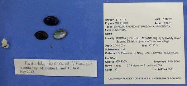
CAS_108829
BURMA [UNION OF MYANMAR]: Ayeyarwady River: Sagaing Division: just N of Ywapale village 21.67209, 95.36214
|

CAS_180852
BURMA [UNION OF MYANMAR]: Ayeyarwady River: Sagaing Division: Mingon: sandy island 0.78 mi N of Mingon 22.05815, 96.02353
|

CAS_180854
BURMA [UNION OF MYANMAR]: Ayeyarwady River: Sagaing Division: Mingon: sandy island 0.78 mi N of Mingon 22.05815, 96.02353
|
|

CAS_180858
BURMA [UNION OF MYANMAR]: Ayeyarwady River: Sagaing Division: Mingon: sandy island 0.78 mi N of Mingon 22.05815, 96.02353
|
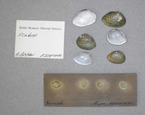
BMNH_88-11-7-5-7
Burmah
|
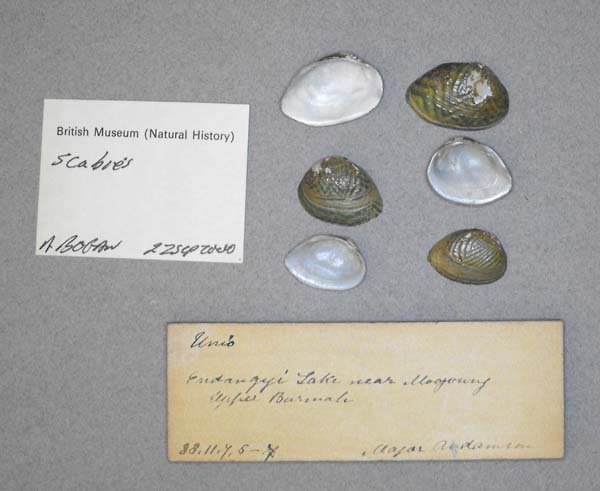
BMNH_88-11-7-5-7
Burmah
|
|

CAS_180817
Chindwin River, Ma-U village, east side of river, Sagaing Division, Burma. 21.75477, 95.20013
|

UMMZ_110307_02
Irawaddi [Irrawaddy] River, Burma
|

BMNH_2471-03-7-1
Mandalay
|
|
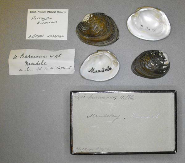
BMNH_88-12-4-1674-1675
Mandalay, Burmah
|

BMNH_MP_D374
Mogaung Chaung, a tributary of the Ayeyarwaddy, Kachin, northern Myamar (Burma)
|
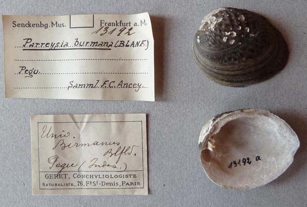
SMF_13192
Pegu
|
|
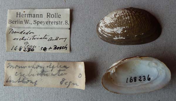
SMF_168236
Pegu
|

USNM_127024
Teinso, Upper Irrawady
|
Thailand
|

SMF_220857
Thailand: Moei River at Ban Mae Kon Ken, Mae Sot
|
Genbank Vouchers
Georeferenced Genbank Vouchers
Myanmar
RMBH_biv_350_1. (16S: MK372460, 18S: PP693701, 28S: MK372490, COI: MK372412, ND1: PP706145, go to Genbank) Myanmar: Ayeyarwady Basin, Chindwin River.
RMBH_biv_350_2. (16S: MK372461, 28S: MK372491, COI: MK372413, go to Genbank) ditto.
RMBH_biv_443_3. (COI: MK372447, go to Genbank) Myanmar: Ayeyarwady River near Mandalay city.
RMBH_biv_445_1. (COI: MK372448, go to Genbank) ditto.
RMBH_biv_419_2. (COI: MK372437, go to Genbank) Myanmar: Ayeyarwady River near Tant Kyi village.
RMBH_biv_419_3. (16S: MK372470, 28S: MK372502, COI: MK372438, go to Genbank) ditto.
RMBH_biv_424_1. (COI: MK372441, go to Genbank) Myanmar: Ayeyarwady River near Tha Phan Kone village.
RMBH_biv_424_2. (16S: MK372473, 28S: MK372505, COI: MK372442, go to Genbank) ditto.
RMBH_biv_424_3. (16S: MK372474, 28S: MK372506, COI: MK372443, go to Genbank) ditto.
|